WinterWxLuvr Posted April 7, 2016 Share Posted April 7, 2016 The fingerprints of the coming Nina showing its rancid colors already. Get ready for the 200 mile north shifts and the inverted vee. Link to comment Share on other sites More sharing options...
nj2va Posted April 7, 2016 Share Posted April 7, 2016 Fear not my fellow spring lovers...8-14 day outlook has us in the warm sector http://www.cpc.ncep.noaa.gov/products/predictions/814day/ Link to comment Share on other sites More sharing options...
North Balti Zen Posted April 7, 2016 Share Posted April 7, 2016 Hey boys!!! It has been a while since I been on here. I heard a rumor it might snow on Saturday so I thought I would come here for the low down!!! Best chance up near the MD/PA border apparently -as would be expected this time of year (or most other times). Latest runs sounded like they went even north of that. But still a chance of snow TV it seems for many. Also, early vegetation/flowers may be slaughtered with the lows Sunday morning in the GFS is right which for some reason will make NPZ happy. Link to comment Share on other sites More sharing options...
BristowWx Posted April 7, 2016 Share Posted April 7, 2016 Fear not my fellow spring lovers...8-14 day outlook has us in the warm sector http://www.cpc.ncep.noaa.gov/products/predictions/814day/ Party is over I guess. back to spring. Ugh Link to comment Share on other sites More sharing options...
EastCoast NPZ Posted April 7, 2016 Share Posted April 7, 2016 Best chance up near the MD/PA border apparently -as would be expected this time of year (or most other times). Latest runs sounded like they went even north of that. But still a chance of snow TV it seems for many. Also, early vegetation/flowers may be slaughtered with the lows Sunday morning in the GFS is right which for some reason will make NPZ happy. LOL. Sorry, man, I just hate flowers. I hate the bright colors, the awful floral smells, the pollen, and the bees. Link to comment Share on other sites More sharing options...
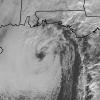
Kmlwx Posted April 7, 2016 Share Posted April 7, 2016 Cool radar to look at this morning. Power flickering here which is unusual for just heavy rain. Link to comment Share on other sites More sharing options...
Kmlwx Posted April 7, 2016 Share Posted April 7, 2016 That line is so pronounced the windshift along it is throwing out rotation markers in GR My friend down in Fredericksburg said it was crazy rain as it went through. Link to comment Share on other sites More sharing options...
nj2va Posted April 7, 2016 Share Posted April 7, 2016 It's a pitch perfect day for Nats opening day. Link to comment Share on other sites More sharing options...
Bob Chill Posted April 7, 2016 Share Posted April 7, 2016 That line is so pronounced the windshift along it is throwing out rotation markers in GR My friend down in Fredericksburg said it was crazy rain as it went through. Vis dropped to what looked like less than half a mile when the line moved through. Heaviest rain I've seen in a long time. Link to comment Share on other sites More sharing options...
Kmlwx Posted April 7, 2016 Share Posted April 7, 2016 Vis dropped to what looked like less than half a mile when the line moved through. Heaviest rain I've seen in a long time. Interesting clump of power outages showed up well ahead of this heavy line in my area. They are blaming weather conditions. I guess light to moderate rain can now cause 8K+ outages. Link to comment Share on other sites More sharing options...
Kmlwx Posted April 7, 2016 Share Posted April 7, 2016 Severe tstm warning Link to comment Share on other sites More sharing options...
smokeybandit Posted April 7, 2016 Share Posted April 7, 2016 Severe Thunderstorm Warning Issued: 10:33 AM EDT Apr. 7, 2016 – National Weather Service The National Weather Service in Sterling Virginia has issued a * Severe Thunderstorm Warning for... Anne Arundel County in central Maryland... eastern Prince Georges County in central Maryland... northwestern Calvert County in southern Maryland... eastern Montgomery County in central Maryland... * until 1130 am EDT * at 1032 am EDT... Doppler radar indicated a line of severe thunderstorms just east of Washington. These storms were located along a line extending from East Riverdale to greater Upper Marlboro to near Marlton... and moving east at 35 mph. * Locations impacted include... Bowie... Annapolis... College Park... Greenbelt... Bladensburg... Chesapeake Beach... North Beach... Upper Marlboro... Prince Georges stadium... Langley Park... Crofton... South river... Galesville... Severn River... largo... Navy-Marine Corps Memorial Stadium... Byrd stadium... Beltsville... fedex field and rhode river. Link to comment Share on other sites More sharing options...
AnEndlessMaze Posted April 7, 2016 Share Posted April 7, 2016 Best chance up near the MD/PA border apparently -as would be expected this time of year (or most other times). Latest runs sounded like they went even north of that. But still a chance of snow TV it seems for many. Also, early vegetation/flowers may be slaughtered with the lows Sunday morning in the GFS is right which for some reason will make NPZ happy. I'm trying to figure out what to do with Saturday morning- I got two newly planted trees that I'm worried about. Foliage is badly damaged, but they haven't fully taken root yet so I'm concerned about them just flat out dying. Heavy rain and very windy! 0.33" so far. Very impressive event. I think this is at least as windy as last weekend! Link to comment Share on other sites More sharing options...
yoda Posted April 7, 2016 Share Posted April 7, 2016 BULLETIN - IMMEDIATE BROADCAST REQUESTED SEVERE THUNDERSTORM WARNING NATIONAL WEATHER SERVICE BALTIMORE MD/WASHINGTON DC ISSUED BY NATIONAL WEATHER SERVICE MOUNT HOLLY NJ 1044 AM EDT THU APR 7 2016 THE NATIONAL WEATHER SERVICE IN STERLING VIRGINIA HAS ISSUED A * SEVERE THUNDERSTORM WARNING FOR... BALTIMORE COUNTY IN NORTHERN MARYLAND... NORTHERN ANNE ARUNDEL COUNTY IN CENTRAL MARYLAND... NORTHEASTERN PRINCE GEORGES COUNTY IN CENTRAL MARYLAND... SOUTHEASTERN HOWARD COUNTY IN CENTRAL MARYLAND... BALTIMORE CITY IN NORTHERN MARYLAND... SOUTHWESTERN HARFORD COUNTY IN NORTHERN MARYLAND... * UNTIL 1145 AM EDT * AT 1043 AM EDT...THIS SEVERE THUNDERSTORM IS CAPABLE OF PRODUCING DAMAGING WINDS IN EXCESS OF 60 MPH. THIS STORM WAS LOCATED OVER CROFTON...AND MOVING NORTHEAST AT 30 MPH. Link to comment Share on other sites More sharing options...
WinterWxLuvr Posted April 7, 2016 Share Posted April 7, 2016 I'd say the chance of seeing any snow other than flurries Fri night into Sat is just about zero. Link to comment Share on other sites More sharing options...
mappy Posted April 7, 2016 Share Posted April 7, 2016 1.2" at home so far, still pouring Link to comment Share on other sites More sharing options...
RickinBaltimore Posted April 7, 2016 Share Posted April 7, 2016 Possible storm damage in my neighborhood: Dundalk | POLICE ACTIVITY | North Point Blvd & Baltimore St | Transformer entirely off of a pole, damage to nearby cars. Power lines down. Debris also in the roadway from a nearby roof. 1 injured as a result. Traffic being diverted. Damage reported at Thompson Dodge on North Point Blvd, windows and vehicles damaged and multiple roofs damaged in Colgate. And edit: http://www.abc2news.com/weather/weather-blogs/storm-damage-in-dundalk Link to comment Share on other sites More sharing options...
Bob Chill Posted April 7, 2016 Share Posted April 7, 2016 I'd say the chance of seeing any snow other than flurries Fri night into Sat is just about zero. Northern tier of MD still has a chance. SLP passing north of the M/D is a dagger for my yard. UL dynamics still in play as the low departs but happens at the worst time of the day. Link to comment Share on other sites More sharing options...
Yeoman Posted April 7, 2016 Share Posted April 7, 2016 Power flickering here which is unusual for just heavy rain. Usually a 5mph wind gust would be enough Link to comment Share on other sites More sharing options...
87storms Posted April 7, 2016 Share Posted April 7, 2016 Feels categorically better outside right now than it has the last couple of days. Link to comment Share on other sites More sharing options...
jonjon Posted April 7, 2016 Share Posted April 7, 2016 Just changed to snow here at 1:30pm. Link to comment Share on other sites More sharing options...
mackerel_sky Posted April 7, 2016 Share Posted April 7, 2016 I'm trying to figure out what to do with Saturday morning- I got two newly planted trees that I'm worried about. Foliage is badly damaged, but they haven't fully taken root yet so I'm concerned about them just flat out dying. Heavy rain and very windy! 0.33" so far. Very impressive event. I think this is at least as windy as last weekend! Just put 2-3" of mulch around the root ball, if you haven't already, and water the trees very thoroughly , before the coldest night ( so Saturday) ! The foliage will die all the way off, but new growth will come out again, in a couple of weeks. I doubt your trees will die, they are tough, even though they aren't rooted in yet. Good luck Link to comment Share on other sites More sharing options...
high risk Posted April 7, 2016 Share Posted April 7, 2016 Fully agree that chances for widespread synoptic snow (as some of yesterday's guidance showed) are pretty much dead now due to the track of the low to our north and resulting strong downslope flow here. But with the upper low passing overhead with very cold temps, the forecast soundings show steep lapse rates, and a few hundred j/kg of cape may be available, so some healthy snow shower/squall activity is a reasonable bet. Northern tier of MD still has a chance. SLP passing north of the M/D is a dagger for my yard. UL dynamics still in play as the low departs but happens at the worst time of the day. Link to comment Share on other sites More sharing options...
AnEndlessMaze Posted April 7, 2016 Share Posted April 7, 2016 Just put 2-3" of mulch around the root ball, if you haven't already, and water the trees very thoroughly , before the coldest night ( so Saturday) ! The foliage will die all the way off, but new growth will come out again, in a couple of weeks. I doubt your trees will die, they are tough, even though they aren't rooted in yet. Good luck Thanks! I have some leftover mulch which I'll add to them tomorrow then. Link to comment Share on other sites More sharing options...
NorthArlington101 Posted April 7, 2016 Share Posted April 7, 2016 Thunder and heavy rain under this little storm. Link to comment Share on other sites More sharing options...
WxUSAF Posted April 7, 2016 Share Posted April 7, 2016 Had a couple tiny hail balls with the last small shower. Link to comment Share on other sites More sharing options...
HighStakes Posted April 7, 2016 Share Posted April 7, 2016 Getty quite windy again. Link to comment Share on other sites More sharing options...
WEATHER53 Posted April 7, 2016 Share Posted April 7, 2016 Sideways downpour in Greenbelt with little bit of hail and t&l Link to comment Share on other sites More sharing options...
H2O Posted April 7, 2016 Share Posted April 7, 2016 Just got under a tstorm warning. Lots of thunder Link to comment Share on other sites More sharing options...
SLPressure Posted April 7, 2016 Share Posted April 7, 2016 WooHoo! Pouring with BIG thunder. Link to comment Share on other sites More sharing options...

Recommended Posts
Archived
This topic is now archived and is closed to further replies.