All Activity
- Past hour
-
There it is... 80%... watch needed soon
-
I just came here to ask exactly that, never seen anything like that on a modal run; I'm got. Would the NHC declare it like that TD over Senegal all those years ago if it meets criteria?
-
Will never have a cool summer again sans a massive volcanic event
-
Just got back from a week on the beach in SC. Came back to a lush lawn. Things are looking much better up here than they have all spring. It's really bad down in SC. Very little surface water. I was in the low country for a week and didn't get a single mosquito bite. That's severe drought. And it didn't rain a drop the whole time we were there.
-

2026 Mid-Atlantic Severe Storm General Discussion
high risk replied to Kmlwx's topic in Mid Atlantic
You’re not wrong that there are some factors working against this setup, and there are some legit questions about storm coverage. That said 1) dynamics are much better today - synoptic lift will be overspreading the area later today 2) we’re still several hours from game time for most of us, and better moisture should be arriving 3) while cape will be lower today compared to a few days ago, shear is way better.- 683 replies
-
- 5
-

-
- severe
- thunderstorms
- (and 7 more)
-
90/66 Need rain, like 1-2". Another quarter to a half inch won't do anything.
-
Looks like some training supercells in Maine
-
that's more than the entirety of some of our cooler summers
-
Interesting storms today. The shear is there, instability lagging as usual. Meh from BTV, but big beam blockage. I've been keeping an eye on Canadian radars for our northern storms, and this is something... That sure looks like a TDS in the Northeast Kingdom.
-

E PA/NJ/DE Summer 2026 Obs/Discussion
RedSky replied to PhiEaglesfan712's topic in Philadelphia Region
Hrr has critically needed showers 3k nam is a dry disaster -
88.8's the past couple days. Surprisingly haven't recorded a 90 this month.
-
Easily the most impressive storm of the year just blew through. Winds were probably 60-70 mph, and it lasted probably a good 20 minutes. Surprisingly we still have power.
-
Hit 91 earlier. Now clouds and 88. Tonight looks like one of the elevated Cape Cod deals. Hopefully it can come further north.
-
57 to 87 so far today. Another beauty. Hopefully we get wet overnight.
-
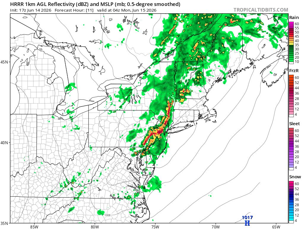
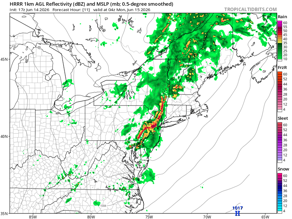
Yeah the latest HRRR hits us pretty good tonight, but not until 11pm. This is a late event.
-
Nice link, great info for the various stations. Bookmarked it for sure./ Thanks
- Today
-
Looking like some pretty crazy dynamics later according to latest HRRR
-
MCD should be coming soon
-
The 12z Euro… holy moly.
-

Central PA Summer 2026 Discussion/Obs Thread
TheDreamTraveler replied to Voyager's topic in Upstate New York/Pennsylvania
I do always wonder when PA will see another outbreak like the May 1989 tornado outbreak. It's always a matter of when not if but it sure has been a long time since that's happened. I'm always in the camp of 'nothing ever happens' since that's usually how it is but eventually we'll get a day where that's not the case. -
This ended up being a 17 hour day. 5a out the door 7a warm up 8a shotgun start 145p shotgun start 445p rain delay 645p restart 8p done 10p home
-

2026-2027 Super El Nino
snowman19 replied to Stormchaserchuck1's topic in Weather Forecasting and Discussion
The PDO doesn’t force ENSO to do anything or prevent it from doing anything, it’s a completely separate extratropical entity. In fact, there are studies that show that ENSO events (especially strong ones) can influence/modulate the PDO if anything, not the other way around. Eric Webb has been arguing that the well coupled ++PMM (subtropical entity) is acting as a +PDO right now -
That cyclone encompassing the North Atlantic from Canada to Ireland is cool.
-
90 here as of 2PM. We could really use the rain as opposed to the wind later on.
-

2026-2027 Super El Nino
PhiEaglesfan712 replied to Stormchaserchuck1's topic in Weather Forecasting and Discussion
If the PDO doesn't turn positive, I think the el nino stays below +2C, and 94-95 is our best analog. PDO should flip if we get above +2C, and definitely if it's above +2.5C. There has never been a +2.5C el nino that had a -PDO. Definitely not the best winter, but we could get something out of one month (most likely February).