

andyhb
-
Posts
20,454 -
Joined
-
Last visited
2 Followers


About andyhb

- Birthday March 18
Recent Profile Visitors
21,186 profile views


-
Large tornado in progress just east of KVWX heading for Fort Branch IN.
-
72 dBZ debris ball south of Indy, that is a mean tornado.
-
That was a different (I believe 4 hour) product than the 24-hour aggregate being shared widely.
-
Main uncertainty being the placement of the warm front and antecedent convection.
-
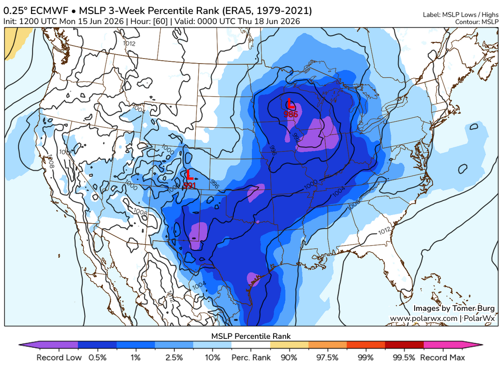
Have to imagine a D2 MDT is coming given the magnitude of the setup being shown by the 00z guidance thus far, with some supercells on the CAMs interacting with it. Just incredible wind fields.
-
Generally when you blend a record strength 500 mb shortwave with a record strength surface low, you're going to expect some pretty anomalous outcomes assuming moisture is available, which it looks to be.
.thumb.png.63de12ab5eb22478206e6197893d2b8c.png)
-
The 12z Euro… holy moly.
-
As of right now, this looks like an outbreak over potentially a large expanse of real estate, with both strong tornadoes and a derecho possible. I’m amazed at how strong the LLJ is across many models right now.
-
Agreed, it looks like another potentially widespread and significant severe weather episode with very strong flow overlapping high moisture. Tuesday could have some potential too.
-
This is hands down one of the best tornado videos I have ever seen. Hopefully a long format one is to follow.
-
Washburn IL, Streator IL, and Kouts IN tornadoes all preliminarily rated EF3.
-
Huge wedge tornado reported NE of Kouts per Isaac Polanski.
-
Tornado down heading for Schaumburg @SchaumburgStormer!
-
That is a major tornado in the middle of the Lake County burbs, that is not going to be good.
-
Giant tornado near Streator IL per Colin Davis. Environment near those two supercells in central IL is extreme, STP of 10, SCP of 40, 3000+ MLCAPE and 500+ ESRH.


.png.981588a393ec053f28cdcd9c1833d79b.png)


