All Activity
- Past hour
-

November 2025 general discussions and probable topic derailings ...
mreaves replied to Typhoon Tip's topic in New England
I ended up with 1.74” of rain between the start as snow and the end as snow. This was a good precip event for us. It didn’t rain so hard that it all ran off, the ground isn’t frozen and vegetation is dormant so it’s all going to the aquifer. Sitting on the board of my village water District made acutely aware of how dry we’ve been. -
Well see. 35.5 now and steady. CAA is often overdone on the island but we’ll see
-

Central PA Fall Discussions and Obs
MAG5035 replied to ChescoWx's topic in Upstate New York/Pennsylvania
I figure this is a good time to post for the first time in a good while. I’ve been very busy all summer and fall, but I’ll be getting back to posting regularly again now that we’re heading into the winter. At any rate first flakes of the season arrived here today. Nothing on the ground though here at the house, at least so far. Very potent snowband has been working the I-80 corridor from about Dubois to Clearfield and now stretching into Centre County and the Bellefonte/State College area. Of particular note is the stretch of I-80 from Dubois (Exit 97) to about the Penfield exit (Exit 111). Looks to be traffic issues there, especially east bound. This band is Huron connected as well, which is enhancing it further. I’ll bet some spots end up with up to 3”, perhaps even a bit more where the heaviest part of the band has trained the most.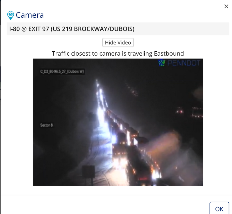
-

Historic Tennessee Valley Cold, Snow, and Ice Events
John1122 replied to Carvers Gap's topic in Tennessee Valley
The event today is probably notable enough to go here. MRX claimed it was 2 days shy of the 2nd earliest snowfall ever in Knoxville. They claimed on Facebook that Tri didn't see measurable snow Halloween 1993. I am certain that isn't true. Records show 1.3 inches for Tri on October 31st 1993. I know there was close to 3 inches here, Oneida and Tazewell. I would guess the 1.3 is probably light for Tri. I know for sure Tri got more than a trace Halloween 1993. However, it's a rare early November day to see snow fall essentially all day long with highs that stay below 35 for most of us, and 20s for some of us. I'd say that 2+ inches of snow fell over most of the areas that got the bands, but it didn't quite manage to stick to any depth due to the nature of it. Either way, early November snow isn't common these days. -

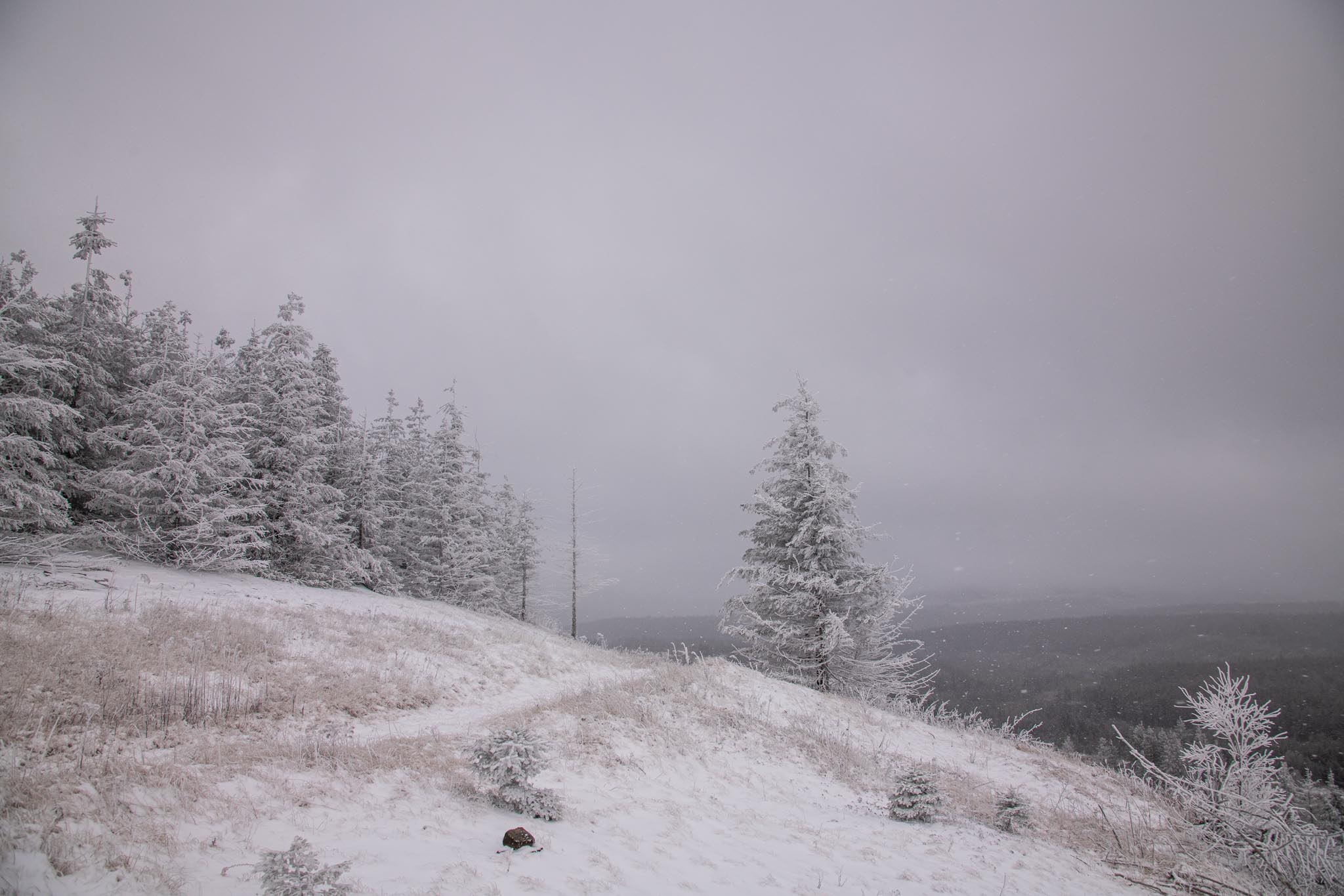
2025-2026 Fall/Winter Mountain Thread
calculus1 replied to Buckethead's topic in Southeastern States
Snowing really good in Cullowhee at WCU right now. I’ve been FaceTiming with my daughter there. She was letting me vicariously enjoy a Jeb walk as she walked around campus. It’s been coming down really well for the past couple of hours there. A truly beautiful early season gift for that community, and Cullowhee doesn’t tend to get big snows being down in the valley like they are. It’s amazing the joy that crystallized water falling out of the sky can bring… -
-
-
https://8-ball-magic.com/index.php#anchor
-
I got 15” from that 3/21 storm. Haven’t had a double-digit snowfall since then.
-
Still CAA through early morning at the mid levels so we have a ways to go. We probably get down to 29-30.
- Today
-
NYC - central park - 14
-

Central PA Fall Discussions and Obs
Blizzard of 93 replied to ChescoWx's topic in Upstate New York/Pennsylvania
I’m hoping a small piece of that lake streamer reaches my yard in Marysville to give me my first flakes tonight. -
Flurries reported in statesville
-

11/8-11/10 First Snow and Lake Effect Event
Jebman replied to Geoboy645's topic in Lakes/Ohio Valley
I want to second that. You guys SHOULD be getting paid. You not getting paid is an OUTRAGE. -
10:30 down to 35 and still eindy, 30.5 is my low for season and 40 coldest at midnight which is already eclipsed.
-
The wind here has been crazy high. It was enough to blow over my trash bin on its side, which I don’t recall ever happening before!
-
And to West Virginia


- 193 replies
-
- 10
-

-
For those interested in space weather, G3 conditions possible late Tuesday night into early morning Wednesday with KP index forecasted as 7+. Not unlike the most recent snow event, a lot of variables at play. And we won’t really know a lot until game time. But nonetheless, potential is there to see aurora across parts of the sub.
-
According to future radar if we are going to see a chance for a period of light snow it will be between 3-430am
-
Have gotten 2" so far, with 1.7" of that last night into this morning. This event has been pretty whelming if not on the underwhelming side. A few spots did ok, it looks like Geauga County did decently this evening. However, the carpet bomb winter storm watch for 5-10" did not work out.
-
Returns starting to blossom north of Greensboro
-

Central PA Fall Discussions and Obs
canderson replied to ChescoWx's topic in Upstate New York/Pennsylvania
Already 31 at 10:30. -
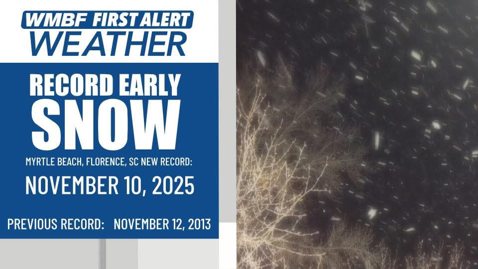
Snowing in...myrtle beach
-
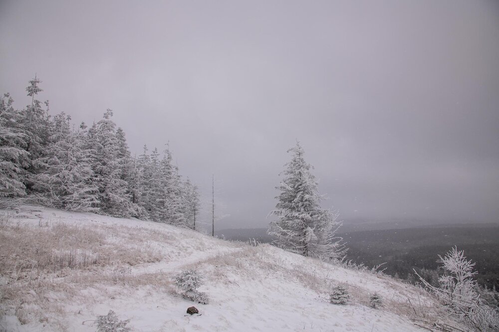
Wow! I have 7.5 inches (at least) and drifts to 15 inches at my house in the Roan highlands. I am just under 3800 feet in elevation but we do well in NW flow. its still absolutely ripping.
-
A few flakes --- small, here now. Wind is whipping pretty good.