Brian D
-
Posts
2,221 -
Joined
-
Last visited
About Brian D

-
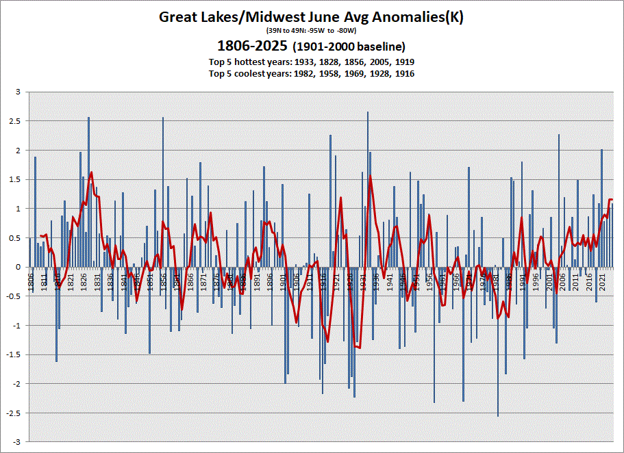
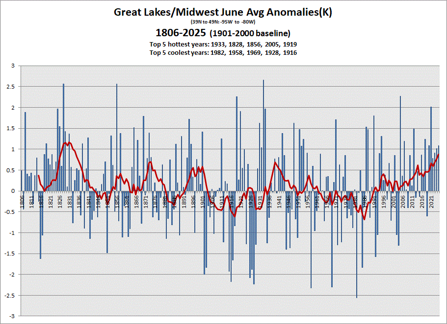
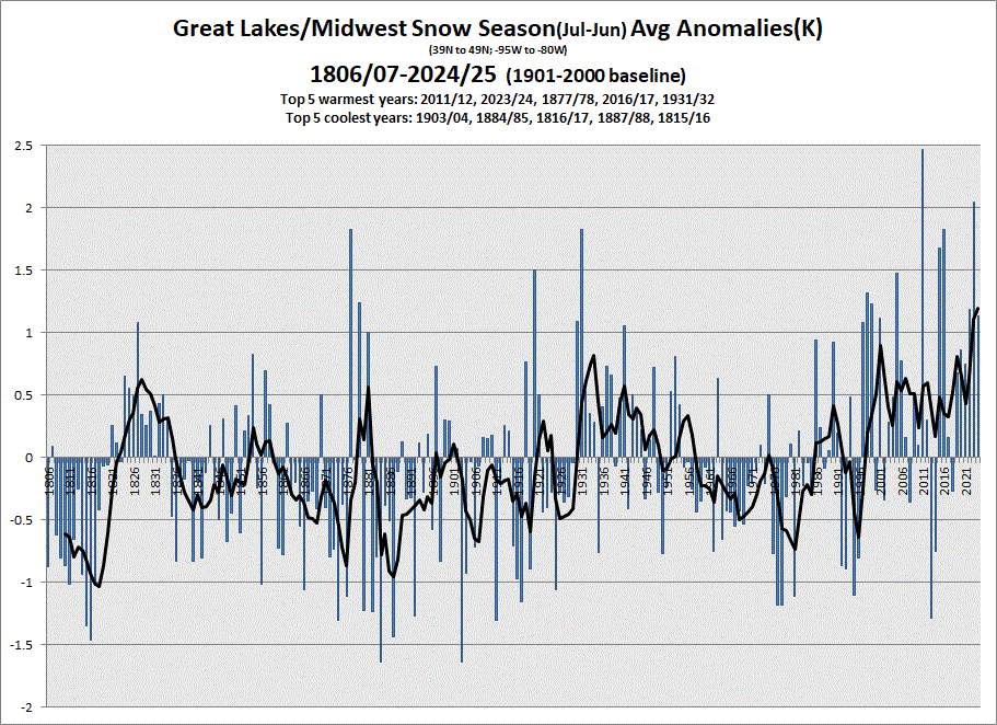
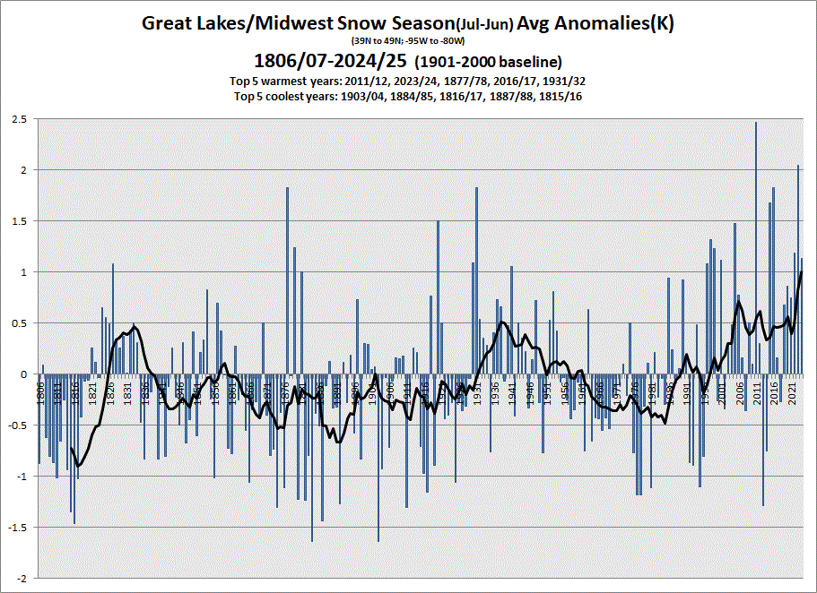
Early data in for June. Above normal driven by the heat across the southern half of the sub. Snow season ended with June. Another very warm one in books driven mostly by 2024 data. 5 & 10 yr trend charts shown respectively.
-
Mellow wx here with 70's n a lake breeze. Some shwrs/stms moved thru inland yesterday, but other than that, not much to speak of. Nice not having hotter, more humid wx.
-
Looks like 1-3" of rain fell across areas of N MN (much of the state actually). Rain started late last night here with 0.46" (7am) and still raining. Pleasant wx on tap after this front leaves for the next week.
-
Pleasant day today with E winds keeping temps in the 70's. Hotter day tomorrow with 80's (90's inland with a heat adv) n stms. Could be a wash for fireworks up my way.
-
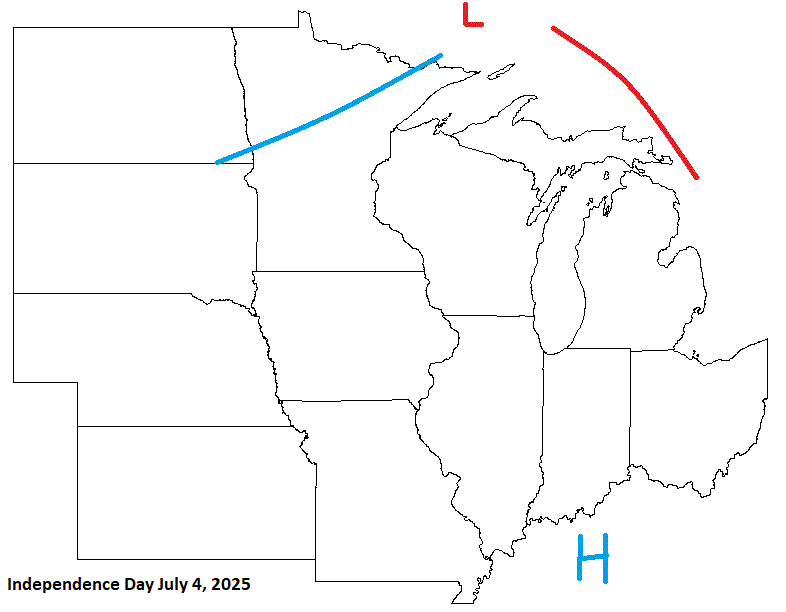
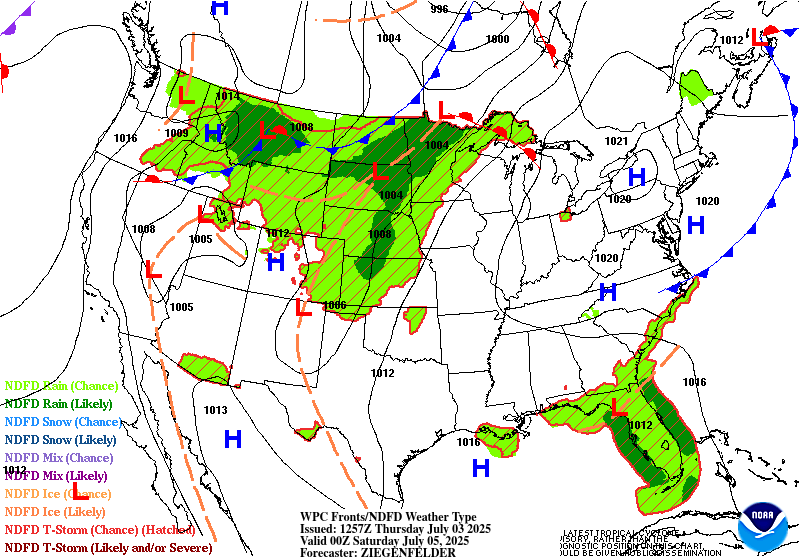
Pretty good cast. Hotter wx with a threat of stms entering the picture for the weekend. Enjoy your holiday weekend ev1.
-
0.93" of rain yesterday. Cloudy, cool day again today with some drizzle this morning. Up to 3.50" here in town for the month. Edging close to avg which is 4.23". June is our wettest month with July not far behind at 4.05".
-
0.10" of rain yesterday. It was a cool, wet day. Thought we'd picked up more rain than that, but it was light. A little more on tap today.
-
Rain on my doorstep, bring it. Very nice day yesterday in the 70's, low dews, and clear blue skies. Nice with no smoke.
-
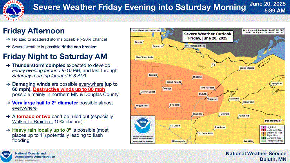
0.41" of rain from the stms that moved through last night. Up to 3" in other areas of NE MN. The Iron Range has had copious amts of rain lately. 5-7" worth. Cornucopia, WI, on the Bayfield peninsula had a 78 mph wind gust, and hail reports around the area up to 1". Grandma's Marathon went well this morning. At 0800 I was awakened by jets from the 148th Fighter Wing out of DLH doing low flybys. Thought it was thunder at first, until the screeching jet noise. And they went over a few times. Pretty cool!
-
The Northshore awaits you & fam. I get to escape the nasty heat this weekend. TY Lake Superior! (I bet half of the state will be up here LOL) Rough stms possible tonight.
-
Decent call here. Not bad 4 yrs out.
-
Beautiful summer day. Highs around 80 with reasonable dews. Sat out on the deck for a little sunbathing. Feels good!
-
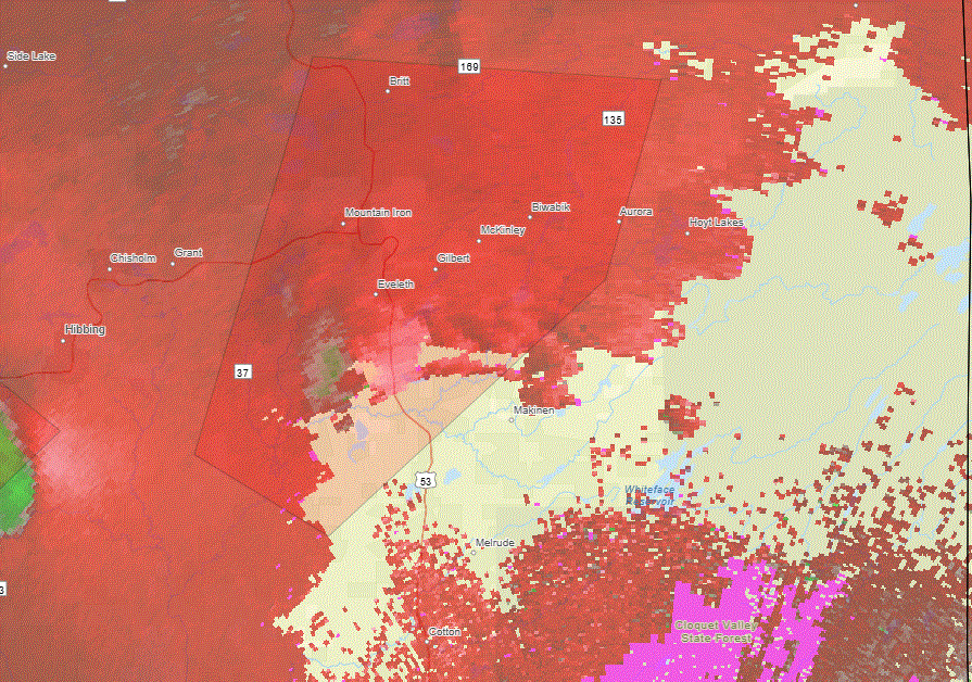
Nothing on the ground. Potential funnel near Hibbing, but that's all. Heavy rains of 2-3"+ with 4"+ reported around Virginia here in NE MN. 0.29" here in town with some thunder during the evening.
-
N one going right over Eveleth. Hope it's not on the ground.
-
Tornado sig near the Iron Range area of NE MN, which is NW of me. 2 possible tornadoes in the area up that way with this one more defined.