All Activity
- Past hour
-
Why did I even think anything different would happen. A hero ball banked 3 in OT to eliminate Towson. That's now 35 years without a conference final appearance.
-
That bottom pic looks like he/she wants to pluck your eye out. It's amazing how many eagles are in the valley now. I see probably one a month but rarely as close as that.
-
As always, when a super warm day is initialized, models lose snow threats. They don't estimate this stuff right when it is ahead of time.
-
that's awesome and great shots. I got lucky and saw a Sandhill? crane in Harvard MA a couple years ago, and seeing it "take off" with a wingspan that was larger than my vehicle, that was a first.
-
yep - excellent 3rd period
-

E PA/NJ/DE Spring 2026 Obs/Discussion
PhiEaglesfan712 replied to PhiEaglesfan712's topic in Philadelphia Region
2009-10 is the only one of those seasons that was really el nino. 1993-94 and 2013-14 were ENSO neutrals, and 2020-21 was a deep moderate la nina. The 1983 and 2016 storms are the only ones that were in el nino. The 1993 storm was an ENSO neutral, and the 2021 one was in that deep moderate la nina of 20-21. -

E PA/NJ/DE Spring 2026 Obs/Discussion
Albedoman replied to PhiEaglesfan712's topic in Philadelphia Region
way too early to even say things like that. Let him sleep while we dig out. Some of the biggest snowfalls ocucr during a raging Nino here. here is my proof. He needs to go to school The Lehigh Valley often sees its highest snowfall totals during El Niño years, which are historically linked to 8 of the 10 snowiest seasons on record for the region. El Niño patterns frequently bring increased moisture to the Mid-Atlantic, often resulting in major winter storms or "nor'easters". Snowiest El Niño Seasons The following winters occurred during El Niño phases and produced some of the highest total snowfall recorded at the Lehigh Valley International Airport (ABE): 1993–1994: 75.2 inches (The all-time record for seasonal snowfall). 2009–2010: 59.8 inches (Includes the "Snowmageddon" period). 2013–2014: 68.1 inches. 2020–2021: 58.1 inches. Notable Individual Storms (El Niño Related) Major single-storm events in the Lehigh Valley often align with these patterns: January 22–23, 2016: 31.7 inches — The biggest two-day snowfall in Lehigh Valley history (often referred to as "Snowzilla" or Winter Storm Jonas). February 1–2, 2021: 27.3 inches — The second-largest recorded snowfall event. February 11–12, 1983: 25.2 inches — A massive nor'easter during a strong El Niño year. March 13–14, 1993: 17.6 inches — Known as the "Storm of the Century". -
Yep it's true: 8 games zero TDs, smh (I'll give him a pass for 2023 since he was hurt...was also hurt in 2019 but still coulda done better, imo)
-
Gonna get wild tomorrow.
-

2026 Mid-Atlantic Severe Storm General Discussion
high risk replied to Kmlwx's topic in Mid Atlantic
In the 00Z suite, although they differ greatly on timing and coverage every CAM other than the NAM Nest has convection in our area at some point during Wednesday afternoon in a modestly favorable environment for severe. I'd say that the initial Day 2 outlook will at a minimum keep us in a MRGL, and a SLGT isn't out of the question. The only shot at severe is with the open warm sector storms, as whatever is on the front early Thursday will be weak. -
You must be new here - welcome to the forum!
-

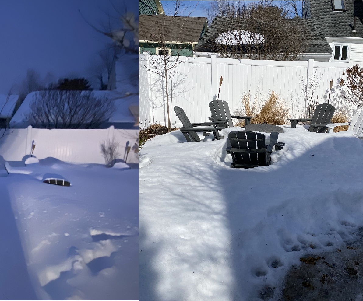
Meltdown's R Us. What's Buried Is Seen Again...
rimetree replied to Cold Miser's topic in New England
My firepit area with Adirondack chairs after the 2/23 blizzard and today...
-
Gimmee summa dat 7 day sucka dust lol
-
WRF-ARW and WRF-NSSL have a similar look for severe cells in N IL tomorrow
-
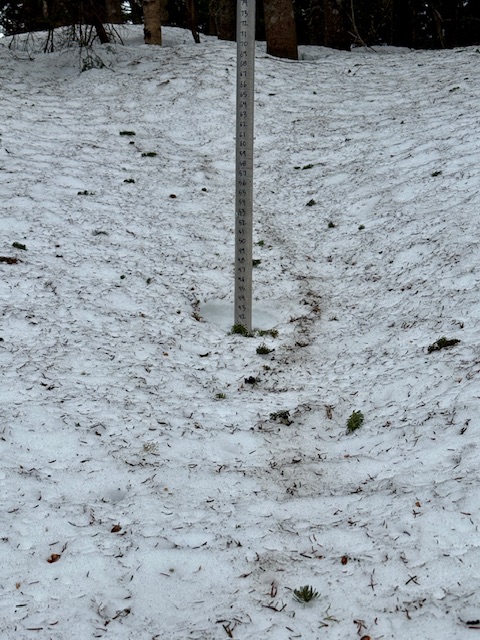
Some snow patches holding on for dear life in the backyard.
- Today
-
I liked Likely more than Andrews. He was a really good blocker for Lamar. Is it true Andrews has never caught a TD in the playoffs (and that's in a lot of games)?
-
Not a tough call to be long Oil for tomorrow.
-

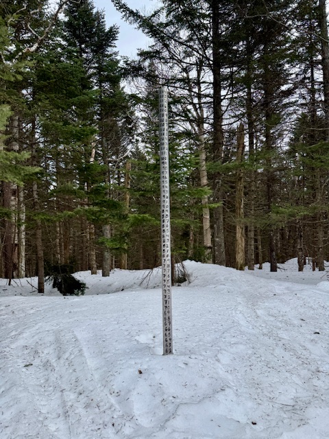
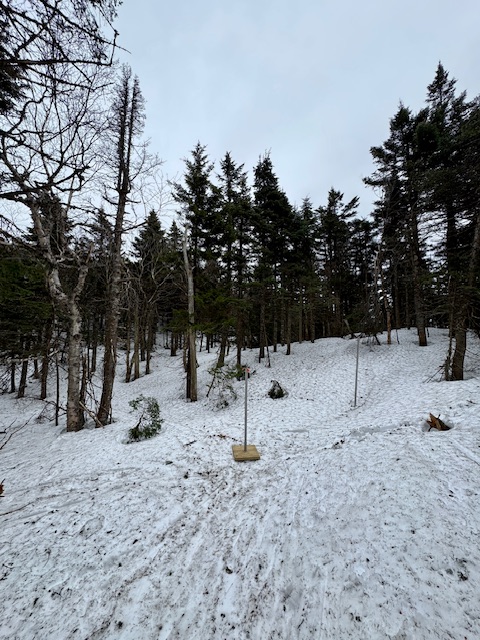
Central PA Spring 2026 Discussion/Obs Thread
canderson replied to Voyager's topic in Upstate New York/Pennsylvania
SM is closed Tuesdays unfortunately -
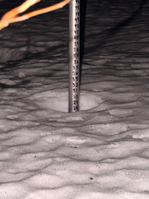
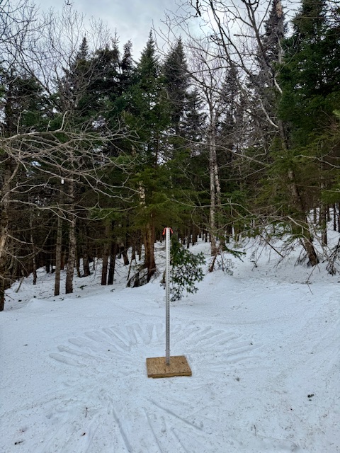
Afternoon round up of the state of the snowpack… High Road Plot (PM reading): 62” Depth (2” decrease past 24 hours, 12” lost past 5 days). Big Spruce Plot (PM reading): 42” Depth (2” decrease past 24 hours, 14” lost past 5 days) Barnes Camp Plot (AM reading): 28” Depth (4” decrease past 24 hours, 14” lost past 5 days). First 24-36 hours saw the biggest melt and the snowpack is getting a bit more resilient as it gets deeper down into some of the previous thaws and ice storm from mid-season. Only 2” decreases past 24 hours at the higher elevation sites is a positive trend but we still have at least 48 hours to go and likely 72 hours. Good spring skiing.

-
WBC has been pretty entertaining this year.
-
Idk if I buy the more northward trend of the front in IL to continue anymore then it has already, but the more north it trends, the higher the population threatened by a potential strong tornado (no guarantee obviously!)
-

E PA/NJ/DE Spring 2026 Obs/Discussion
Ralph Wiggum replied to PhiEaglesfan712's topic in Philadelphia Region
Former local met Chris Sauers says we might as well sleep right thru next winter. Raging Nino with well AN temps basically start to finish. Mild and wet, little snow. -
We spring.


-
Wild game. 7-3. And US beating Mexico 5-2 in the 7th!
-
Supposed to be 83 tomorrow here, a record high.

.thumb.png.4150b06c63a21f61052e47a612bf1818.png)