pcbjr Posted October 7, 2016 Share Posted October 7, 2016 so still no nhc active link here- Question : as of 11:00 is he more off shore and weakening? Link to comment Share on other sites More sharing options...
winterymix Posted October 7, 2016 Share Posted October 7, 2016 2 minutes ago, DoctorMu said: The eyeball will contact Cape Canaveral if the current vector continues, imo I guess we'll know in 5 to 8 hours from now. Link to comment Share on other sites More sharing options...
jm1220 Posted October 7, 2016 Share Posted October 7, 2016 2 minutes ago, DoctorMu said: The eyewall will contact Cape Canaveral if the current vector continues, imo I agree the western eyewall might make it to Cape Canaveral, but it'll be a race between that and the ridge orientation nudging it east. And the western eyewall won't be anything like the north or east eyewall. Link to comment Share on other sites More sharing options...
Amped Posted October 7, 2016 Share Posted October 7, 2016 Found a way of tracking the motion thats easier on the eyes. Link to comment Share on other sites More sharing options...
jojo762 Posted October 7, 2016 Share Posted October 7, 2016 Just now, pcbjr said: so still no nhc active link here- Question : as of 11:00 is he more off shore and weakening? Not weakening, but doesn't appear to be strengthening either. The nearly constant (for several hours) bizarre inner-structure of Matthew with concentric eye walls has halted any potential strengthening it appears. Link to comment Share on other sites More sharing options...
Drz1111 Posted October 7, 2016 Share Posted October 7, 2016 1 minute ago, jojo762 said: Not weakening, but doesn't appear to be strengthening either. The nearly constant (for several hours) bizarre inner-structure of Matthew with concentric eye walls has halted any potential strengthening it appears. It's not bizarre, it's super common in intense, mature tropical cyclones. Link to comment Share on other sites More sharing options...
winterymix Posted October 7, 2016 Share Posted October 7, 2016 4,845,260 customers without power in Fl. Link to comment Share on other sites More sharing options...
ROOSTA Posted October 7, 2016 Share Posted October 7, 2016 3 minutes ago, pcbjr said: so still no nhc active link here- Question : as of 11:00 is he more off shore and weakening? Same here. Probably routing to the same hub. Other then that maxima in IEW most of the wind field expanded to the N and E Link to comment Share on other sites More sharing options...
Tibet Posted October 7, 2016 Share Posted October 7, 2016 1 minute ago, winterymix said: 4,845,260 customers without power in Fl. Do you have a source you can share for that? Link to comment Share on other sites More sharing options...
jojo762 Posted October 7, 2016 Share Posted October 7, 2016 FL hurricane-force wind field has definitely expanded N/E. Gotta wonder where all the energy is going with the pressure being sub-940... Note: This might not be 100% accurate, but generally appears the the outer eye-wall is beginning to fill in more with stronger convection/radar returns, which may finally choke off the inner eye-wall. Link to comment Share on other sites More sharing options...
friedmators Posted October 7, 2016 Share Posted October 7, 2016 3 minutes ago, Tibet said: Do you have a source you can share for that? Thats total FPL customers...80k out https://www.fpl.com/storm/customer-outages.html Link to comment Share on other sites More sharing options...
Morris Posted October 7, 2016 Share Posted October 7, 2016 102kts dropsonde NE eyewall. Link to comment Share on other sites More sharing options...
MAG5035 Posted October 7, 2016 Share Posted October 7, 2016 Some of the more solid rain bands and probable sustained TS with high end TS/ Cat 1 gusts are starting to move into the region of shoreline between Vero and Palm Beaches. Tracking this elaborate dance of the inner and outer eyewalls has been fascinating if not maddening on radar. KMLB and KAMX radars are about 175 miles apart and the center of Matthew lies smack in between them offshore currently. It will get better as the night goes on as the hurricane tracks towards Melbourne (MLB) but right now the beams from both radars are hitting the inner eye at roughly 10-14k feet. Looking at velocities of stuff coming in towards Vero to Jupiter region is interrupted by velocities changing from toward to away due to the storm's trajectory. But can see enough to deduce that conditions are likely really headed downhill in that area...alot of 40-60+knot velocities either side that would easily get mixed down in the embedded stronger cells/bands. Also noteworthy, the double wind maxima in the NE quadrant is evident on Melbourne's radar with two areas of 95-105 knots at about the 9-10k feet level. Link to comment Share on other sites More sharing options...
wxmx Posted October 7, 2016 Share Posted October 7, 2016 6 minutes ago, jojo762 said: FL hurricane-force wind field has definitely expanded N/E. Gotta wonder where all the energy is going with the pressure being sub-940... Note: This might not be 100% accurate, but generally appears the the outer eye-wall is beginning to fill in more with stronger convection/radar returns, which may finally choke off the inner eye-wall. Yes, it appears to be accurate. FL winds in the OEW are now 108kts+ on the NE quad, which is impressive. Link to comment Share on other sites More sharing options...
Roger Smith Posted October 7, 2016 Share Posted October 7, 2016 03z (11 pm) max gusts on land in FL __ 52 mph at Melbourne. Coastal and offshore buoys in 40-50 knot range. When the NHC was up I noticed that the 12z predicted position was almost identical to buoy 41009 just offshore Cape Canaveral. RGEM has track 10-30 miles off coast, continues with the loop theme at 48h. CMC analysis showed 570 dm 500-mb low over Matthew's position at 00z. 12h prog for that was 569 dm. Link to comment Share on other sites More sharing options...
bdgwx Posted October 7, 2016 Share Posted October 7, 2016 5 minutes ago, jojo762 said: FL hurricane-force wind field has definitely expanded N/E. Gotta wonder where all the energy is going with the pressure being sub-940... Note: This might not be 100% accurate, but generally appears the the outer eye-wall is beginning to fill in more with stronger convection/radar returns, which may finally choke off the inner eye-wall. As of 00Z Matthew's integrated kinetic energy has actually been increasing throughout the day even though the maximum speed of the surface winds hasn't changed much. Matthew's power output is going into moving more parcels at faster speeds overall instead of increasing the speeds of the fewer parcels that were already fast to begin with. A broadening of the wind field would be an expected response in this situation. Link to comment Share on other sites More sharing options...
wxmx Posted October 7, 2016 Share Posted October 7, 2016 0z GFS is a tad west of 18z....half eye over Cape Canaveral this time Link to comment Share on other sites More sharing options...
Amped Posted October 7, 2016 Share Posted October 7, 2016 00z GFS is the same track as 18z. Link to comment Share on other sites More sharing options...
jm1220 Posted October 7, 2016 Share Posted October 7, 2016 2 minutes ago, Roger Smith said: 03z (11 pm) max gusts on land in FL __ 52 mph at Melbourne. Coastal and offshore buoys in 40-50 knot range. When the NHC was up I noticed that the 12z predicted position was almost identical to buoy 41009 just offshore Cape Canaveral. RGEM has track 10-30 miles off coast, continues with the loop theme at 48h. CMC analysis showed 570 dm 500-mb low over Matthew's position at 00z. 12h prog for that was 569 dm. There'll probably be hurricane force wind somewhere before the end, maybe Cocoa Beach/Cape Canaveral. The western outer eyewall band should still make it that far. Massive bullet dodged tonight (hopefully). The few dozen miles east of projections is doing the trick so far. Link to comment Share on other sites More sharing options...
Chargers09 Posted October 7, 2016 Share Posted October 7, 2016 Can we stop declaring an early victory and just forecast please Link to comment Share on other sites More sharing options...
Animal Posted October 7, 2016 Share Posted October 7, 2016 0z GFS does indicate the storm makes landfall in Northern FL. I don't have all the high tech views, but looking AT ncep, the storm hugs the Florida coast and landfall is possible. Link to comment Share on other sites More sharing options...
HKY_WX Posted October 7, 2016 Share Posted October 7, 2016 GFS take center directly over Cape Canaveral and then parallels the coastline. Link to comment Share on other sites More sharing options...
LovintheWhiteFluff Posted October 7, 2016 Share Posted October 7, 2016 Looks as if the OEW has finally reached the IEW on the N side. http://weather.cod.edu/satrad/nexrad/index.php?type=MLB-N0Q-1-24 Link to comment Share on other sites More sharing options...
RUNNAWAYICEBERG Posted October 7, 2016 Share Posted October 7, 2016 24 minutes ago, Tibet said: Do you have a source you can share for that? Its 90k in FL per TWC. Link to comment Share on other sites More sharing options...
Akeem the African Dream Posted October 7, 2016 Share Posted October 7, 2016 71 mph gust in Jensen Beach Link to comment Share on other sites More sharing options...
Yeoman Posted October 7, 2016 Share Posted October 7, 2016 That eye is about ready to become 100 miles wide Link to comment Share on other sites More sharing options...
Amped Posted October 7, 2016 Share Posted October 7, 2016 4 minutes ago, LovintheWhiteFluff said: Looks as if the OEW has finally reach the IEW on the N side. http://weather.cod.edu/satrad/nexrad/index.php?type=MLB-N0Q-1-24 Yes goign to be an interesting few yours. Never seen this live on radar. Link to comment Share on other sites More sharing options...
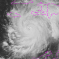
Eduardo Posted October 7, 2016 Share Posted October 7, 2016 5 minutes ago, Amped said: Yes goign to be an interesting few yours. Never seen this live on radar. Definitely some cool stuff. Sorta similar to what happened with Wilma as she crossed the peninsula in 2005: Link to comment Share on other sites More sharing options...
e46and2 Posted October 7, 2016 Share Posted October 7, 2016 cocoa beach live feed Link to comment Share on other sites More sharing options...
jojo762 Posted October 7, 2016 Share Posted October 7, 2016 Basing off the vector from the most recent recon fixes, it is going to be a very close call for cape canaveral later this morning. Something near to or slightly under 100kts sustained should be expected (barring some unforeseen strengthening/weakening.) Link to comment Share on other sites More sharing options...


Recommended Posts
Archived
This topic is now archived and is closed to further replies.