Roger Smith Posted October 7, 2016 Share Posted October 7, 2016 At 02z or 10 p.m. EDT, the peak wind gusts on land in FL were 49 mph at Vero Beach, although Palm Beach is not available. Ocean buoy 41009 east of Cape Canaveral has gusts to 43 knots that we can expect will ramp up rather quickly. Sebastian Inlet also reporting 40 knots sustained. My estimate is also that the eye is headed for Cape Canaveral and Cocoa Beach might be grazed by the western side of it. This is by no means a bust for any locations north of Jupiter (yet) and nobody should assume they are off the hook, the radar presentation makes it appear that the storm is slowly accelerating but it is gaining longitude and almost certainly won't be a significant miss, but some form of shore-hugging trajectory with wobbles and eyewall rotations being key to the details of what actually happens. Link to comment Share on other sites More sharing options...
jojo762 Posted October 7, 2016 Share Posted October 7, 2016 recon found ~110kt SFMR surface winds in the northeast eye wall. Pressure remains unchanged. Only about 80kt in southwest eye wall. There are also two wind maxima in the southwest quad. Link to comment Share on other sites More sharing options...
Morris Posted October 7, 2016 Share Posted October 7, 2016 Pressure is not changed per new AF recon pass. Link to comment Share on other sites More sharing options...
Amped Posted October 7, 2016 Share Posted October 7, 2016 6 minutes ago, toxictwister00 said: Something else I've noticed recently looking at that same radar the rain bands are more widespread in coverage than a few hours ago. The western side of Matthew looked so anemic earlier with the rain bands. Those bands are too closely spaced for deepening, it shouldn't look like one big blob. Link to comment Share on other sites More sharing options...
Jaguars Posted October 7, 2016 Share Posted October 7, 2016 If you follow the OEW you can see that Matthew is ever so slowly eating up the ground between itself and the coastline. It's going to be a very close call for landfall either way. Link to comment Share on other sites More sharing options...
jojo762 Posted October 7, 2016 Share Posted October 7, 2016 Two wind maxima are also obvious per recon in the northeast quad. That IEW is being very pesky... Link to comment Share on other sites More sharing options...
hlcater Posted October 7, 2016 Share Posted October 7, 2016 Outer eyewall is stronger at FL(Flight Level) than inner eyewall, however inner eyewall still maintains near cat 4 windspeeds at the surface. Inner eyewall should start weakening since winds aloft are not nearly as impressive as they were and outer eyewall windspeeds are increasing at a decent rate. Link to comment Share on other sites More sharing options...
Morris Posted October 7, 2016 Share Posted October 7, 2016 NHC's website along with recon data sources are currently offline. Not sure how long it may last. Cowan Link to comment Share on other sites More sharing options...
NavarreDon Posted October 7, 2016 Share Posted October 7, 2016 130/939 @ 11:00Sent from my iPhone using Tapatalk Link to comment Share on other sites More sharing options...
jojo762 Posted October 7, 2016 Share Posted October 7, 2016 11pm EDT advisory: 130mph, 939mb, NNW 13mph... Link to comment Share on other sites More sharing options...
bobbutts Posted October 7, 2016 Share Posted October 7, 2016 The landfall point is important, but with this storm there will probably be a significant distance of coastline that gets eyewall conditions. Farther north actually having the eye pass over. Then landfall, which will probably bring higher winds and surge, which also may move along the coast for some time. The exact landfall point is pretty much academic considering how large an area could potentially be affected by the eye, especially the outer one if it continues in this form. Link to comment Share on other sites More sharing options...
jojo762 Posted October 7, 2016 Share Posted October 7, 2016 3 minutes ago, pcbjr said: Where are you linking from - NHC site is not available on this end? This was according to Norcross on TWC. Looks like all of the .noaa websites are down, SPC, NHC, WPC, etc. Link to comment Share on other sites More sharing options...
Dosh Posted October 7, 2016 Share Posted October 7, 2016 NW quadrant looking the strongest, and there's more development on the SE side of the IEW. My brother's in Port St Lucie working for FPL, looks like his nights about to get rough :/ Link to comment Share on other sites More sharing options...
jm1220 Posted October 7, 2016 Share Posted October 7, 2016 The FL coast slopes NNW here on out, so the eye will have to really turn NW for a while to make landfall anywhere in FL. I'm pretty confident at this point it doesn't happen. The western eyewall might make it onto Cape Canaveral, but a full landfall is pretty unlikely now. This morning's good north jog maybe saved it. The models shifting east at 0z makes me more confident. Link to comment Share on other sites More sharing options...
Chinook Posted October 7, 2016 Share Posted October 7, 2016 If you have trouble accessing the NHC web site, try this: http://kamala.cod.edu/TPC/ Link to comment Share on other sites More sharing options...
jojo762 Posted October 7, 2016 Share Posted October 7, 2016 2 minutes ago, jm1220 said: The FL coast slopes NNW here on out, so the eye will have to really turn NW for a while to make landfall anywhere in FL. I'm pretty confident at this point it doesn't happen. The western eyewall might make it onto Cape Canaveral, but a full landfall is pretty unlikely now. This morning's good north jog maybe saved it. The models shifting east at 0z makes me more confident. Somebody at TWC appeared to have made an error. Trajectory is still to the NW. Cone however has shifted significantly in the short-term. Link to comment Share on other sites More sharing options...
Windspeed Posted October 7, 2016 Share Posted October 7, 2016 NOAA's servers are not resolving. No information as to what is causing the issue. Obviously this is why the NHC is not pulling. Link to comment Share on other sites More sharing options...
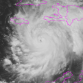
LovintheWhiteFluff Posted October 7, 2016 Share Posted October 7, 2016 Can't get to the update page, but grabbed this: Link to comment Share on other sites More sharing options...
pcbjr Posted October 7, 2016 Share Posted October 7, 2016 1 minute ago, jojo762 said: Somebody at TWC appeared to have made an error. Trajectory is still to the NW. Cone however has shifted significantly. Somehow my question about where and how to link the NHC got deleted. Mods? If so - PM me Mod. This is a legitimate question. What is the trajectory/cone change (?) - as I cannot get the NHC to load. Link to comment Share on other sites More sharing options...
DoctorMu Posted October 7, 2016 Share Posted October 7, 2016 5 minutes ago, jm1220 said: The FL coast slopes NNW here on out, so the eye will have to really turn NW for a while to make landfall anywhere in FL. I'm pretty confident at this point it doesn't happen. The western eyewall might make it onto Cape Canaveral, but a full landfall is pretty unlikely now. This morning's good north jog maybe saved it. The models shifting east at 0z makes me more confident. Except the vector of the storm slightly west of parallel with the coastline Following the inner eyeball has been problematic. Link to comment Share on other sites More sharing options...
LovintheWhiteFluff Posted October 7, 2016 Share Posted October 7, 2016 1 minute ago, pcbjr said: Somehow my question about where and how to link the NHC got deleted. Mods? If so - PM me Mod. This is a legitimate question. What is the trajectory/cone change (?) - as I cannot get the NHC to load. Neither can I, but I made this as big as possible to look at. Looks like it's offshore for Florida. Link to comment Share on other sites More sharing options...
DoctorMu Posted October 7, 2016 Share Posted October 7, 2016 The inner wall has jogged to the eastern edge of the outer eye wall, giving the illusion that the path is significantly east of predicted Link to comment Share on other sites More sharing options...
bdgwx Posted October 7, 2016 Share Posted October 7, 2016 I would say Matthew has transitioned into a neutrally favorable environment overall, but it will begin to become more unfavorable as it gains latitude and experiences more wind shear, moves over water with less heat content, and starts pulling in dry air from the northwest. The minimum central pressure has held mostly steady the last several hours. The secondary wind maximum obviously impeded further intensification during the period of time where environmental conditions were most optimal for an RI event. A gradual weakening seems like the best call right now. Link to comment Share on other sites More sharing options...
RU848789 Posted October 7, 2016 Share Posted October 7, 2016 11 pm update: pressure dropped all day, but just bumped up a bit, indicating weakening - was down to 934 mbar and is now 939 mbar; winds still listed as 130 mph (Norcross on TWC, who is superb, thought they'd come down a little). He said the energy of the storm has spread out some, with a bit weaker winds, but over a larger area (so the same sum of total kinetic energy). However, the storm's center is looking to be staying a bit further off the coast right now than originally thought - and I just saw the cone and the center is now expected to stay off the coast perhaps for the entire ride up the coast, i.e., maybe no landfall. That would be huge in reducing the winds and rain and storm surge at least somewhat. NHC site is down - I'm getting the info from TWC, who does have it directly from the NHC. It might cause people to not heed the next warning, though, but it's still great news for public safety. Link to comment Share on other sites More sharing options...
friedmators Posted October 7, 2016 Share Posted October 7, 2016 Not sure if its frictional convergence or just the fact the storm is getting closer to the radar source but it looks better to me over the last hour. Link to comment Share on other sites More sharing options...
winterymix Posted October 7, 2016 Share Posted October 7, 2016 I'll venture a guess of partial land fall at or just north of St. Augustine. Link to comment Share on other sites More sharing options...
jojo762 Posted October 7, 2016 Share Posted October 7, 2016 Not nearly as on shore as it once was, for sure. Link to comment Share on other sites More sharing options...
LakeEffectKing Posted October 7, 2016 Share Posted October 7, 2016 This is going to take another decent jog to the left of the current motion here over the next hour or so.. Link to comment Share on other sites More sharing options...
DoctorMu Posted October 7, 2016 Share Posted October 7, 2016 1 minute ago, winterymix said: I'll venture a guess of partial land fall at or just north of St. Augustine. The eyewall will contact Cape Canaveral if the current vector continues, imo Link to comment Share on other sites More sharing options...
jojo762 Posted October 7, 2016 Share Posted October 7, 2016 Just now, WeatherFan202 said: I can not get onto the NHC website. If anyone here can, can they please post the 11 pm discussion. HURRICANE MATTHEW DISCUSSION NUMBER 36 NWS NATIONAL HURRICANE CENTER MIAMI FL AL142016 1100 PM EDT THU OCT 06 2016 The satellite appearance of Matthew has improved during the past several hours, with an eye embedded within a more circular central dense overcast and an increase in the outer banding. Reports from a NOAA Hurricane Hunter aircraft and coastal radar data show the presence of centric eyewalls with diameters of about 8 and 60 n mi respectively. The NOAA aircraft earlier reported a minimum pressure of 937 mb, and an Air Force Reserve Hurricane Hunter just reported estimated surface winds of 109 kt from the SFMR and a pressure of 939 mb. Based on these data, the initial intensity is 115 kt. The initial motion is 325/11 kt. For the next 24-48 hours, Matthew should move around the western end of the subtropical ridge, with the motion gradually turning northward and then northeastward. During this time, the center of the guidance envelope and the various consensus models have shifted a little to the east. However, the ECMWF, GFS, and UKMET continue to suggest the possibility of the hurricane making landfall in Florida and then moving near the coasts of Georgia and South Carolina. This part of the forecast is nudged a little to the east and lies between the model consensus and the previous forecast. After 48 hours, a mid- to upper-level ridge is forecast to build north and west of Matthew, and the track guidance forecasts a southeasterly to southerly motion in response. While there is still a large spread, the GFS, ECMWF, and UKMET are in better agreement that Matthew should move south between the ridge and Hurricane Nicole to the east. This part of the forecast follows this guidance and lies between the GFS and ECMWF. During the next 12-24 hours, Matthew will likely weaken a little as it undergoes an eyewall replacement cycle. After that time, it is expected to encounter strong southwesterly vertical shear, and later in the forecast period dry air is likely to entrain into the cyclone. This combination should cause steady weakening, and Matthew is forecast to drop below hurricane strength by 72 hours. The new intensity forecast is in best agreement with the SHIPS model. Link to comment Share on other sites More sharing options...


Recommended Posts
Archived
This topic is now archived and is closed to further replies.