-
Posts
2,891 -
Joined
-
Last visited
About NavarreDon

- Birthday 04/12/1965
Profile Information
-
Four Letter Airport Code For Weather Obs (Such as KDCA)
KNPA
-
Gender
Male
-
Location:
Navarre, FL
Recent Profile Visitors
4,584 profile views
-

93L – “Inactive” Season Posting Check-In (NEVER MIND)
NavarreDon replied to BarryStantonGBP's topic in Tropical Headquarters
Here’s a nice write up from MOB. This might be beneficial to newer/less tropical savvy forum members. Sorry for the length! .DISCUSSION... Issued at 114 AM CDT Wed Jul 16 2025 Things are looking a little more active for the upcoming days. The entire next three days or so will be centered around Invest 93L and what comes of that. Currently the mid level center is located near the Big Bend Region of Florida embedded in a blob of storms. However, it appears that what low level center we had has lost its way. We have the body of a potential system but the legs wandered off into north Florida and until we grow a new pair of legs this system is likely to struggle. Unfortunately, the moisture will still arrive eventually leading to a rather soggy next couple of days and the potential of heavy rainfall on Thursday. Today will be rather similar to Tuesday. Rain chances will likely remain confined to the coast and east of I-65 during the afternoon where the influences of the Invest are most felt. The biggest thing will be the potential for heavy rainfall from slow moving storms. PWATS will be above 2 inches with overall likely flow leading to slow moving and efficient rain makers. However, with how weak the low is and no true focus for training convection, any flooding rain would likely be isolated and focused around the poor drainage areas of the coastal cities. This is rather noticeable in some of the ensemble guidance with some individual members hinting at some higher totals approaching 3 to 5 inches but it is sporadic in nature with an overall mean of around 1 inch. This does not give much confidence in flooding and thus we will not go with any sort of flood watch at this time. With the system likely remaining rather weak and disheveled and the upper ridge in full control, expect temperatures to get warm across areas northwest of I-65. Heat indices will likely climb to the 106 to 108 range across southeastern Mississippi during the afternoon and overall heat risk will be high across this area. Could consider a heat advisory; however, hotter times are coming and overall heat stress will likely be confined to a rather short period. Thus have differed on issuing one. Heading into the end of the week, things will remain active with the potential tropical low slowly meandering towards Louisiana. The good news is guidance is far from enthused with this system as the upper ridge continues to push back on the storm and its limited time over water/proximity to land should keep things in check. Even if it did organize more, the stronger ensemble members take it further south and west into the Gulf (more time over water and further from land) before making landfall in south central Louisiana well west of our area. A stronger storm would also help boost the ridge to our north and likely drive the storm west and keep us in the clear from most of the nasty stuff. The biggest concern looks to be Thursday as rain chances will be highest. PWATS will climb into the 2.25 to 2.5 inch range along the northeastern side of the system. Much like Wednesday, these moisture levels certainly support a risk of efficient rain makers; however, the aforementioned weaker system coupled with a stronger ridge really plays against a more widespread heavy rain threat without a true focus. IF and thats a big if, the system strengthens a little quicker, then a more focused rain threat may materialize across coastal Alabama and maybe into southeastern Mississippi. Overall guidance isn`t enthused and thats probably an artifact of the system struggling overall. Rain chances will continue through Friday before the ridge builds back in for the weekend. A high risk of rip currents will begin on Thursday and last til at least Saturday as increasing wave action and onshore flow from the invest begins. . -
NavarreDon started following Tropical Storm Chantal
-

2024-2025 Fall/Winter Mountain Thread
NavarreDon replied to Buckethead's topic in Southeastern States
One of my best friends (now retired) was a flight surgeon and spent a good bit of time at NAS Pensacola. We will always have a piece of the Mnts in our hearts but we love living here. Thank you all for the kind words and letting me share my out of place posts in your thread! . -
https://x.com/nwsmobile/status/1882145805613838512?s=46&t=0ZvB_AF2VfA6c0SDxf53yA .
-
https://x.com/iembot_mob/status/1882022996195389884?s=46&t=0ZvB_AF2VfA6c0SDxf53yA .
-
Navarre FL 7.75” for a final tally. 16 degrees for the low this morning. Milton FL 20 miles north of me shattered the all time Florida record for snow with 8.8”. It’s been an event that I can’t wrap my head around! .
- 369 replies
-
- 14
-

-

2024-2025 Fall/Winter Mountain Thread
NavarreDon replied to Buckethead's topic in Southeastern States
Good morning from the Panhandle of Florida Mnt & Foothill Peeps, we ended the event with 7.75” of snow & some drifts upwards of 16”. It’s currently 16 degrees. This has truly been a historic storm down this way. Records have been shattered from Louisiana to the Florida Panhandle. Thank you for letting me share my excitement in your thread!!! . -
Up to an astounding 7” here in Navarre & still snowing!!! Finding it hard to wrap my head around it. .
- 369 replies
-
- 15
-

-

2024-2025 Fall/Winter Mountain Thread
NavarreDon replied to Buckethead's topic in Southeastern States
Last pics before dark of what has been one of the most surreal snow days of my life! 24 degrees and still snowing! . -

2024-2025 Fall/Winter Mountain Thread
NavarreDon replied to Buckethead's topic in Southeastern States
Still puking!!! . -
Still puking in Navarre, over 4” best I can tell with the wind. We have some 12” drifts. .
- 369 replies
-
- 20
-

-

-

-
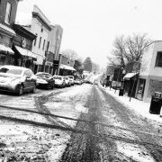
Come to Florida they said, it’ll be sunny & warm! 25 and this….yes I’m loving it. .
- 369 replies
-
- 21
-

-

-

2024-2025 Fall/Winter Mountain Thread
NavarreDon replied to Buckethead's topic in Southeastern States
I’m butting in again, I’m just floored! When I think it can’t get harder it does. This is truly a once in a lifetime event for the Gulf Coast. . -
Puking snow in the Panhandle of FL!!! .
- 369 replies
-
- 14
-

-

2024-2025 Fall/Winter Mountain Thread
NavarreDon replied to Buckethead's topic in Southeastern States
Indeed!!! . -

2024-2025 Fall/Winter Mountain Thread
NavarreDon replied to Buckethead's topic in Southeastern States
Double post


