All Activity
- Past hour
-

2026-2027 Super El Nino
roardog replied to Stormchaserchuck1's topic in Weather Forecasting and Discussion
I feel like once you get into super Nino status that stronger might even be better here just because there should have a tremendous amount of moisture streaming into the country. Some of that is bound to try to make its way up this way like it did in 2015-2016. I guess if we have a record setting Nino then it’s something we’ve never experienced so technically there isn’t even an analog. -
The NBM shows WFO MQT reaching 99 degrees, which would place today in a 4-way tie for the all-time record (period of record since 1961). If downsloping can get the shoreline to 100 degrees, it will be only the 27th time 100 degrees has been recorded in the City of Marquette since the 1860s (including times with less reliable instrumentation and siting). The Ironwood WWTP site has not recorded a 100 degree temperature since the 1940s, while the Iron Mountain WWTP site has only reached 100 3 times since the 1940s (the IMT ASOS has never recorded 100 degrees F since it was installed in 1996). All of this to say, the level of heat today will likely (50+%) be on the level that most Yoopers would have to leave the UP to experience in their lifetimes. Overnight lows tonight only look to fall to the low to mid 70s, providing little relief for those without air conditioning.
-
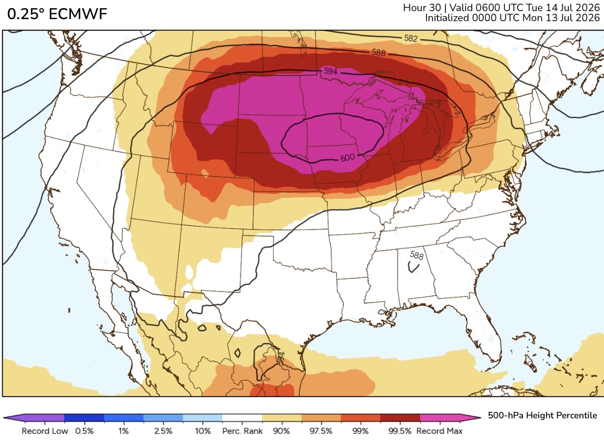
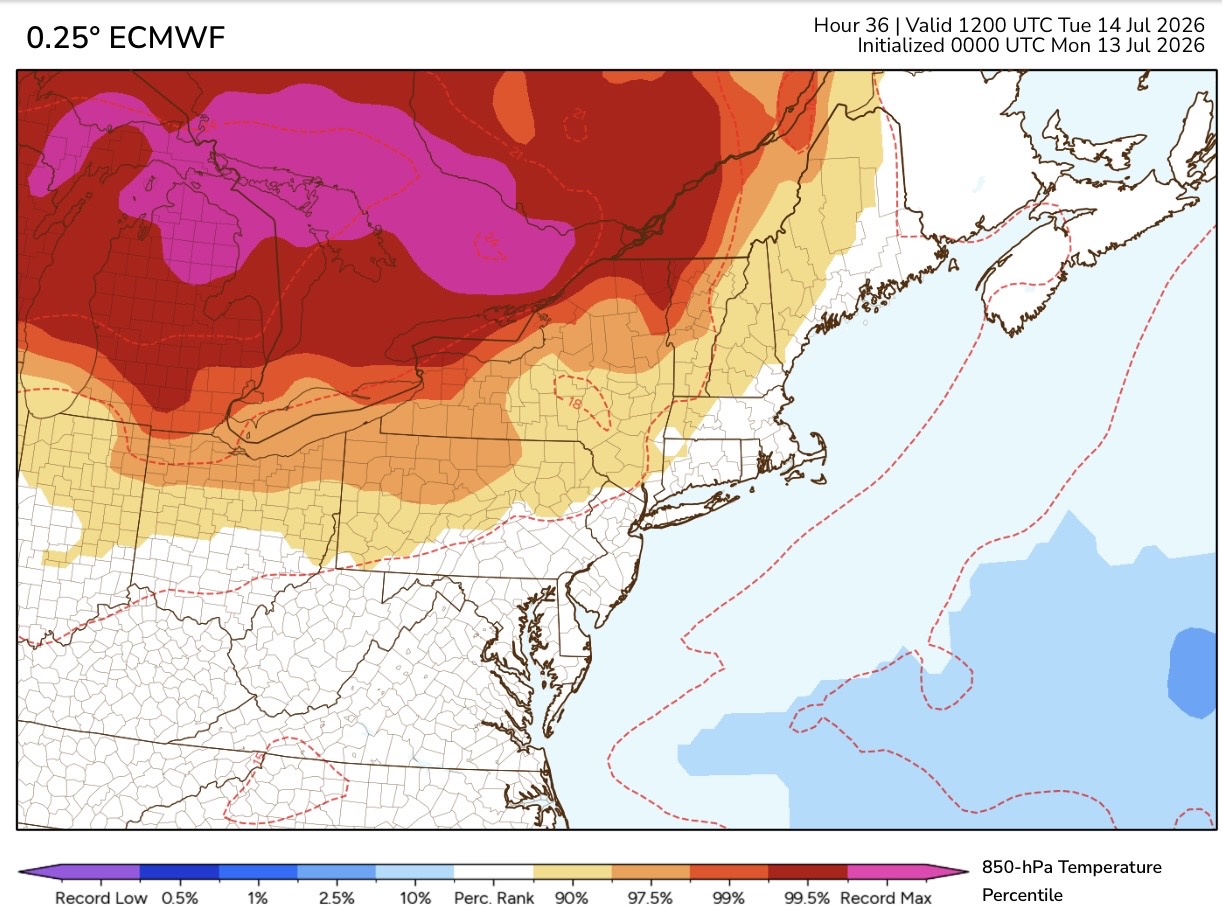
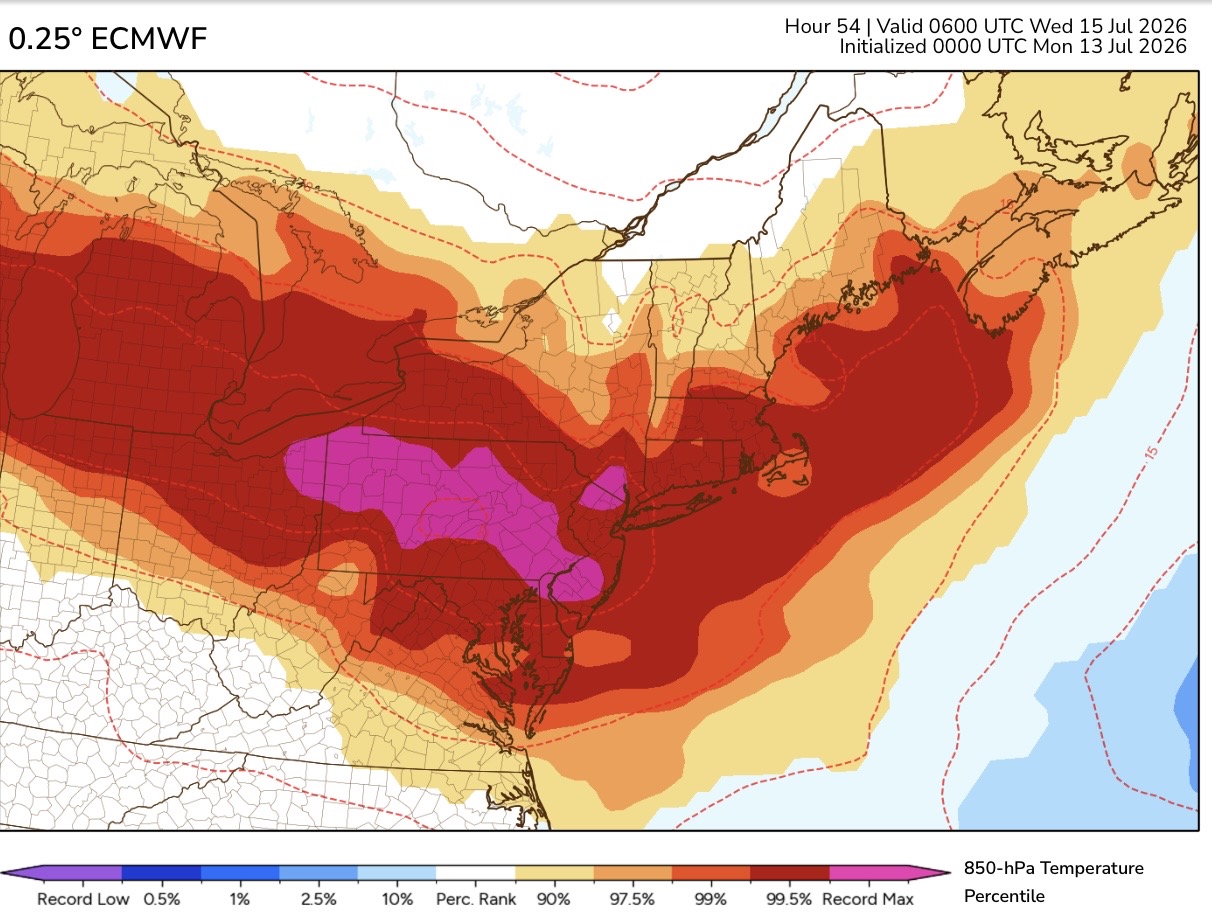
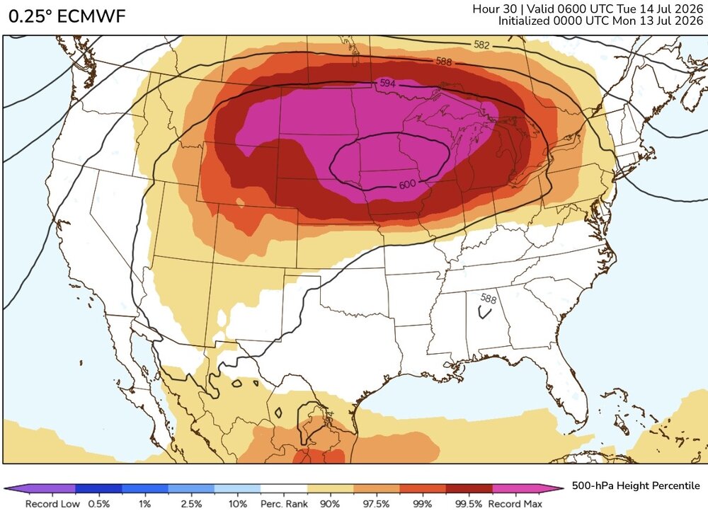
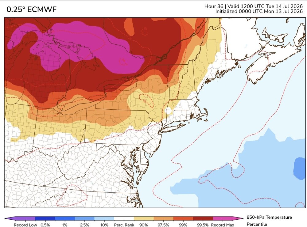
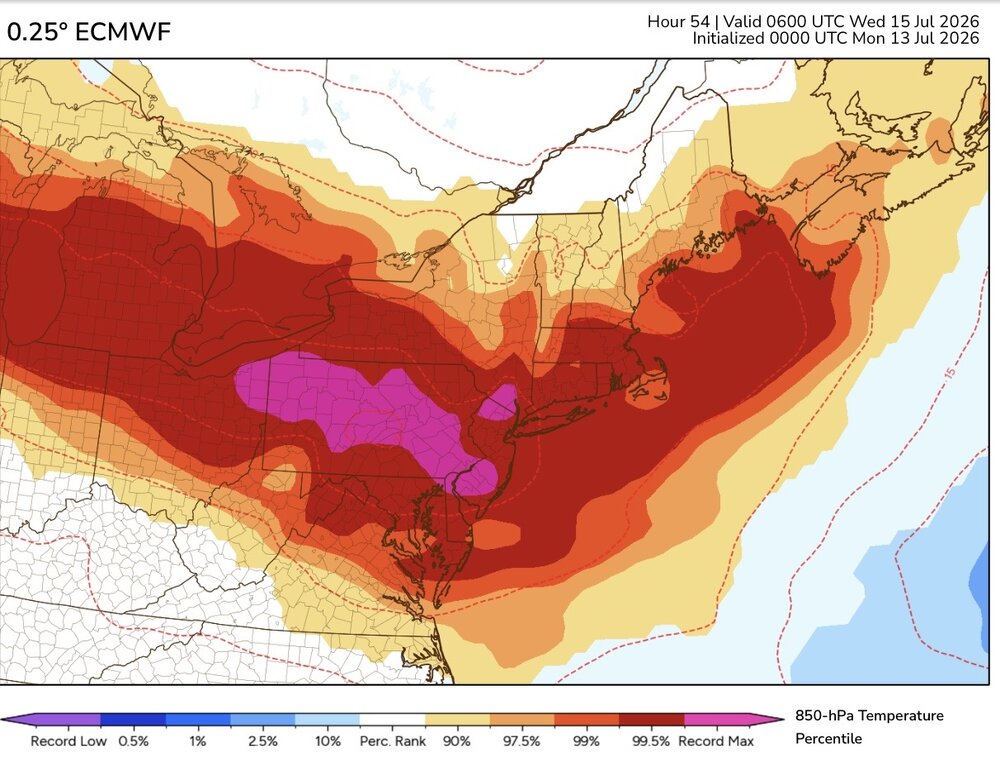
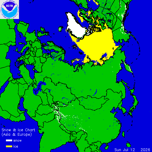
All-time record highs with this developing record 600 dm ridge. The 850 mb plume is forecast to set all-time warmest 850mb temperatures from Ontario into the Northeast. But the models have the 850 mb temperatures peaking at night. So they actually begin coming down a bit during Wednesday afternoon. The Euro and GFS both have 102°-104° at the warmest spots across the region Wednesday. RECORD EVENT REPORT NATIONAL WEATHER SERVICE BILLINGS MT 506 PM MDT SUN JUL 12 2026 ...RECORD HIGH TEMPERATURES ACROSS THE REGION TODAY... HERE IS A SUMMARY OF DAILY RECORDS AND ALL-TIME RECORDS TIED OR BROKEN SO FAR TODAY, SUNDAY, JULY 12TH. DAILY RECORDS BROKEN SITE HIGH TEMP PREVIOUS RECORD PERIOD OF RECORD BEGINS BILLINGS 111 107 (2002) 1934 LIVINGSTON 105 103 (2002) 1948 MILES CITY 115 104 (1954) 1937 SHERIDAN 109 104 (2002) 1907 BAKER 110 103 (2006) 1998 ALL-TIME RECORDS TIED OR BROKEN SITE HIGH TEMP PREVIOUS ALL-TIME RECORD PERIOD OF RECORD BEGINS BILLINGS 111 108 (7/14/2002) 1934 LIVINGSTON 105 105 (8/5/1961) 1948 MILES CITY 115 111 (6/26/2012) 1937 SHERIDAN 109 107 (7/27/2021) 1907 BAKER 110 109 (7/25/2024) 1998 AN UPDATED SUMMARY OF DAILY AND ALL-TIME RECORDS WILL BE SENT AT THE END OF THE DAY IF NEEDED.
-
Had another good rain overnight, bringing the total to 4.46in. Like John said, when it rains, it just pulses up and keeps going. Whether it’s storms or just rain, it keeps on regenerating over the areas it rains on. A fantastic way to help alleviate the drought. I’m not sure it will fill the lakes up the rest of the way to their summer pool level, but it is sure beginning to make a difference.
-
 MCS type look down this way. They tend to hold on longer than guidance and are poorly modeled (trajectory, intensity) at very short lead times if they get going. Kind of a mind of its own type deal… Would expect a big fizzle here on the seacoast but with northerly flow, anticipating at least some hefty downpours, which would be nice—could use the rain.
 -
Cloudy, dry and 65° but the smoke from the western fires is noticeable. AQI in the high 60s isn't horrible but it's enough to see and feel.
-

Central PA Summer 2026 Discussion/Obs Thread
Itstrainingtime replied to Voyager's topic in Upstate New York/Pennsylvania
Interesting...I got down to 62 all the way down here. -
I was thinking the same thing. I remember as a kid strobe light thunderstorms in the middle of the night. You'd wake up to pouring rain and continues flashing and loud thunder. I honestly can't remember the last time that happened.
-
62 this morning. Refreshing.
-
Maybe it is just an 'older man' reminiscing about younger days, but I swear we used to get the 'leftovers' from big midwestern (IL/IN/MO/KY/OH) storms to swing thru here from the W or NW late overnight into the early morning hours.
-

2026-2027 Super El Nino
LakePaste25 replied to Stormchaserchuck1's topic in Weather Forecasting and Discussion
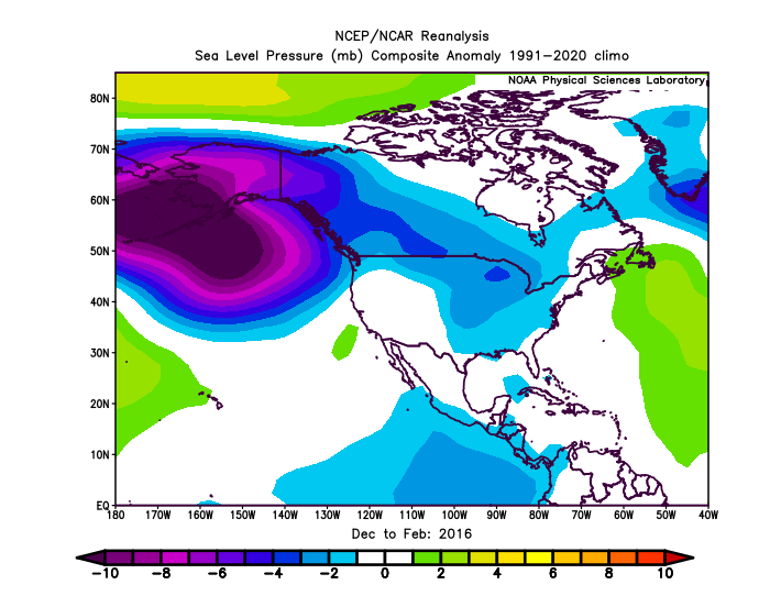
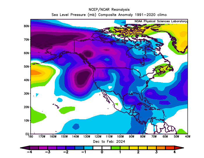
The stronger ridges and weaker troughs are likely playing a huge role. If you look at SLP, it’s less muted. However, still some subtle differences between the events.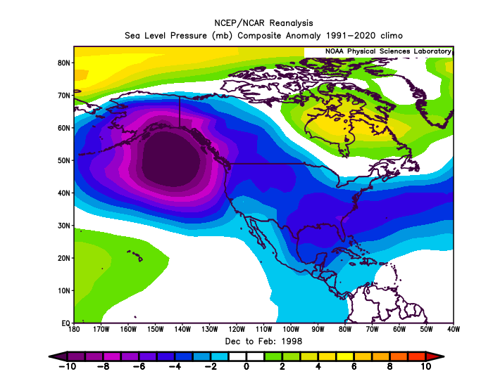
-

Chester County PA - Analytical Battle of Actual vs. Altered Climate Data
chubbs replied to ChescoWx's topic in Climate Change
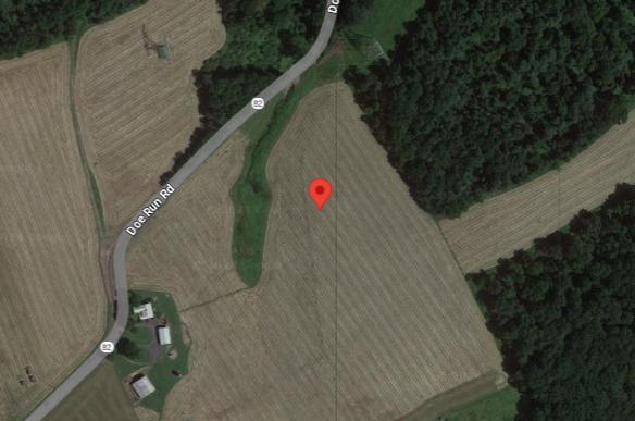
You aren't looking at the chart I posted. Per your table the Chesco COOPs and the Philadelphia Airport both averaged 54.1 between 1942-44. After 1945 the large cooling moves started in the Chesco COOPs. By the early 1970s the COOPs were almost as cool as ABE. Clearly shown in the chart I posted above. If you don't correct for station moves, the raw COOP data is unusable for climate purposes in this post-war period. Not sure why this is so hard for you to accept. The Coatesville stations below, 1930-1945 and 1949+ are very different. One is much cooler than the other and the local raw data shows it. You can't treat these two sites as the same station, an adjustment is needed. That's why NCEI gets the right answer for Chesco and you don't.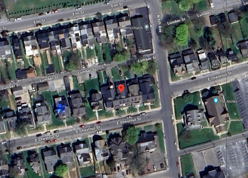
-

Central PA Summer 2026 Discussion/Obs Thread
pawatch replied to Voyager's topic in Upstate New York/Pennsylvania
64 degrees this morning! -
-

Central PA Summer 2026 Discussion/Obs Thread
mahantango#1 replied to Voyager's topic in Upstate New York/Pennsylvania
URGENT - WEATHER MESSAGE National Weather Service State College PA 204 AM EDT Mon Jul 13 2026 PAZ004>006-010>012-018-019-027-028-037-041-042-045-046-049>053- 056>059-140700- /O.NEW.KCTP.HT.Y.0004.260714T1500Z-260715T0000Z/ Warren-McKean-Potter-Elk-Cameron-Northern Clinton-Northern Centre- Southern Centre-Mifflin-Juniata-Tioga-Northern Lycoming-Sullivan- Southern Clinton-Southern Lycoming-Union-Snyder-Montour- Northumberland-Columbia-Perry-Dauphin-Schuylkill-Lebanon- Including the cities of St. Marys, Laporte, Emporium, Wellsboro, Pottsville, Warren, Berwick, Hershey, Shamokin, Ridgway, Lewistown, Mansfield, Trout Run, Danville, Mifflintown, Sunbury, Lock Haven, Williamsport, Harrisburg, Lebanon, Renovo, Selinsgrove, Bloomsburg, State College, Philipsburg, Lewisburg, Coudersport, Newport, and Bradford 204 AM EDT Mon Jul 13 2026 ...HEAT ADVISORY IN EFFECT FROM 11 AM TO 8 PM EDT TUESDAY... * WHAT...Heat index values of 96 to 103 degrees expected. * WHERE...A portion of central Pennsylvania. * WHEN...From 11 AM to 8 PM EDT Tuesday. * IMPACTS...Hot temperatures and high humidity may cause heat illnesses. * ADDITIONAL DETAILS...The Heat Advisory may need to be extended into Wednesday for a portion of central Pennsylvania as another hot day is looking increasingly likely. PRECAUTIONARY/PREPAREDNESS ACTIONS... Drink plenty of fluids, stay out of the sun, and stay in an air-conditioned room. Check up on relatives and neighbors, and provide pets with adequate water and shelter from the sun. Know the signs and symptoms of heat exhaustion and heat stroke. Review heat safety and preparedness information at weather.gov/safety/heat. If you do not have air conditioning in your home or lack shelter, you can call 211 or visit pa211.org for assistance locating appropriate shelter from the heat. && $$ - Today
-
Over 4” at the farm in Louisburg since yesterday and still pouring
-
@WxWatcher007 home brew next weekend???
-
0.5” Friday night. 1.6” last night. Total for July so far: 7.3 “ The Falls Lake watershed has been the place to be the last two months.
-

2026-2027 Super El Nino
bluewave replied to Stormchaserchuck1's topic in Weather Forecasting and Discussion
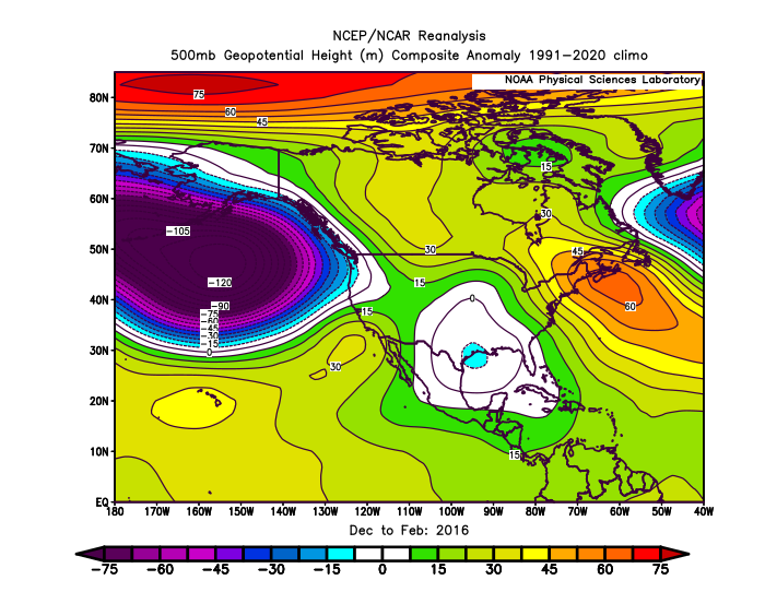
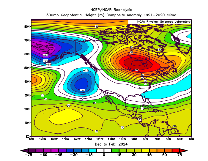
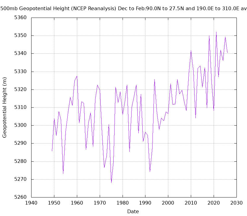
I realize that and was talking more generally about the DJF means. 1997-1998 had the strongest connection between the Aleutian low and the low across the Southern Tier of the CONUS. There is always going to be variability from month to month and season to season between different super El Ninos. By 2015-2016 the Aleutian low was weaker along with the low in the Southeast even with the strong +PDO. 2023-2024 also had a weaker Aleutian low that split into two pieces. So the low across the Southeast was weaker than 1997-1998 also in the means. It’s also possible that the warming climate leading stronger and more extensive ridges and weaker troughs is playing a role also. The chart below shows the rising 500mb heights over North America and the adjacent oceans during DJF.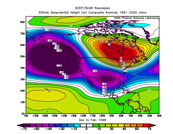
-
lol
-
locked in

-
Gorgeous clear morning! 68 degrees out.
-
 https://vgrsansordonnance.top/# Viagra 100 mg sans ordonnance
 -
Non-stop rain tonight.
-

2026-2027 Super El Nino
BlizzardWx replied to Stormchaserchuck1's topic in Weather Forecasting and Discussion
I've been thinking about this too. Makes you wonder if with CC what is typical of el nino could be changing or if we've just been oversubscribing a small sample size. Either one says we aren't necessarily going to get a big GOA low. It also says maybe the El nino - PDO connection is less settled than we think.