All Activity
- Past hour
-

Occasional Thoughts on Climate Change
donsutherland1 replied to donsutherland1's topic in Climate Change
I forgot a third reason he likely isn't employed in his field of study, and it's probably the most significant one: Profound dishonesty. Ethics still matters in many professions. Here's the latest example: He refers to the following document: https://archive.ipcc.ch/pdf/ipcc-principles/ipcc-principles.pdf Notice that this document was prepared in 1998. That is a decade after the IPCC was established. At that time, scientific understanding of contemporary climate change and the predominant role of human activities were far better understood. If one wants to find the IPCC's original purpose, one has to go back to the founding documents. That was UNGA Res. 43-53. Its original mission was not limited to human-induced climate change. It covered climate change in its entirety.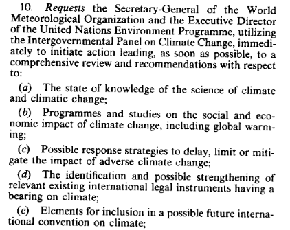

-
 How's Pete's foliage coming along?
 -
Wet, humid summer. Making up for the 8 month drought. When does the next drought start? Seems like its all or nothing the last few years.
-
aww do you want me to make long posts to entertain you little piggies? haha
-

Central PA Summer 2026 Discussion/Obs Thread
Mount Joy Snowman replied to Voyager's topic in Upstate New York/Pennsylvania
Low of 62. Boat day. -
-
White Plains recorded its fourth consecutive low in the 50s. The last time that happened in July was during 2009. At that time, an El Niño was developing. Strong El Niño conditions are already present this year.
-
CSU MLP guidance favors south of the area for Tuesday. CIPS is not enthused really. NCAR which normally is overly bullish is not terrible but given its normal...is under enthused as well.
-

E PA/NJ/DE Summer 2026 Obs/Discussion
Violentweatherfan replied to PhiEaglesfan712's topic in Philadelphia Region
Me too. Heard cicadas the same time you did, but they are sparse. Kinda hoping they’ll come out in force. -
Picked up .80 inches in heavy rain this morning. Closing in on 6 inches for the month.
-
Loud morning!
-

Central PA Summer 2026 Discussion/Obs Thread
canderson replied to Voyager's topic in Upstate New York/Pennsylvania
Had a little rain shower early this am -

Dewgust 2026: Summer's Last Stand
Damage In Tolland replied to Prismshine Productions's topic in New England
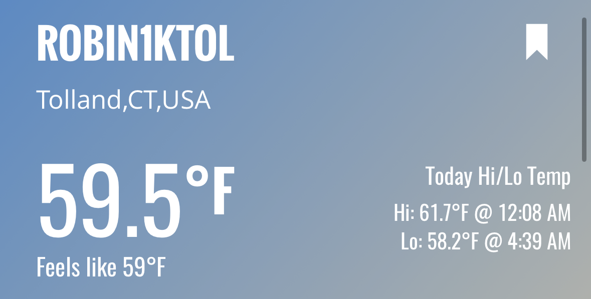
Torch ! -
DCA has had one above average precip month since June 2025. That was due to the sleet storm in January. July to date is -0.32" so maybe we can get lucky over these last few days.
-
More more comfortable temperatures here than areas to our west.
-
Outstanding stretch of weather on LI
- Today
-
57.9 this morning 3 consecutive nights below 60 degrees in July, last time that happened out here at ISP was 2018
-
 You missed the stuff the other day?
 -
More rain and storms this morning. Looks like a good chance of severe weather this week as well.
-
He doesn’t even know where I live lol
-

Central PA Summer 2026 Discussion/Obs Thread
mahantango#1 replied to Voyager's topic in Upstate New York/Pennsylvania
Hazardous Weather Outlook National Weather Service State College PA 312 AM EDT Sun Jul 26 2026 PAZ028-036-050-052-056-057-059-063-270715- Juniata-Franklin-Snyder-Northumberland-Perry-Dauphin-Lebanon- Cumberland- 312 AM EDT Sun Jul 26 2026 This Hazardous Weather Outlook is for central Pennsylvania. .DAY ONE...Today and tonight. Scattered strong to severe thunderstorms with gusty winds and isolated instances of hail are possible this afternoon and evening. .DAYS TWO THROUGH SEVEN...Monday through Saturday. Scattered strong to potentially severe thunderstorms with localized damaging wind gusts, hail and heavy rain will move into the Central and Eastern Pennsylvania on Tuesday. .SPOTTER INFORMATION STATEMENT... Spotters are encouraged to report significant hazardous weather. Hazardous Weather Outlook National Weather Service State College PA 312 AM EDT Sun Jul 26 2026 PAZ064>066-270715- Adams-York-Lancaster- 312 AM EDT Sun Jul 26 2026 This Hazardous Weather Outlook is for central Pennsylvania. .DAY ONE...Today and tonight. Scattered strong to severe thunderstorms with gusty winds and isolated instances of hail are possible this afternoon and evening. .DAYS TWO THROUGH SEVEN...Monday through Saturday. Scattered strong to potentially severe thunderstorms with localized damaging wind gusts, hail and heavy rain will move into the Central and Eastern Pennsylvania on Tuesday. .SPOTTER INFORMATION STATEMENT... Spotters are encouraged to report significant hazardous weather. -
 Yeah, 49F here. Can’t get enough of these days. Bring the deluge.
 -
 58° Just not a cold place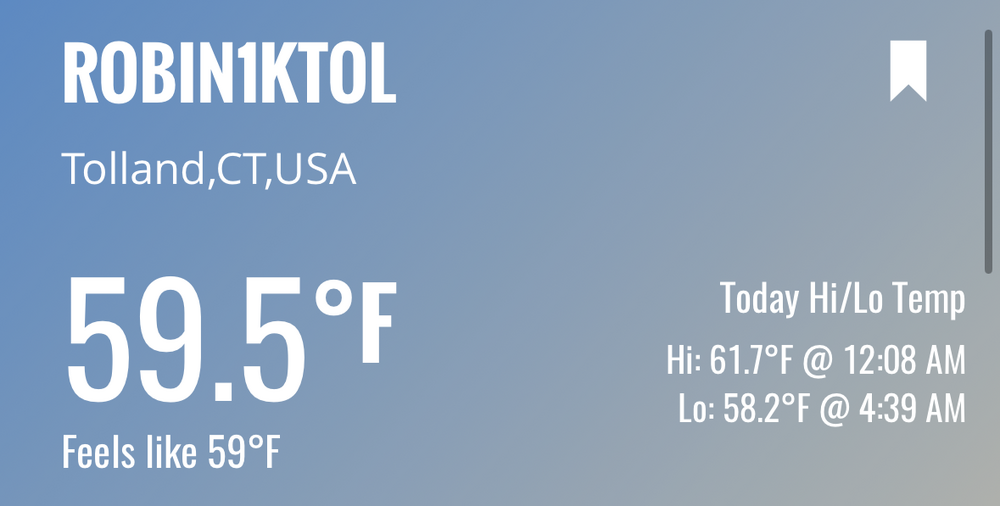
-
Morning day 3 discussion from SPC Day 3 Convective Outlook NWS Storm Prediction Center Norman OK 0226 AM CDT Sun Jul 26 2026 Valid 281200Z - 291200Z ...THERE IS A SLIGHT RISK OF SEVERE THUNDERSTORMS FROM THE SOUTHERN MID-ATLANTIC INTO THE CAROLINAS AND CENTRAL AND SOUTHERN APPALACHIANS... ...SUMMARY... Severe thunderstorms capable of mainly damaging winds appear possible from the southern Mid-Atlantic into the Carolinas and central and southern Appalachians Tuesday into Tuesday evening. Isolated severe wind gusts may occur in the central High Plains. ...Synopsis... A short-wave trough initially over the lower Great Lakes Tuesday morning is forecast to evolve into a closed low over the Mid-Atlantic. Within the base of that feature, a belt of enhanced mid-level flow will spread from the OH Valley into VA and NC by afternoon. At the surface, an area of low pressure over southwest ON Tuesday morning is expected to reform in the Delmarva by afternoon with a lee trough extending southwest along the Piedmont. Meanwhile, a cold front will advance southeast through the central and southern Appalachians, the southern Mid-Atlantic into the Carolinas. ...Mid-Atlantic into Southern Appalachians... Showers and thunderstorms (some potentially strong) are expected to be ongoing Tuesday morning from the upper OH Valley into the Mid-Atlantic and central Appalachians within a zone of forcing for ascent preceding the short-wave trough. Various 00Z model data indicate deep convection lingering into afternoon from the central Appalachians into the Delmarva and points north, leading to uncertainty in the degree of air mass destabilization in those areas. Where stronger heating can occur, the presence of a moist air mass will contribute to moderate instability by afternoon within a kinematic environment featuring anywhere from 30 to 45 kt of deep-layer shear. Thunderstorms are expected to increase in coverage and intensity during the afternoon preferentially along the cold front and lee trough where sufficient destabilization has occurred. Organized storm modes appear possible, including supercells and bowing structures, with the primary hazards being damaging wind gusts. Some tornado threat could materialize Tuesday afternoon in the Delmarva near the surface low. That threat is conditional on sufficient air mass destabilization and the presence of a supercell mode.
-

2026-2027 Super El Nino
snowman19 replied to Stormchaserchuck1's topic in Weather Forecasting and Discussion
It’s basically a guarantee that the models get even stronger with the El Niño on the August runs. This ongoing WWB is record-breaking, literally off the charts and the current DWKW is gaining strength…. Subsurface: 2026 vs. 1997 vs. 2015 vs. 2023: