All Activity
- Past hour
-

2026-2027 Super El Nino
bluewave replied to Stormchaserchuck1's topic in Weather Forecasting and Discussion
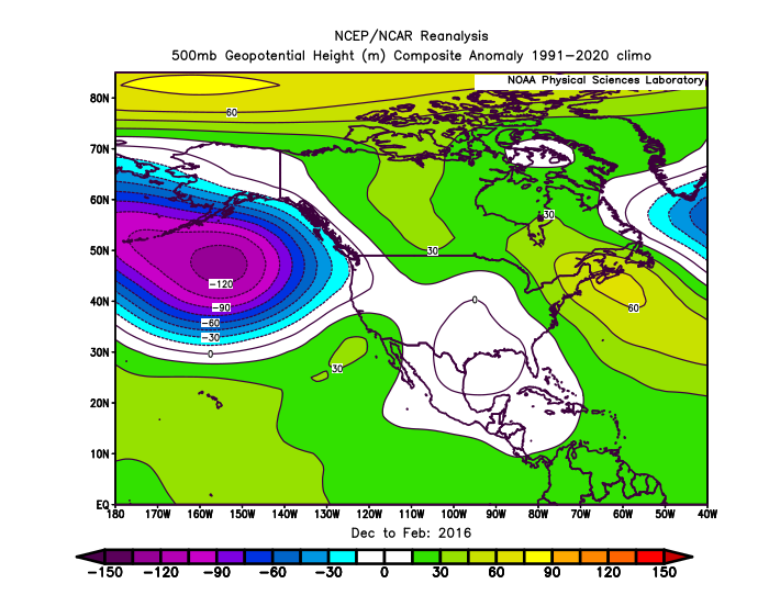
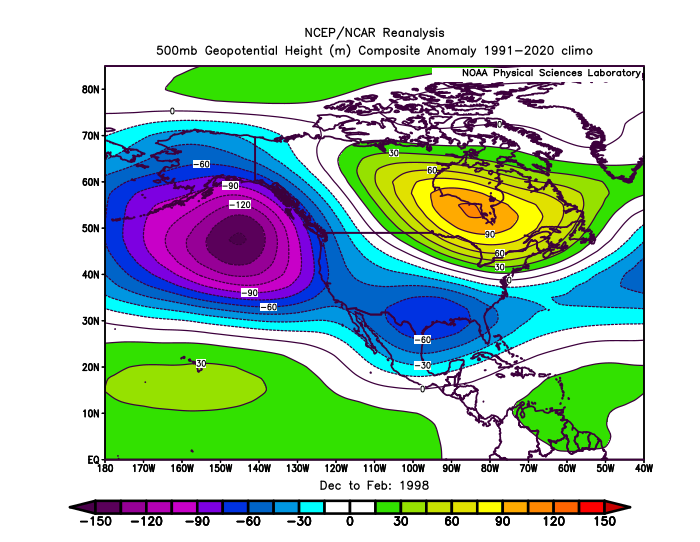
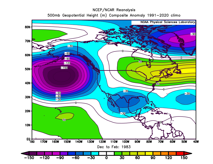
The main expansion mostly occurred following the 2015-2016 super El Niño with the big global temperature jump to a much higher baseline. It’s part of the reason that the ridges have been more impressive than the troughs as the planet warms regardless of the ENSO phase. The mid-latitude ridge growth has been driving the persistent -PDO/-AMO SST patterns. But there could be a feedback process at work between the ocean and atmosphere. We can notice the Aleutian low weakening since the 1980s with the super El Niños.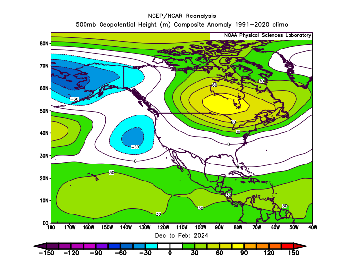
-

Saturday, July 18, 2026 Thunderstorm/Severe Weather Potential
WinterWolf replied to weatherwiz's topic in New England
Ahhh ok…makes sense now. Thanks Hippy. -
I took my lunch break. Looks like I’ll be taking a second lunch break soon
-

2026 Atlantic Hurricane Season
NavarreDon replied to Stormchaserchuck1's topic in Tropical Headquarters
We have orange, ZCZC MIATWOAT ALL TTAA00 KNHC DDHHMM Tropical Weather Outlook NWS National Hurricane Center Miami FL 200 PM EDT Sat Jul 18 2026 For the North Atlantic...Caribbean Sea and the Gulf of America: 1. Northern Gulf of America and near Florida (AL91): Satellite images and surface observations indicate that a broad surface low is forming over the eastern Gulf of America. However, the associated winds remain light, and the showers and thunderstorms are still disorganized. Gradual development of this system is possible, and it could become a tropical depression while it moves slowly northward or north-northwestward during the next few days. Interests along the Florida Gulf coast, southern Alabama, and southwestern Georgia should monitor the progress of this system as it is expected to bring heavy rain to portions of that region during the next several days. An Air Force Reserve reconnaissance aircraft is scheduled to investigate the system on Sunday, if needed. * Formation chance through 48 hours...low...30 percent. * Formation chance through 7 days...medium...40 percent. . -
remember your creed soldier
-
And another classic miss from SW to NE. Lots of thunder, wind, not enough rain to wet the ground and 1 mile north gets pummelled.
-
It's toast for this region. It's already nearly 2pm
-

2026 Mid-Atlantic Severe Storm General Discussion
midatlanticweather replied to Kmlwx's topic in Mid Atlantic
Strike out of the blue (well haze today) I got one around July 4th that lit up the outside even with the sunshine. A year ago one struck behind the neighbor's house and fired the well pump. That one there is furthest one I have seen from the main cell, maybe a storm is trying to form there -
Ughhhh this weather is disrupting my work again.
-

2026-2027 Super El Nino
jaxjagman replied to Stormchaserchuck1's topic in Weather Forecasting and Discussion
Heres that article recently posted https://www.severe-weather.eu/global-weather/rare-atlantic-nina-joins-super-el-nino-atmospheric-shield-hurricane-season-winter-united-states-canada-fa/ -
Bad storm hitting home and a big storm just north of me on lake Keowee.
-
I think east of the city is toast for anything later other than dying convection
-
I haven't yet seen anything concrete but that was the most well defined hook echo I've seen in the GTA. The QLCS has a few cells with spacing but its a tad crowded. The og sup is nearing Niagara on the Lake but may slip past. Kettle Point ON has a tight cell that is sus. Grab from Instant Weather:
-
Would anyone venture to guess how eastern Morris County might be affected by storms between 4:00 - 6:00 PM? I have to travel in that area around that time.
-
its appropriate that "Weathers" is the starting pitcher for the Yanks tonight - now the question is whether or not they will be rained out - Mets Phillies at 3:05 in Philly should be able to be squeezed in
-
If it doesn’t clear out pretty substantially I think we’re mostly shot for anything later but I’ll take whatever rain we get.
-
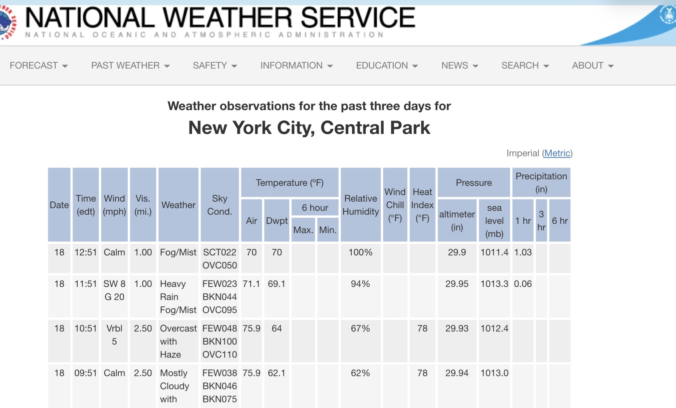
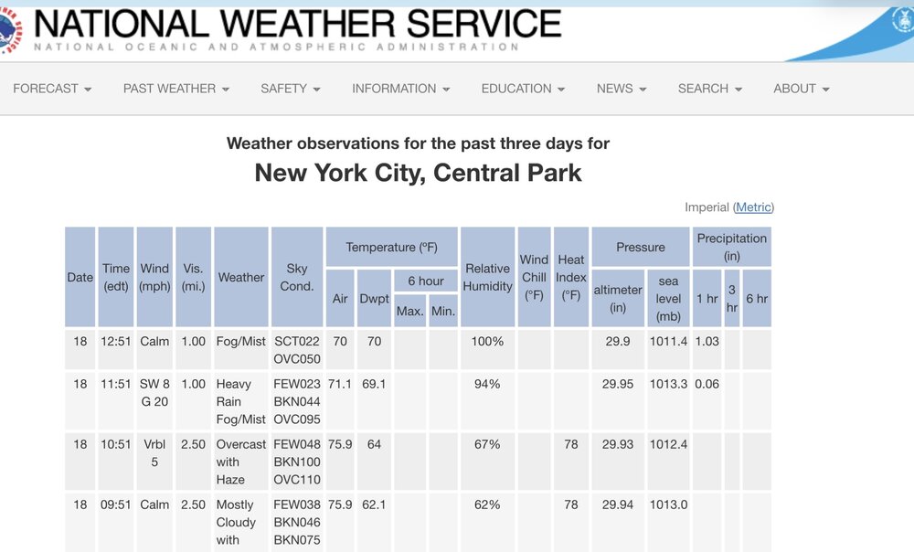
1.03 in Central Park between 11:51 and 12:51. As always ….
-

2026 Mid-Atlantic Severe Storm General Discussion
SnowenOutThere replied to Kmlwx's topic in Mid Atlantic
Storm near Madison VA is rotating. Has a well defined mesocyclone on radar, and it’s even further from the warm front than most of us. -
One storm after another. Fun from a weather enthusiast point of view, crappy for somebody who has been on the road all day.
-
1.5” - would be fine missing the severe threat this evening but we’ll see how it works out.
-
New severe thunderstorm watches in IN/MI/OH/PA along with the enhanced risk outlook type area. A few storms are getting going in Flint in South Bend, but nothing much. Probably a marginal severe storm by Flint. KDTX has no radar data, by the way, so that's a bummer for me an a couple of you guys in Michigan.
-
Hysterical that JFK’s latest ob is TSTM/Smoke.
-
92/79/108
-
Well over 2” of rain here
-

Saturday, July 18, 2026 Thunderstorm/Severe Weather Potential
HIPPYVALLEY replied to weatherwiz's topic in New England