

jaxjagman
-
Posts
9,127 -
Joined
-
Last visited
About jaxjagman

Recent Profile Visitors
11,303 profile views
.thumb.jpg.049f4a7f726ada07e8cd30bd17e713cb.jpg)


-
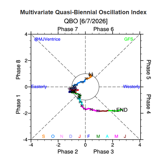
I'll side with you right now Carver But i'm not exactly sure what analog you would even start with ATM. in the strong Ninos in 91-92 and 97-98 winter both had a EQBO Now the strong NINO of 2015-16 had a WQBO but the QBO flaked out into winter,not sure thats a worthy analog year or could we see a repeat,dunno.Here is a paer by Kang,WooSoo and Chun on this https://agupubs.onlinelibrary.wiley.com/doi/full/10.1029/2022GL100101
-
Dont even look severe hardly Wed,go figure with the models in the mid range..lol
-

2026-2027 Super El Nino
jaxjagman replied to Stormchaserchuck1's topic in Weather Forecasting and Discussion
+PDO can happen even in a NINA,but more likely in a NINO,maybe more study to what actually starts a period?Dacula has the Index of the PDO going back into the last century https://www.daculaweather.com/4_pdo_index.php -
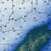
Maybe South east TN can get some storms later,cold front is still well out west but the Lapse rates and low level shear showing isnt that great later on,but there is convection that has recently popped up alomg the TN/MS line,guess we will see later.Wed looks to better as Jeff mentioned above,but even that the GFS fluctuates each run seemingly
-
2026-2027 Super El Nino
jaxjagman replied to Stormchaserchuck1's topic in Weather Forecasting and Discussion
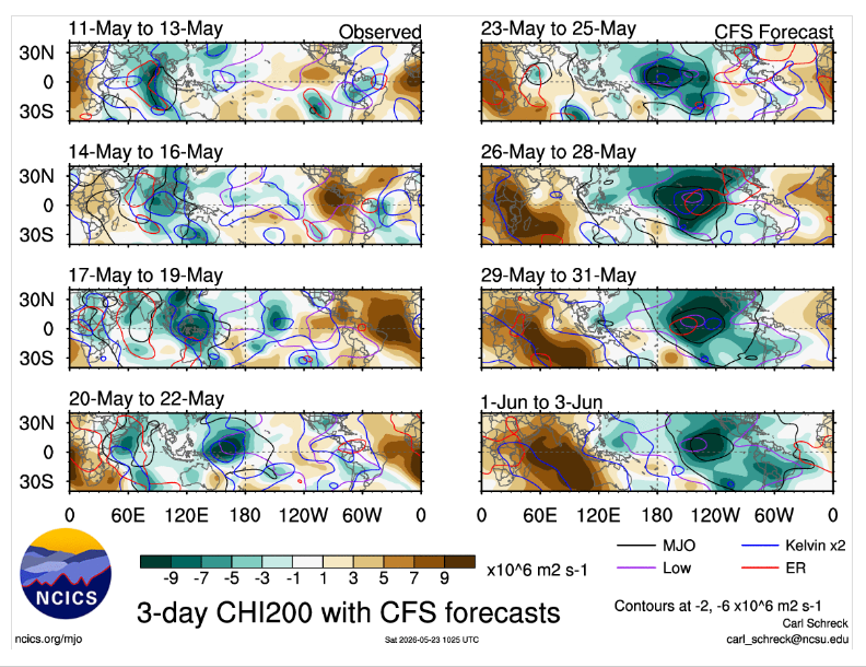
Im kinda skeptic you see any big change in the SST'S in the east.Seems like we are fixing to see a WWB getting combatted with possibly a strong EWB,which is why you see the RMMS showing a decent signal into the WP when we get into July and beyond,other than that maybe a ERW off the Peruvian coast which could possibly warm 3 up,should not be much going on well into July -
Short range models whiiffed,better convection was seemingly in SW Tn,but nothing really severe
-
Maybe someone will get a good snow strorm this winter,other than that its more than likely going to be AN,we seem to be already headed towards WQBO the next few weeks,more than likely a brick PV probably this winter
-
2026-2027 Super El Nino
jaxjagman replied to Stormchaserchuck1's topic in Weather Forecasting and Discussion
-
2026-2027 Super El Nino
jaxjagman replied to Stormchaserchuck1's topic in Weather Forecasting and Discussion
Has there ever been a ENSO maybe comparable to this on other than maybe 2009?Even this WWB upcoming is seemingly going to combatted more or less with a EWB -
Dont see much of any severe the next several days just some possible thunder,guess its that time to go hibernate back into seasonal threads..lol
-
2026-2027 Super El Nino
jaxjagman replied to Stormchaserchuck1's topic in Weather Forecasting and Discussion
-
Maybe we will see thunderstorms anyways in the upcoming days,seems like we fixing to see a ERW along with maybe a CCKW,in which the Rossby wave will kick off the strong WWB EAST of the IDL, This would kick off a more monsoonal flow and put us in a wet unstable pattern in a few days more or less.Least we should see some much needed rains here
-
I think that was the cell i was watching on my radar yesterday
-
Allergies have been kicking my butt the past couple days,i havent paid much attention to anything weather related the past couple days,so glad we got some rain and knocked the pollen down
-
Looks close to where we are at, we are off Carothers


