All Activity
- Past hour
-
Looks like the models are doing Lucy with the football again, on the rain in my area. Went from 1+ inch totals to the Euro splitting the rain and mostly missing my area. It spit out .14 inches for the next 7 days here now.
-
1.33” here. Definitely needed.
-
Did touch 70 today - gorgeous out.
-

Central PA Spring 2026 Discussion/Obs Thread
mahantango#1 replied to Voyager's topic in Upstate New York/Pennsylvania
That's terrible news regarding the fruit trees. -
Hmmmm... afternoon AFD from LWX about Wednesday. Granted we will likely fail... but only chance for a while The better chance for showers and some thunderstorms would be on Wednesday as a brunt of the upper trough moves toward the Eastern Seaboard. A remnant MCV will likely be wrapped up in this larger scale trough, the timing and amplitude of which will dictate the extent of any strong to severe weather in the Mid- Atlantic. As is typical with these features, their finer scale details (as well as leftover upstream convective debris) cast uncertainty into the extent of heating/instability. Conditionally speaking, increasing winds throughout the lower/mid troposphere on Wednesday as this wave approaches. Large scale ascent also increases. The most likely area for appreciable instability to develop would be southwest of a line from roughly Elkins WV to Ocean City MD. This area is closer to the source of low-level moisture return, and may see some better heating southeast of more abundant clouds and in the vicinity of a developing warm frontal feature. Resultant thunderstorm activity may tend to track along the warm front later in the day, again contingent upon the extent of available instability. Some risk for gusty to damaging winds or perhaps a tornado or two may develop, with an even more conditional risk of hail should stronger more discrete cells develop.
-
I still think the area south of ATL gets F'd again. The moisture just disappears whenever it gets close. I've seen it way too many times the last 9 mos.
-
WB 12Z EPS, hug Member 48!

-
I’ve paid this zero attention - is this a mountain snow threat? Can’t help but automatically look at the 850 line on these maps.
-
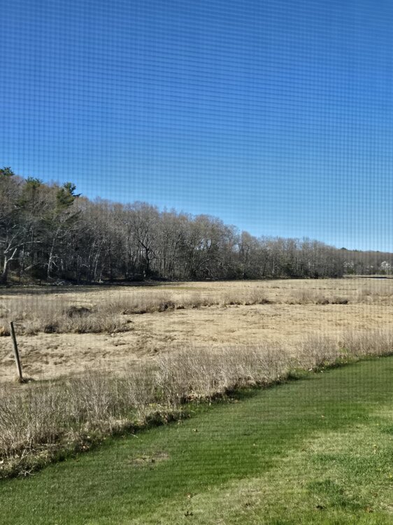
South shore of MA has yet to leaf out directly on the coast. Ita crazy how far behind we are. Today was nice. Hoping we can get out of this coastal influence we've been stuck in for weeks
- Today
-
Pollen seems to be peaking again.
-

Potential Sever Weather Outbreak 4/27/2026
andyhb replied to pen_artist's topic in Lakes/Ohio Valley
PDS tornado watch out for the area surrounding the MS/OH River confluence. 80/80 tornado probabilities. -
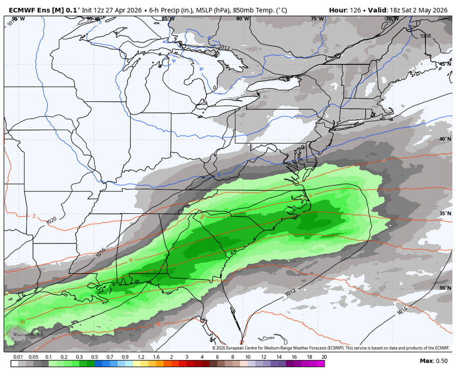
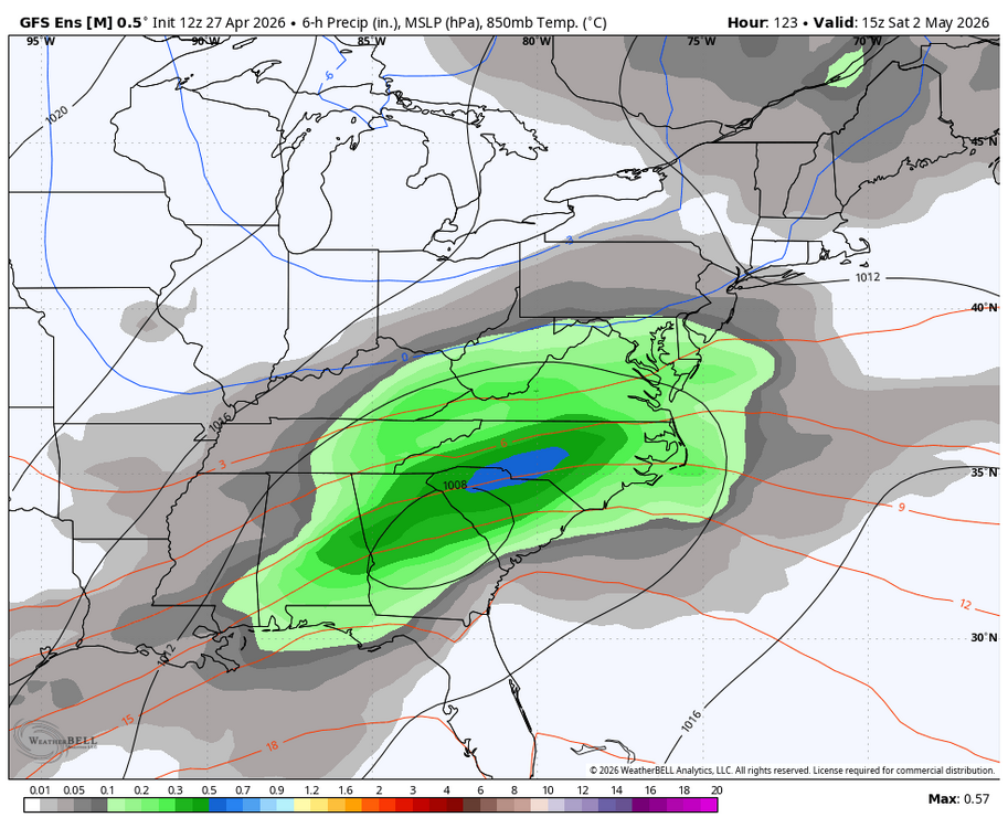
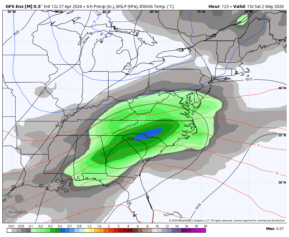
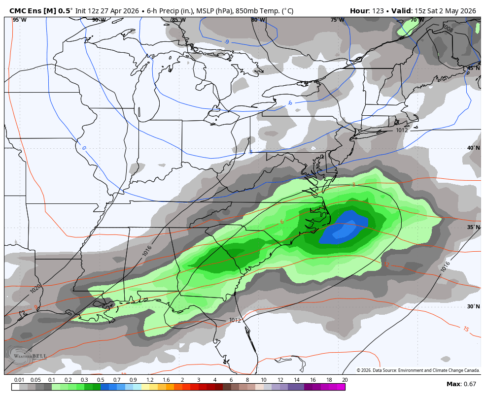
WB 12Z ensembles for Saturday.

-
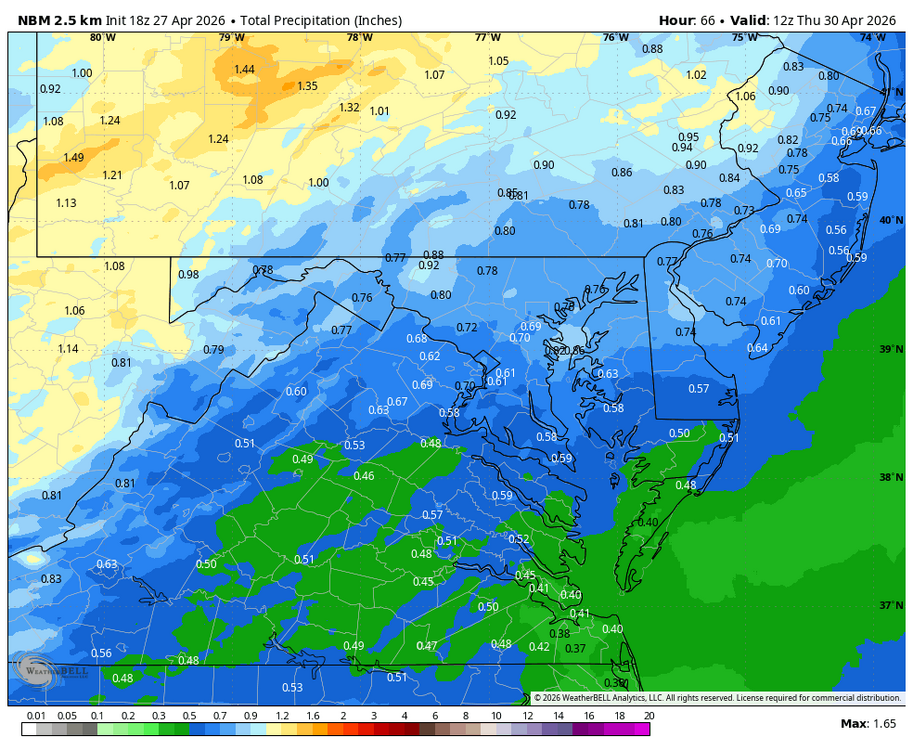
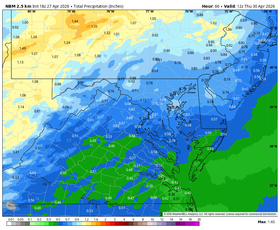
WB 18Z NBM for Wed.
-
Pretty aggressive wording on this SMW over Lake Michigan
-

Potential Sever Weather Outbreak 4/27/2026
sbnwx85 replied to pen_artist's topic in Lakes/Ohio Valley
HRRR at least makes things worth keeping an eye on for the rest of us tonight.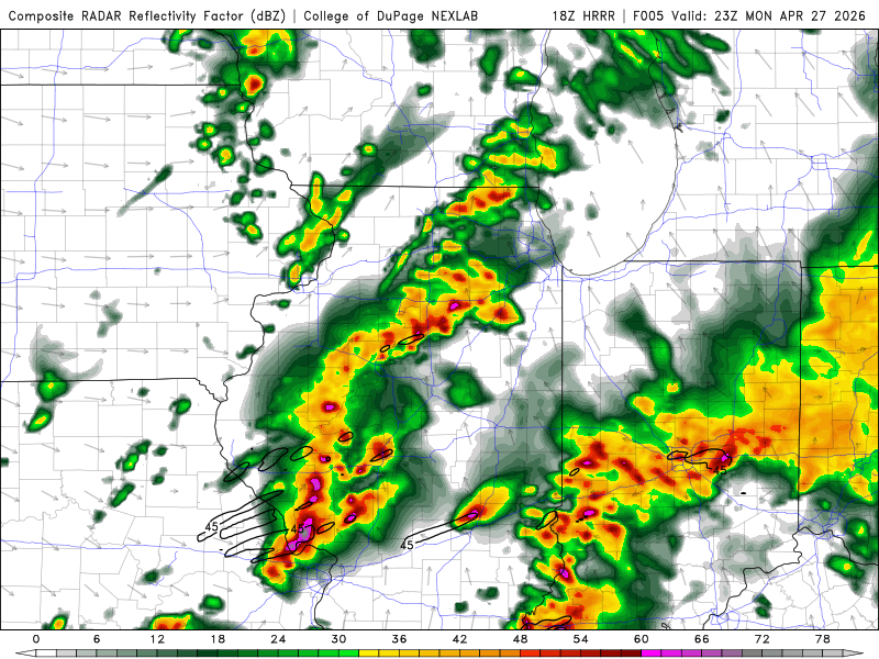
-

Central PA Spring 2026 Discussion/Obs Thread
canderson replied to Voyager's topic in Upstate New York/Pennsylvania
Back home. What a beauty of a day here. -
Fortunately we don't talk politics in here, so i won't be able to do that. Have a wonderful day and try to help the youth of America.
-

Potential Sever Weather Outbreak 4/27/2026
Malacka11 replied to pen_artist's topic in Lakes/Ohio Valley
Still holding out hope for at least a GV line moving through before dark -

Potential Sever Weather Outbreak 4/27/2026
CheeselandSkies replied to pen_artist's topic in Lakes/Ohio Valley
Does the clearing now pushing from the eastern half of IA/NE MO into NW IL/SW WI mean anything or is it too little, too late? SPC pretty thoroughly chopped away our severe probabilities on the northern end with the 1630 update. -

Potential Sever Weather Outbreak 4/27/2026
A-L-E-K replied to pen_artist's topic in Lakes/Ohio Valley
never forget -
2 tornado warnings for STL in like 90 minutes
-
Based on current observations, the northern extent of true surfaced-based severe weather should extend roughly on a line from St Louis east/northeast ward. HRRR has the southern portion lit up with discrete cells before going linear.
.thumb.png.f5bf89887c3221f58715db5d63310b34.png)
-
.thumb.jpg.6a4895b2a43f87359e4e7d04a6fa0d14.jpg)
Central PA Spring 2026 Discussion/Obs Thread
Yardstickgozinya replied to Voyager's topic in Upstate New York/Pennsylvania
I knew it was going happen before it did. It wasn't just about the freeze.It was also about the stage of fruit development. -
54.1°
-
Central PA Spring 2026 Discussion/Obs Thread
Yardstickgozinya replied to Voyager's topic in Upstate New York/Pennsylvania
I apologize if it's already been talked about. I'm haven't been stopping around the forum too much lately. Many fruit farms are reporting 100% loss of fruit as of today from the last freeze. I myself also lost everything. The last freeze did turn out to be locally, one of the most agricultural devastating freezes since i've been a member here.


.thumb.jpg.ad3a2e31d30aff035044689b311a0540.jpg)


.png.2120f695ed20f2c4174c4eb6d5de5ca7.png)

