mob1
-
Posts
2,794 -
Joined
-
Last visited
About mob1

-
To be fair, one of them ended up being a confirmed tornado (as it law enforcement confirmed, not radar). In the beginning it was definitely outflow dominant though.
-
Aside from the cells near Springfield (which might be outflow dominant for now, though it seems to be becoming more surfaced based now) the area to watch are there cells here to see if they can remain discrete or semi-discrete as it moves eastward into a loaded environment. If it congeals into a line quickly, it obviously greatly diminishes the strong tornado threat.
-
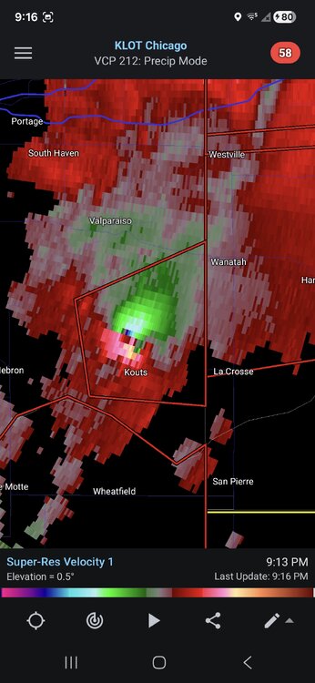
Southern and SW neighborhoods of Chicago getting hit pretty good.
-
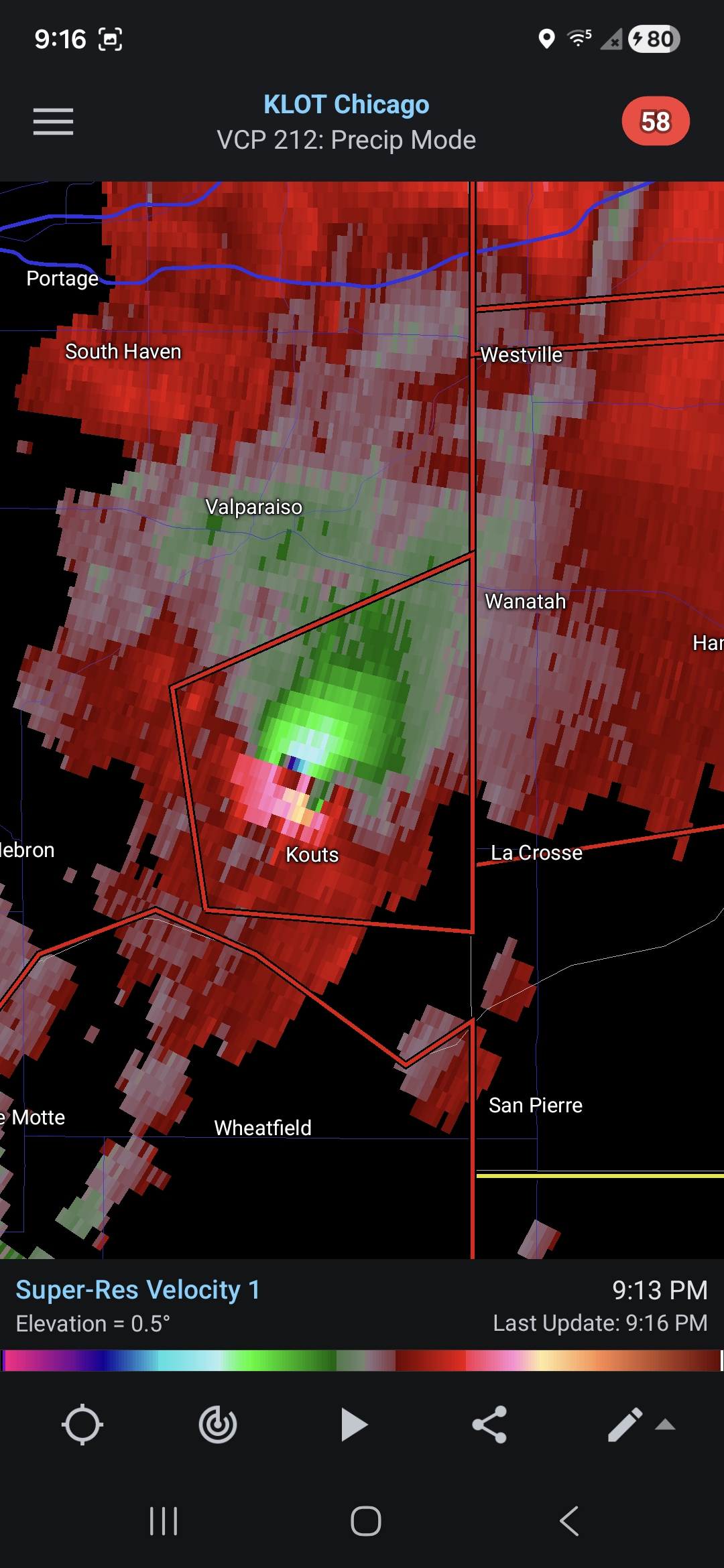
Absolutely insane velocity scans on that cell.
-
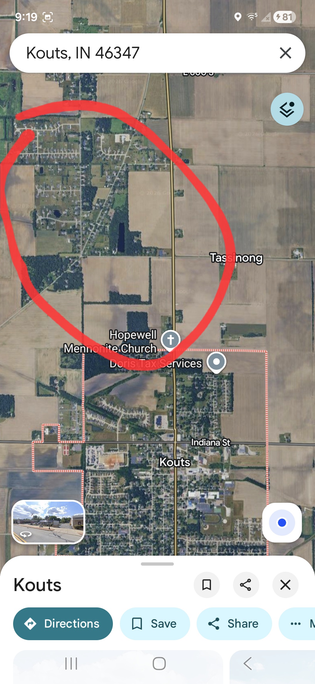
There's a fairly decently sized housing development just north of Kouts, hopefully it's not hitting that. Couplet looks even stronger now.

-
The cell just north of Waldo IL might be next to go if it can stave off any crap-vection.
-
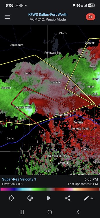
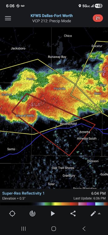
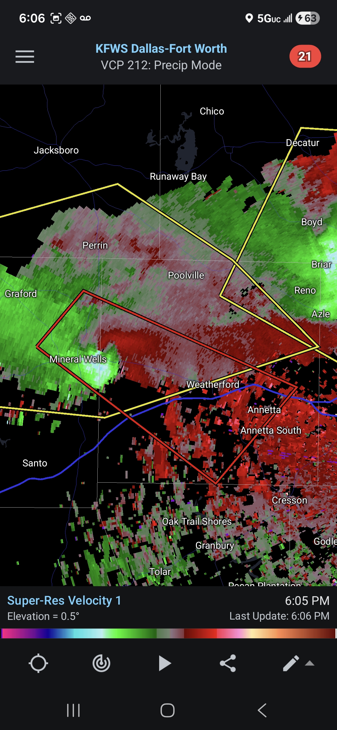
Decent couplet on the cell near Mineral Wells TX. Solid radar presentation as well.
-
Really underwhelming so far, we'll see if this'll turn into a nocturnal event.
-
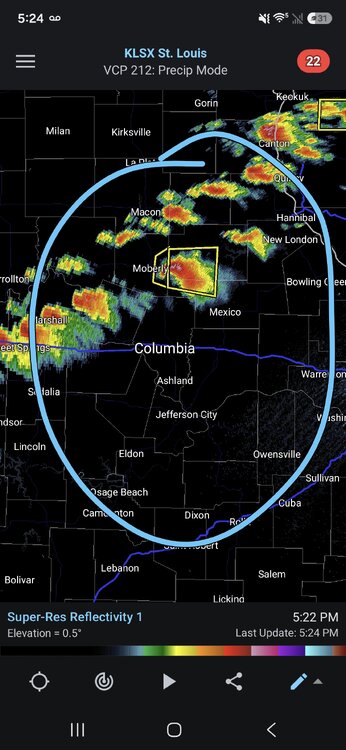
Based on current observations, the northern extent of true surfaced-based severe weather should extend roughly on a line from St Louis east/northeast ward. HRRR has the southern portion lit up with discrete cells before going linear.
.thumb.png.f5bf89887c3221f58715db5d63310b34.png)
-
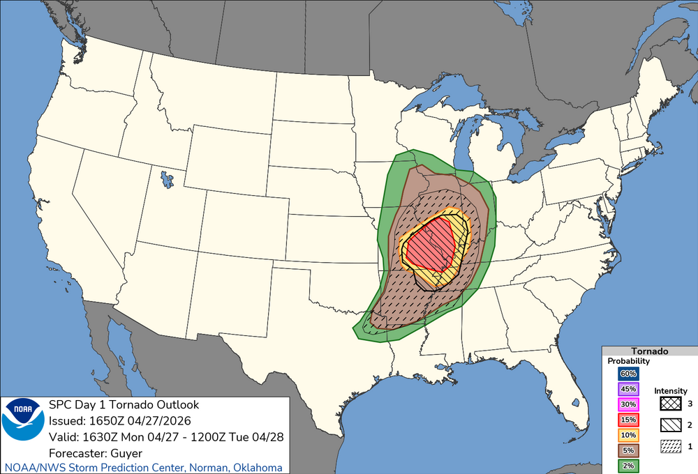
New outlook nudged things a bit south
-
I wonder if the threat moves even further south based on where the current precipitation and outflow boundary is.
-
https://x.com/NickKrasz_Wx/status/2047770770005529075?s=20
-
Thanks for opening a thread for this, some of the soundings for Monday look pretty wild. Obviously every severe weather threat has many failure modes, but the potential is definitely there for a high-end event.
-
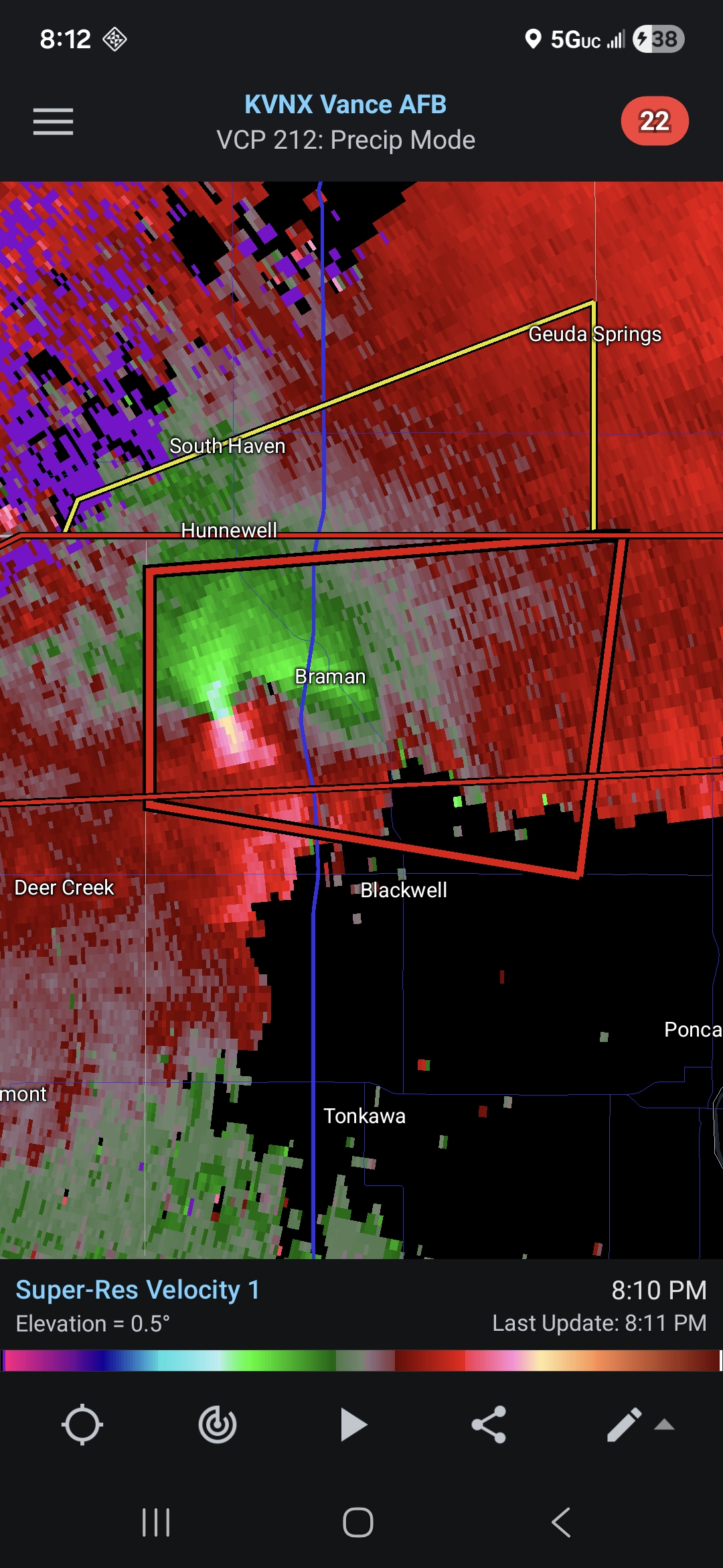
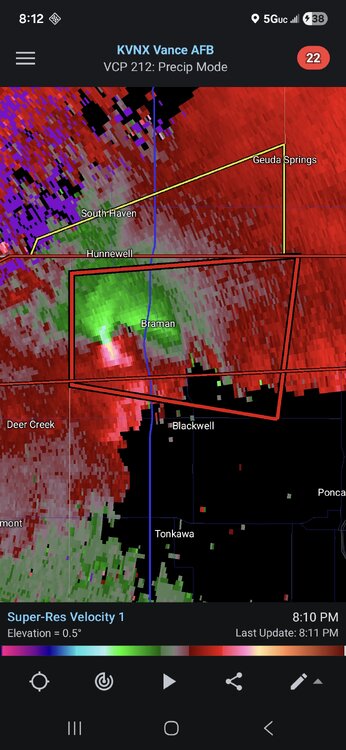
Since there's no active severe thread in the other subforum I'll just it here. PDS warned storm approaching Braman OK.
-
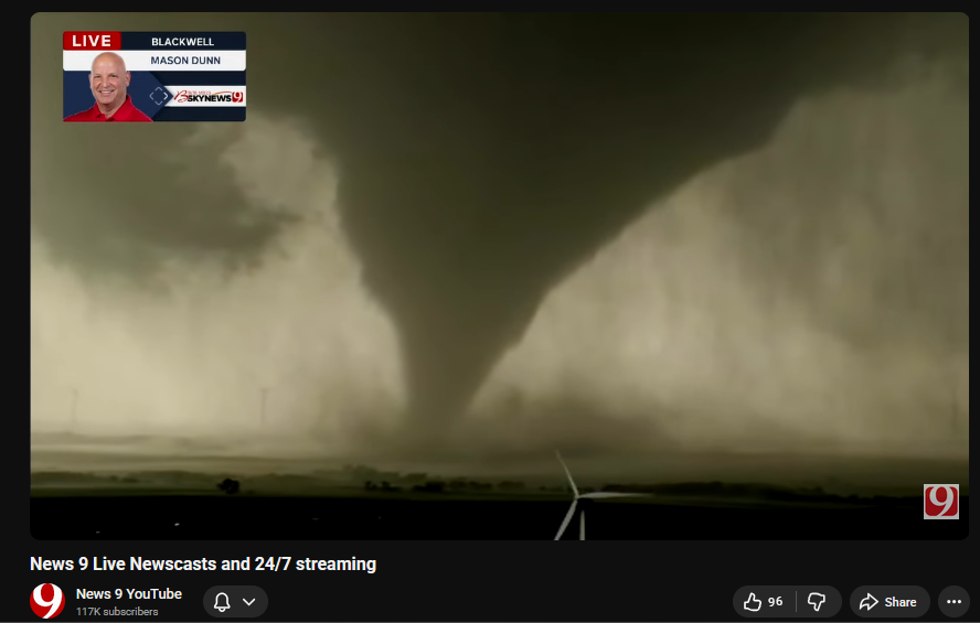
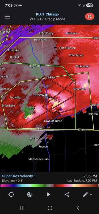
Confirmed tornado just south of Janesville. Possibly twin tornadoes.


.png.2120f695ed20f2c4174c4eb6d5de5ca7.png)