mob1
-
Posts
2,367 -
Joined
-
Last visited
Content Type
Profiles
Blogs
Forums
American Weather
Media Demo
Store
Gallery
Everything posted by mob1
-
I think I saw an 80+ dBZ reflectivity earlier. Absolutely bonkers hailers today.
-
PDS warned again over a pretty populated area.
-
The GTG shear on the PDS warned tornado in western Texas was pretty high end for a few scans. Looks somewhat messy now.
-
Little shower approaching here and the trajectory of the showers to NW moving SE look promising (though it might miss to my north). My lawn is loving all this water.
-
The cell east of Spencer TN had a pretty intense couplet (though not as impressive in the last few scans) and a weak TDS.
-
2025 Short Range Severe Weather Discussion
mob1 replied to Chicago Storm's topic in Lakes/Ohio Valley
Bismarck IL looks to have taken a hit from a confirmed tornado. -
Confirmed tornado moving through a very populated area near Jackson TN, though luckily it doesn't look particularly strong on radar.
-
This is definitely doing some damage. Pretty wild week of severe weather.

-
That doesn't look good

-
https://x.com/IsaacWx_/status/1924296288197087657 That's one big tornado
-
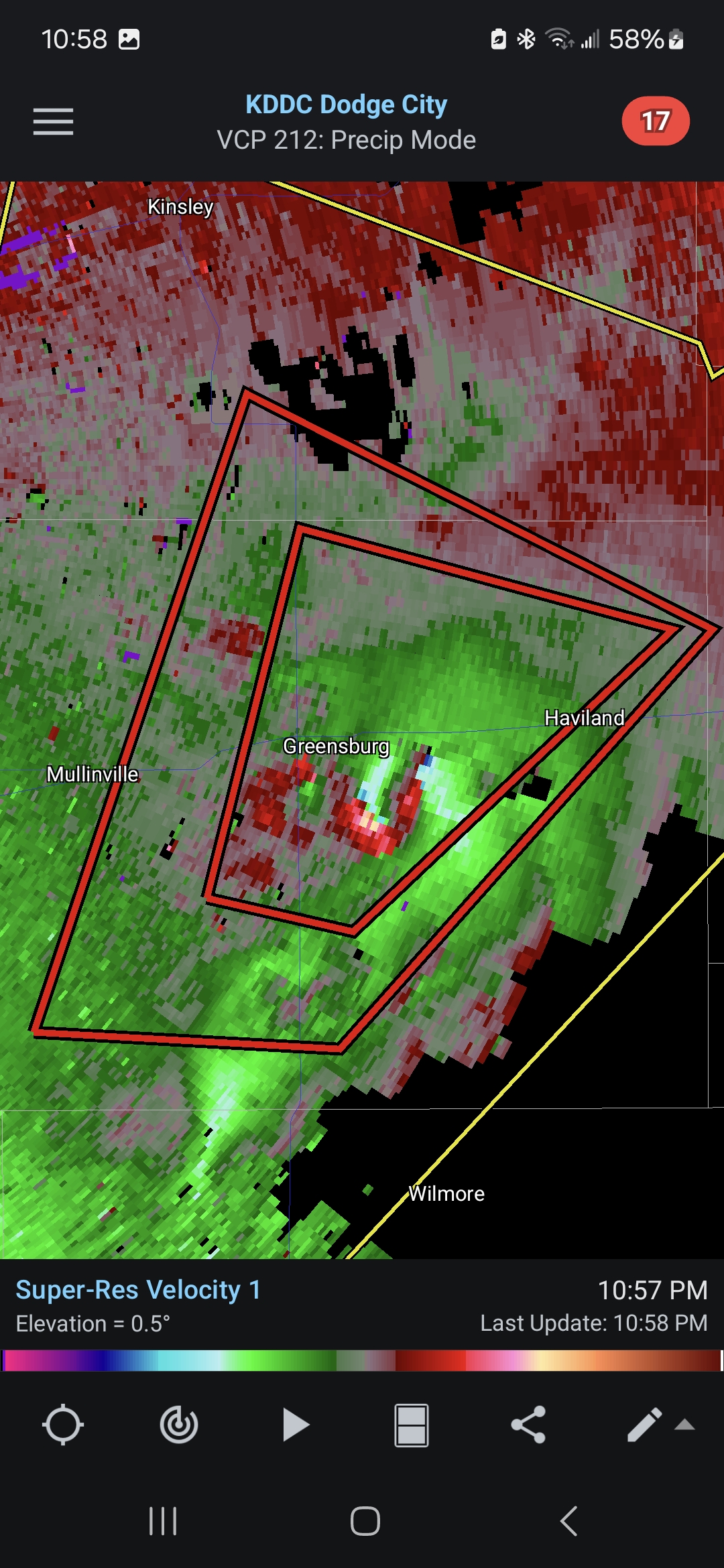
Tornado emergency for Geensburg.
-
https://x.com/Sekai_WX/status/1924271751128563984 Looked ominous on radar but holy hell!
-
PDS warned now

-
This looks primed to take off. Ingested a bit of junk convection but if it can stay clean it'll be in a good environment.
-
TDS with that storm now (though velocity scans haven't looked overly impressive in the last few scans). Storm keeps cycling as well. CO tornadoes are always photogenic and have interesting evolutions.
-
TORE with it now
-
The tornadic cell just south of Marion IL has a mean couplet.
-
Pretty good structure on the southernmost cell in MO, it'll be interesting to see if it takes off as it moves east into a more primed environment. Edit: confirmed TOG with it now.
-
2025 Short Range Severe Weather Discussion
mob1 replied to Chicago Storm's topic in Lakes/Ohio Valley
On Google Maps it seems that most of houses are on the southern side of town so hopefully it missed them to the north (though it's hard to tell). -
2025 Short Range Severe Weather Discussion
mob1 replied to Chicago Storm's topic in Lakes/Ohio Valley
Tornado emergency on that for Essex IA now. -
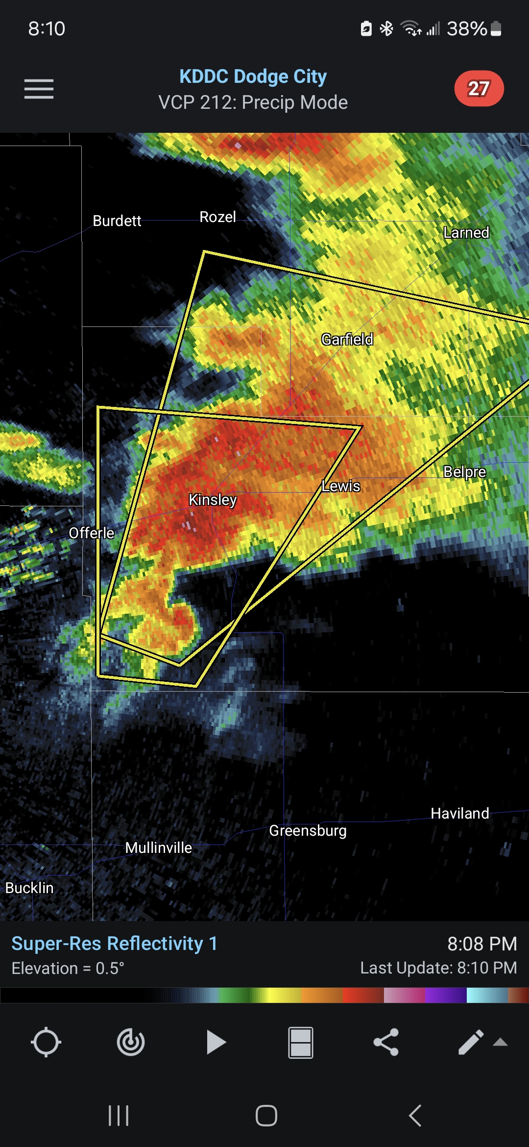
That cell is now PDS warned and has a fairly significant TDS. Surprisingly busy day in TX, we'll see what happens as they move east into better instability.
-
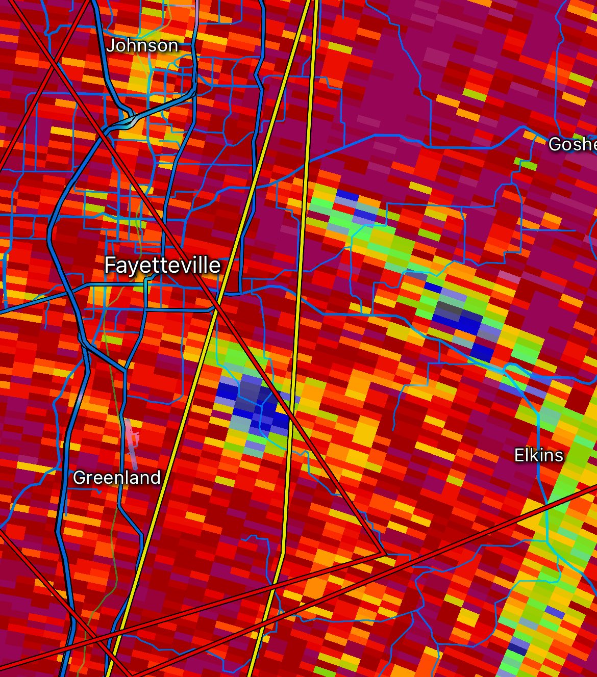
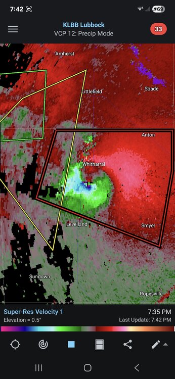
That is a pretty mean looking couplet entering the Holly Lake Ranch area.
-
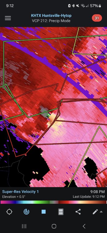
PDS warning with that one. Edit; it occluded just north of Clarksville but looks like it's about to put down another one. On a related note, tornado parameters in Arkansas are insane right now.
-
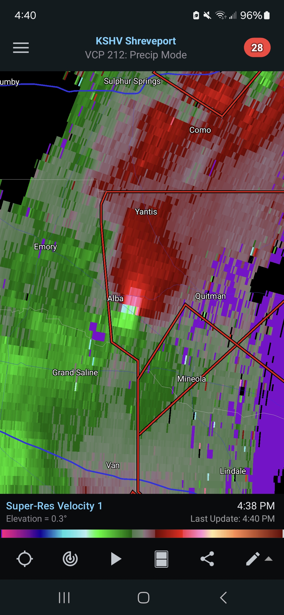
It's in a crappy radar spot, but odds are pretty good that the tornado north of Grand Saline is a formidable one.

-
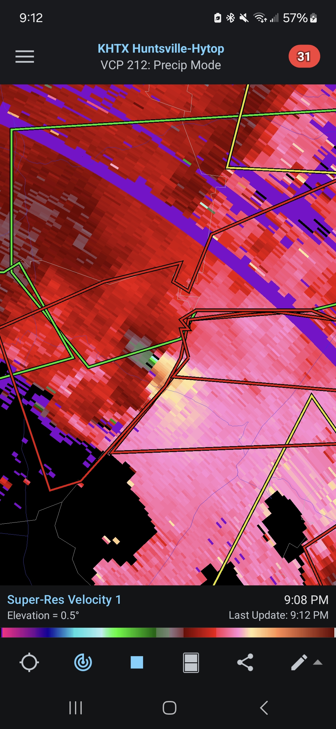
It has occluded now for the most part as it heads to Midway AL, but that was an extremely intense couplet for a while as it went between Troy and Banks. It's fortunate that it wasn't a few miles west.