mob1
-
Posts
2,830 -
Joined
-
Last visited
Content Type
Profiles
Blogs
Forums
American Weather
Media Demo
Store
Gallery
Everything posted by mob1
-
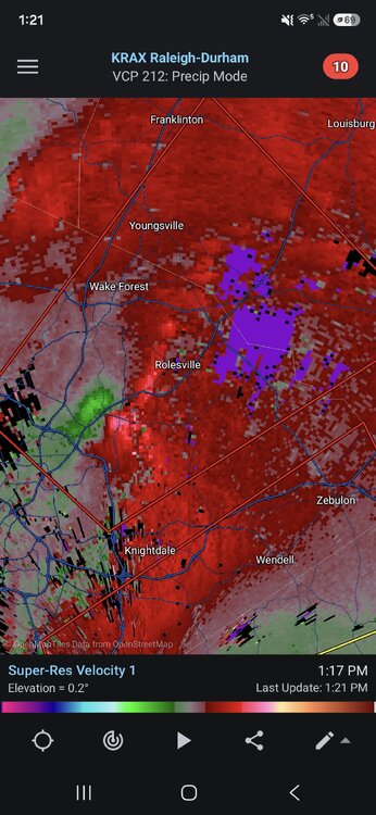
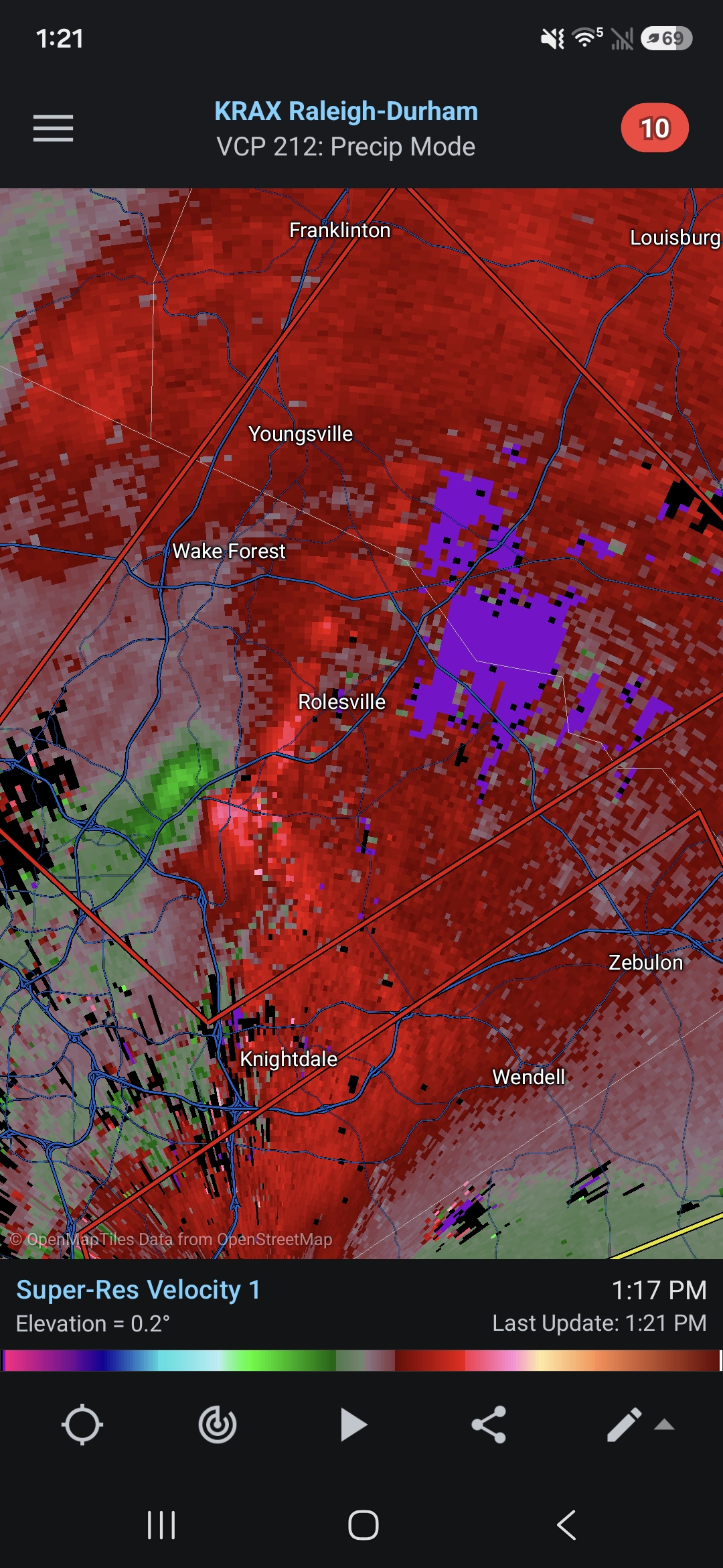
Confirmed tornado approaching Rolesville
-
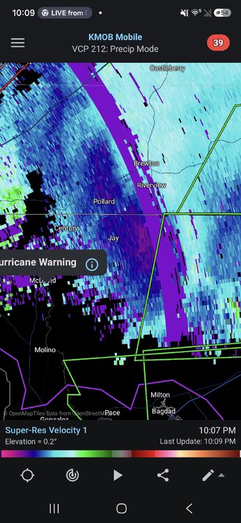
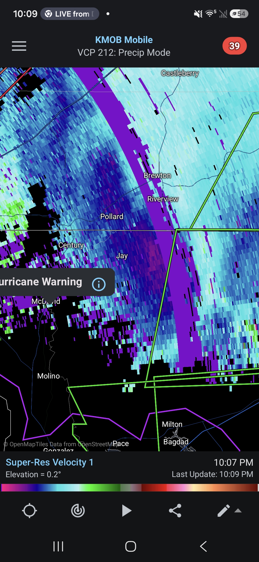
Radar velocities still show some 100 mph winds just off the deck for areas just inland
-
Pretty impressive actually, not sure what some of you expected.
-
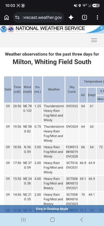
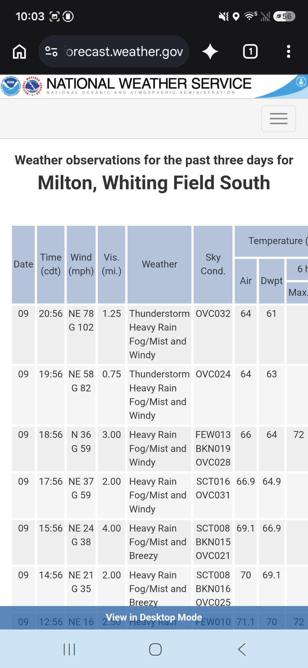
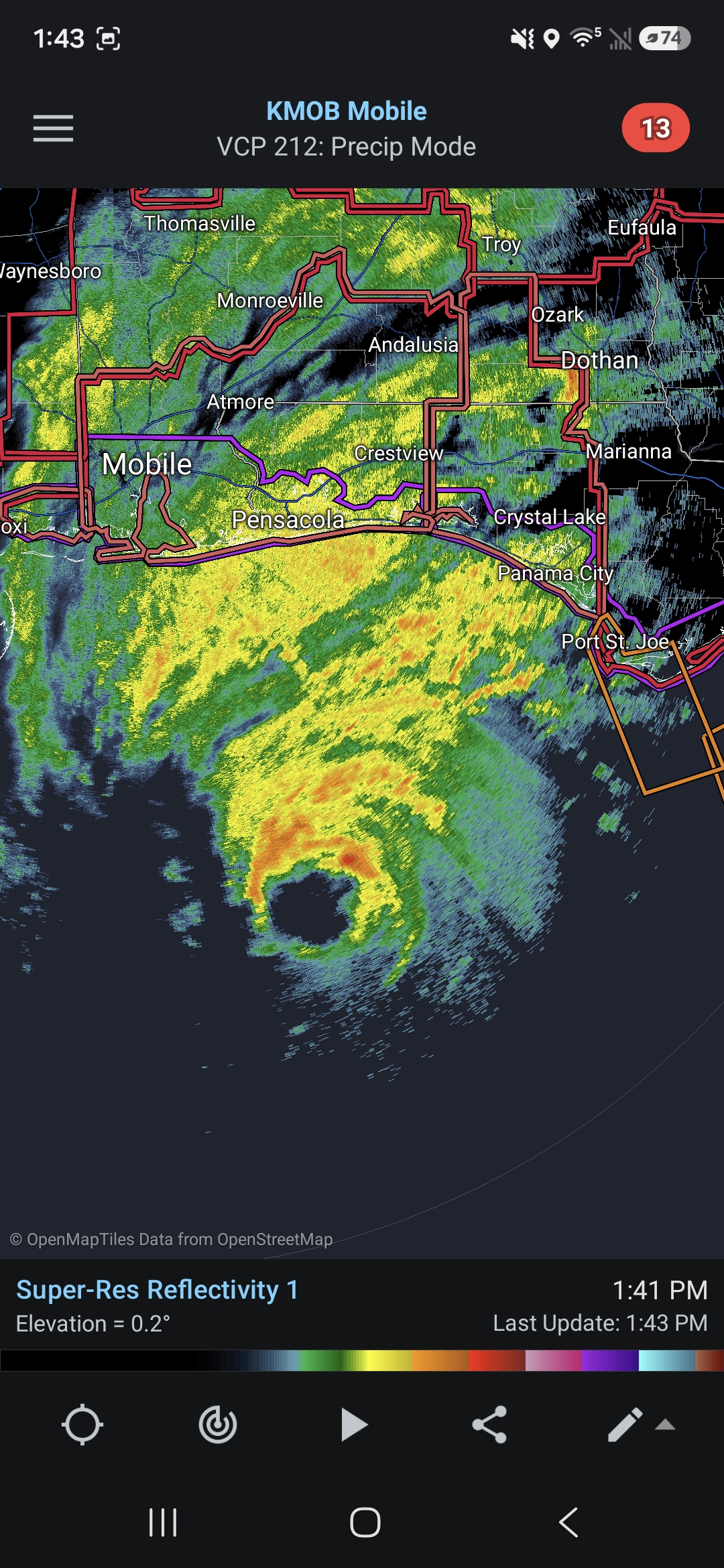
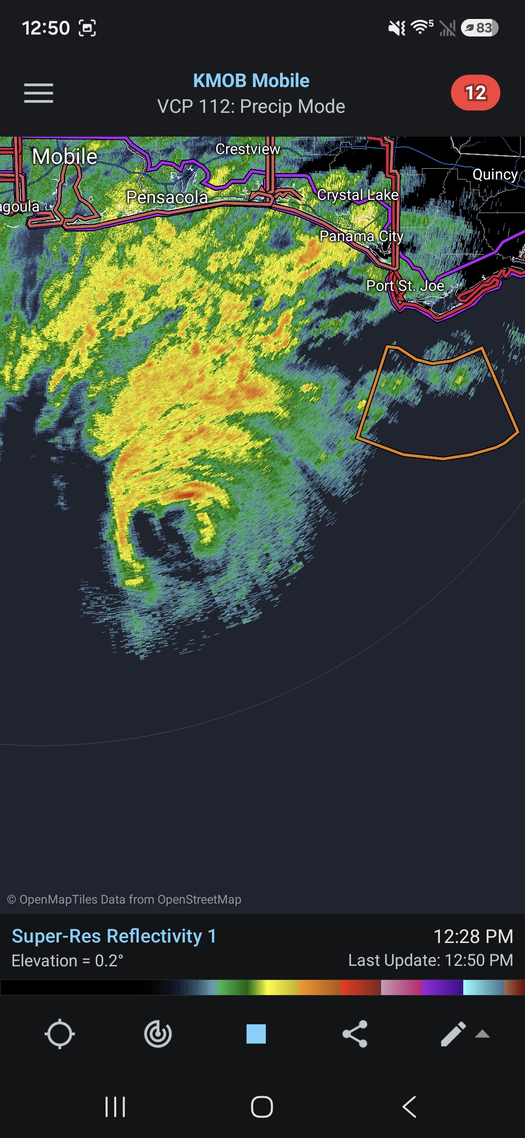
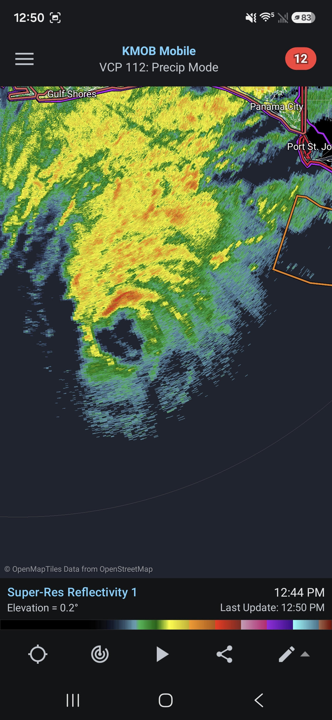
Some hurricane force gusts starting to show on personal weather stations along the immediate beaches east of Pensacola.
-
Looks like the more consistent and stronger winds will move into the coastal areas between Pensacola and Panama Beach in the next 30-60 minutes.
-
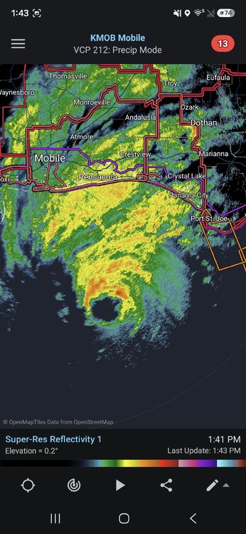
So resilient
-
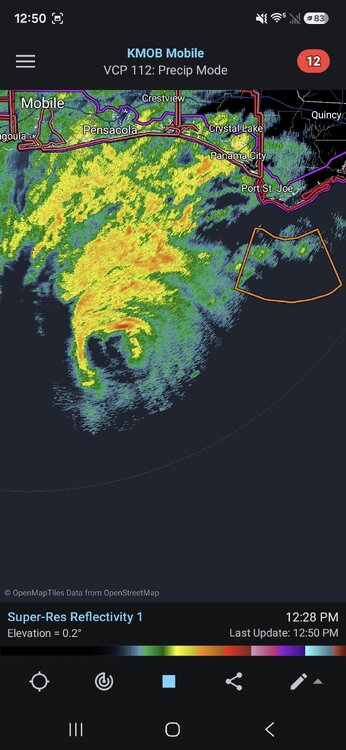
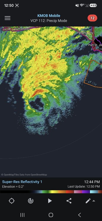
Radar (and the microwave pass posted above) did show some signs of degrading and possibly starting an EWRC, but radar has since improved.
-
Based on radar it could be a bit more of an eyewall meld than a true EWRC (which is sometimes common as it approaches land and the friction causes it to tighten up a bit) but it's definitely degrading which is welcome timing.
-
Surge is always tricky to nail down, but while the inhibiting factors will help, there's actually a decently large areas of strong winds on the eastern side of the storm and I believe the northern gulf is slightly more susceptible to surge due to the shallow continental shelf. Likely won't be devastating, but I can see areas like Destin seeing a fairly significant storm surge.
-
Strong Nor'Easter/Hybrid Storm Late September 2026
mob1 replied to Rjay's topic in New York City Metro
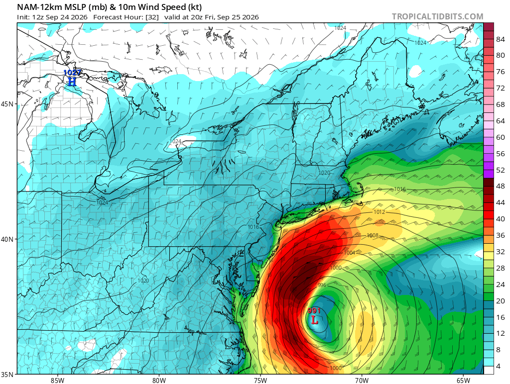
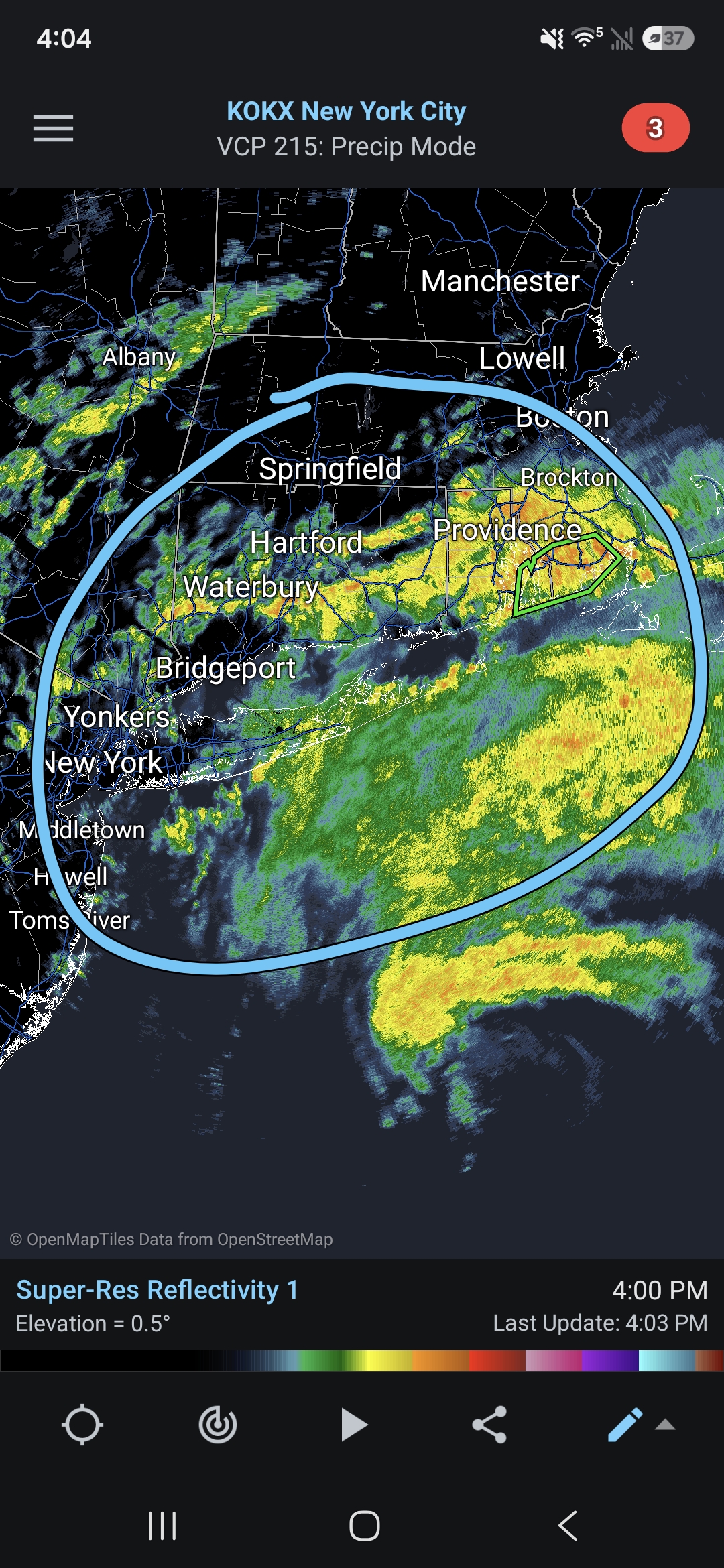
NAM is pretty far south with the precipitation so we'll see, but I'm assuming some of this will rotate through in the next 6-12 hours.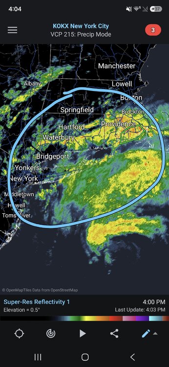
-
Strong Nor'Easter/Hybrid Storm Late September 2026
mob1 replied to Rjay's topic in New York City Metro
There's an obvious tradeoff with both a southern and northern track, I just personally enjoy the wind aspect more. Was hoping to get some of the more extreme outcomes depicted by some morning runs, though verbatim this was likely very overdone.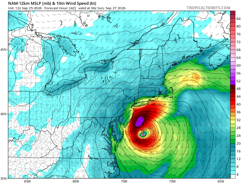
-
Strong Nor'Easter/Hybrid Storm Late September 2026
mob1 replied to Rjay's topic in New York City Metro
Not really the point, other models have it as well. You want the storm to move westward at the latitude of Ocean City NJ or so and ideally before it occludes. The models that showed that earlier had the best winds Saturday night into Sunday..thumb.png.0f956fe8d693ebc234700595efae8b25.png)
-
Strong Nor'Easter/Hybrid Storm Late September 2026
mob1 replied to Rjay's topic in New York City Metro
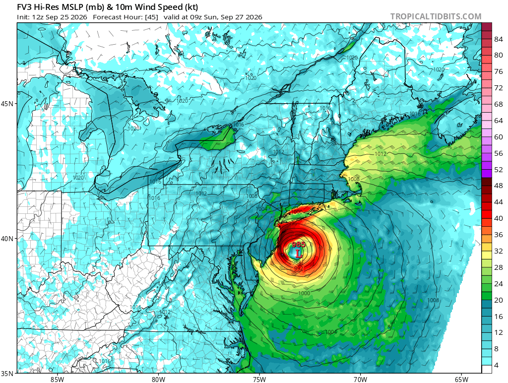
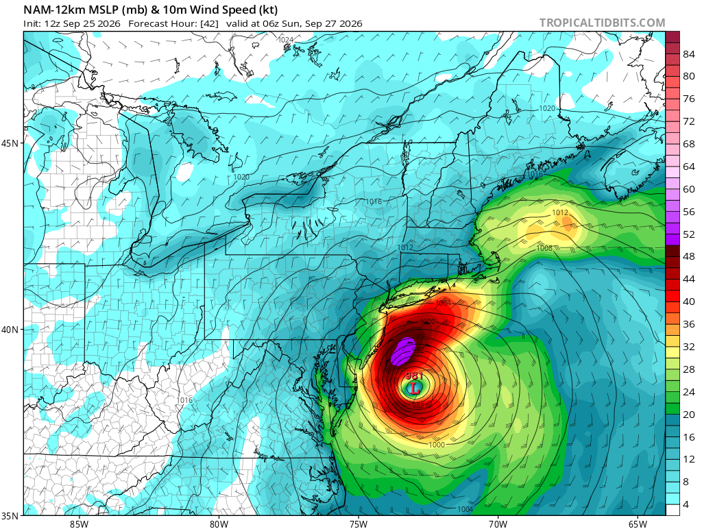
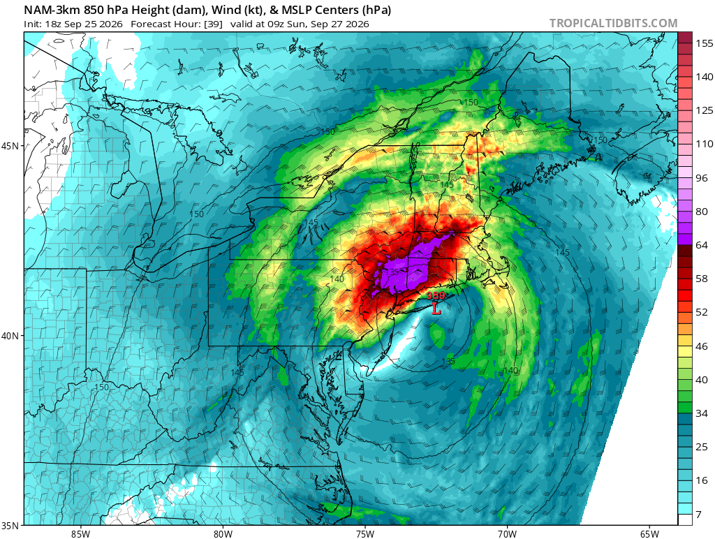
Hi Res NAM (and some other models) have this occurring a bit further north and has much tamer winds than some earlier runs. We'll see if it was just a blip but often as these events approach they trend a bit NE and weaker so we get a bit of a lackluster storm relative to expectations. We'll see how it unfolds, but personally I much prefer the 12Z NAM runs (despite sputting out far less precipitation. Rain events are a dime a dozen, good wind and coastal flooding is somewhat rarer).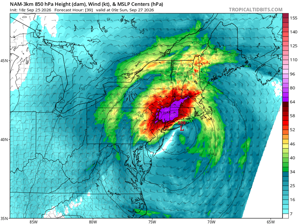
-
Strong Nor'Easter/Hybrid Storm Late September 2026
mob1 replied to Rjay's topic in New York City Metro
Does indeed come ashore in central NJ.thumb.png.2269e19a7c652be687bc17c39a1942b0.png)
-
Strong Nor'Easter/Hybrid Storm Late September 2026
mob1 replied to Rjay's topic in New York City Metro
Thanks but that's 06Z. 12Z is running now on Pivotal so we'll see in a few. -
Strong Nor'Easter/Hybrid Storm Late September 2026
mob1 replied to Rjay's topic in New York City Metro
Can you please post it? Curious is to where exactly it comes ashore. -
Strong Nor'Easter/Hybrid Storm Late September 2026
mob1 replied to Rjay's topic in New York City Metro
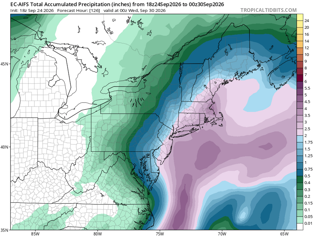
This is the track that'll yield the worst winds and coastal flooding. The models that have it go over the NY harbor or so are less extreme (this is obviously especially true for the central NJ coastline.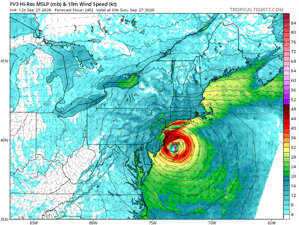
-
Strong Nor'Easter/Hybrid Storm Late September 2026
mob1 replied to Rjay's topic in New York City Metro
-
Strong Nor'Easter/Hybrid Storm Late September 2026
mob1 replied to Rjay's topic in New York City Metro
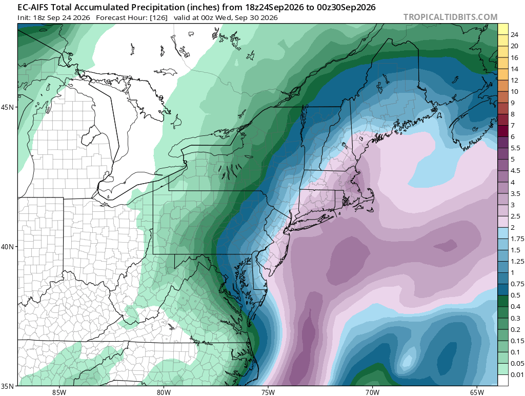
RGEM also shifted SW. If this trend is real (too soon to tell given how globals look), it'll really eat into the precipitation totals for northern areas. -
Strong Nor'Easter/Hybrid Storm Late September 2026
mob1 replied to Rjay's topic in New York City Metro
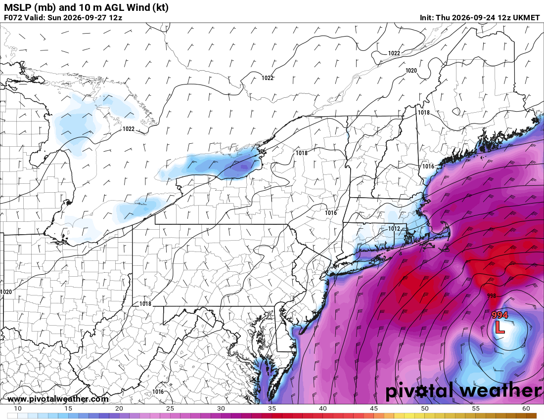
Not sure what it showed in prior runs. Here it is at hour 72 for example, now compare it with the western camps. It does inch it's way west eventually, but at that point the winds have very little bite left.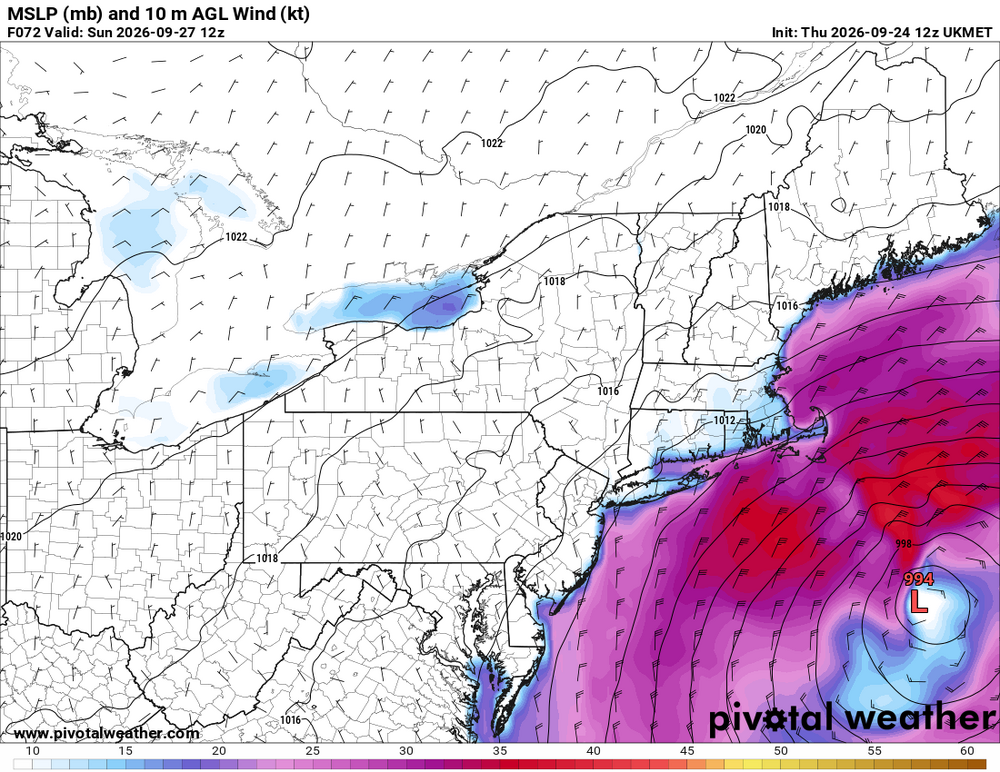
-
Strong Nor'Easter/Hybrid Storm Late September 2026
mob1 replied to Rjay's topic in New York City Metro
UKIE is pretty far east, and while it does bring some rain eventually (as the storm retrograde SW) at that point it's largely occluded and winds throughout are very meh. -
Strong Nor'Easter/Hybrid Storm Late September 2026
mob1 replied to Rjay's topic in New York City Metro
Big change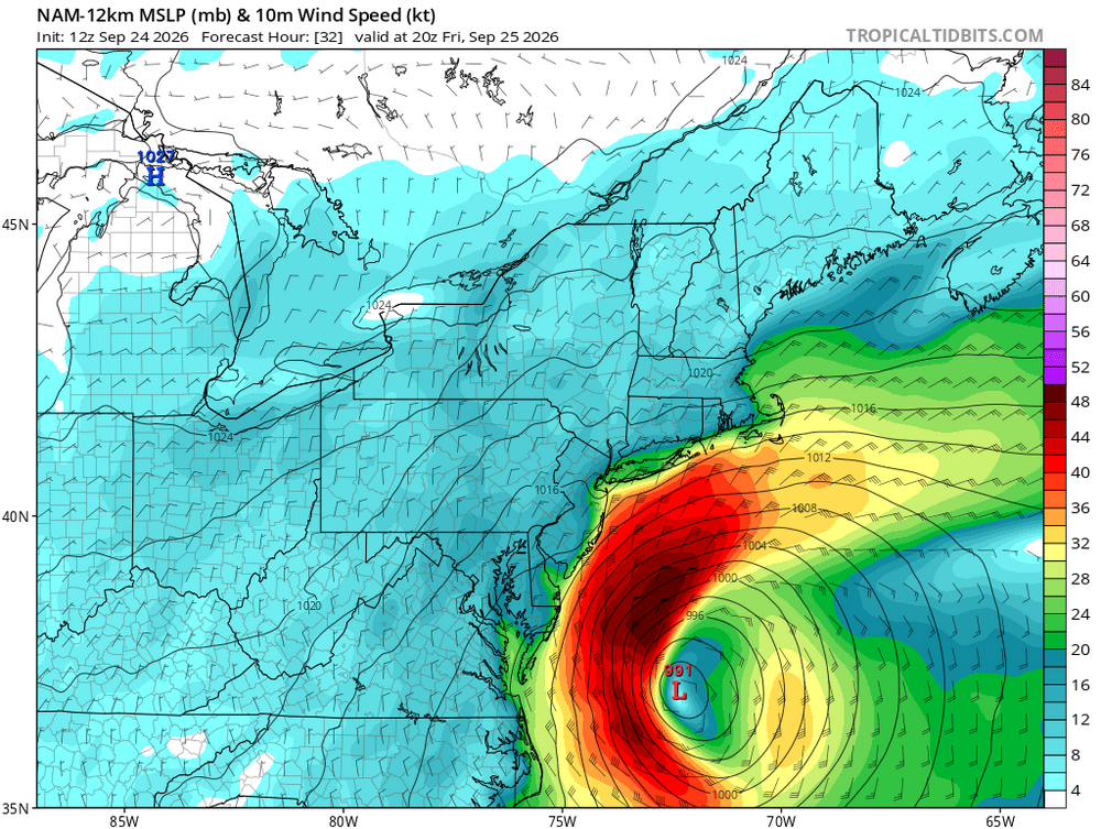
-
Strong Nor'Easter/Hybrid Storm Late September 2026
mob1 replied to Rjay's topic in New York City Metro
NAM is a fairly significant event for the coast -
Strong Nor'Easter/Hybrid Storm Late September 2026
mob1 replied to Rjay's topic in New York City Metro
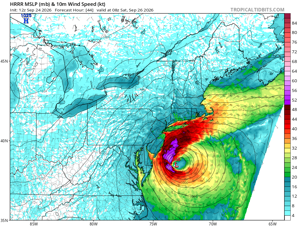
While the HRRR is notoriously too amped and NW at this range, it's too far off of what the 0Z Euro had (though it's far tamer in its latest run) and if other models come in that tucked to the coast I could see this being a more significant wind event than what's currently expected.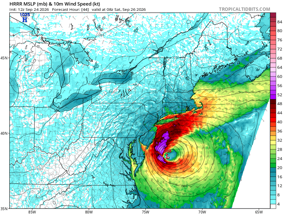
-
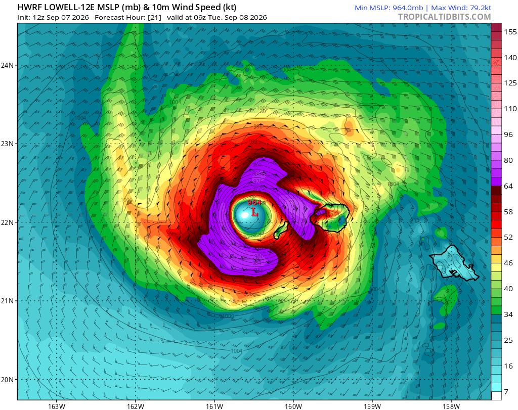
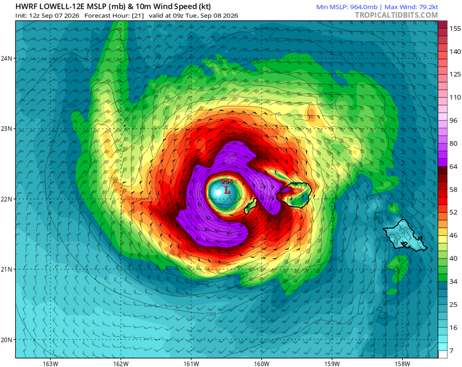
Recent eastward trends have made things a lot more interesting for Kauai.



.png.f4e91e01d9944c46a21209e75897329c.png)
.png.cece8a497d8cff894c7c600f9caacfaf.png)