All Activity
- Past hour
-
NYC really sucks at snowfall measurements. There hasn't been an updated since yesterday afternoon from any of the sites (including Central Park). But oddly enough, thrre was adiditonal measurable precipitation at Central Park specifically after the previous 1pm snowfall total, so there was almost certainly more snoefall that accumulatrd beyond the officia 19.7".
-
End of next week continues to look torchy.
-
Yeah if you’re an A after DJF it’s locked in…especially down there.
-
KJU did whenever he felt like shoveling. He got 16-20” measurements in the backyard to spot checking the 18.75” total from clearing. . Roof assisted? Possible…but no way to know. Make it 17” for your records if you prefer but my book confirmed and closed lol.
-

"Don’t do it" 2026 Blizzard obs, updates and pictures.
HoarfrostHubb replied to Ginx snewx's topic in New England
Yep. That was Clinch Leatherwood, aka Messenger and some other names doing checks of Phil’s reports. Pretty assholeish, god rest his soul. -

"Don’t do it" 2026 Blizzard obs, updates and pictures.
CoastalWx replied to Ginx snewx's topic in New England
My snow was only wet for a few hours and then when the real heavy stuff came it was below 32. I actually think it helped make it accumulate more. Areas to my south were getting 3”/hr near 32. -

Blizzard of 2026 Storm Thread/OBS
Violentweatherfan replied to Mikeymac5306's topic in Philadelphia Region
Any radar loops yet showing the death band over Levittown Pa yet? -
Can someone please tell me what happened with the RGEM though? I was tracking it all Sunday into Sunday night. It busted dry everywhere, and we’re talking runs while the storm is happening. It almost looked like a glitch. Its hires version did better. Just for example here was the rgem/hires rgem 6z run for MA/RI. Ridiculous.
-

"Don’t do it" 2026 Blizzard obs, updates and pictures.
Baroclinic Zone replied to Ginx snewx's topic in New England
Winds were easily 50mph at TAN. -

Is we back? February discussion thread
TauntonBlizzard2013 replied to mahk_webstah's topic in New England
Winter can’t really be anything other than an A here now -
A piece of good news is that the models don’t currently have a heavy 1.50”+ rainstorm in the near future. The best outcome going forward would be a series of weaker lows like the current runs are showing without much total QPF. This way we could see many days with gradual melt with highs into the 40s and the increasing sun angle. Hopefully, a heavy rainstorm holds off until early March after the snowpack has had a chance to melt gradually.
-
Haha. Took a break from some model runs and come back to both the GFS and EURO a miss to the south out here. It is getting comical at this point. Too far north, south, east and west is the Winchester way. I have started looking at properties out near JonJon. Was just hoping to avoid the additional hour to the beaches when I retire. Driving when your old sucks.
-

Central PA Winter 25/26 Discussion and Obs
pawatch replied to MAG5035's topic in Upstate New York/Pennsylvania
What sun angle? It’s been cloudy almost everyday -
My snowfall is now slightly above normal for the season. I noticed last week that for the first time, possibly ever, my running snowfall average (41.2") is now below what is considered KMGJs (42.2"). The past few years has really been eating into my seasonal average snowfall. So as it stands now, this seasons 44.5" here is the most since '20-'21s 53.8".
-
I said it after the first failed threat in December, we need all models on board if we expect to score. I should have stuck with that premise over the weekend but put my chips on the failed, overperformer modeling. Oh well, just another live and never learn in the wacky, weenie world of snowpium. As for next week, I haven't even looked at it, taking the one threat/failure at a time approach. One thing is for sure, not saying they will be right, but all modeling ends winter after next week. So if it's going to happen, next week is it.
-
"Don’t do it" 2026 Blizzard obs, updates and pictures.
CoastalWx replied to Ginx snewx's topic in New England
Well wet snow initially and winds over 70. -
Some fairly rare NE to SW upslope action in Pen-Mar this AM. Putting down a fresh coating.
-
"Don’t do it" 2026 Blizzard obs, updates and pictures.
Baroclinic Zone replied to Ginx snewx's topic in New England
Thanks for checking. -

"Don’t do it" 2026 Blizzard obs, updates and pictures.
Damage In Tolland replied to Ginx snewx's topic in New England
Was it more the wet snow or winds that did so much damage? -

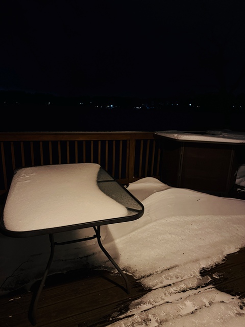
"Don’t do it" 2026 Blizzard obs, updates and pictures.
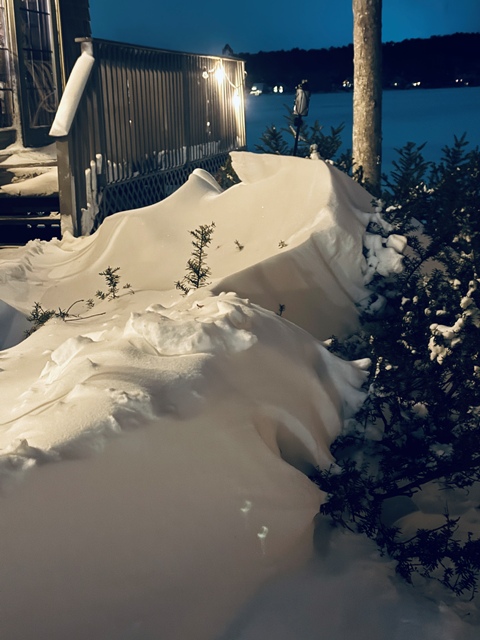
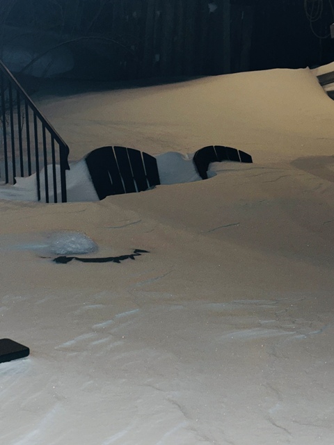
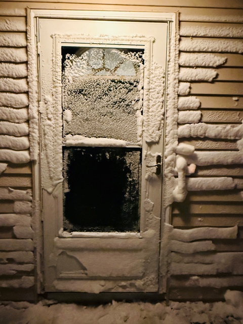
Cold Miser replied to Ginx snewx's topic in New England
Some photos from last night. Adirondack chairs, still uncomfortable, and useless. Note the deck and the lack of snow. Wind just came off the lake and probably blew it all to Providence.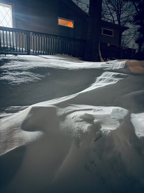
-

Pittsburgh/Western PA WINTER ‘25/‘26
RitualOfTheTrout replied to Burghblizz's topic in Upstate New York/Pennsylvania
I do think we probably have another 10 days here give or take before it really warms up. Euro still wants one more big cold shot before we warm up too. Should be plenty of time to hit average or above average snow for the season. After mid-March who knows, it may get cold again relatively speaking, but obviously increasingly harder to snow even if it does. -
"Don’t do it" 2026 Blizzard obs, updates and pictures.
CoastalWx replied to Ginx snewx's topic in New England
Power issue likely. Nobody has power there. -

Winter 2025-26 Medium/Long Range Discussion
Cary67 replied to michsnowfreak's topic in Lakes/Ohio Valley
If it wasn't for LES ORD could join RFD in the sub 30 sweepstakes club. Clippers have dusted Chicago a bit more than the rest of N. IL also. Every mile further E/NE under the trough helps. Great winter for Toronto -
..RECORD DAILY LOW MAXIMUM TEMPERATURE SET AT ASHEVILLE THE HIGH TEMPERATURE WAS ONLY 28 DEGREES MONDAY, FEBRUARY 23 AT THE ASHEVILLE REGIONAL AIRPORT. THIS BREAKS THE OLD RECORD LOW MAXIMUM OF 29 DEGREES, SET IN 1989. RECORDS FOR THE ASHEVILLE AREA GO BACK TO 1869.
-
Pittsburgh/Western PA WINTER ‘25/‘26
RitualOfTheTrout replied to Burghblizz's topic in Upstate New York/Pennsylvania
Ah ok, yeah, I think I have browsed there before, it's been a few years.


