Search the Community
Showing results for tags 'cold'.
-
Cold to start. Will storms return or mostly dry? Early spring? What will the groundhog say?
-
The 12z CFS run apparently gives us snow. Even though it doesn't really show it on the precip type maps, it does show it on the snow depth maps. October 13, 2025 officially marks the start of the 2025-26 Digital Snow Thread! Coastal on 11/08: Clipper on 11/10
-
Thought I would create a general obs thread for winter in case anyone sees some snow this AM and of course for the rest of the winter. @Knoxtron looks like some temps are between 34 and 36 down your way. Some radar returns down in. NE Alabama look snow-like: Wouldn't be surprised if you, or John, or one of our Cumberland county folks get a quick dusting.
-
I figured it was time to start the next monthly winter thread. Let the speculation/discussion begin.
-
A chilly and windy day to start the year following rain and thunderstorms the prior day.
-
As of 730 PM Monday Dec 30, ensembles have faded a bit the past day or two of model cycles. Snow event (minor) still could occur but suppression mostly south of us or delay til around the 8th. Snow may come in pieces Monday Jan 6-early 9th. Slower seems more likely for our area around the 8th when more longitudinal 5H troughing approaches from the Great Lakes as per the NAEFS which has considerable Canadian model influence. An important feature may be the apparently big short wave diving southeast from western Hud Bay around the 7th and how much backing of the flow will occur ahead of it when it is modeled into the upper Great Lakes by the 8th. Added ensembles (EPS and GEFS) for Monday the 6th--chance of 1" on the Canadian GEPS even less. Also the NWS D7 LOW chance for more than 1/4" of qpf which leads into the 6th. The CPC 3PM/30 probabilistic hazard outlook points out a better chance 7th onward. Hopefully modeling will become more favorable for snowfall. This post is an attempt to grab the first possible snow of January 2025 in NYC but is issued with considerable uncertainty - less than usual confidence and only for the period of Jan 6-12z/9. IF snow does occur (more than a Trace), then this thread can serve as the observations. The tags have ice pellets added, in case Great Lakes 5h troughing around the 8th forces mid level above freezing temps into our area with one possible low center into the Great Lakes. 720A/4 edited the headline to limit event to the 6th and dropped the ice pellet tag. The event has at least held onto the 6h for timing since the initial Dec 30 post, but the max axis in PA-NJ has shifted south about 150 miles since the post started 6 days ago. That is worthy of keeping in mind when posting threads 6 days in advance... limits confidence of occurrence. A positive note the accuracy of the D7 WPC chance of 1/4" frozen in the Ohio Valley!
-
Welcome to Meteorological winter! A nice wintery start!
-
 We may get the sequel to the current event Thursday and Friday through the weekend. The ICON came more on board with the GFS tonight. The Canadian is trying a bit itself. We aren't likely to get nearly as much snow as we did with this system, but some of us may get more. People rarely like the sequel better, after all. But maybe for our mix/rain victims, this one will be better. The original is going to be hard to beat for most of us.
- 372 replies
-
- 11
-

-

-
- cold
- arctic blast
- (and 1 more)
-
Most of our long range looks are well into December now. Hopefully we can have a better winter than last year, which was an all-time worst here. The first week of the month looks to be near normal temp wise and probably drier than normal, even though CPC favors AN precip.
-
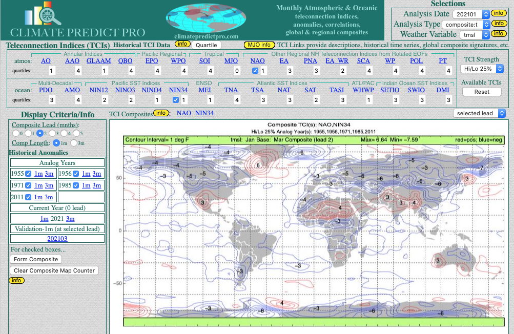
Carver's spoke of creating an early winter spec thread recently, and after another day in the 70s in August, I figured why not get the ball rolling. This for general long term talk about the potential winter patterns, etc. Right now, the EPO has went negative, it's at -12, and is in the East descending phase. In 2021-22 it fell into the negative in May and stayed deeply negative until the following May. So it should descend throughout winter. Below, average pressure anomalies over NH when the QBO is negative. Higher in the PNA/NAO region, lower over the south and eastern U.S. (These maps may initially appear confusing, since they greens are positive numbers. It just means that the they are higher by those margins over those areas or lower by those margins over those areas when there isn't a -QBO in place. Just keep in mind green = lower pressure and cooler temps during -QBO years) There tends to be higher pressure over the North Pole during a -QBO, which results in a weaker jet stream/polar vortex on average. During an El Nino/-QBO combination our forum region is slightly BN for temps DJF and pressures are quite a bit lower across the Southeast (our storm track). The map doesn't look unlike this for temps, but BN for Texas, Tennessee, North Carolina and up the east coast is more prominent than the CPC map here. Especially over Texas.
-
Can be worse, right? I mean, the first half of May looks trainwrecky. Won't even be able to reach 50 for the first day or two of the month.
-
Thought this one was fired up already since fall started a couple weeks ago. Just realized I was posting in the spring/summer thread still. Of course love to keep winter storm obs in the storm threads for later reading all in a single thread. But these are good for daily obs or notable events outside the storm threads. That said, I hit 47.3 this morning after a day time high of 69 degrees yesterday. Pretty similar temperatures for this same period in September 2015 when we got a nice first cold front of the season on 9/13 and had two days of great temps. It was 70/46 on 9/13 and 66/43 on 9/14 that year. Current temp is 71 degrees here, sunny. It was 72 about an hour ago but dropped back a little. In 2015 we never got back above the 84ish range after the front. It had been in the upper 80s for days on end leading into it.
-
Not looking good this year, but we'll see I guess.
-
 Looks like the first ten days or so will be warm, but that is not a lock. After three years of La Nina, we are probably closing-in on our last few months of this ENSO phase. La Nina's often yield warm Januarys, but something makes me think we buck the trend this month for at least part of the month. I have January as AN in my seasonal forecast, but a portion of the last 20 days of the month could be quite cold. I still expect some wild swings this winter w/ a base warm pattern and very cold interludes.
- 923 replies
-
- 1
-
-
- warm start
- cold
- (and 4 more)
-
We will soon find out if the high latitude blocking signatures pay dividends for our area. May need a boat and may also need snow shovels. We'll try separating this into threads by month. If that doesn't work, I will simply switch this to Part I of winter. Have fun and good luck!
- 582 replies
-
- 6
-
-
-
- snow
- freezing rain
- (and 4 more)
-
Here are a few winter outlooks. Feel free to add any others or your own thoughts https://www.noaa.gov/news-release/us-winter-outlook-warmer-drier-south-with-ongoing-la-nina This year La Niña returns for the third consecutive winter, driving warmer-than-average temperatures for the Southwest and along the Gulf Coast and eastern seaboard, according to NOAA’s U.S. Winter Outlook released today by the Climate Prediction Center — a division of the National Weather Service. Starting in December 2022 through February 2023, NOAA predicts drier-than-average conditions across the South with wetter-than-average conditions for areas of the Ohio Valley, Great Lakes, northern Rockies and Pacific Northwest.
-
 Since we do have a variety of forum posters in areas that will see snow/sleet/ZR - at least initially and on the backend, plus there is a flood threat, along with some potential advisory-level winds and possibly record breaking cold, decided to go ahead and make an obs thread. Currently misty and mostly virga and 36 with dp 32 here in NW Philly.
 -
February discussion for all things winter in the Tennessee Valley Sub-forum. When we have a likely event 2-3 days out we can create an individual thread for said storm. It helps for record keeping purposes as a lot us like to look back on old threads to learn, etc. Hope everyone is doing well.
-
Well, we are just one season away from winter. Nice to have a respite from the heat this week as the remnants of Ida depart the area. Thoughts and prayers for all of those affected by the hurricane along the Gulf Coast. Rainfall along the far eastern valley has been steady but reasonable - more as you go west I am nearly certain. This morning features light rain/drizzle and very low cloud decks. Lows in the northern valley are supposed to get into the 50s during the next few nights, and that is welcome news! Saw the first evidence of maples beginning to change color this morning. There is this one maple in our neighborhood which always changes first. Some of the dogwoods are beginning to show red in their leaves. Sycamores along the river are showing some yellow. For sure, some of that could be heat stress. Well, it is the first day of meteorological fall. I suspect this season will feature a quick snap to winter time temps late in the season. I am thinking warm early-mid fall, and then a sudden flip to cold. Somebody please fire-up an obs thread and also a banter thread for fall.
-
This report talks a bit more about the natural gas market and how you can use weather to make money trading. My newsletter Climatelligence for just $13/month is a far cry from the thousands of a month that clients pay to learn how to trade commodities. https://www.bestweatherinc.com/commodities/how-we-predicted-the-arctic-pig-for-february-setting-the-energy-markets-on-fire/

-
We are hitting well into the window for December discussion. My best event of winter was on December 12th last year and I believe in 2019 it was a December event for the far Eastern areas. That was as the pattern of a very cold November bled into December. To get there this year we are going to have to count on the pattern to switch in December itself. Hints that it may, at least for a short time, as we head into the last few days of November and first week of December.
-

First Cape Cod MA snow? - After December 4th??????
USCAPEWEATHERAF posted a blog entry in Once a legend always a legend
The forecast for snow and cold looks dim the next 10 days, however beyond that time period, looks to the first real chance at a snowy and cold regime over New England and at least as far south as the 38N latitude line. Anyone south of that latitude needs to wait until further into January time frame, but for those of us north of that latitude, the pattern change is being seen by most of the guidance after day 7-9 time frame, it looks like after December 4th an arctic front swings through the Northeastern USA states and brings a return of true arctic air and snow could be a possibility. Stay tuned! Right now it looks like a 60% chance at seeing at least 2 snowstorms, while a 40% chance exists that we see suppression depression. -
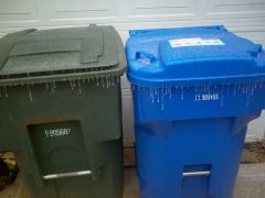
From the album: Jan 25 Icy Weather
-
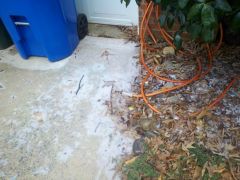
From the album: Jan 25 Icy Weather
-
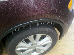
From the album: Jan 25 Icy Weather