Search the Community
Showing results for tags 'teleconnections'.
-
Put your weather links in this thread. That way, as we add new people to this region, they have places to go and learn. Plus, it gives us all a quick reference. As a general rule, most of us abide by "read more and post less." However, for this forum to work...people have to participate. When making a comment, just be sure to add some weather expertise to your discussion(even if it is limited). Instead of saying, "Boy, it is raining outside." Try this, "The National Weather Service radar is showing heavy returns over middle Tennessee." Instead of saying, "The weather models are showing a torch," try this..."The GFS is showing warm temps at hour n." Read as much as you can. Google is a great tool. And don't be afraid to ask questions. That's how all of us learned to get to our varying levels of expertise. Last update: November 2018
-
A potential cold December exists for the eastern half of the United States. Following the historical Buffalo snowfall and the NAO index going negative in the face of the third straight winter of La Nina, this video discusses how to use teleconnections to predict weather months in advance--ENJOY
-
- teleconnections
- ao prediction winter
- (and 5 more)
-

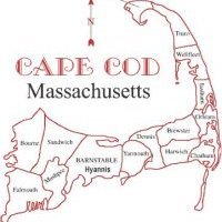
First Cape Cod MA snow? - After December 4th??????
USCAPEWEATHERAF posted a blog entry in Once a legend always a legend
The forecast for snow and cold looks dim the next 10 days, however beyond that time period, looks to the first real chance at a snowy and cold regime over New England and at least as far south as the 38N latitude line. Anyone south of that latitude needs to wait until further into January time frame, but for those of us north of that latitude, the pattern change is being seen by most of the guidance after day 7-9 time frame, it looks like after December 4th an arctic front swings through the Northeastern USA states and brings a return of true arctic air and snow could be a possibility. Stay tuned! Right now it looks like a 60% chance at seeing at least 2 snowstorms, while a 40% chance exists that we see suppression depression.-
- teleconnections
- snow
-
(and 1 more)
Tagged with:
-
Ok the pattern upcoming for the next two weeks is quite simple. Simply put, it remains a negative to neutral PNA, positive NAO and positive AO, this means cold air will continue to filter into the western Canada and Western US, while the eastern US and eastern Canada remain underneath a strong ridge of high pressure with southwesterly winds and warm temperatures. By the end of October, this pattern may switch to more seasonal temperatures showing a cooling trend by the beginning of November. the models show some semblance of a -AO/+PNA pattern emerging in the long range but the NAO remains positive or neutral at best. Time will tell, but we will certainly run into a winter cold snap sometime in the future, perhaps near.


