Search the Community
Showing results for tags 'hurricane'.
Found 10 results
-
 It has been a somewhat slow Western Pacific Typhoon Season so far this year. The season started late in July, only four or five (depending on your choice in agency) typhoons have been observed so far, and ACE still remains a fair bit below 100*10^4 kt^2. Things may be changing though, especially with La Nina struggling to develop. At the time of this original post, Tropical Storm Meranti has just developed, and it may go on to be a very powerful typhoon. WV loop above will continue to update and stay current.
 -

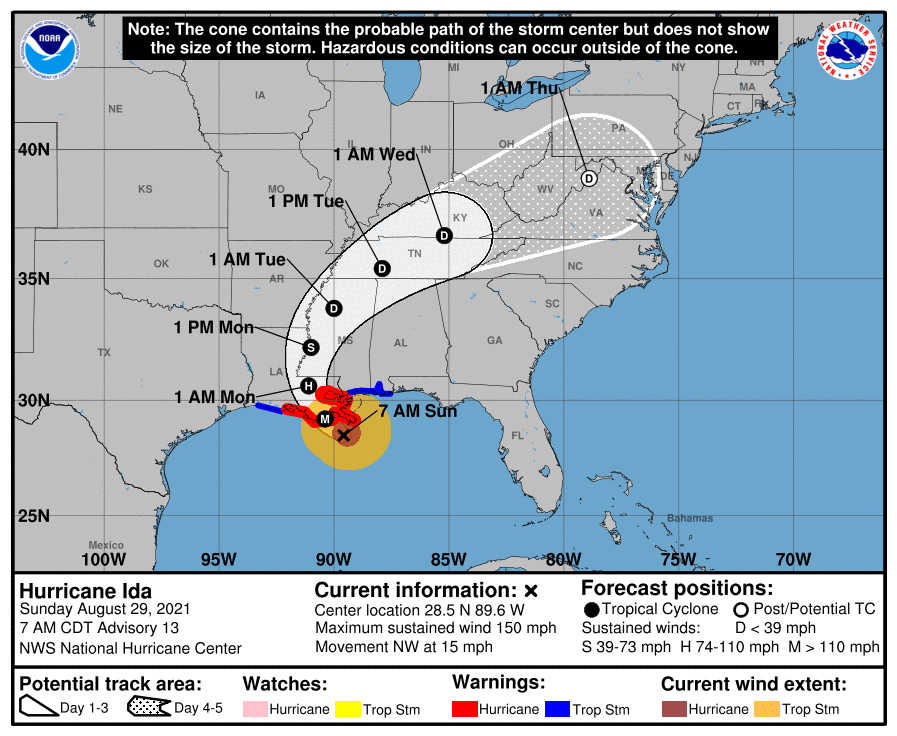
Hurricane Debby - flooding rain threat region wide
olafminesaw posted a topic in Southeastern States
The WPC is bullish on heavy rain inland. Coastal areas still the main risk region with the possibility for the biggest flood event since Florence. -
Tropical threats? Another heatwave? Discuss here.
- 852 replies
-
- 1
-

-
- hurricane
- tropical storm
- (and 1 more)
-
Tropical threats? Another heatwave? Discuss here.
-
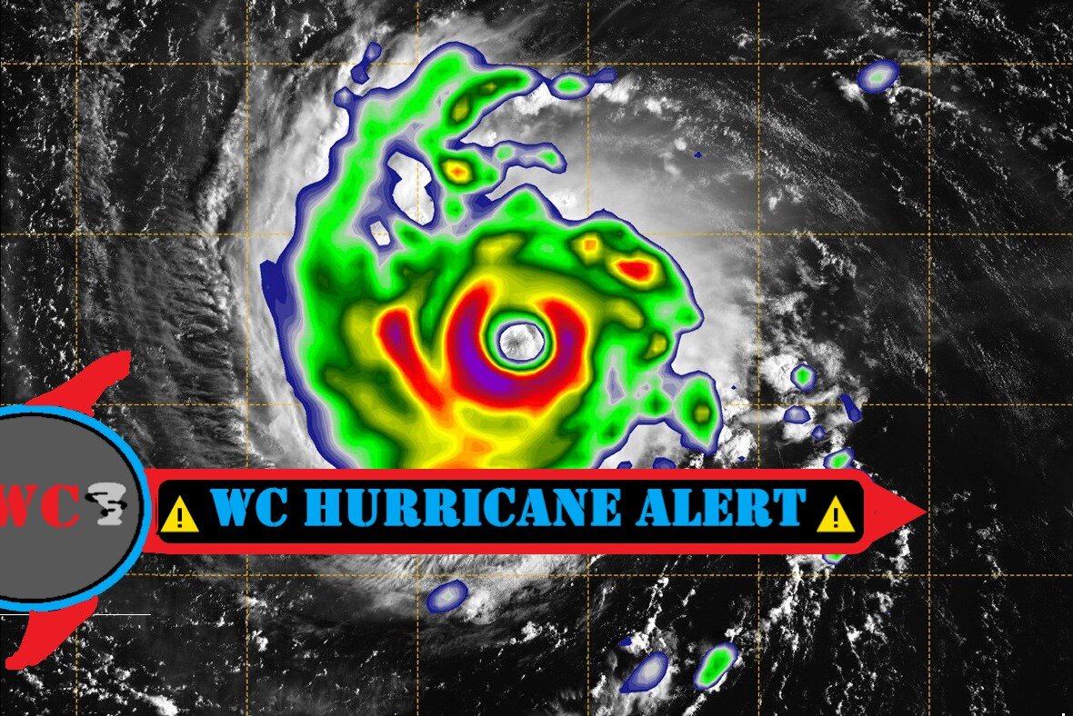
 For your enjoyment
 -
You will find this interesting with respect to the MJO, La Nina and the loop current in the Gulf of Mexico https://www.bestweatherinc.com/hurricane/video-factors-affecting-the-2022-hurricane-season/
-
 Seems to be getting closer and closer to the CWA with rain impacts. Ukie, hot off the press.
-
 Texas Weather Center https://www.weathercentertx.com/us-hurricane-center/ Here are several useful links for tracking hurricanes so you can stay up to date with hurricane data! https://www.nhc.noaa.gov/ http://www.trackthetropics.com/ https://www.nesdis.noaa.gov/hurricane-imagery
-

Could GOM Low become a hurricane?
USCAPEWEATHERAF posted a blog entry in Once a legend always a legend
Models are not crazy about the tropics right now but we have two areas of interest growing in the Tropical Atlantic as I write this blog. First area of concern is close to home, in what we call a homegrown threat, an area of thunderstorms grew into an area of low pressure earlier this afternoon and is growing with thunderstorm activity. It developed from a leftover frontal boundary currently racing off to the Northeast over the western Atlantic Ocean. TS Emily grew from the same front yesterday and is now quickly diminishing in a midst of a shear and dry air. Just as I thought from yesterday this area needed to be monitored as the area of frontal shear caused by a front in the GOM appears to be lessening now and is near 10-20 knots instead of 30-40 knots yesterday. This shear should continue to drop according to the 18z GFS run yesterday afternoon. This small area of low pressure is already well defined on satellite imagery this evening and appears to be gaining convection. Depending upon if the convection is consistent and persistent will determine the tropical outlook on this system. Next system of interest is a tropical wave currently in the MDR battling dry air to the north of it and the ITCZ influence to the south of it. Shear is light to moderate, not enough to stop development, should become an invest tomorrow morning. Stay tuned this system could become a threat to the lesser Antilles islands in the mid term.