All Activity
- Past hour
-
They put my area in the severe t storm watch but I'm on the western edge of it. So not sure I'll get anything. The MCS complex last night wasn't as strong as the one the night before last. It was just rain by the time it crossed my area and I got .20 from it. The night before I got .80 in about 30 minutes.
-
You do realize that line will intensify and build East right?
-
Looks like everything will be too far west. NW NJ looks like the spot to be
-
Each model has a different jackpot area which is typical in convective setups. It’s very hard to pinpoint exact locations. Most of the rain today and tonight will fall in a relatively short period. There’s also quite a high risk of microbursts today, like what we saw yesterday, hence the watch. Could also see an isolated tornado.
-
Drought buster in eastern PA. Already up to 1 inch today.
-
 Up to 1.24
 -
 Quick 0.46" here in Holyoke.. enough to test my sewer backwater valve (it held fine, but the cover gasket seeped a bit... cleaned and retightened..)
 -
Game on! Sent from my SM-G998U using Tapatalk
-
Steamy 82 / 71 between building storms
-
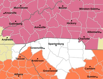
https://forecast.weather.gov/showsigwx.php?warnzone=NCZ053&warncounty=NCC021&firewxzone=NCZ053&local_place1=2 Miles ENE Bent Creek NC&product1=Severe+Thunderstorm+Watch&lat=35.5109&lon=-82.6143 Severe thunderstorm watch.
-
Severe Thunderstorm Watch just posted for entire area
-
 Typhoon Dolphin (12W) is expected to get to 165kt by the JTWC. (July 31st)
 -
 That dude in Monson must have 2-3”
 -

2026-2027 Super El Nino
Maestrobjwa replied to Stormchaserchuck1's topic in Weather Forecasting and Discussion
And ya think that's primed to happen this time, too? (And was it the same in 72-73?) -
 Looks like this stuff was fueled by a pretty tight theta-e gradient and on the edge of some pretty decent MUCAPE. MUCAPE values of 2000 J surging north through SNE. That's not too bad...I don't recall guidance having MUCAPE that high
 -
-
Surprised they issued a severe thunderstorm watch for all of NJ
-
The first MCS appears to be holding together more than forecast, which could very well kill the chance for any severe in NC today. Frankly all I want is some more rain.
-
 Don't think we see more east of berks until later tonight.
 -

2026 Mid-Atlantic Severe Storm General Discussion
Eskimo Joe replied to Kmlwx's topic in Mid Atlantic
I only make the sure bets. Vegas can't have all the fun. -

2026 Mid-Atlantic Severe Storm General Discussion
high risk replied to Kmlwx's topic in Mid Atlantic
You're not exactly going out on a limb with that prediction.... -
 HREF is missing the rain coming through now
 -
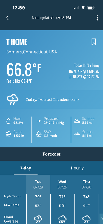
This station is about 5 miles or so NW 1.55” . Sun trying to come back out so hopefully another chance later
-
2026 Mid-Atlantic Severe Storm General Discussion
high risk replied to Kmlwx's topic in Mid Atlantic
Sort of. That day involved some local storms that initiated followed by the main band along the forcing arriving from the northwest during the evening hours. This looks to be a line forming just to our northwest during the early/mid afternoon and rolling through at dinner time before making a quick exit. There is some curvature in the hodographs, so the tornado threat is definitely non-zero, although the forcing may result in a more linear structure. The box will go up for northern sections first, because there is good cam agreement on an initial wave of storms for northeast MD/PA/NJ earlier this afternoon.