All Activity
- Past hour
-
Comical
-
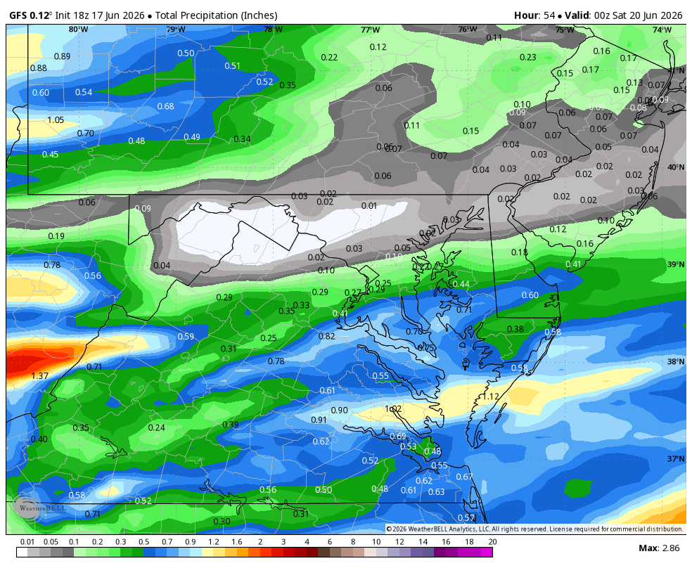
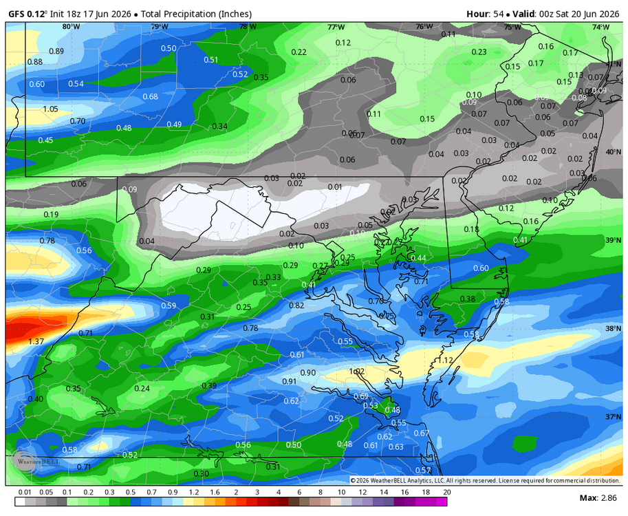
WB 18Z GFS forecasting much needed rain for southern/SE zones by Friday afternoon with frontal boundary and remnants of Arthur.
-
My last measurable rainfall IMBY was May 24.
-
High of 75.8° low of 49.1°. About perfect.
-

Central PA Summer 2026 Discussion/Obs Thread
canderson replied to Voyager's topic in Upstate New York/Pennsylvania
We probably won’t even get rain tomorrow but it’ll be very windy -
.thumb.jpg.6a4895b2a43f87359e4e7d04a6fa0d14.jpg)
Central PA Summer 2026 Discussion/Obs Thread
Yardstickgozinya replied to Voyager's topic in Upstate New York/Pennsylvania
If nothing else, the cumulus out here are getting taller here this afternoon. -
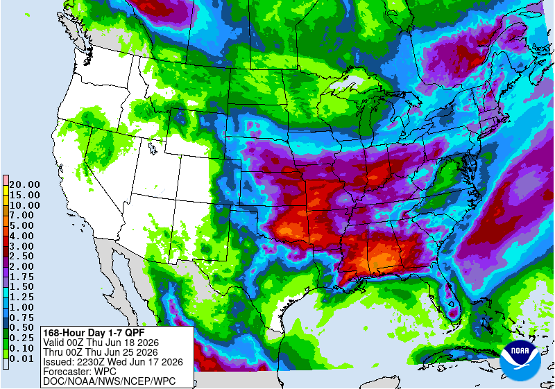
a drop in the bucket compared to what we really need - soaking rains of 1 to 2 inches every week for a few months
-
Watch that be the biggest tornado of the day.
-

super el nino banter thread
Cobalt replied to forkyfork's topic in Weather Forecasting and Discussion
note the gaps in date
-
possible tornado and 2.5" hail by Decatur IL
-
Local law enforcement reports the Audrain County storm in MO may be producing a funnel cloud near state road 15.
-
That would be me.
-
Wasn't there someone in this thread earlier that was lamenting Wisconsin getting shafted again?
-
super el nino banter thread
Cobalt replied to forkyfork's topic in Weather Forecasting and Discussion
Note the date
-
Hopefully we get at least a quarter inch tomorrow
-
None of the rotation on the Illinois cells looks like much, but Decatur is about to get rocked with a huge hail core
-
Likely strong tornado ongoing in IA heading toward southwest/west wisconsin
-
Don't even need ac lately
-
Big boy hail south of ILX
-
70/60 Tor Watch just issued for Central Indiana.
-

2026 Mid-Atlantic Severe Storm General Discussion
Eskimo Joe replied to Kmlwx's topic in Mid Atlantic
Agreed. The Euro and GFS AI models seem to be proficient at picking what systems will spin up and when. I'm very much excited about that. -
2026 Mid-Atlantic Severe Storm General Discussion
Eskimo Joe replied to Kmlwx's topic in Mid Atlantic
Don't look now, but the HRRR looks like it's trying for at least some storms tomorrow. -
Yeah it'll split around us. Front should get into northwest Tenn. Risk farther east and south is that subsidence northwest of the decaying TC squashes things. Then the said TC remnants are sliding deep south. That'd be nice in winter. Somebody has to say it, lol!
- Today
-
What a fascinating radar. Basically a string of supercells every 15 miles from Chicago to Wichita.
-
Got an emergency management confirmed tornado on the Logan County, IL cell. Also an LSR for a funnel cloud captured on a sky cam.