All Activity
- Past hour
-
Jackass seems like a jackass. I rarely see him post. Just posting emotions.
-
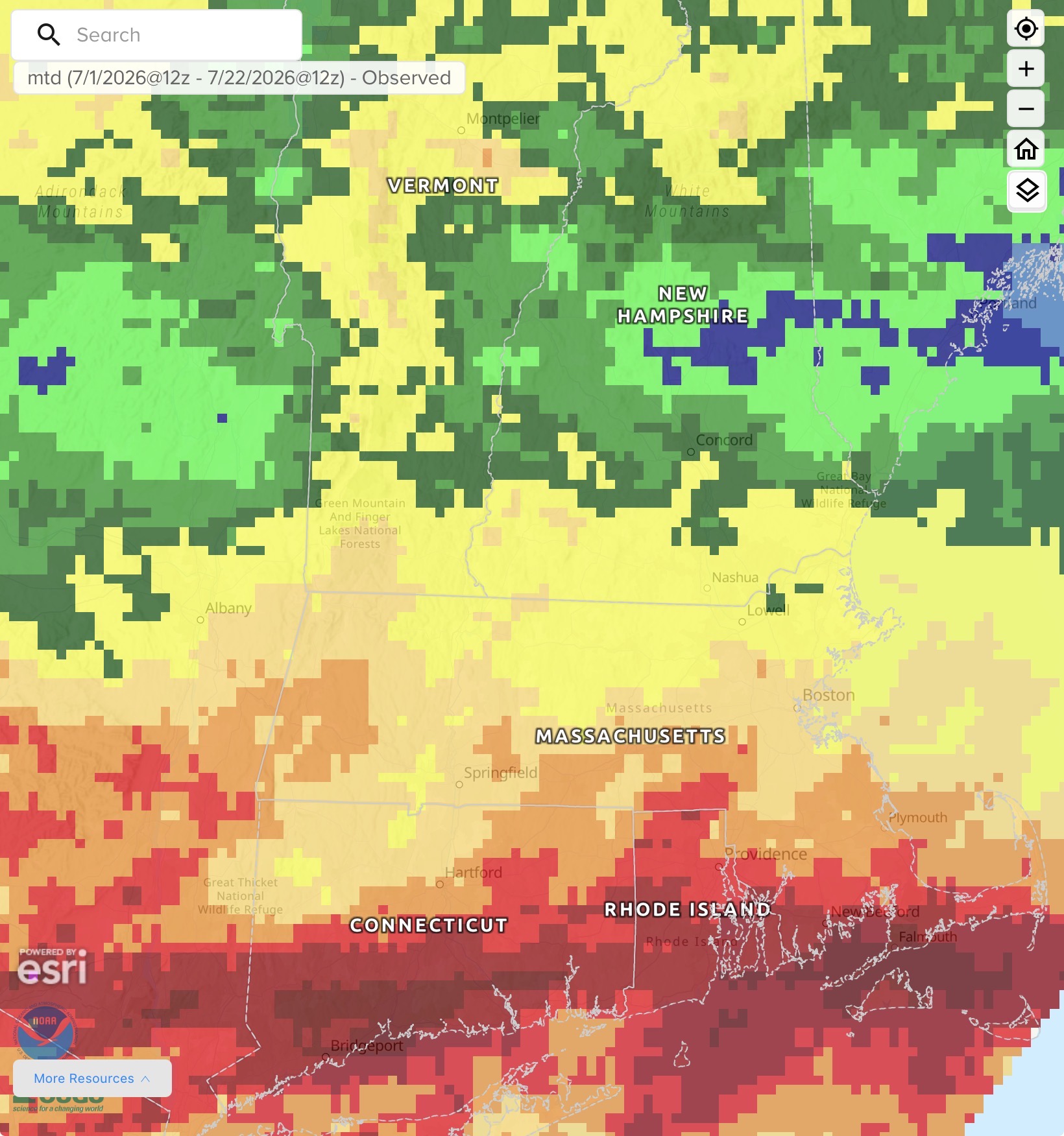
Yesterday's .93" helped, but was hardly anything notable. Unless we get at least one more significant rain I will still end up with another month below 2" total precip. It got me wondering how often this has happened recently, so I went back through the records for the last LAST 2 years and checked: 2026 JUL: 1.80 (to date) JUN: 1.59 MAY: 3.70 APR: 1.49 MAR: 1.62 FEB: 1.70 JAN: .71 2025 DEC: .99 NOV: .83 OCT: 1.86 SEP: 1.60 AUG: .68 JUL: 4.05 JUN: 4.40 MAY: 12.04 APR: 1.77 MAR: 1.74 FEB: 1.20 JAN: .49 2024 DEC: 2.74 NOV: 1.00 OCT: .50 SEP: 3.38 AUG: 10.08 JUL: 1.46 JUN: .82 Unreal. I knew it was bad, but this puts this drought in perspective. 8 months out of the last 25 have been 1" or below 18 of the last 25 months have been below 2". We had 9 straight months below 2" (Apr '26 - Aug '25) and in that stretch had 3 straight months below 1". 10 of the past 11 months have been below 2". And we had another stretch of 6 out of 7 (Apr '25 - Oct '24) in this stretch. And if the rest of July fails, we add another below 2" month to these stats. WTF happened in May '25 and Aug '24?? What a ridiculous anomoly. 37% of our total rain the past 25 months fell in those two months. Without that, this place would be uninhabitable.
-

2026-2027 Super El Nino
Stormchaserchuck1 replied to Stormchaserchuck1's topic in Weather Forecasting and Discussion
I'm just saying... in the last 3 Winter's it's come within +0.25 of actual DJFM NAO each time. That can range from +2 to -2 so that's pretty good. It's hard to tell exact number this year because what I based it on, NCAR, has been discontinued, but based on TT dailies, it is negative right now. -

2026-2027 Super El Nino
Typhoon Tip replied to Stormchaserchuck1's topic in Weather Forecasting and Discussion
Mmm I'm not sure those can be parsed out like that... "Actually the cold blob AGW based is just south of Greenland, which is a +NAO tendency. I'm pointing out a cold pool south of New Foundland. Here is the correlation composite " I would still proceed with interpretive caution. Look at it this way ... if the cold blob,due to AMOC flux variance is making that NF region "prone" to a colder expression, then a comparative failure in the index correlation is happening...because the former would mean that less forcing is causing the expression to take place. In short ... misleading a circulation mode that isn't so. That kind of shit is making the CC attribution seriously f with these mass field aspect. man As far as the cold blob itself ... -NAO and +NAO are taking place more independent because the atmospheric indexes are being driven by a set of forcing, vs the AMOC --> cold blob emerging because of changes in the AMOC. Again...use with caution. -

2026 Mid-Atlantic Severe Storm General Discussion
wawarriors4 replied to Kmlwx's topic in Mid Atlantic
-
 We have a long "plateau" here, and since our averages are "live" (every daily entry affects them), the numbers here are as of today. Our daily mean warms above 65 on July 1 (June's warmth added a full week of 65+) and that lasts thru August 10. Today's average is 66.04, the only day (currently) above 66, so it's all downhill from here. Given the short/mid forecasts, I think this summer will end without any 66+. Last night's 0.49" brought the month to 1.94". Average thru 7/22 is 2.82". Might cut the deficit a bit if the storms hit us this afternoon, but not much chance for 0.88" and it's dry for the next 4-5 days.
 -
 swing and a miss at home with the line. start the clock over and maybe we'll get measurable in a week??? congrats to SNE on your monsoon.
 -

2026-2027 Super El Nino
Jebman replied to Stormchaserchuck1's topic in Weather Forecasting and Discussion
Typhoon, Please post a hell of a lot more! I have always enjoyed reading your discourses! Love it! Post a LOT more! -
2026-2027 Super El Nino
Stormchaserchuck1 replied to Stormchaserchuck1's topic in Weather Forecasting and Discussion
Actually the cold blob AGW based is just south of Greenland, which is a +NAO tendency. I'm pointing out a cold pool south of New Foundland. Here is the correlation composite Here is the trend in global temperature. The cold blob does not overloap my -NAO favored area (above map is default positive so it's opposite for -NAO predictor). If anything the Atlantic cold blob is a Winter +NAO favored tendency, by a lot actually. Furthermore, my May-Sept N. Atlantic SSTA index has not had a net -NAO prediction in a long time. I discovered the method in 2005, and have been practicing it every year since then. It is 15-5 at getting the Winter sign correctly, and within my estimated 0.54SD, it has performed 11-9. So it's not some random thing that I am assume - I have been testing it and it has been working. -
3.26” across the river from 8am yesterday to 8am today. 82° now which would be great if the dewpoint weren’t 76.
-

2026 Mid-Atlantic Severe Storm General Discussion
Herb@MAWS replied to Kmlwx's topic in Mid Atlantic
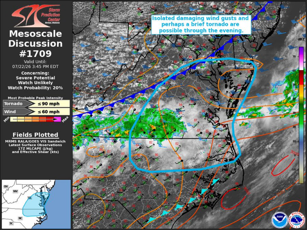
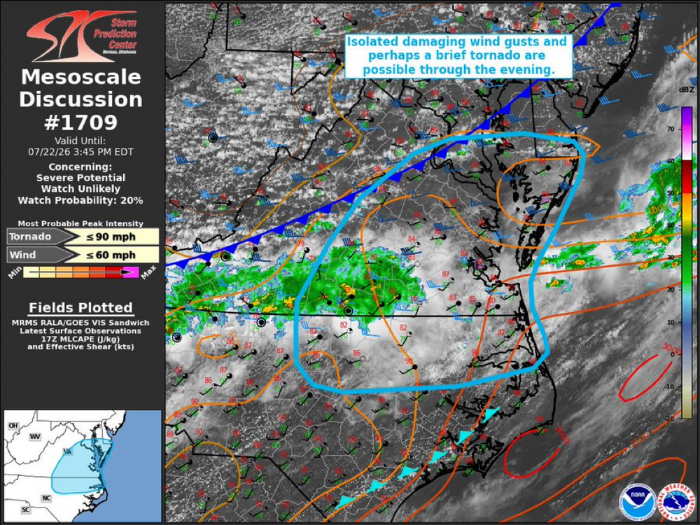
The deep moisture was pushed way south overnight, into southern Virginia. With the main front moving in later today there is a spotty chance for someone to get a localized shower or a storm. Odds greatly favor northern Virginia/Fredericksburg area and points south/SE ….. as opposed to those of us up in the Baltimore area. Although I do notice the local forecast here/Columbia went from mostly sunny …. to 30% chance of a scattered shower/storm later in the afternoon during peak heating but that could be as much for just covering all the bases in case anything isolated pops up. Consider yourself lucky if you’re north of DC and get some rain this afternoon. Not expecting much if anything. -
Looks like an overall great stretch of weather coming up. Near normal temps, pleasant nights and mornings with lower dews. Drier weather
-
 I may have to leave the board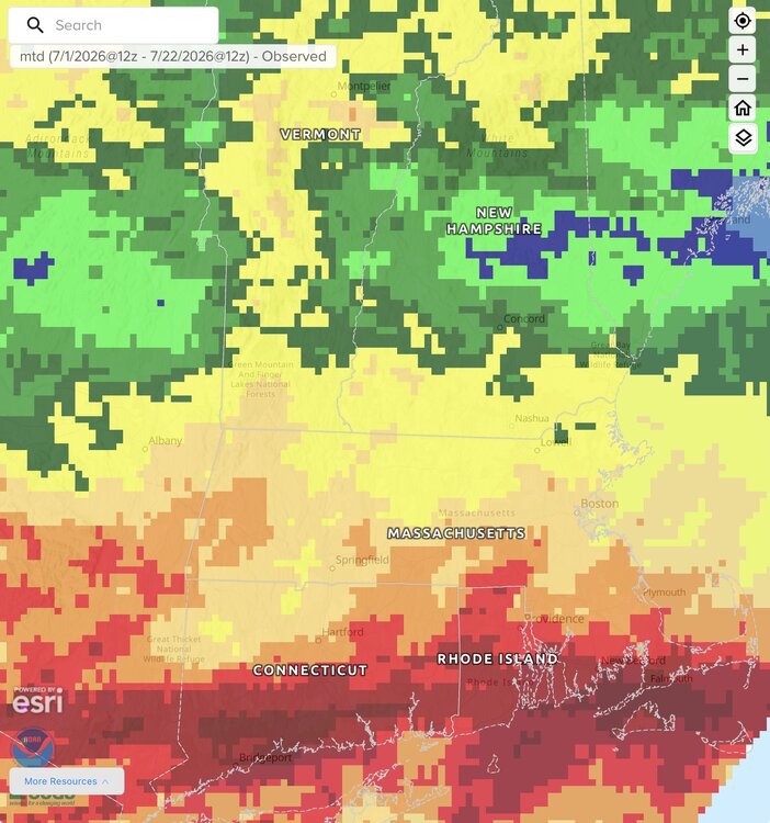
-

super el nino banter thread
Maestrobjwa replied to forkyfork's topic in Weather Forecasting and Discussion
Did you just say...
- Today
-
Large population center explains why... How many times have those same people called for a snowy winter for Iowa??? Lol
-
 Serious ass rain.
 -
Today John Lennon could have easily added ‘imagine if we didn’t click’ to his song. As always we will click …..
-
Another water (not too much) into the basement storm too.
-
 prednisone 1 mg daily: TheraCore Pharmacy - TheraCore
 -
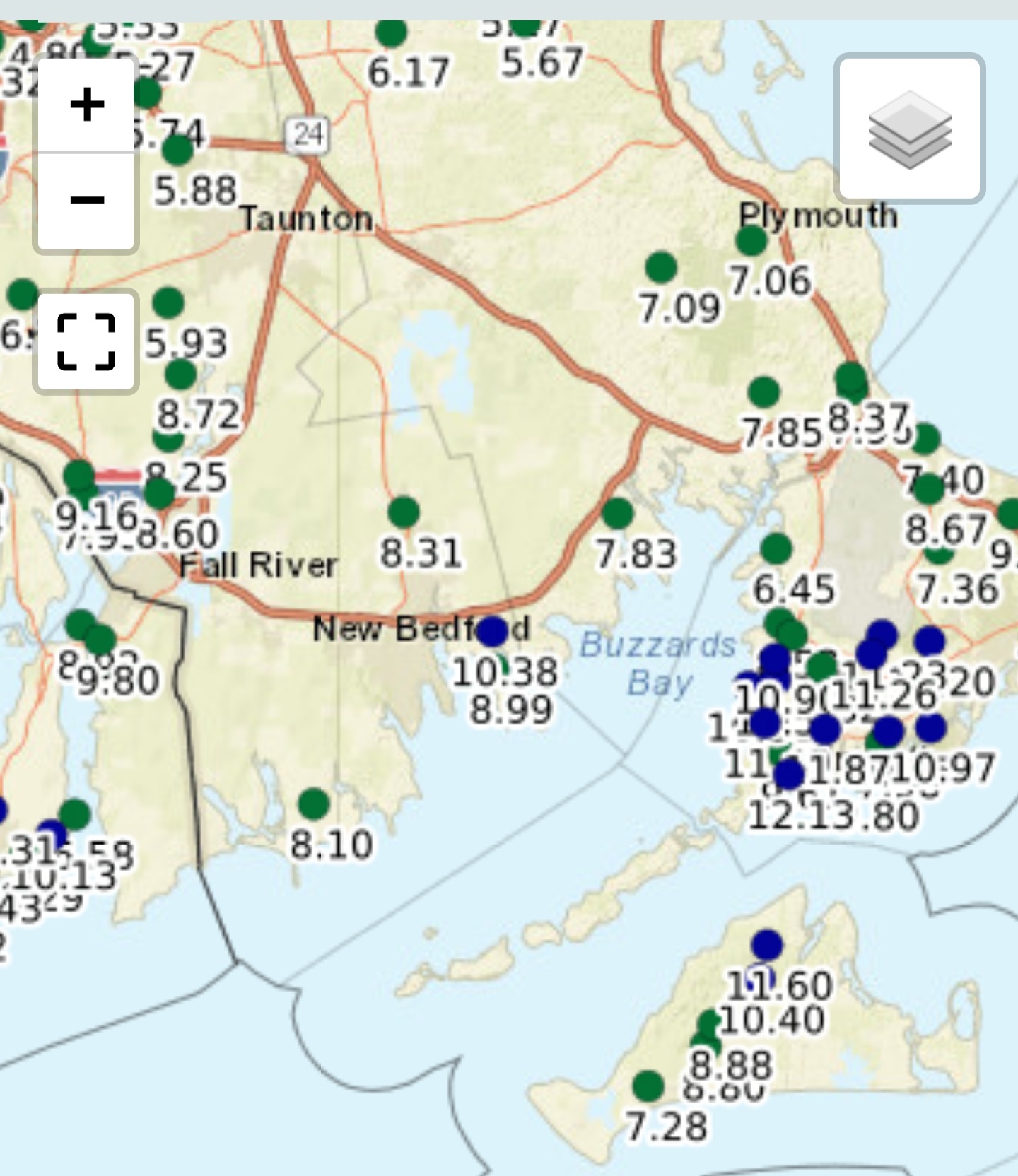
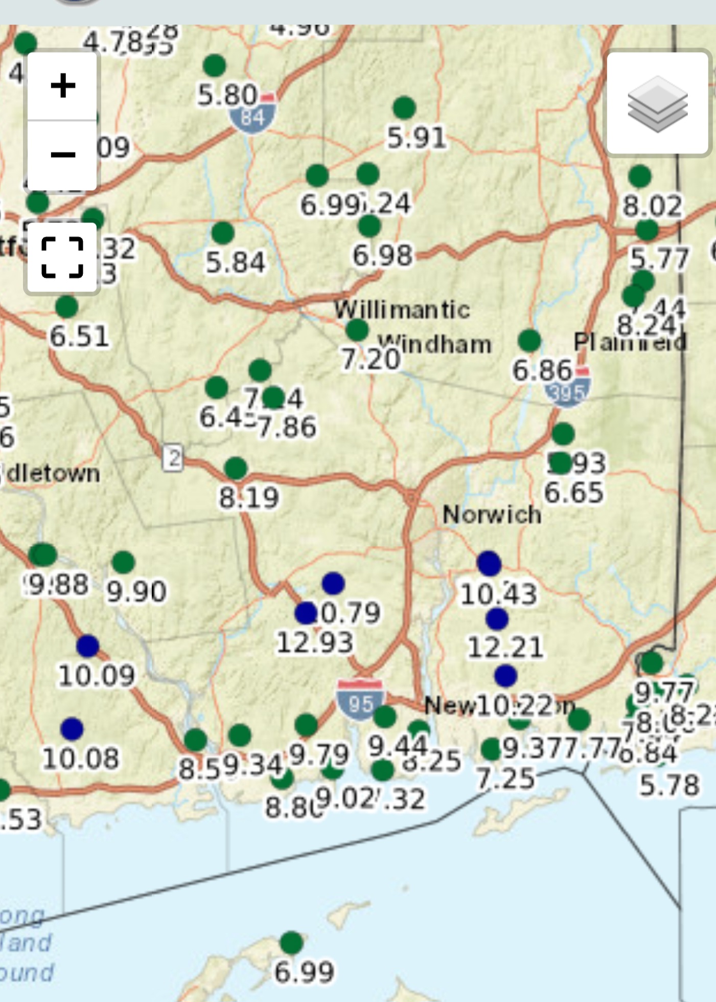
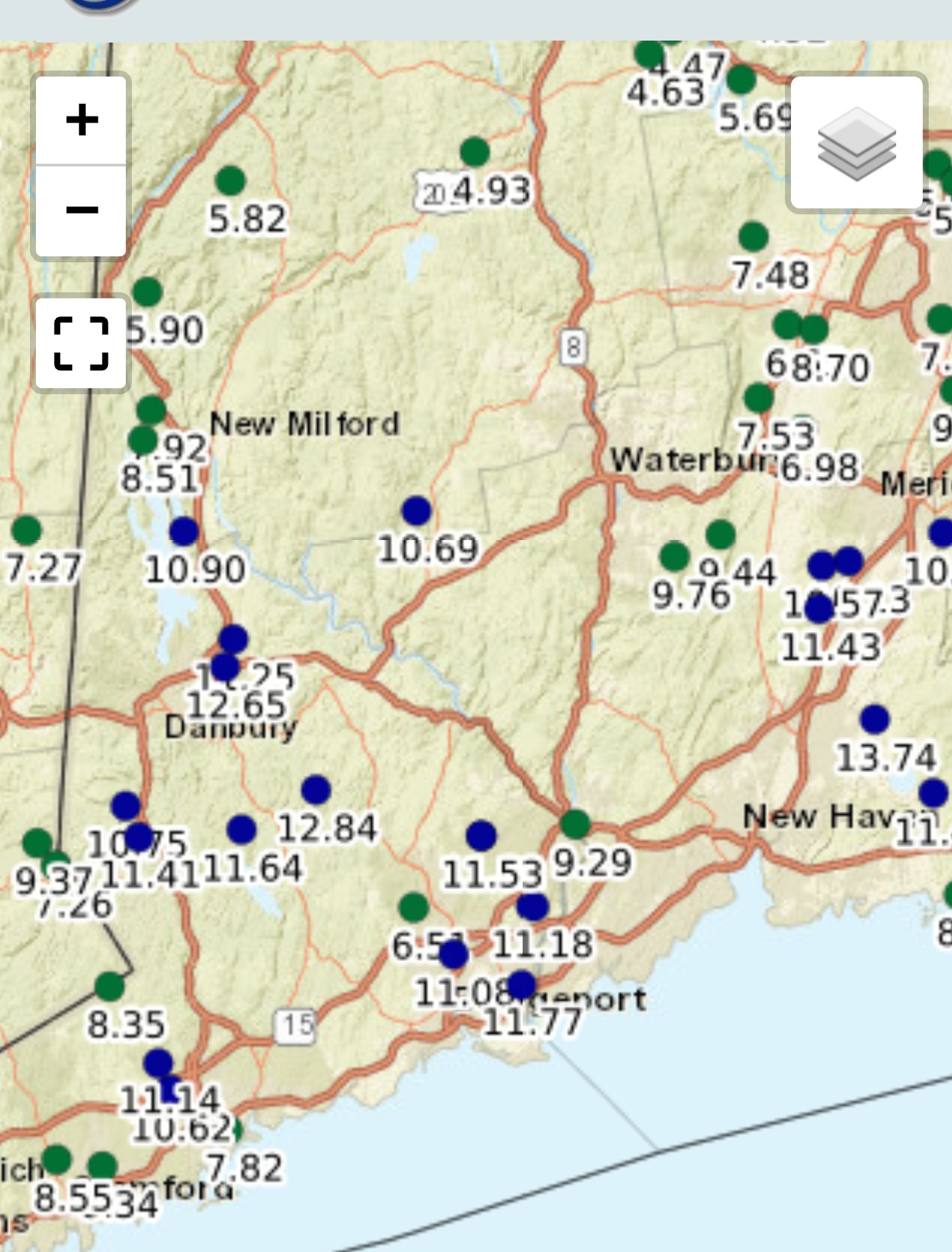
So ended up with 1.14” at the house in Frederick. Monthly total of 8.90” so far. compared to the 2 and a half inches last July. Not sure what we got here in Lewes last night. The thunder was so loud and we are in a ground floor condo and it shook the entire room. I have heard that there was a situation down in Chincoteague overnight at the camp grounds. Tent campers were having a rough night with flooding and campers that did not put their awnings down had them ripped off. And they got hit again this morning. There is standing water all over here in Lewes. Have seen video of the water spout off of Lewes last night. Am glad I looked at weather on Monday and decided to not take the ferry over to Cape May yesterday. Could have been an interesting ride if we were on the last ferry.
-
Dewpoints dropping to the mid - low 60s 86/64
-
 exit 5 (shop) .56"
 -
12Z UKMET: 1005 mb Galveston hour 33 -Has TS force winds C and W LA coast but nowhere in TX. -Rainfall for GLV-HOU only ~0.5-75”. Max is ~4” and is near Matagorda Bay. TROPICAL STORM BERTHA ANALYSED POSITION : 29.8N 88.4W ATCF IDENTIFIER : AL022026 LEAD CENTRAL MAXIMUM WIND VERIFYING TIME TIME POSITION PRESSURE (MB) SPEED (KNOTS) -------------- ---- -------- ------------- ------------- 1200UTC 22.07.2026 0 29.8N 88.4W 1000 40 0000UTC 23.07.2026 12 29.3N 90.7W 1003 33 1200UTC 23.07.2026 24 29.0N 92.4W 1001 43 0000UTC 24.07.2026 36 CEASED TRACKING
-
 Garden variety thunderstorm. Also good for the soul.