wx2fish Posted January 16 Share Posted January 16 Primarily sleet and snow grains for the past half hour with some flakes in the heavier echoes Link to comment Share on other sites More sharing options...
ORH_wxman Posted January 16 Share Posted January 16 Solid layer of ice on everything now. Crust on top of the snow. 3 Link to comment Share on other sites More sharing options...
STILL N OF PIKE Posted January 16 Share Posted January 16 Just now, ORH_wxman said: Solid layer of ice on everything now. Crust on top of the snow. There is ice all the way into Lynnfield Ma currently Link to comment Share on other sites More sharing options...
iceman1 Posted January 16 Share Posted January 16 my area has about 2 inches and its mixing now 2 Link to comment Share on other sites More sharing options...
STILL N OF PIKE Posted January 16 Share Posted January 16 Looks like the 32f isotherm may wind up 15 miles or so SE than what mesos had 1 Link to comment Share on other sites More sharing options...
SJonesWX Posted January 16 Share Posted January 16 hearing sleet hitting the windows at my office near MHT. I am surprised it has gotten this far. Link to comment Share on other sites More sharing options...
ma blizzard Posted January 16 Share Posted January 16 gotta give credit to the models that showed the potential for 0.1"-0.25" QPF as freezing rain .. looks well on the way to verifying 1 Link to comment Share on other sites More sharing options...
dryslot Posted January 16 Share Posted January 16 Rates have increased, 27dbz's, Looks like we have 2"+ on the ground now, 2 Link to comment Share on other sites More sharing options...
cardinalland Posted January 16 Share Posted January 16 4 minutes ago, ma blizzard said: gotta give credit to the models that showed the potential for 0.1"-0.25" QPF as freezing rain .. looks well on the way to verifying definitely verifying in new haven. we’ve got 0.2” of ice on top of the snow and it is rock solid 1 Link to comment Share on other sites More sharing options...
powderfreak Posted January 16 Share Posted January 16 1 minute ago, dryslot said: Rates have increased, 27dbz's, Looks like we have 2"+ on the ground now, Can see us losing our 1-1.5”/hr meso band there. Link to comment Share on other sites More sharing options...
CoastalWx Posted January 16 Share Posted January 16 Been sheets of rain and 36. What's left of the snow will be a glacier. Link to comment Share on other sites More sharing options...
dryslot Posted January 16 Share Posted January 16 1 minute ago, powderfreak said: Can see us losing our 1-1.5”/hr meso band there. Looks like the fun is still yet to come here, looks like its going to fall in that stripe that the models advertised last night. Link to comment Share on other sites More sharing options...
NorEastermass128 Posted January 16 Share Posted January 16 Pouring. Winter 2023-2024 rolls onward. 1 1 Link to comment Share on other sites More sharing options...
alex Posted January 16 Share Posted January 16 About 3-4" here. Much heavier than I was expecting. It's gonna be a great week for skiing as long as you're bundled up Michelin man style 1 Link to comment Share on other sites More sharing options...
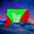
STILL N OF PIKE Posted January 16 Share Posted January 16 Where is that mix line for NH friends Link to comment Share on other sites More sharing options...
FlashFreeze Posted January 16 Share Posted January 16 freezing rain and sleet has turned back to snow in Barkhamsted 27° 1 Link to comment Share on other sites More sharing options...
UnitedWx Posted January 16 Share Posted January 16 Just changed back to snow here in westfield. Just as I finished snow blowing the driveway 1 Link to comment Share on other sites More sharing options...
ORH_wxman Posted January 16 Share Posted January 16 12 minutes ago, ma blizzard said: gotta give credit to the models that showed the potential for 0.1"-0.25" QPF as freezing rain .. looks well on the way to verifying Yeah I thought it would be more sleety than ZR given how marginal the warm layer is, but we have a solid glaze on everything...pretty sure at least 0.1" already. But it's possible that the drying aloft in the mid-levels (esp in the DGZ) helped it go to ZR quicker. 2 1 Link to comment Share on other sites More sharing options...
TheMainer Posted January 16 Share Posted January 16 8 minutes ago, dryslot said: Looks like the fun is still yet to come here, looks like its going to fall in that stripe that the models advertised last night. 1/2" of snow here, starting to come down more steadily, been lightly falling since Noon. Hoping we still get our 6+ as I've already teed up to take off Thursday to go grooming 1 Link to comment Share on other sites More sharing options...
jbenedet Posted January 16 Share Posted January 16 Gonna finish here with about 3”. Mixing and slotting. 1 Link to comment Share on other sites More sharing options...
Typhoon Tip Posted January 16 Share Posted January 16 3", then switched to IP at varying fall rates about an hour and half ago. 25F 19 on the season 1 Link to comment Share on other sites More sharing options...
mreaves Posted January 16 Share Posted January 16 10 minutes ago, powderfreak said: Can see us losing our 1-1.5”/hr meso band there. I'm hoping we still have a couple of hours of decent snow. Haven't been able to get out and measure yet. Link to comment Share on other sites More sharing options...
wx2fish Posted January 16 Share Posted January 16 7 minutes ago, STILL N OF PIKE said: Where is that mix line for NH friends I'm not far from exit on 3 on 93 and keeps going back and forth depending on intensity, more snow now with a heavy echo. Seems to have stalled out, and may be nearing it's northernmost point. Might have one more push, but nam maxed out around 4pm. Link to comment Share on other sites More sharing options...
Typhoon Tip Posted January 16 Share Posted January 16 Really interested in how/why the Euro and GFS did so poorly with this even even when < 96 hours. 3 Link to comment Share on other sites More sharing options...
dryslot Posted January 16 Share Posted January 16 4 minutes ago, TheMainer said: 1/2" of snow here, starting to come down more steadily, been lightly falling since Noon. Hoping we still get our 6+ as I've already teed up to take off Thursday to go grooming All this, Highlighted portion is what i was referring to last night that we may see development sooner and that would up qpf and snowfall, Ratios are going to be well above 10:1, So the kuchie is probably a better choice. Mesoscale Discussion 0075 NWS Storm Prediction Center Norman OK 1249 PM CST Tue Jan 16 2024 Areas affected...Much of interior Maine Concerning...Heavy snow Valid 161849Z - 162245Z SUMMARY...Heavy snow rates on the order of 1-2 inches per hour are increasingly likely by 4-7 PM EST, and probably will linger further into the evening, before spreading to the northeast of the region. DISCUSSION...Downstream of a significant short wave impulse turning northeastward through the lower Great Lakes region, cyclogenesis is underway along a surface frontal zone near the northern Mid Atlantic through southern New England coast vicinity. Associated large-scale ascent is contributing to an expanding and intensifying precipitation shield beneath cooling cloud tops inland of coastal areas. It appears that this will continue while overspreading the remainder of northern New England through the balance of the afternoon, in response to further strengthening of lower/mid-tropospheric warm advection and forcing for upward vertical motion. A general consensus of latest model output indicates a more rapid deepening of the surface cyclone will commence by 21-00Z, largely offshore, across and northeast of the Cape Cod vicinity by 21-00Z. Across the coastal plain into higher terrain of Maine, deep-layer lift, becoming maximized within the mid-level layer favorably cold for large dendritic ice crystal growth, is forecast to become increasingly conducive to heavy snow rates around or above 1 inch per hour by 21-22Z, if not earlier. This will be aided by cold thermodynamic profiles entirely below freezing, and supportive of moderately large snow to liquid water equivalent ratios, as low-level moisture advection off the Atlantic contributes to increasing precipitable water content (.4 to .6 inches). Strengthening frontogentic forcing may contribute to bands of heavier snow rates approaching 2 inches per hour, with the heavy snow lingering through mid to late evening before diminishing and/or spreading with the large-scale ascent northeast of the region. ..Kerr.. 01/16/2024 ...Please see www.spc.noaa.gov for graphic product... ATTN...WFO...CAR...GYX... LAT...LON 45666715 44236966 43657102 44227114 45277053 46276909 46776794 45666715 1 1 Link to comment Share on other sites More sharing options...
PWMan Posted January 16 Share Posted January 16 Intensity dropped way off, pingers mixed in. Maybe 1-2 inches down. 24F Link to comment Share on other sites More sharing options...
STILL N OF PIKE Posted January 16 Share Posted January 16 A few flakes mixing back into WaWa cams 1 Link to comment Share on other sites More sharing options...
ORH_wxman Posted January 16 Share Posted January 16 Just now, STILL N OF PIKE said: A few flakes mixing back into WaWa cams You can see the mix line collapsing back east on CC now. Looks like it just went through Hartford and Springfield further south Link to comment Share on other sites More sharing options...
dryslot Posted January 16 Share Posted January 16 3 minutes ago, PWMan said: Intensity dropped way off, pingers mixed in. Maybe 1-2 inches down. 24F You can see it skirtng the coast on CC down there, It probably washes out with heavier rates. Link to comment Share on other sites More sharing options...
Connecticut Appleman Posted January 16 Share Posted January 16 Just flipped back to snow here in New Hartford. Link to comment Share on other sites More sharing options...

Recommended Posts
Create an account or sign in to comment
You need to be a member in order to leave a comment
Create an account
Sign up for a new account in our community. It's easy!
Register a new accountSign in
Already have an account? Sign in here.
Sign In Now