cardinalland
-
Posts
533 -
Joined
-
Last visited
About cardinalland

Recent Profile Visitors
4,562 profile views




-
In other news, 2026 has now surpassed 1983. Now, 2026 is the season that has produced the second least ACE in the satellite era. We'll see if that holds or if some late season storm ups the ACE further. In an interesting parallel, the EPAC is to date at its second highest ACE recorded in the season, but it should soon reach #1.
-
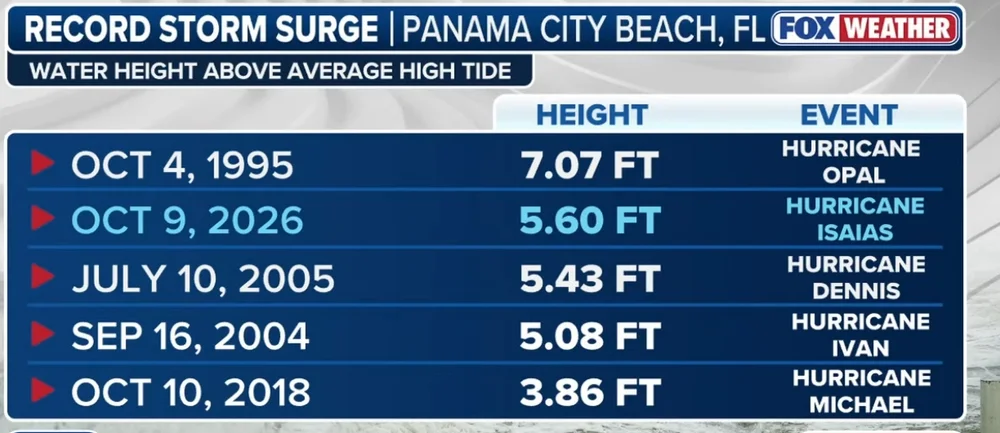
At the risk of contributing further to a pointless argument: Maximum sustained winds should be the most intense (sustained) winds measured anywhere in the hurricane. The strongest winds are probably going to be offshore or right on the beach. What are the odds that there's an anemometer at that exact location? Then, there's the issue that the power could be out when the highest winds hit, and of course, winds of this intensity aren't exactly gentle to meteorological equipment. The maximum sustained winds I've seen recorded with this storm on land is 92.8 mph, which is 88% of NHC's max sustained winds at landfall and is nearly Category 2 strength. That's about as good as you're gonna get since we don't have recon over land to drop a sonde over the exact point with the most intense winds. Anyways, I'm now seeing nearly 700k customers without power in the region, I hope the recovery goes smoothly
-
-
140k customers without power in the region and climbing fast (was 100k 15 minutes ago)
-
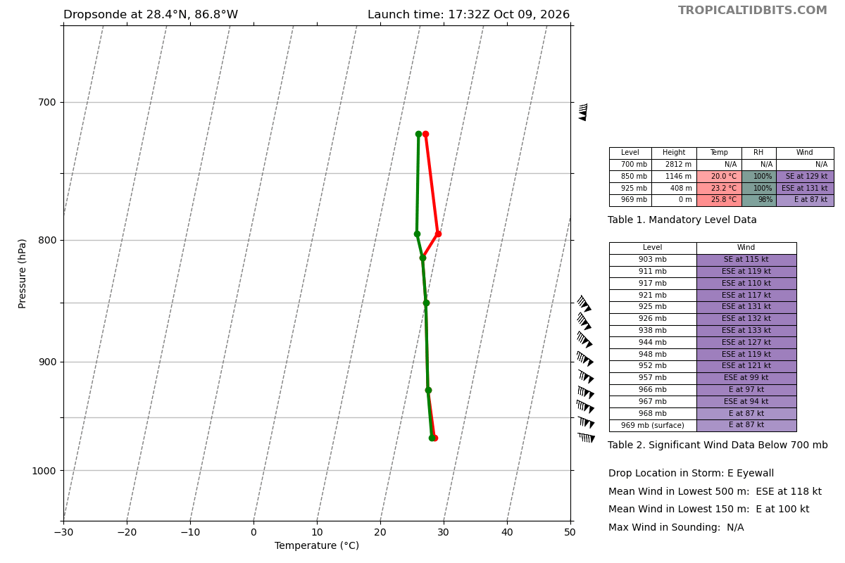
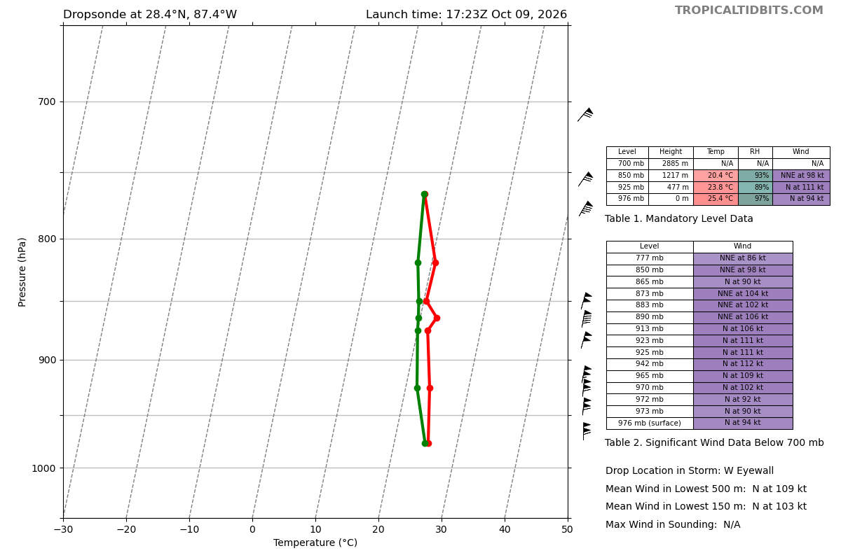
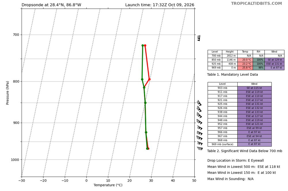
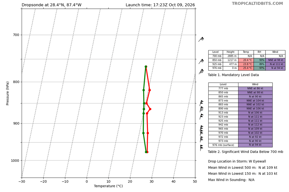
This wouldn't warrant an upgrade, but the data shows a storm that's pretty robust. 150 mph winds at 925mb-938mb, which is about 800-1200ft above the surface
-
110 mph surface winds in the west eyewall
-
Not sure about the microwave pass but radar improving is mostly an artifact of the storm entering radar range. Beam height (per RadarScope) is still about 30,000 ft near the South eyewall so it's just entering the range where the whole eyewall can be seen
-
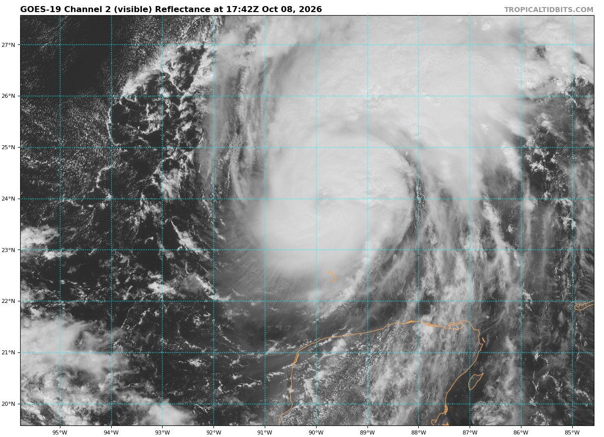
This hurricane must have body insecurity issues with everything that people have said about it in the last couple of days It looks pretty normal for a Category 3 hurricane, and unfortunately does not appear to be weakening yet
-
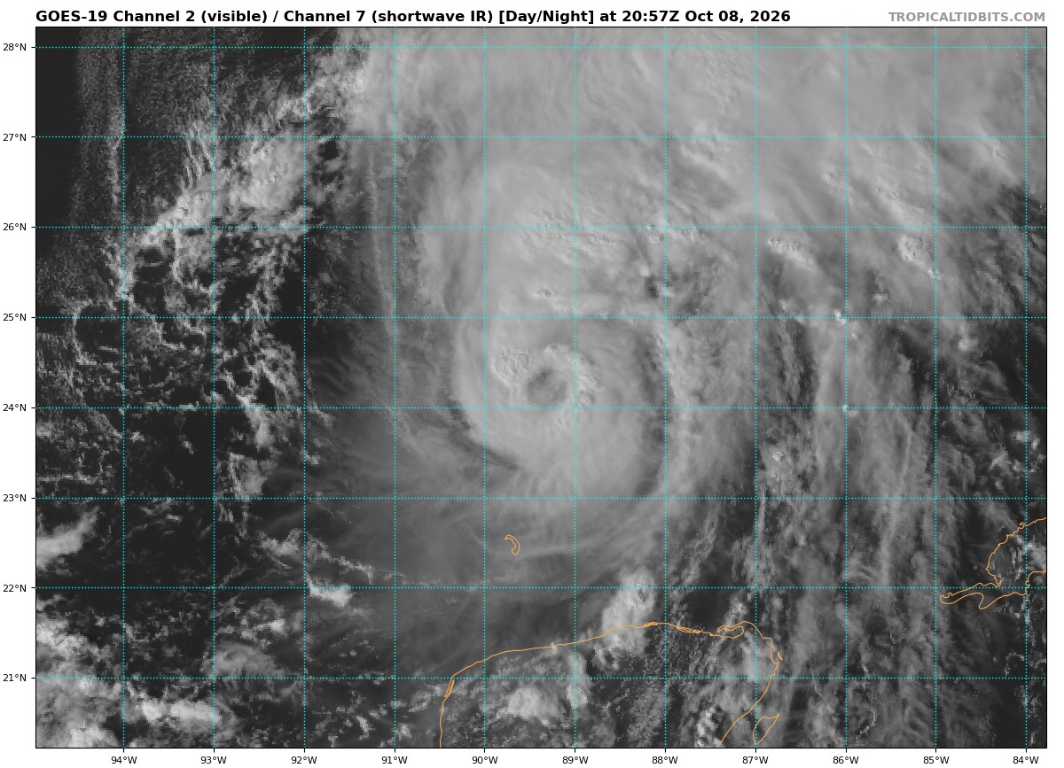
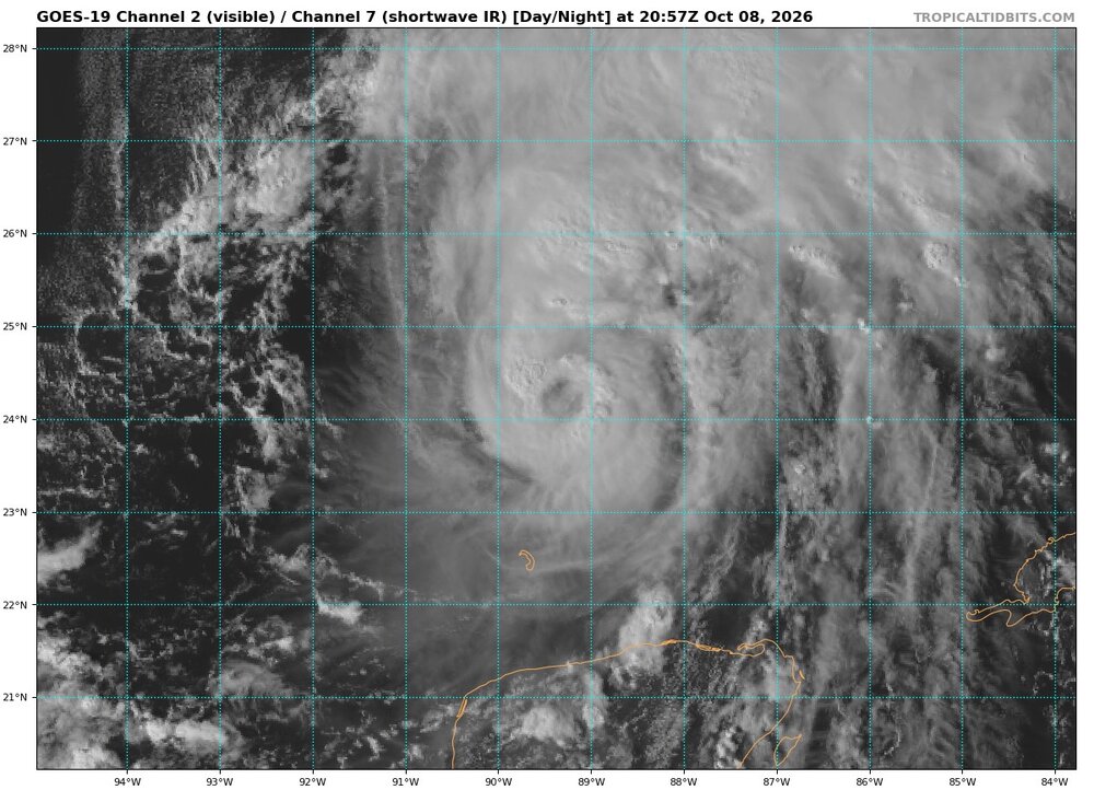
Eye has continued to develop and clear. Looks like a Cat 1-2 hurricane, which is what it is
-
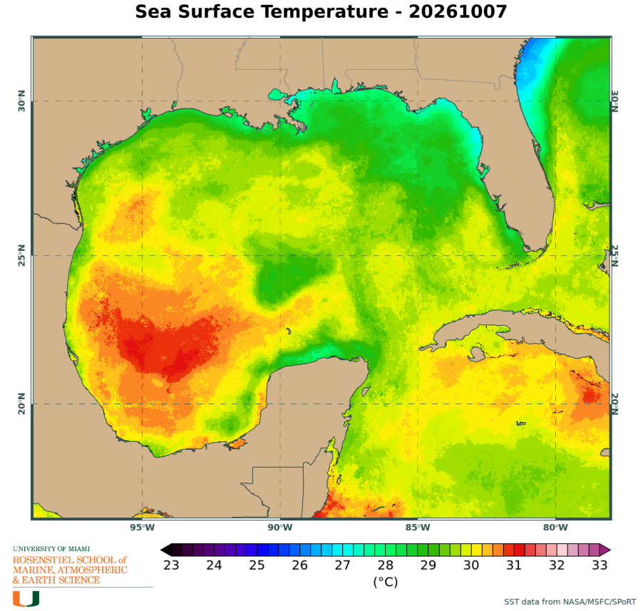
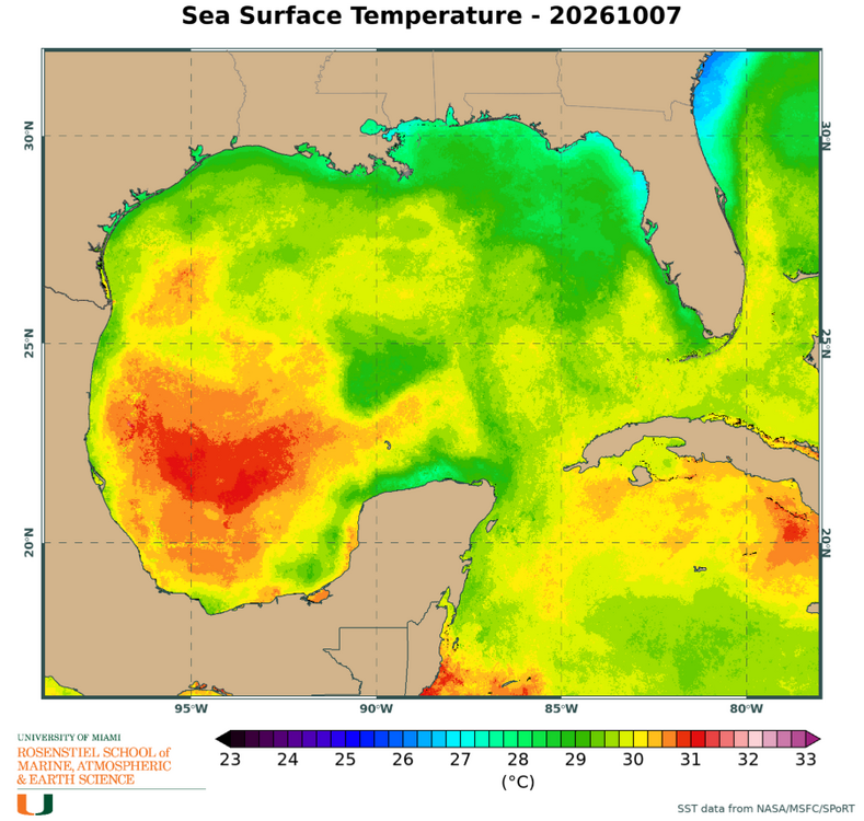
It’s passing over some slightly cooler SSTs right now
-
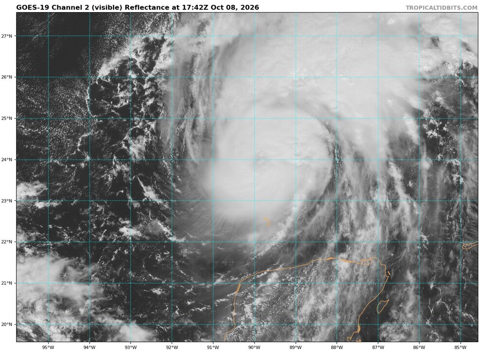
It appears the eye is starting to clear
-
I stand corrected. Thank you
-
The hurricane was declared as such at 11:30pm eastern on 10/7 after a Hurricane Hunters pass. So it’s a little dicey. Of course there’s a good chance 1905 had a hurricane earlier in their season that we didn’t detect
-
1905 was a day later (10/7 at 11:30pm vs 10/8) In the satellite era, yes, by far (previous record was 9/11)
-
Look at all those hot towers Would agree on a C1 landfall being most likely right now. Reaching C3+ over the open ocean beforehand looks very attainable.