ma blizzard
-
Posts
3,081 -
Joined
-
Last visited
Content Type
Profiles
Blogs
Forums
American Weather
Media Demo
Store
Gallery
Everything posted by ma blizzard
-
4.97"
-
in your defense? if you looked at the models you would know they all had a bullseye over your head
-
downslope off the ORH hills gonna help your area with winds
-
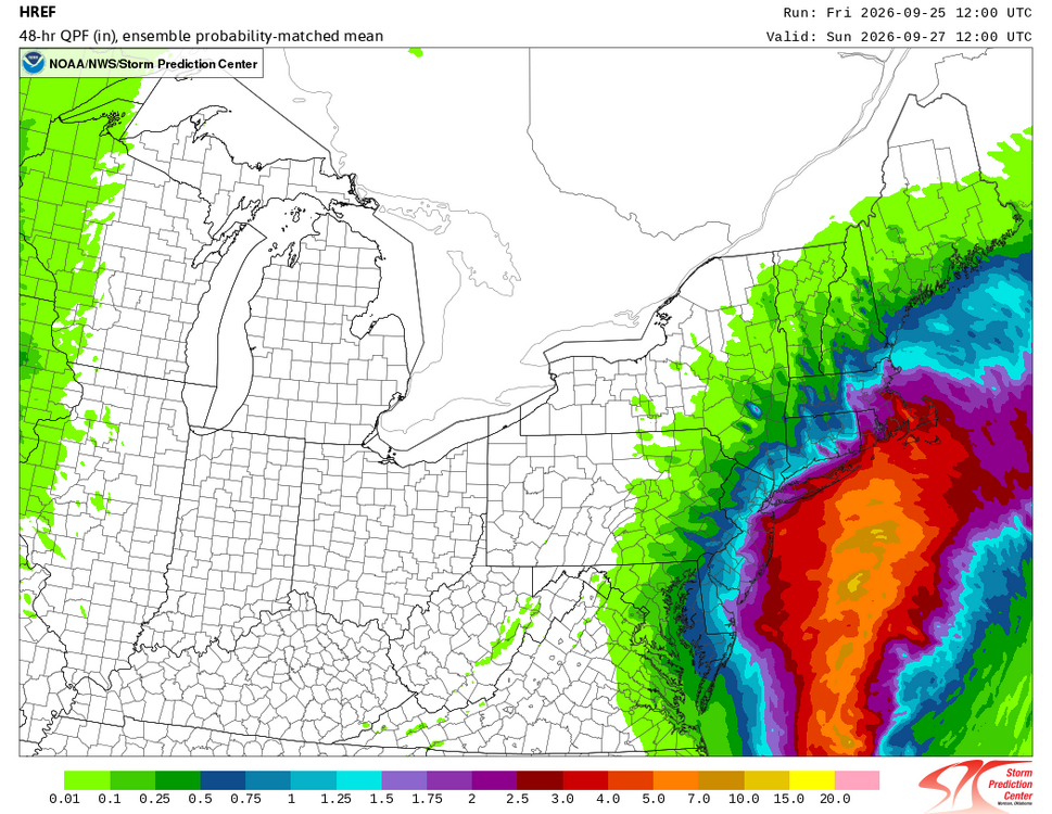
Not everyday you can see such clear orographic effects and frictional convergence in SE Mass along the coast .. totals thru 12z Sunday morning so just getting started
-
disastrous timing for plants currently flowering ..
-
Septorcher 2026 Discussion - Endless Summer
ma blizzard replied to Damage In Tolland's topic in New England
6z EURO most impressive with the LLJ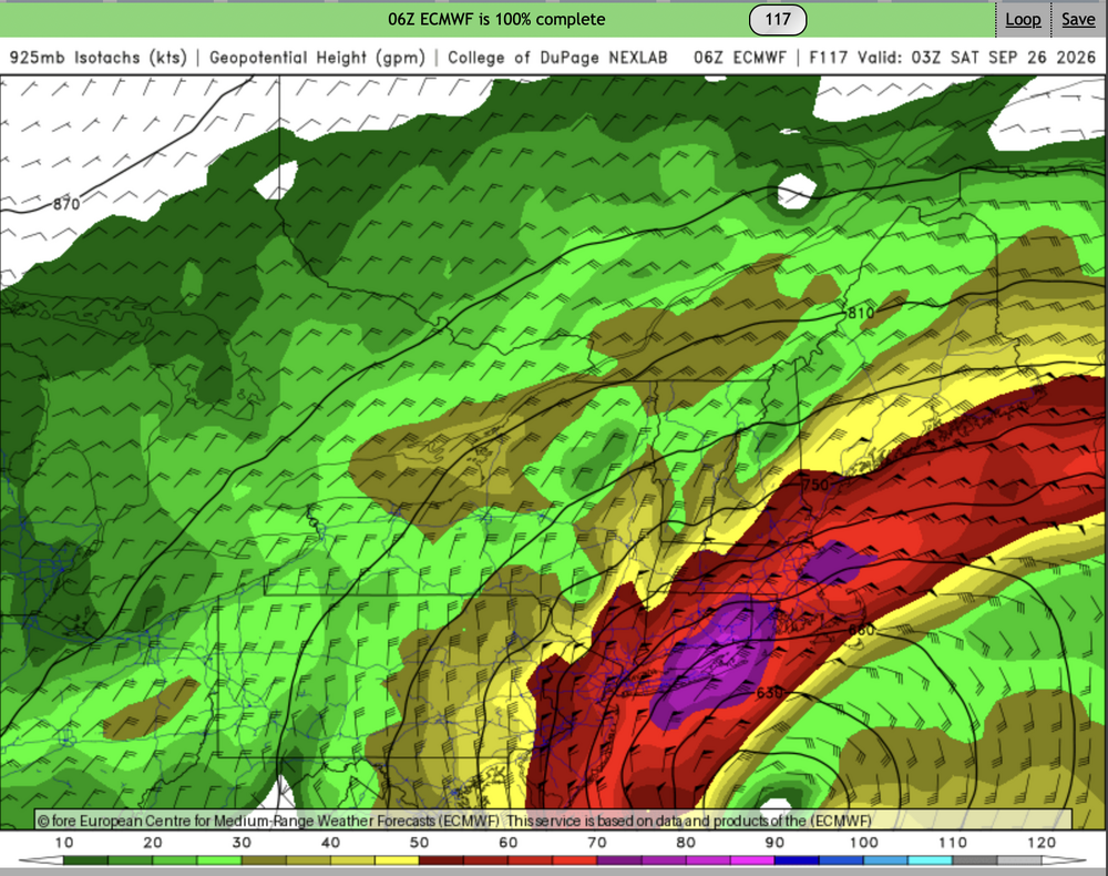
-
Septorcher 2026 Discussion - Endless Summer
ma blizzard replied to Damage In Tolland's topic in New England
H5 is such a mess, gonna take awhile for the models to resolve this -
tough when the trolling doesn’t have the desired effect
-
Septorcher 2026 Discussion - Endless Summer
ma blizzard replied to Damage In Tolland's topic in New England
OWD 39 last night .. not bad -
Monday, August 31 - Thursday, September 3, 2026 Convective Episodes
ma blizzard replied to weatherwiz's topic in New England
at least we should get some good coastals as we head into fall with El Niño -
Augdewst 2026: Summer's Last Stand
ma blizzard replied to Prismshine Productions's topic in New England
nino summers torch second half of september into october -
Augdewst 2026: Summer's Last Stand
ma blizzard replied to Prismshine Productions's topic in New England
maybe the storms ride along the boundary separating MU 60s vs 70+ dews? I'm with ya though def bullish on storms this evening / tonight -
Augdewst 2026: Summer's Last Stand
ma blizzard replied to Prismshine Productions's topic in New England
sad to say not everyone could see the charts through the haze -
Augdewst 2026: Summer's Last Stand
ma blizzard replied to Prismshine Productions's topic in New England
next week looking muggy .. 12z euro is legit 70+ dews all of next week -
3 day total of 2.54" so far wild that ORH is over 5.5" over the same time only about 10 mi west
-
solid trend over the past few days to really pump up heights in our region in the medium range as WAR retrogrades
-
liking just E of ORH hills for second jack
-
WPC already going slight risk D3/4 with talk of upgrading to moderate in the discussion Will be interesting to see CAMs as we get into range. Potential is there for prolific totals.
-
would be fun to have a VEI 6/7 leading into a super nino winter
-
An aug 1944 like stretch could be staring them right in the face and they wouldn't even be able to tell with all the curtains of smoke wafting between them and the computer screen
-
we’ve been trying to tell them
-
first week of august trending warmer
-
Looks like the smoke will linger into Thursday too Been interesting following the HRRR simulations: https://www.pivotalweather.com/model.php?m=hrrr&p=smoke_viden&rh=2026071418&fh=loop&r=us_ne&dpdt=&mc=
-
early morning was tropical but looks like starting around mid morning ish with better mixing dews dropped into the mid 60s
-
crazy that most models drop the freezing level as low as 1500'-2000' between 12z - 15z Saturday morning for ORH county decent chance of flakes at the top of Watchusett at the very least