ma blizzard
-
Posts
3,059 -
Joined
-
Last visited
Content Type
Profiles
Blogs
Forums
American Weather
Media Demo
Store
Gallery
Everything posted by ma blizzard
-
Looks like the smoke will linger into Thursday too Been interesting following the HRRR simulations: https://www.pivotalweather.com/model.php?m=hrrr&p=smoke_viden&rh=2026071418&fh=loop&r=us_ne&dpdt=&mc=
-
early morning was tropical but looks like starting around mid morning ish with better mixing dews dropped into the mid 60s
-
crazy that most models drop the freezing level as low as 1500'-2000' between 12z - 15z Saturday morning for ORH county decent chance of flakes at the top of Watchusett at the very least
-
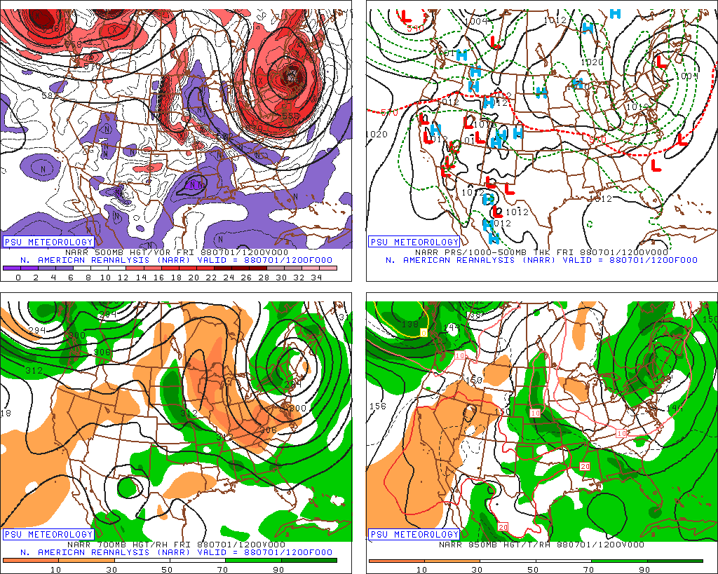
Impressive for 7/1!
-
sucks we couldn't get the coastal to pass closer tonight .. could have been a late season snow for the higher elevations
-
69.6" Appreciate all the work you put into making these maps
-
sleet mixing in
-
could be a sneaky interesting day if we can get something to pop
-
63 with sun breaking out the past hour turned out much nicer than anticipated
-
I'd imagine an April 1976 redux today would have the favored areas approaching 100 lets do it
-
0.6"
-
ripping pretty good .. might pick up a quick inch at this rate
-
35/32 S-
-
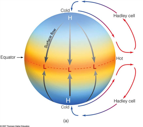
Tips latest Hadley Cell model ..
-
71 off a low of 31 .. 40 degree swing not bad warmest day since 10/7
-
32.4/30, rain locally seems like ~500’ is the freezing level
-
the problem is how much QPF you waste before dropping below freezing
-
Im thinking ORH hills south of rt2 might be the best bet until they flip to sleet/snow
-
might be in a decent spot to get ZR? either that or an epic scalping
-
quite the cold drain on some of the mesos .. probably overdone but entertaining solutions
-
28.7/26, PLZR getting icy out there
-
1.6” before flipping to sleet
-
absolutely nuking quarters right now .. best snow growth since the Norlun
-
28/25, moderate snow huge flakes too bad we flip to sleet within the hour
-
you should be in a good spot for this one