yoda Posted January 7, 2014 Share Posted January 7, 2014 LWX has added 30 POPS for frz rain or snow Thurs night Link to comment Share on other sites More sharing options...
NCWX Posted January 7, 2014 Share Posted January 7, 2014 Out here it will be enough ice to close school again........ Like last week I think it will over perform. Link to comment Share on other sites More sharing options...
Scraff Posted January 7, 2014 Share Posted January 7, 2014 Well if Justin Berk is on board: Snow returns as arctic air departs... Here is the Canadian Model forecast outlook for Friday Morning. Note: This model has been consistently building back moisture for this time frame. I've mentioned it here for a few days. The GFS Model just started hinting at it, so many other forecasts will likely begin to mention it shortly. We are in a pattern with over performing events that arrive a little early. I would leave an arrival window from Thursday Night open too. How much? It is too early (I never make my first call outside of 48 hrs) But... This looks like a few inches over a quick event. Time frame 6-8 hours Faith-in-the-Flakes* Link to comment Share on other sites More sharing options...
Ji Posted January 7, 2014 Share Posted January 7, 2014 We need this one. Might be our last for 7 whole days! hate wasting a week. We only have so much winter Link to comment Share on other sites More sharing options...
steinweather Posted January 7, 2014 Share Posted January 7, 2014 HAZARDOUS WEATHER OUTLOOKNATIONAL WEATHER SERVICE MOUNT HOLLY NJ344 PM EST TUE JAN 7 2014DEZ002>004-MDZ012-015-019-020-082045-KENT-INLAND SUSSEX-DELAWARE BEACHES-KENT MD-QUEEN ANNES-TALBOT-CAROLINE-344 PM EST TUE JAN 7 2014 .DAYS TWO THROUGH SEVEN...WEDNESDAY THROUGH MONDAY.THERE IS A CHANCE OF A LIGHT WINTRY MIX LATE THURSDAY NIGHT ANDFRIDAY. Link to comment Share on other sites More sharing options...
CAPE Posted January 7, 2014 Share Posted January 7, 2014 Well if Justin Berk is on board: Snow returns as arctic air departs... Here is the Canadian Model forecast outlook for Friday Morning. Note: This model has been consistently building back moisture for this time frame. I've mentioned it here for a few days. The GFS Model just started hinting at it, so many other forecasts will likely begin to mention it shortly. We are in a pattern with over performing events that arrive a little early. I would leave an arrival window from Thursday Night open too. How much? It is too early (I never make my first call outside of 48 hrs) But... This looks like a few inches over a quick event. Time frame 6-8 hours Faith-in-the-Flakes* Lol JB...yeah a few inches. Good luck with that. Outside chance of less than an inch somewhere...maybe. Why are all storms over-performers in his mind? ALWAYS. Must be #faithintheflakeskoolaid Link to comment Share on other sites More sharing options...
Bob Chill Posted January 7, 2014 Share Posted January 7, 2014 Lol JB...yeah a few inches. Good luck with that. Outside chance of less than an inch somewhere...maybe. Why are all storms over-performers in his mind? ALWAYS. Must be #faithintheflakeskoolaid Well...he's not reaching for the "impossible".... Link to comment Share on other sites More sharing options...
NCWX Posted January 7, 2014 Share Posted January 7, 2014 Last weeks storm was forecasted to only make a tenth to and inch pretty much everywhere, and many people got 3-5 inches. It could happen again. Link to comment Share on other sites More sharing options...
WinterWxLuvr Posted January 7, 2014 Share Posted January 7, 2014 Well...he's not reaching for the "impossible".... nonevent.JPG There are a few wet members on the GFS. It isn't a matter of them spreading out the precip. Basically they are in two camps. Nothing or more organized area of precip. Link to comment Share on other sites More sharing options...
ravensrule Posted January 7, 2014 Share Posted January 7, 2014 Well...he's not reaching for the "impossible".... nonevent.JPG Bring that blue nipple north 70 miles and i will be a happy man. Link to comment Share on other sites More sharing options...
usedtobe Posted January 7, 2014 Share Posted January 7, 2014 Last weeks storm was forecasted to only make a tenth to and inch pretty much everywhere, and many people got 3-5 inches. It could happen again. The last system actually had a really nice upper level center coming our way on a really good track to give us snow as long as the sfc low didn't track right over us. look at how pathetic the 500 vorticity center is with this threat. The only thing going for it is some warm advection and the exit region of a weak jet streak. Plus it has temp issues....someone might see a dusting to an inch before the sucker mixes but they'll be lucky. Heck, I wasn't even planning on writing an article on it. Link to comment Share on other sites More sharing options...
SLPressure Posted January 8, 2014 Share Posted January 8, 2014 The last system actually had a really nice upper level center coming our way on a really good track to give us snow as long as the sfc low didn't track right over us. look at how pathetic the 500 vorticity center is with this threat. The only thing going for it is some warm advection and the exit region of a weak jet streak. Plus it has temp issues....someone might see a dusting to an inch before the sucker mixes but they'll be lucky. Heck, I wasn't even planning on writing an article on it. When Wes talks, everyone listens. Next! Link to comment Share on other sites More sharing options...
Bob Chill Posted January 8, 2014 Share Posted January 8, 2014 look at how pathetic the 500 vorticity center is with this threat. It will create it's own vorticity. The hideous polar vortex may leave a destructive path of vorticitous leftovers to be consumed like hotdogs at a nats game. The weak little innocent vort is going to be a hideous step brother of the dreaded...PV of DOOOOM Link to comment Share on other sites More sharing options...
CAPE Posted January 8, 2014 Share Posted January 8, 2014 Last weeks storm was forecasted to only make a tenth to and inch pretty much everywhere, and many people got 3-5 inches. It could happen again. No comparison. That storm had a strong vort to our south and some juice, not to mention incoming cold. This "threat' has none of the above. Link to comment Share on other sites More sharing options...
usedtobe Posted January 8, 2014 Share Posted January 8, 2014 When Wes talks, everyone listens. Next! Maybe I should write something on it though tomorrow am busy. I'm more interested in the longer range. Link to comment Share on other sites More sharing options...
WxUSAF Posted January 8, 2014 Share Posted January 8, 2014 12z NAM looks good for flurries to a dusting for folks north of DC Friday morning. GFS looks like sprinkles. Link to comment Share on other sites More sharing options...
BaltimoreWxGuy Posted January 8, 2014 Share Posted January 8, 2014 Earlier in the week it looked like this had slightly more potential...clearly the high is not in an ideal location, nor is there significant overrunning precipitation with how far southwest the initial storm system will be....Could be conversational flakes especially northwest but outside of that, this looks like a useless thread as of now Link to comment Share on other sites More sharing options...
gymengineer Posted January 8, 2014 Share Posted January 8, 2014 12z NAM looks good for flurries to a dusting for folks north of DC Friday morning. GFS looks like sprinkles. well, verbatim light freezing rain on the GFS. Link to comment Share on other sites More sharing options...
usedtobe Posted January 8, 2014 Share Posted January 8, 2014 12z NAM looks good for flurries to a dusting for folks north of DC Friday morning. GFS looks like sprinkles. With such a putrid 500, I think that's about all you can look for, dusting to the north but probably light freezing rain to rain and not much of it. Link to comment Share on other sites More sharing options...
WinterWxLuvr Posted January 8, 2014 Share Posted January 8, 2014 I'm thinking this isn't a dead issue just yet. It wasn't much under the best scenario, but we might still see a little snow/ice Fri morning. Link to comment Share on other sites More sharing options...
Ji Posted January 8, 2014 Share Posted January 8, 2014 worst event since i went to Marcus house in Manchester for crabs with DT Link to comment Share on other sites More sharing options...
ravensrule Posted January 8, 2014 Share Posted January 8, 2014 worst event since i went to Marcus house in Manchester for crabs with DT You gave DT crabs?, no wonder he hates this board. Link to comment Share on other sites More sharing options...
I-83 BLIZZARD Posted January 8, 2014 Share Posted January 8, 2014 worst event since i went to Marcus house in Manchester for crabs with DT :lmao: :lmao: That's like the big three at Yalta Summit of Weather. I would like to buy a commemorative coin of the event! Link to comment Share on other sites More sharing options...
HighStakes Posted January 8, 2014 Share Posted January 8, 2014 :lmao: :lmao: That's like the big three at Yalta Summit of Weather. I would like to buy a commemorative coin of the event! What a dangerous combination and to think it may have been within walking distance of my house. Good thing I didn't live here then. Link to comment Share on other sites More sharing options...
Sparky Posted January 9, 2014 Share Posted January 9, 2014 worst event since i went to Marcus house in Manchester for crabs with DT I was there. Link to comment Share on other sites More sharing options...
WinterWxLuvr Posted January 9, 2014 Share Posted January 9, 2014 C'mon. It's worth a little discussion. Dusting/Freezing drizzle tomorrow morning? Looking a bit better than it did a couple days ago. Link to comment Share on other sites More sharing options...
aldie 22 Posted January 9, 2014 Share Posted January 9, 2014 Gfs and nam have more moisture and warmth Link to comment Share on other sites More sharing options...
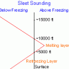
WinterWxLuvr Posted January 9, 2014 Share Posted January 9, 2014 Becoming much wetter. Gonna be a close call on temps. Will it be frozen or wet? Link to comment Share on other sites More sharing options...
wxdude64 Posted January 9, 2014 Share Posted January 9, 2014 Very marginal event, but looks like it will hit early am, so may have 'rush hour' issues. I don't see more than 0.10 liquid for anybody, but if it is all freezing rain a little goes a long way on roadways. Link to comment Share on other sites More sharing options...
WinterWxLuvr Posted January 9, 2014 Share Posted January 9, 2014 Very marginal event, but looks like it will hit early am, so may have 'rush hour' issues. I don't see more than 0.10 liquid for anybody, but if it is all freezing rain a little goes a long way on roadways. NAM is now painting upwards of 0.25 region wide by 18z tomorrow. That's a good deal wetter than anything we've seen modeled for this in a good while. Link to comment Share on other sites More sharing options...

Recommended Posts
Archived
This topic is now archived and is closed to further replies.