All Activity
- Past hour
-
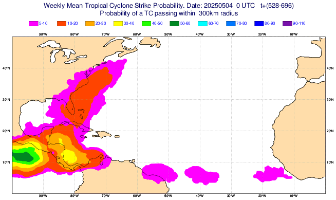
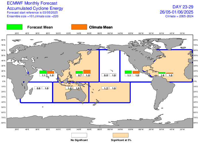
Elevated TC threat SE US May 26th-June 1st per Euto Weeklies fwiw: signal has persisted for a few days for then:
-
Sorry bud
-
Meanwhile I wore a sweater and the heat ran all day. Lol spring in the midwest
-
Noone remembers summers.
-
I have this theory, post 2016 every third winter has been a snowless torch fest. 16-17, 19-20, 22-23 The latter two had totals less than an inch for the 95 corridor. This upcoming winter will test the theory to see if it holds.
-
About .35” in SW Nassua. Finally got through the trees when we had decent rates. I hope this isn’t another warm season tracking rain like snow accumulations.
-
There seems to be some moisture coming. Should be beneficial rains at a time when the region can benefit from it, soak it up… during green up. The vegetation is thirsty when it becomes active again.

-
That's the setup for an EPIC FEBRUARY PATTERN
-
My car is buried under maple keys. It's ridiculous.
-
Although varying intensities, it has been raining nonstop here since 4 PM.
- Today
-
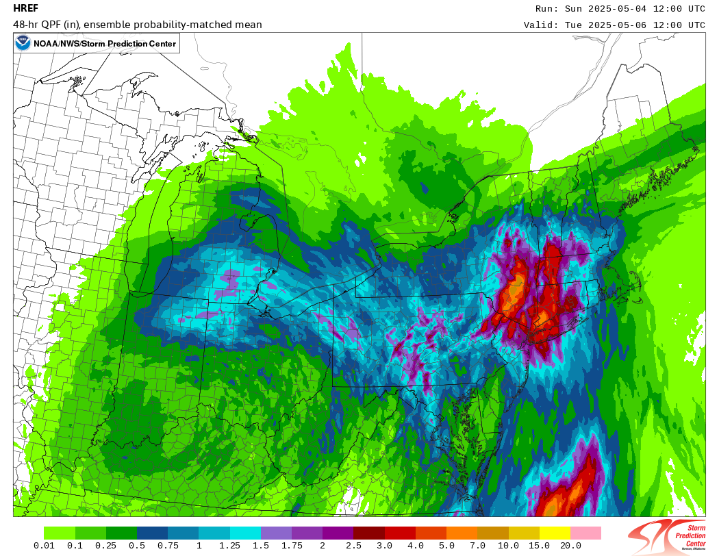
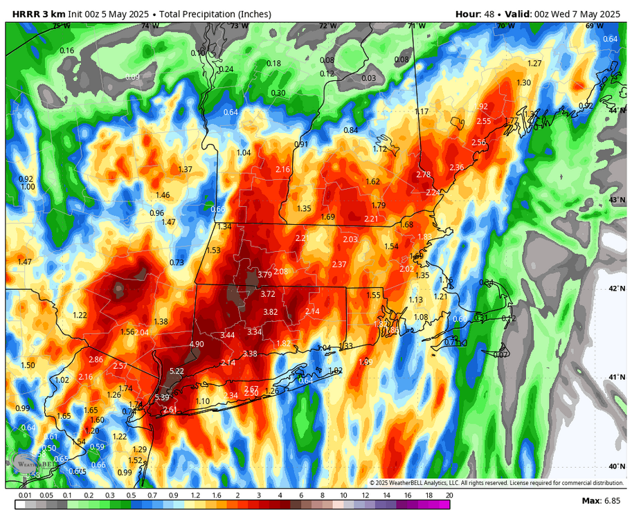
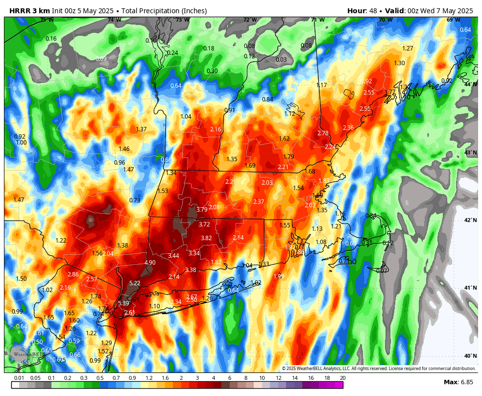
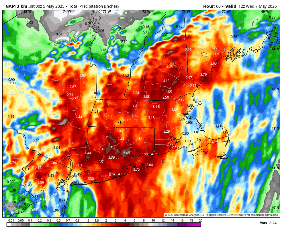
HREF looks wet for central and western new england through Tuesday (12z means some of this has fallen already).

-
The infamous zone of suck rears its ugly head once again. Folks in the interior think I’m full of it but if you walk outside it’s like standing on the side of a fishing boat with a bunch of salty, pudgy men wondering where it all went wrong.
-
I was in Nassau today. More rain than here at home
-
Just over an inch here, most of which fell during about a 20 minute time frame of tremendous downpours.
-

E PA/NJ/DE Spring 2025 Obs/Discussion
LVLion77 replied to PhiEaglesfan712's topic in Philadelphia Region
Just an observation. Each time the precip forecast missed badly this spring, like today, we had an easterly wind here in the LV. I am no meteorologist and I could be very wrong, but this time of the year that east wind equals a cool stable flow off the Atlantic. Perhaps that is the factor that blows up a number of these forecast? Upstate NY seems to have gotten our forecasted heavy rains today. We are forecasted to have east winds Monday as well. . -
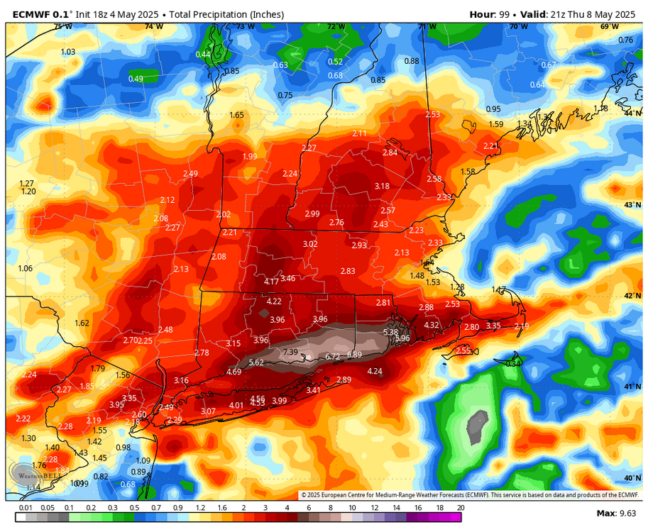
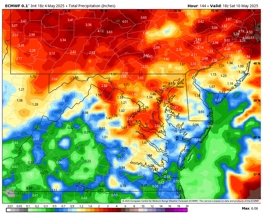
WB 18Z EURO....rain continues... latest 6 day.
-
0.13 today
-
It's not gonna happen for me today; there's an invisible wall over I-40 that shreds every cell as it goes north. Better luck this week I guess.
-
Everything meaningful missed either N, W or E.
-
Not charts, “off the charts” . 53/51 back home now after SNH weekend. Really no difference weather wise between the two spots.
-
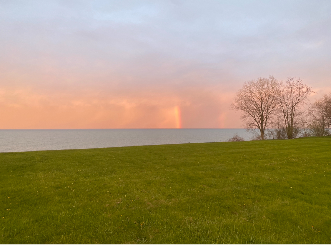
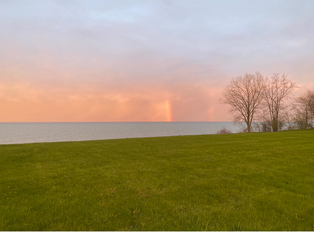
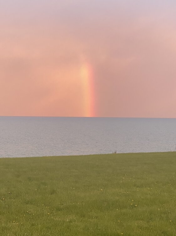
Sunset up here was pretty cool especially out over the lake. The sky turned several different shades as the sun went down. Also caught this in Racine just north of the system which was a nice bonus
-

E PA/NJ/DE Spring 2025 Obs/Discussion
Albedoman replied to PhiEaglesfan712's topic in Philadelphia Region
I agree. From 2-4 inches to less than an inch for the LV and points north. I received a whopping .02 more rain than you today. Hell, the new small leaves on the trees kept the street dry. There were more pollen sacs in the street from last nights gusty winds and brief heavy shower that I thought the township could bring out the plow. Training of t storms is not in the cards anytime soon. -
Kittatinny Ridge-Appalachian Trail in western and northern SC and the Del River on the west side might play a role. I agree w your obs.
-
0.18" for today. Power flickered c.7:15p Moon peaking through now
-
0.12" here today. 0.40" for the weekend. Not too bad, but hopefully a much bigger soaking tomorrow into Tuesday.


.thumb.png.4150b06c63a21f61052e47a612bf1818.png)