
TheNiño
-
Posts
290 -
Joined
-
Last visited
About TheNiño

Recent Profile Visitors
4,479 profile views


-
Potential Sever Weather Outbreak 4/27/2026
TheNiño replied to pen_artist's topic in Lakes/Ohio Valley
Milwaukee has 35,000 without power as well -
Potential Sever Weather Outbreak 4/27/2026
TheNiño replied to pen_artist's topic in Lakes/Ohio Valley
Moderate now for parts of Missouri and Illinois. I feel somewhat vindicated. -
Potential Sever Weather Outbreak 4/27/2026
TheNiño replied to pen_artist's topic in Lakes/Ohio Valley
00z HRRR came in hot for eastern Missouri and central Illinois. Looking like a more limited risk for LOT but things down south are looking quite spicy Edit: No moderate risk on the new day 1. Is my weenie certificate mailed to me or do I need to pick it up in person? -
Potential Sever Weather Outbreak 4/27/2026
TheNiño replied to pen_artist's topic in Lakes/Ohio Valley
No moderate risk on the day 2 so I’ll probably be wrong. But I still see high risk potential in the Springfield area tomorrow. I’m willing to take the weenie penalty if I’m wrong but at the very least there should be a moderate there. I don’t know I’m just some fucking guy. -
Potential Sever Weather Outbreak 4/27/2026
TheNiño replied to pen_artist's topic in Lakes/Ohio Valley
Am I being a weenie thinking this has high risk potential around the STL to Springfield area? I know it’s still too early to tell but the models certainly aren’t backing down. -
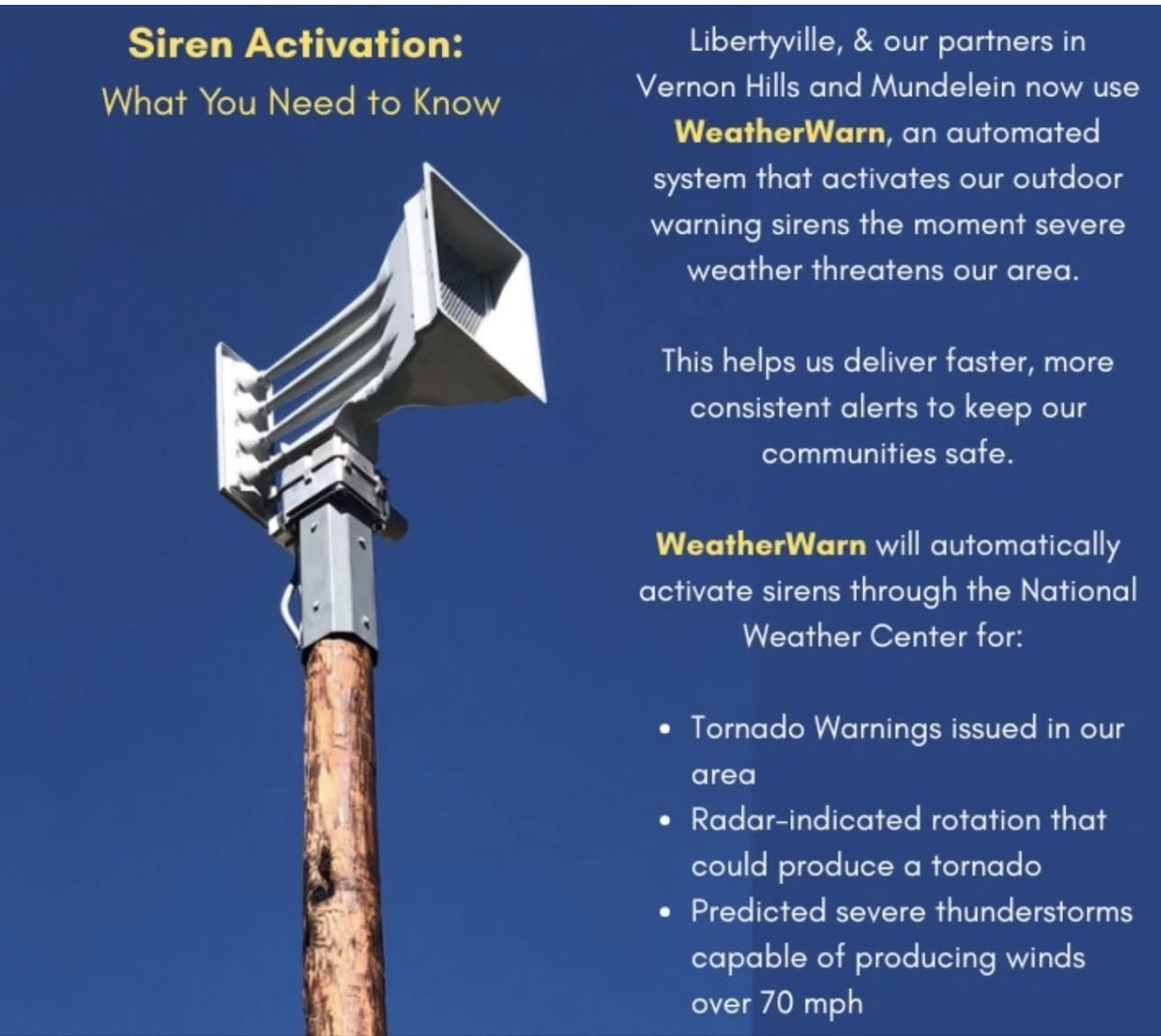
Fair response. I have a friend there and he claimed the sirens activated first before any warning was issued, then again after the threat had passed and he sent me video of the fact in real time. But I appreciate your first hand account, he’s not a weather weenie. I made a post in the banter thread about the automated system being used and how it’s working. Appreciate your genuine experience with it. I’m not trying to shit on the new system just wanting to get legit first hand experiences which you did so thank you.
-
Yeah I don’t mean to be sounding critical and this isn’t really on the spc, the warning was justified. This is more on my city specifically. I get it, tornado warning is issued so they sound the alarm. But then 90min (not an exaggeration) elapsed and they never sounded them again. Meanwhile Libertyville’s automated alarm system kept going off well after the threat had passed.
-
Ours went off 90 min ahead of time then never went off again when it finally hit, and there was definitely radar indicated rotation when it did arrive. Plus it was the 4th day in a row our sirens have gone off way too early. Being right next to the lake we are always at the tail end of these warnings. The general public has to be so irritated at this point. I get they want to give as much warning time as possible but 90min and then not sounding them again when the threat is imminent is not ideal.
-
Anyone have thoughts on this? So far I am not a fan. Mundelein had their sirens go off on Tuesday for a severe thunderstorm warning that didn’t really amount to anything. Today Libertyville had their sirens go off an hour before a warning was ever even issued, then went off 2 more times during and then again after the threat had already passed. Not sure having sirens go off for severe thunderstorm warnings is a great idea. People are just going to start ignoring them more than they already are. I understand the desire to automate them but I’m not sure it’s working all that well right now. We all know the story about crying wolf.

-
Jonas…. Son of a bitch.
-
4th tornado warning in 4 days now lol
-
Third tornado warning in as many days here
-
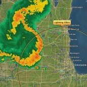
Nice big watch box now. Some strong-ish language… Tornado Watch for portions of Central and Eastern lowa Northern Illinois Extreme Southeast Minnesota Southern Wisconsin Lake Michigan Effective this Tuesday afternoon and evening from 230 PM until 1000 PM CDT. Primary threats include... Several tornadoes and a couple intense tornadoes likely Widespread large hail and scattered very large hail events to 4 inches in diameter likely Scattered damaging winds likely with isolated significant gusts to 75 mph possible SUMMARY...Supercell thunderstorms will pose a threat for very large to giant hail this afternoon and evening as they track eastward, with the largest hailstones potentially reaching up to 3-4 inches in diameter. The threat for several tornadoes will increase later this afternoon and evening along a warm front, and any sustained supercell will be capable of producing a strong tornado. Otherwise, scattered to numerous severe/damaging winds may eventually occur as thunderstorms consolidate into one or more bowing clusters, with peak gusts up to 65-75 mph.
-
It’s definitely time.
-
Was wondering if that could possibly be the first PDS watch of the year. Might not be enough to reach that criteria but it could be close.