bristolri_wx
-
Posts
2,105 -
Joined
-
Last visited
About bristolri_wx

- Birthday 03/20/1978
Recent Profile Visitors
4,683 profile views


-

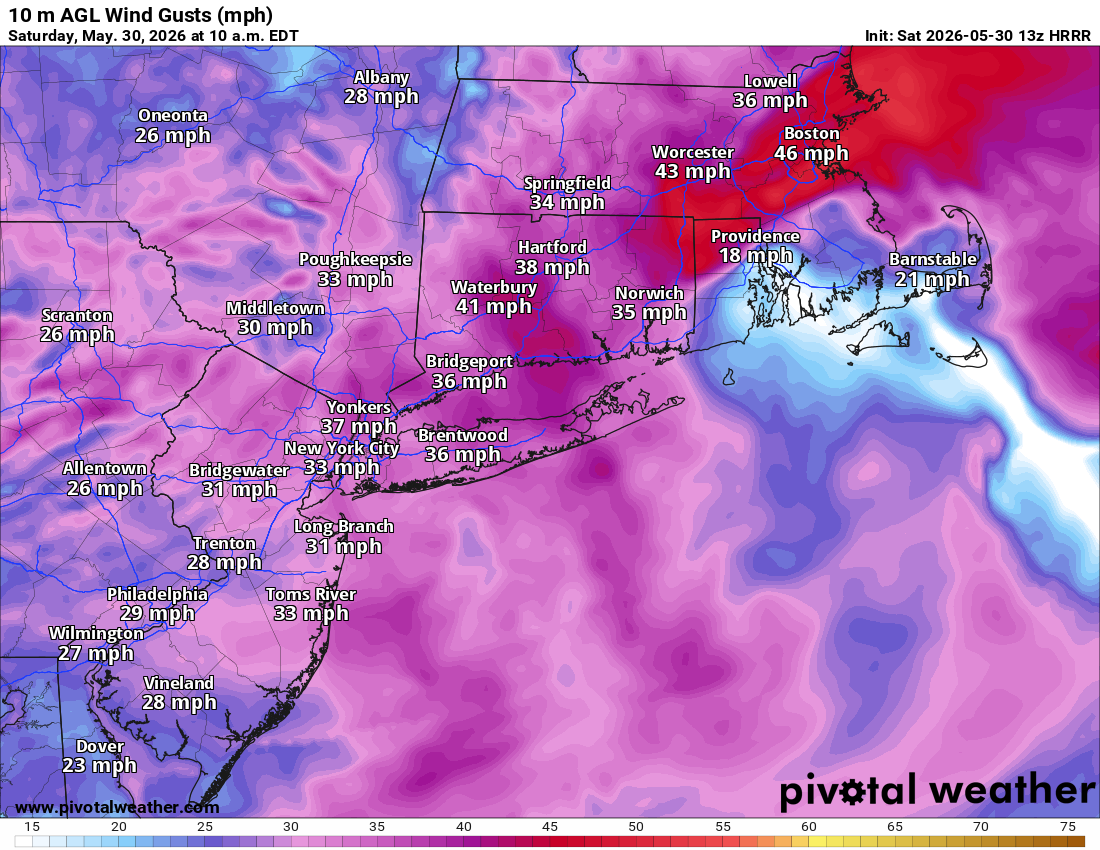
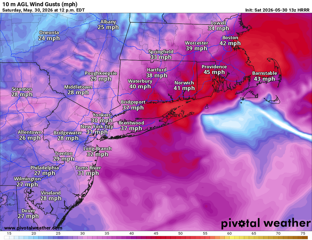
Anomalous Late Spring storm May 30 2026
bristolri_wx replied to HoarfrostHubb's topic in New England
Interesting little bugger lol... G19_sector_ne_GEOCOLOR_240fr_20260530-1040.mp4 -
Anomalous Late Spring storm May 30 2026
bristolri_wx replied to HoarfrostHubb's topic in New England
Trying to figure out why everyone else is talking about wind and I look outside and see leaves barely moving... I guess it will be here in the next hour or two.
-
At least this storm is interesting. Better than 48 hours of drizzle and fog. Of course worse than a 75/55 and sunny Saturday.
-
Looking at guidance I think the storm Fri/Sat will produce more QPF over a wider area than is currently being forecasted.
-
I just did my first cut of the season last week. I've been gradually transitioning my lawn to drought resistant fescue and clover and it's been pretty low maintenance. I don't water or use fertilizer unless I'm planting seed. It's gotten pretty damn dry on occasion but it bounces back much more quickly than when I had more bluegrass to contend with, which would really not deal well with the dry conditions.
-
You are the lucky one. Radar is getting shredded as precip moves east. Put me in the “if it’s gonna rain make it worth it.” camp. These nickel and dime precip events are just annoying. Dry air be damned.
-
Lots of beneficial rain falling on the parched areas of Block Island Sound right now lol. Hopefully it comes north a little. Rain has been getting shredded on potholes in RI as of late…
-
Got to about 84 here before the sea breeze kicked in. Beautiful day! AC's are on for now...
-
Winter 2025-2026 Offers Return to Normalcy
bristolri_wx replied to 40/70 Benchmark's topic in New England
Great review of the forecast, Ray. Thanks for the write up. It was interesting and educational to read. -
Did I win the install competition by never taking them out of the windows last Fall? All four are locked and loaded for the heat next week. Though I may not need it in my coastal location thanks to sea breezes...
-
Neat. How did you set this up? Edit: Noticed you used base44.com under the hood.
-
Probably should rename it warm season banter. I'm sure this one will last most of the summer too. Seems to be the trend last year or so...
-
I can’t recommend enough YouTube Premium. There’s a ton of great content that becomes enjoyable once you remove the ads. It’s astonishing how much more I have been watching it since I subscribed to prevent my son from seeing ads.
-
It’s not that difficult these days. Would be much more impressive if it were 1985 and not 2025. Lots of sources for news and sports without having to use traditional media. And I used to work in radio…
-
Oh please, what type of crisis is this for the NFL? It's like a 2 out of 10. Off the field issues of this nature like this rarely cause a blip in the NFL, and pro sports in general. As others have mentioned, her career is probably more destroyed than his is, mostly because she's a journalist covering the NFL. You must be a Giants or Jets fan...