All Activity
- Past hour
-
Possible Record Breaking Cold + Snow Sunday 1/25 - Tuesday 1/27
BoulderWX replied to TriPol's topic in New York City Metro
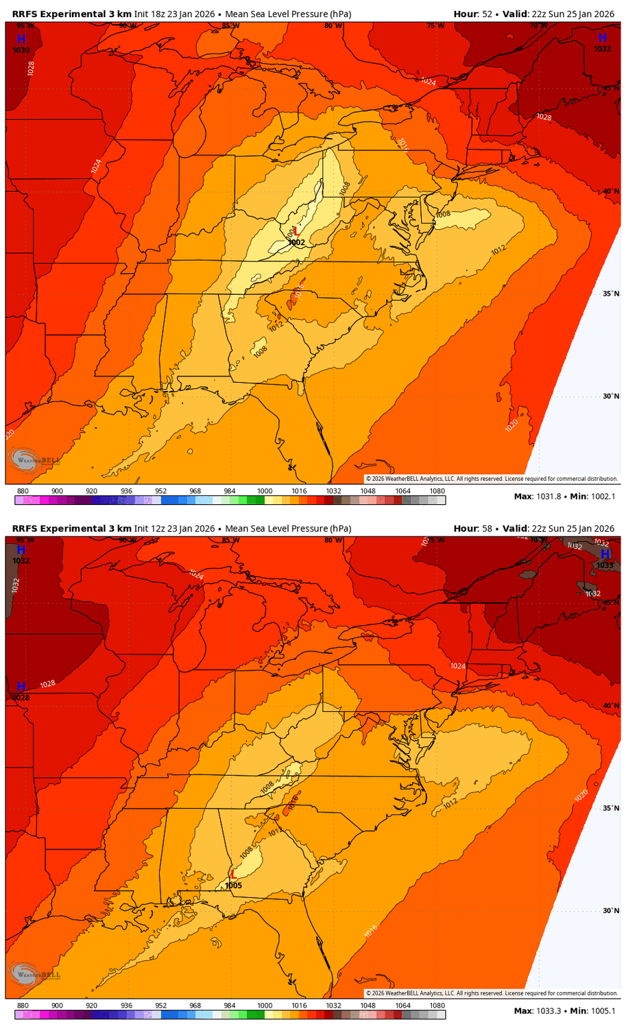
NAM, RRFS, NAM 3K, EURO are all single digit snowfalls for the nyc metro. It’s not just the NAM, though NAM is the least snowy of the bunch -
January 24-26: Miracle or Mirage JV/Banter Thread!
Rvarookie replied to SnowenOutThere's topic in Mid Atlantic
This is the stupidest fuckin storm. Started out fun to track and then went to shit trying to understand it. -

Pittsburgh/Western PA WINTER ‘25/‘26
MikeB_01 replied to Burghblizz's topic in Upstate New York/Pennsylvania
this is an interesting question. I'm not sure the heavy precip can have the same affect on a column of air that has already been saturated? Someone way smarter than me would need to address this -
I assume you're in New York?
-

“Cory’s in LA! Let’s MECS!” Jan. 24-26 Disco
RUNNAWAYICEBERG replied to TheSnowman's topic in New England
Yea poor five O…his cruiser will need a paint job after this. -
I've seen it plenty of times this far out....it's rarely too warm inside of like 36 hours.
-

1/24-1/25 Major Winter Storm - S. IL, IN, and OH
Baum replied to A-L-E-K's topic in Lakes/Ohio Valley
-

Texas 2026 Discussion/Observations
Stx_Thunder replied to Stx_Thunder's topic in Central/Western States
Yes. Very, significant LIs for this kind of scenario. Just about every single parameter I can think of is lined up for a possibly catastrophic ETX ice storm. But I feel even these most reliable winter wx models are still underdoing the accumulation potential with such a powerful incoming SS trough for this winter wx setup. That's also why I still wouldn't let my guard down even in CTX or Austin/San Antonio region also. -
Jan 24-26 Weekend Snow and Sleetfest Model Thread Part Tres
Ruin replied to H2O's topic in Mid Atlantic
Sleet way over done warm bias om model. Fresh artic air strong high -
The HRRR looks like it is over-doing the downslope, but I never, ever discount that model. If one model can see downslope, it is that one. The 3k NAM basically got rid of the downslope - not sure if it is a hiccup or if the mountain wave was less. The HRRR is basically showing that NE TN is going to takes its time getting precip in here. As you know, not uncommon. The 12z Euro, 18z NAM(southward jog), 12z GFS, 12z RGEM....take some time to get precip, but then they just overwhelm the dry air, and send it. Ice is so difficult to forecast in the Tennessee Valley. I have seen cold get trapped and never leave until the event is over. I have seen it scoured immediately. My experience says this cold air erodes pretty quickly. But........this hp setup is different than most other events. It is strong. If I was just looking at a map and scientifically had to make a call...I would say that big high is gonna pour cold air down the west slopes of the Apps and hold onto frozen precip just a bit longer.
-

Jan 24-26 Weekend Snow and Sleetfest Model Thread Part Tres
psuhoffman replied to H2O's topic in Mid Atlantic
-
Its the truth
-
To go from suppressed to this is disgusting.
-

January 25-26 Winter Storm Potential
anthonyweather replied to Ralph Wiggum's topic in Philadelphia Region
Yep they have been unbeatable. Hate to see the NAM go . -

“Cory’s in LA! Let’s MECS!” Jan. 24-26 Disco
40/70 Benchmark replied to TheSnowman's topic in New England
18z NAM looks great!! -

“Cory’s in LA! Let’s MECS!” Jan. 24-26 Disco
TauntonBlizzard2013 replied to TheSnowman's topic in New England
I’d definitely be concerned in NYC -
How many times have I heard this from you
-

Central PA Winter 25/26 Discussion and Obs
Mount Joy Snowman replied to MAG5035's topic in Upstate New York/Pennsylvania
We sure have, which is why I never totally rule it out, but it had panels where it was literally showing the thermals colder and further south on all levels yet showing the sleet line further north. Bizarre. -

Possible Record Breaking Cold + Snow Sunday 1/25 - Tuesday 1/27
NEG NAO replied to TriPol's topic in New York City Metro
the goal is too make that NAM run the outlier -
Im a Bills fan! You want to talk about disappointment? We apparently live for it
-
If you want to claim a window for a storm, you cant just post a random op run and say ooh look a storm! lol ( not that Ralph did that, idk) You do this-
-
Central PA Winter 25/26 Discussion and Obs
Ruin replied to MAG5035's topic in Upstate New York/Pennsylvania
I still dont buy that this is a fresh injection of arctic.Air the highs holding firm up north and it's supplying enough cold air.I think it's a warm bias -
It’s not the only model that has warmer air ticking north though, Just something to watch.
-

Pittsburgh/Western PA WINTER ‘25/‘26
colonel717 replied to Burghblizz's topic in Upstate New York/Pennsylvania
-

Possible Record Breaking Cold + Snow Sunday 1/25 - Tuesday 1/27
Joe4alb replied to TriPol's topic in New York City Metro
Icons rolling, lets see if we can bat .000 for the 18z suite


.gif.bf815ab746a2b655fd2d6c9103730e55.gif)


