All Activity
- Past hour
-

Spring/Summer 2026 Pattern Discussion Thread
jaxjagman replied to Carvers Gap's topic in Tennessee Valley
MJO moving into the Maritime.GFS and Euro is trying to light the torch for our parts but we seem to be in a -NAO right now into the next several day, Typically the MJO moving into P5 mean this time of year heat stroke moves into the plains not us,ensembles seem to look good ATM -

Augdewst 2026: Summer's Last Stand
SJonesWX replied to Prismshine Productions's topic in New England
85/72. disgusting. -

2026 Mid-Atlantic Severe Storm General Discussion
southmdwatcher replied to Kmlwx's topic in Mid Atlantic
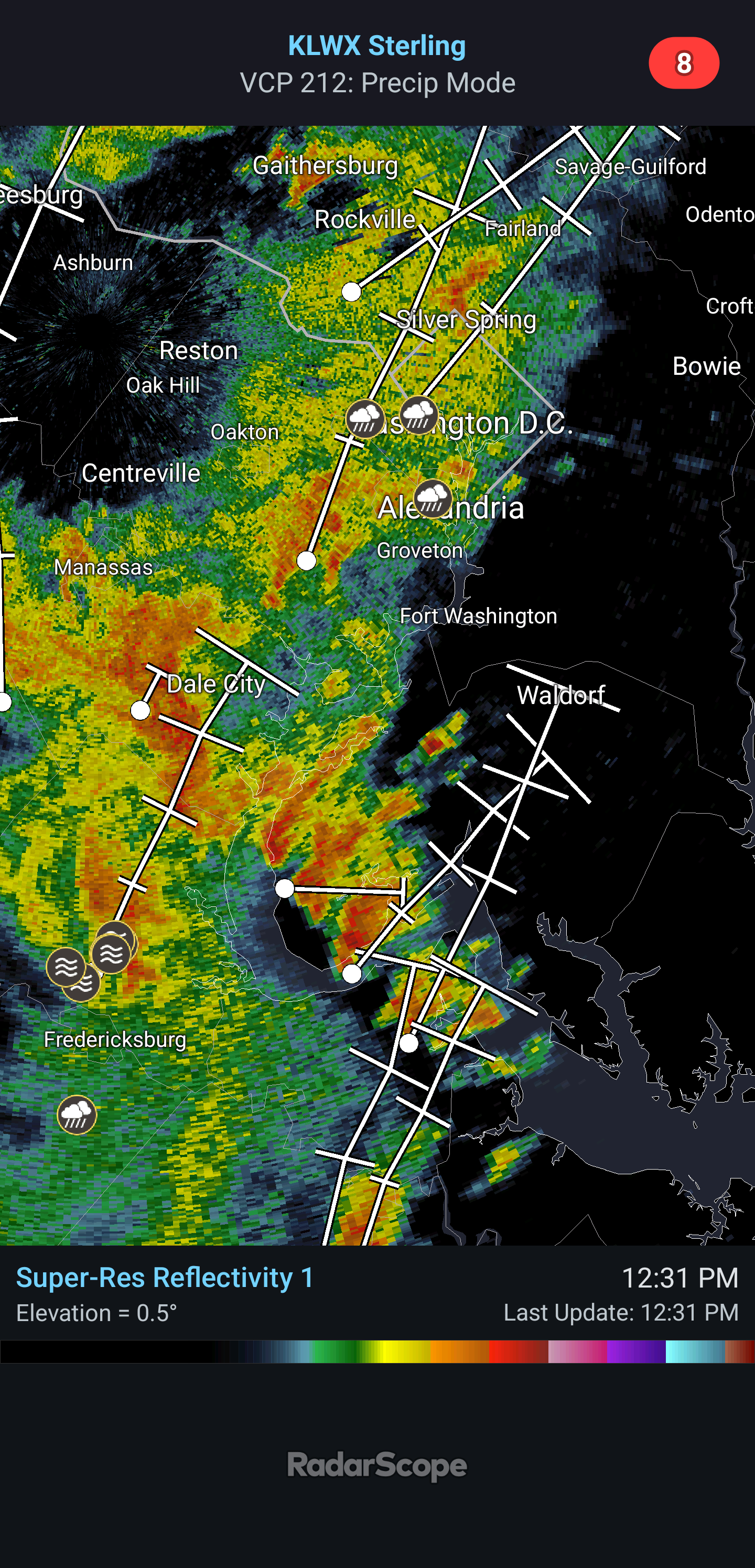
Some rotation evident on radar near Springfield -
Looking like a slight forecast miss by the NAM
-
Hudson Valley and Western CT as well. Still very wet here.
-
Nice looking storm clouds to my south from second floor window. PA is getting dumped on today.
-
Looks like some supercells are already trying to get going as they move towards DC. A lot already have a bit of a rotation going on them.
-

E PA/NJ/DE Summer 2026 Obs/Discussion
Birds~69 replied to PhiEaglesfan712's topic in Philadelphia Region
Preseason games start later since they went from 4 to 3 preseason games. Birds 1st preseason 8/15/Ravens...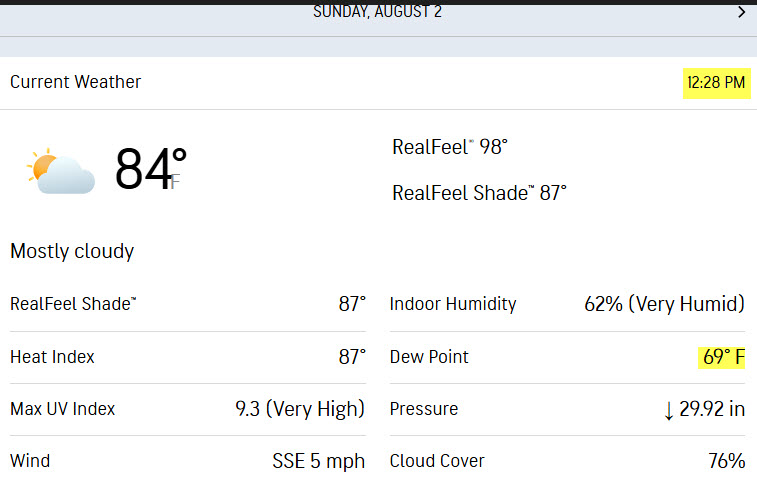
-
Rain and in many places a LOT of it is incoming....radar is awesome, bring it!!
-
Agree, but its a season long thing. What's his record now, 4-10? Could be 10-4 lol
-

2026 Mid-Atlantic Severe Storm General Discussion
wxmeddler replied to Kmlwx's topic in Mid Atlantic
I've been thinking / under the impression that the flooding threat from this system has been underplayed by WPC / LWX since about Wednesday. We don't often get 2.25" PWAT's coupled with a cut-off low to our southwest with a 200mb right entrance overhead. At least LWX on Saturday AM started to pick up the rainfall risk and has been amplifying the message since.- 1,697 replies
-
- 1
-

-
- severe
- thunderstorms
- (and 7 more)
-
Pouring rain here right now
-

Augdewst 2026: Summer's Last Stand
weatherwiz replied to Prismshine Productions's topic in New England
The big difference in this versus the previous setups is this rain isn't spread out over a long duration. This will be the type of stuff that produces 2-4" in 1-2 hours versus several-plus hours. -
A bit off here. HP will slide E with a front moving in with scattered shwrs/stms.
-
He went up against arguably the best pither in the NL. The Orioles had their changes twice and just could cash in. That 15 pitch at bat in the 7th did him in.
-
.thumb.gif.f92b16c631a1d15d405ed77b33f0710d.gif)
Augdewst 2026: Summer's Last Stand
Torch Tiger replied to Prismshine Productions's topic in New England
The lines are drawn -

Augdewst 2026: Summer's Last Stand
Baroclinic Zone replied to Prismshine Productions's topic in New England
Dews today and yesterday have been oppressive, low to mid 70s. -

Augdewst 2026: Summer's Last Stand
Damage In Tolland replied to Prismshine Productions's topic in New England
Not seeing that. Everyone will rain but only a very narrow area will get anything of bigger significance. There will be a small zone that trains .. but it’s nothing widespread -
Yea I haven’t noticed any real browning of grass here. Very green summer overall, especially when compared to the tumbleweed summers we’ve had recently.
-
Augdewst 2026: Summer's Last Stand
weatherwiz replied to Prismshine Productions's topic in New England
Rainfall rates will be quite impressive tomorrow and the initial round of rain is going to be on the widespread side and then we see what we can develop during the day in terms of convection. You have a stout southerly LLJ into the region with 8850 dewpoints +16 to +17C and PWAT values between 2.20" and 2.40". There is no capping and you have the LFC right about the same height as the LCL. The radar is going to be lit up with rain and continuous development of downpours and embedded thunder throughout the day and this will train across a large area. -
Already at a 74 dewpoint at my station now.
-
thinking about going to the hamptons for a day trip for the beach and pool but that rain looks like it could approach quite fast!
-

2026-2027 Super El Nino
40/70 Benchmark replied to Stormchaserchuck1's topic in Weather Forecasting and Discussion
2009 was a pure Modoki season and was much weaker in magnitude. 1957 was basin-wide, but it was focused pretty far west and was barely a super-event. Forget 2009, but I guess 1957 is about as cold as one could expect, which was around normal. -
Partly sunny and 83/75 here. Got a surprise 0.2 yesterday afternoon and hoping for more today.
-

Central PA Summer 2026 Discussion/Obs Thread
canderson replied to Voyager's topic in Upstate New York/Pennsylvania
Only .01” here. It was like 150% humid this am.