All Activity
- Past hour
-
Let's break the power grid. 105+
-
Much of central PA is now under a moderate risk of excessive rainfall today. CTP highlighting the area for "Dangerous Flooding."
-
We live on an island surrounded by water…
-
Yeah I’m selling on 104-106. 100 though seems possible
-
This looks fun for Thursday....
-
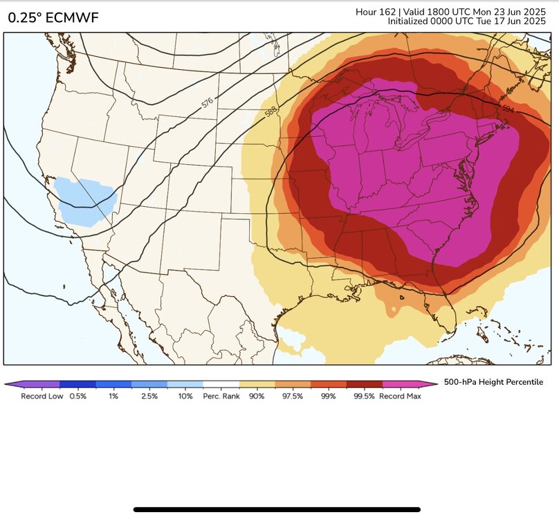
We just set the all-time 500mb height last June at 599 DM. So getting a ridge nearly this strong only a year later is pretty extreme. Several spots around the region made it to 100°. This time around the models are forecasting 850mb temperatures which will be several degrees higher around 22C to 23C. So there is a good chance that the usual warm spots from Central NJ to interior Queens will see 100° or higher heat next week with how unusually well the ensembles agree. Newark recently set their June all-time high of 103° back in 2021 which could be challenged. LGA recorded their 2nd highest June high temperature at 100°. Their all-time June high is 101° set in 2017.
-
lets frickin roast
-

E PA/NJ/DE Summer 2025 Obs/Discussion
LVblizzard replied to Hurricane Agnes's topic in Philadelphia Region
Slight risk for Thursday…of course I won’t be around, instead I’ll be in Denver baking in 100 degree heat. I also managed to pick the deadest 3 day period for storms in Denver since storm season began, so no chasing like I was looking forward to. Oh well. -
Euro ran way too high last year at range. GFS seems to have a high bias in the metro areas too.
-
While a bit warmer out than yesterday, 71. Just got myself a nice cup of tea and popped my slippers on. Also I know there are others on here with PWS in their yards. I have had my station reporting to Weather Underground for sometime now. But I finally was able to get my reporting set up for PWSWeather. It does not activate right away as it does quality checks of your station before making it active. But I have mine up and reporting now. You can find the link below in my signature. They have a handy App also for on the go.
-
Yeah, that is why I was confused a bit. I never noticed that either.
-
Pouring in Greenfield at the moment.
-
65/63 small droplet sheet rain nonstop since 11pm last night. Far cry from the 20% chance of showers that the NWS forecast was showing as late as 5pm yesterday.
-
all time june records are possible
-
Managed to get .24" from the scattered storms yesterday and early this morning, plenty for the garden.
-
Damn NAM...

-
I haven't watered at all this year. Not even my planting beds. And I'm cutting my grass every 5 days.
-
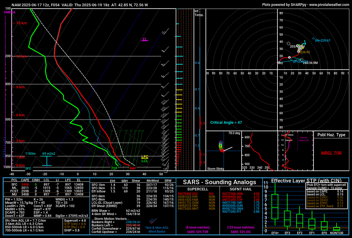
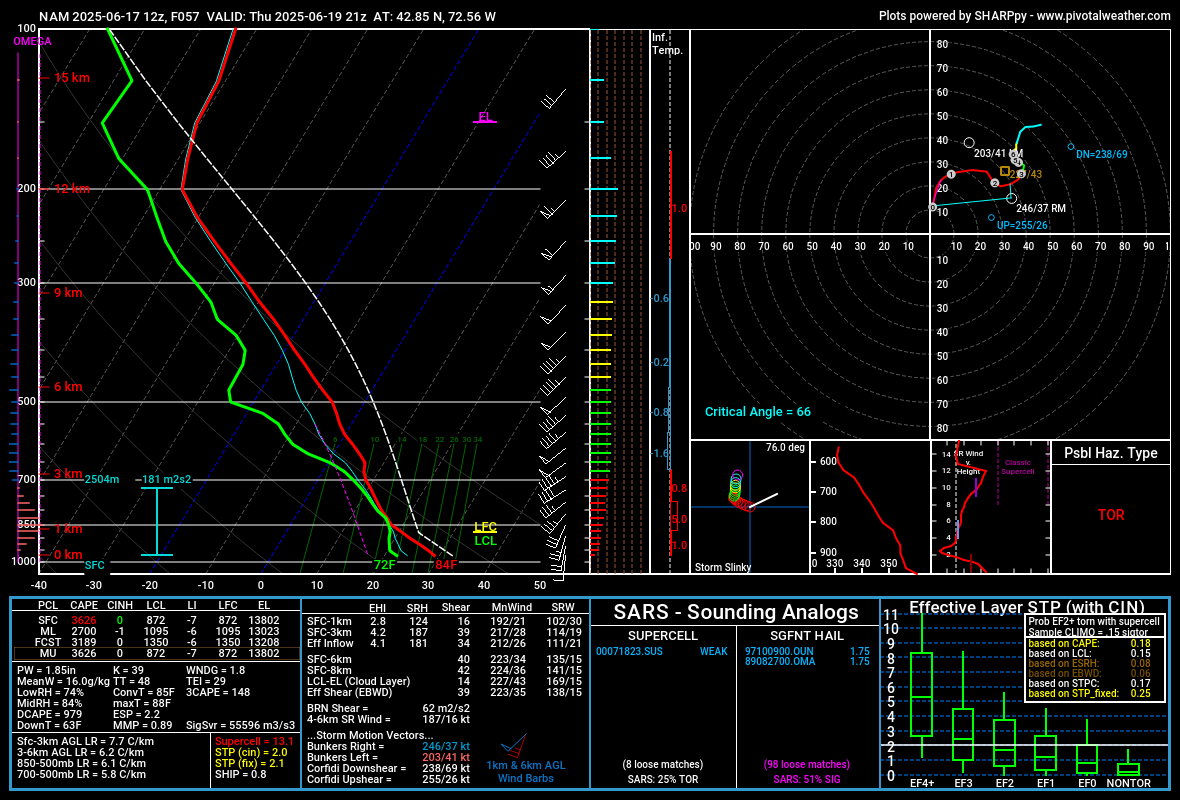
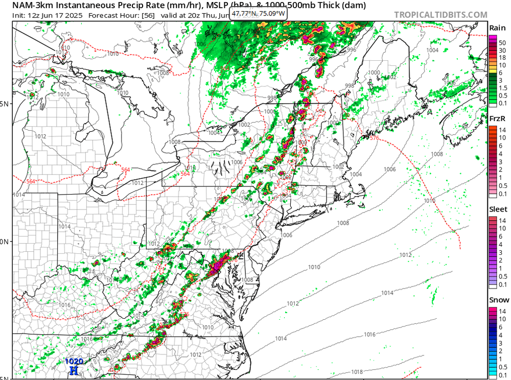
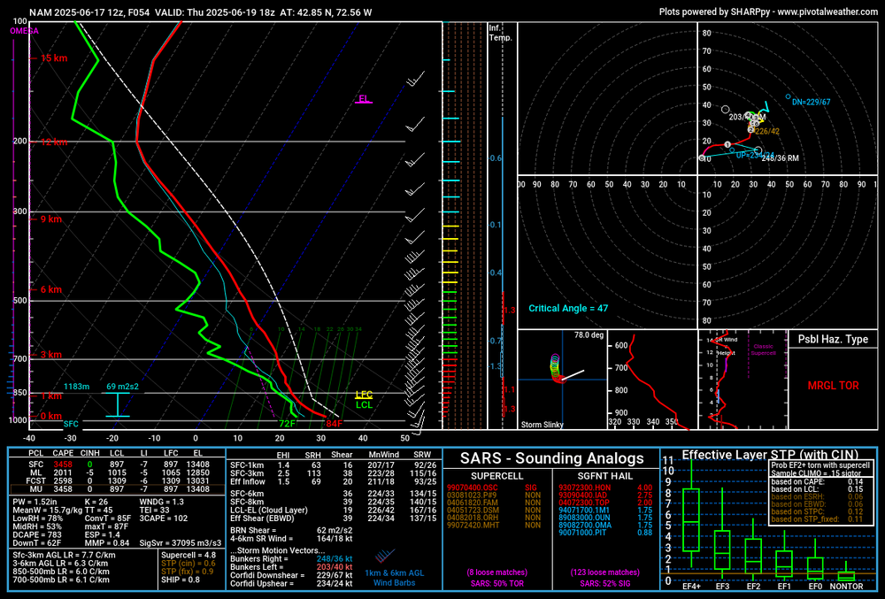
That MCV looks like a frickin' landcane on the 12Z 3K NAM. Too bad it can't be coming through 3-4 hours later.
-
keep dreaming snow bunnies
-

2025-2026 ENSO
PhiEaglesfan712 replied to 40/70 Benchmark's topic in Weather Forecasting and Discussion
Is this what happened on 7/22/2011 when EWR got to 108? -
Hey not only is the 6z Euro AI free (regular 6z Euro is locked on Pivotal and Tidbits takes forever) it also goes out to 360 hours. I don't know how I never noticed lol
-
Any break from the heat is good, I really hope the AI is right
-
2 days, as it has lower 70s on Friday, then back to 90s for 2 days
-
The updated CPC map (from yesterday) has us in an even higher probability contour. We gonna cook
-
Today was always modeled as a bit wet. Dry here so far but the warmth moves in a bit tomorrow but Thursday looks downright hot. Summer dew break Friday and Saturday and then we’re off to the races.


.thumb.png.4150b06c63a21f61052e47a612bf1818.png)