All Activity
- Past hour
-
crude oil just hit $118/bbl - hope folks have bikes / scooters / EVs or their Smartrip card ready for this summer lol
-
Tuesday looks yikes on CAMS so far. If a storm latches onto the WF...thread worthy?
-

Meltdown's R Us. What's Buried Is Seen Again...
powderfreak replied to Cold Miser's topic in New England
11-12” here. Been a hairdryer. CAD land doing well. -
SSW should be giving us -NAO by the end of the month.. doesn't always work though, and the last few March's SSWs haven't had much of a -nao correlation. Should be interesting to see if models have it wrong though
-
could be from +TNH bc of the SSW?
-

Winter 2025-26 Medium/Long Range Discussion
michsnowfreak replied to michsnowfreak's topic in Lakes/Ohio Valley
AI Euro has done decent this winter. But get ready for plenty of model waffling this week. -
Strong +NAO being the biggest counter factor
-

2026 Mid-Atlantic Severe Storm General Discussion
high risk replied to Kmlwx's topic in Mid Atlantic
Soundings for later Wednesday do look interesting, but what will trigger storms? Maybe there is a subtle shortwave in the flow to do something, and the ECMWF admittedly does suggest a couple of open warm sector storms, but I'm skeptical. It appears that the strong forcing won't arrive until early Thursday, the most unfavorable time of day possible for this setup. -
Closer to the Philly are, but whether it be NYC or PHL, most of the snowstorms that happened after March 15 are in the middle or or immediately following a very cold period. Just look at 1956, 1958, or 2018, for example. This is not the case this year. Most of the area had 70+ highs today. That's not the weather that preceeds a 2nd half of March snowstorm. This isn't the New England region, where the sun angle as weaker and snow is a more common occurrence after March 15.
-
Teleconnections look completely unfavorable for a sustained below average temp regime during the second half of March though. I just think the models are completely off base here in regards to what happens after St. Patrick's Day for the Midwest especially.
-

2026-2027 El Nino
Stormchaserchuck1 replied to Stormchaserchuck1's topic in Weather Forecasting and Discussion
I noticed this pattern last Winter, which we had never really seen before. Then of course the extreme's that followed this year -

Winter 2025-26 Medium/Long Range Discussion
cmillzz replied to michsnowfreak's topic in Lakes/Ohio Valley
AI GFS wasn’t terrible, and funnily enough it’s been one of the more consistent models. Seems to be fairly good at picking up long range pattern changes. -

Spring 2026 Pattern Discussion Thread
Carvers Gap replied to Carvers Gap's topic in Tennessee Valley
They 18z GFS is an impressive snow storm for middle and western areas around 210. It will almost assuredly change, but it is an example of what some of us have been watching. It looks like 2-3 strong amplifications beginning around St Patrick's Day. -
Yeah, I’m not talking about the run itself. I’m just what my thoughts are on that period.
- Today
-

2026-2027 El Nino
SnoSki14 replied to Stormchaserchuck1's topic in Weather Forecasting and Discussion
Multiple 100+ readings in Phoenix likely this March...that's nuts. -
I'll let you know on April 1. Seen way to many mid March to early April snowstorms to give a final grade on March 8th. For now a B+.
-
Dont you live in Philadelphia? How do you make these declarative statements for a region you're not even part of.
-
and we thought food prices were high now....just wait already down to 39 here
-
Now that riding season is over, Melt it all away, Today was a good start, High was 61°F, Next 2 days is 60's too, Extra hour of daylight doesn't hurt either.
-

Winter 2025-26 Medium/Long Range Discussion
DocATL replied to michsnowfreak's topic in Lakes/Ohio Valley
AI Euro is looney toons. GEFS also. Sigh. -
Saw my first forsythia blooms in Columbia the other day.
-
There continues to be a signal for something on the mean for around St Patty's day. We shall see.
-
The fog the past week made for some interesting times for photos!
-
Today's EWR: 73 / 48 (+21) NYC: 69 / 50 (+19)
-
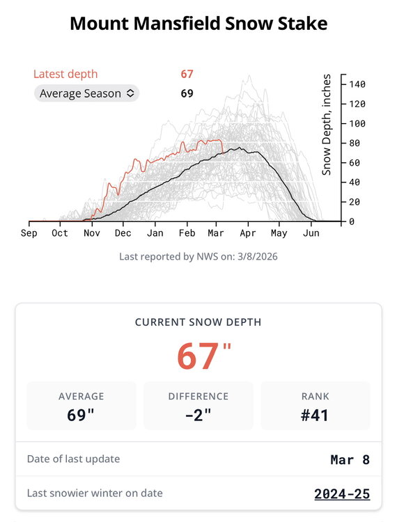
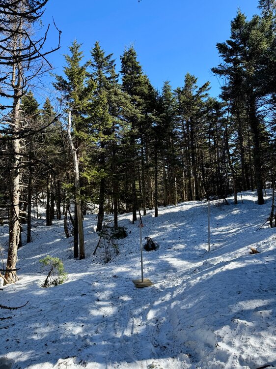
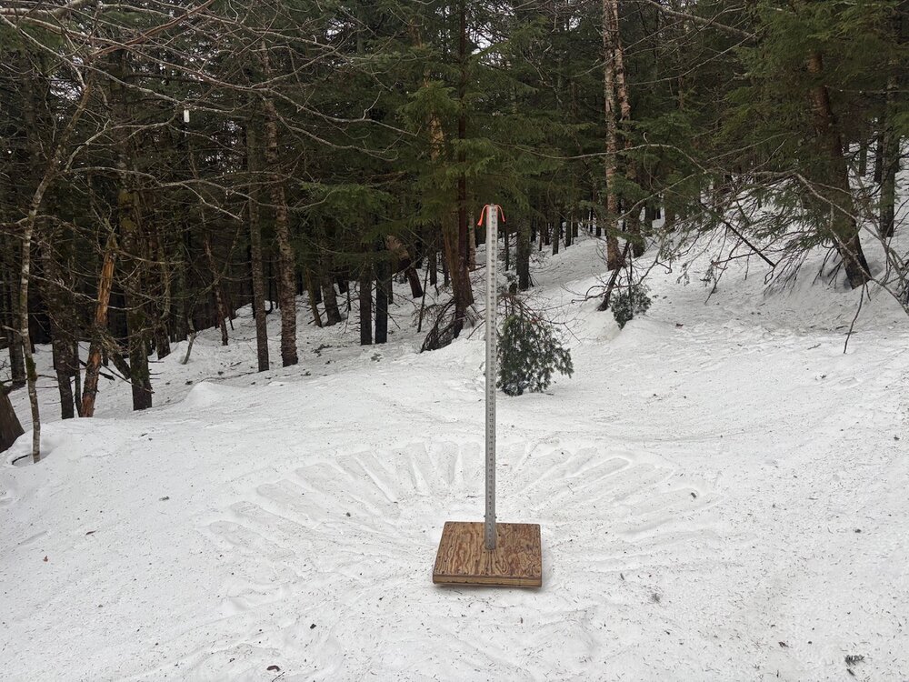
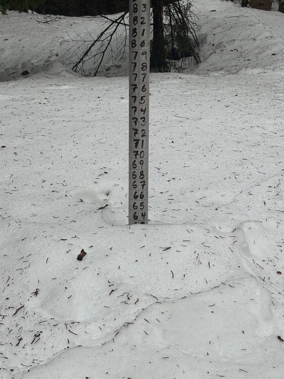
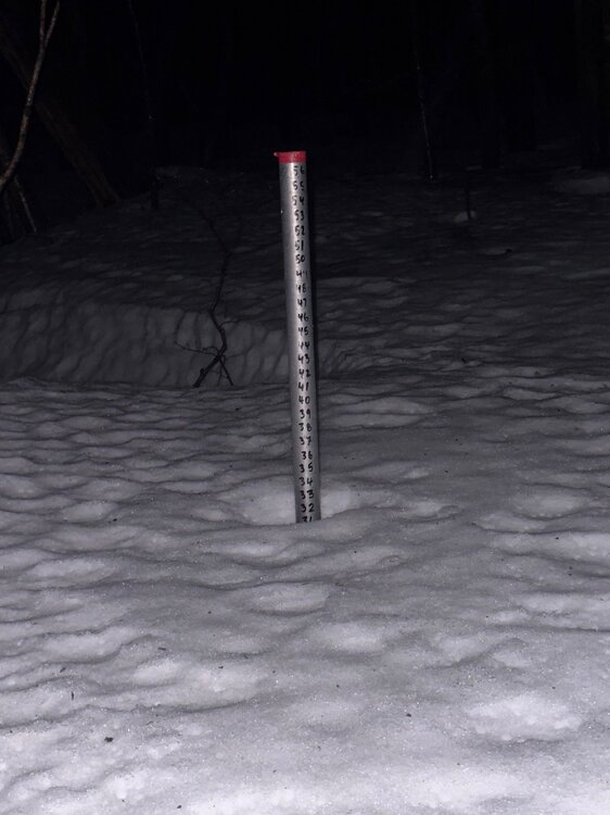
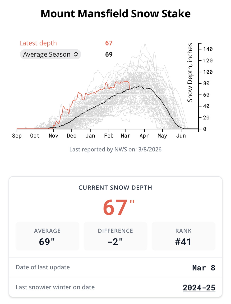
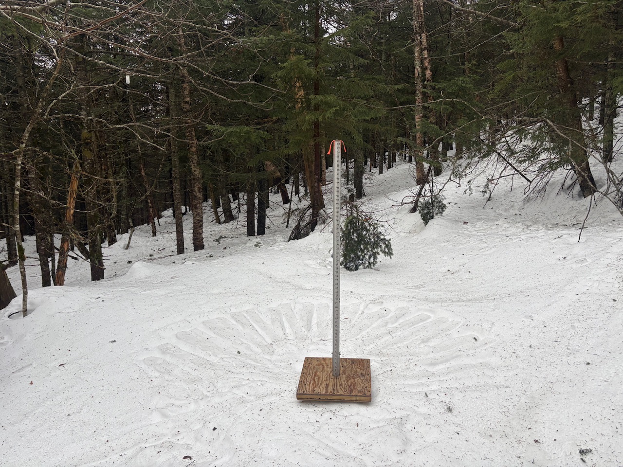
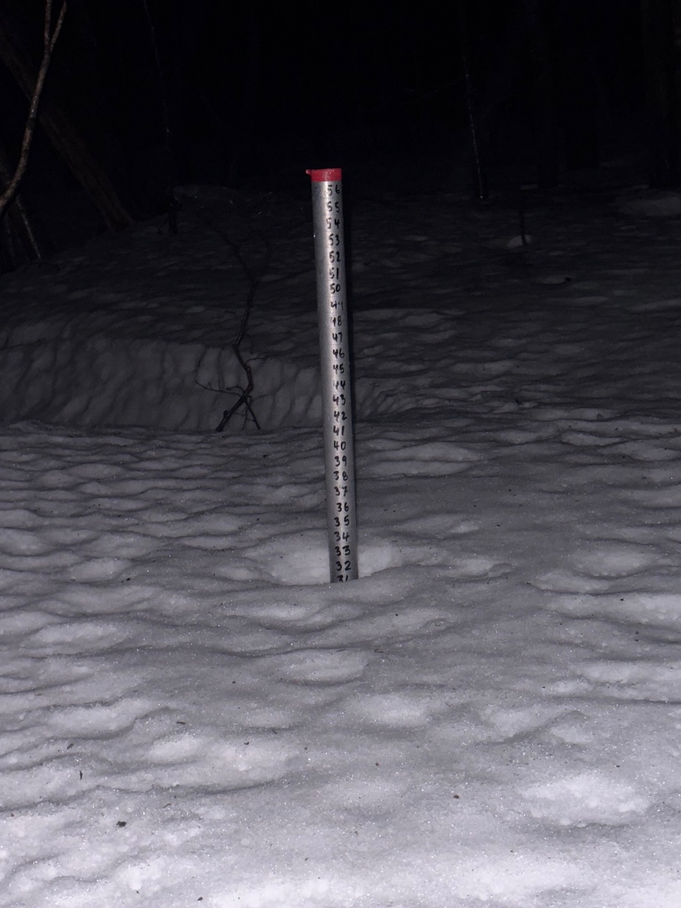
First time below normal snowpack on the season. The Mansfield stake lost a solid foot. Our Stowe Mtn Resort plots lost a similar amount across multiple elevations and aspects over the past 2-3 days. Don’t let anyone tell you ski areas don’t measure snow and work to preserve the observations. High Road (primary plot at 3,000ft), 2/3rds of the way up the mountain. 72-64” Spruce Peak knoll… 56” to 44”. Barnes Camp 1550ft… 42” to 32”.