All Activity
- Past hour
-

2026 Mid-Atlantic Severe Storm General Discussion
Eskimo Joe replied to Kmlwx's topic in Mid Atlantic
At this point, I would just be happy with a regionwide 1.5" - 2.5" of rain. We are seriously in need of a recharge of the aquifers and water ways. -
Smokey skies again?
-
What makes this month’s rain even more impressive in the triangle is we achieved these totals without a tropical system involved. And it hasn’t been just a couple rogue storms, it has been consistent heavy events from the start to the end of the month. With many areas now over a foot of rain with more possible tomorrow, this month is working towards the top 5 wettest months all time for the area and probably the wettest ever without a significant tropical system to influence the totals. The drought isn’t over but per WRAL we needed 18” in July to end it and I’m sitting over 13” and RDU has nearly 12. That is damn impressive and lakes and rivers have responded as well
-
 EverNorth Pharmacy: EverNorth Pharmacy - canadian pharmacy 365
 -
It’s interesting that both the Arctic and the Antarctic have been cold the last 2 months.
-

Central PA Summer 2026 Discussion/Obs Thread
pawatch replied to Voyager's topic in Upstate New York/Pennsylvania
We definitely need some rain. Lets hope their prediction is right. -
That storm had some intense ground strikes. It woke me up for sure. I did not pop up the drone as it was already pouring too much.
-
yeah during the week is fine-just don't need the rain here-everyone still cleaning up the damage from last week.
-
Good. I’ll take Tuesday rain and a clear weekend all of the time, better than a bad weekend
-
Rather impressive thunderstorm last evening around 12:30 a.m. moving north to south along the western edges of northern Delaware. Received about 75 in of rain.
-
 Just what we need here!
 -
 I doubt you’d find a resident there that said 102° is not hot. The record for yesterday is 104° in 1931 and 1933. They’re also now +7.0F for the month where the std devs are at their lowest. Looks like that 80.8F mean will place this July at the 4th warmest all time with 8 of the top 9 warmest Julys occurring since 2000. I won’t pretend to claim I know the history of the MLS ASOS siting though. Maybe pre-ASOS was a “cooler” siting.
 -
I still would generally favor south of DC for tomorrow. But the NAM nest and HRRR do get activity (some seemingly severe?) into all areas tomorrow. After shrinking the 15% contour to the south of us yesterday, CSU guidance has it back north of the M/D line. So that's good. We'll see (as always!)
- 1,484 replies
-
- 2
-

-
- severe
- thunderstorms
- (and 7 more)
-
Average highs start dropping now at ORD. The slow March towards fall has begun
-
 some will flood
.thumb.png.93e8b91b288417f70070a3682a18a028.png)
-
Meso models very wet for the tri-state-the area of bullseye varies but a wet signal for sure
-
It looks like our chance of storms all week evolved into a chance of a couple rounds of storms tomorrow and that's about it. Boring continues to be the rule imo. I'd like to see the tropics wake up.
- Today
-
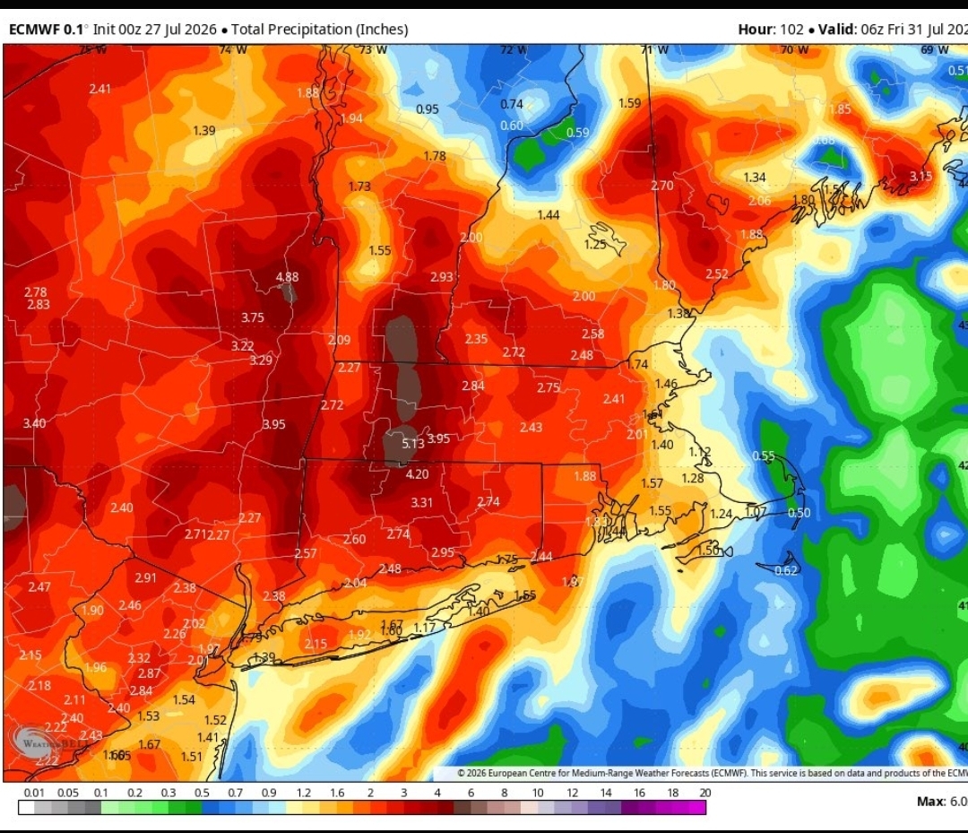
 Whitewater rafting on the Connecticut?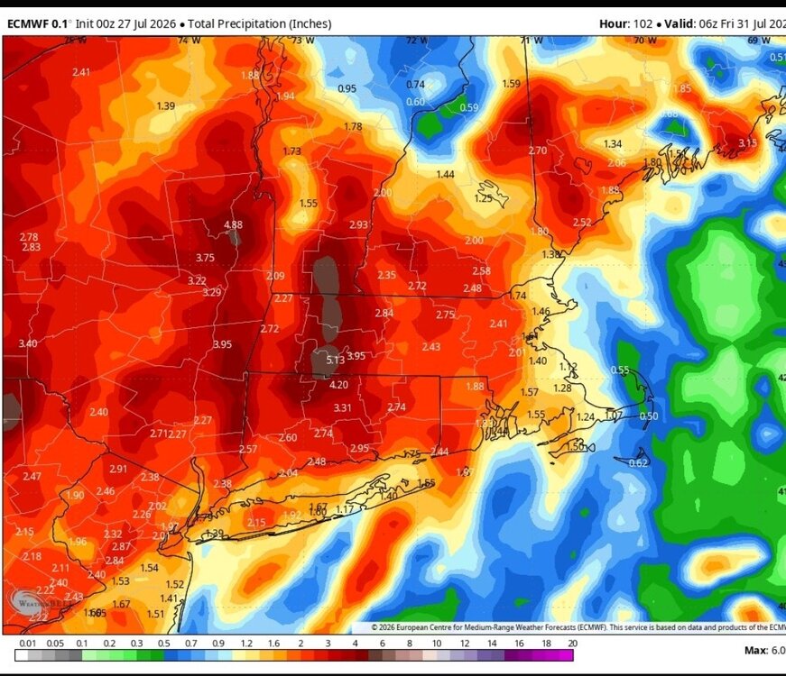
-
Nasty.
-
I think that tells you all you need to know in terms of seasonal temp anomaly, which really only has about a 1/10 chance of being cold in this modern era, anyway...so it really doesn't tell you much.
-
.76” from last night.
-
That's the $64 question for this year. Will we see the same type of "gobsmaking" global warming we saw in 2023 or will this year behave more like a typical strong/super el nino. So far I'd put this year in the typical camp, with global air temperatures lagging the rise in ENSO and global SST. One aspect that has held back global temperatures in the past 2 months has been very cold temperatures in Antarctica associated with a strong AAO+ regime. In 2023 AAO was strongly positive in January (see AAO table below), reversing by March, and staying negative through September. So the AAO boosted global temperatures in the first half of 2023 but are holding them back this year. One of the many factors that contributes to a different outcome in 2026 vs 2023. If the AAO reverses in August there will be an added boost in global temperatures on top of ENSO. We will see. 2023 2.304 0.554 -0.258 -0.921 1.452 -0.438 -0.818 -0.038 -1.050 0.535 0.097 1.510 2024 0.922 1.043 -0.058 1.005 -0.073 0.210 -0.597 -2.150 0.098 -0.567 1.020 -0.826 2025 -0.080 -0.271 0.733 1.138 0.509 0.209 0.753 0.357 -0.709 -1.236 -1.324 -1.136 2026 0.848 0.489 0.492 -0.125 0.544 2.506
-
Showers in OC.
-
Seriously. I had the same thought. Feels like I’m wearing the air. Pretty dense fog here next to the lake too
-
0.3" last night, a lot of thunder and lightning










.png.a505a0e4ce29d943af9b57aef9335ec9.png)