All Activity
- Past hour
-

E PA/NJ/DE Winter 2025-26 Obs/Discussion
Birds~69 replied to LVblizzard's topic in Philadelphia Region
Currently we only had two since 2018 of 6 inches or more so we're not exactly setting records. -
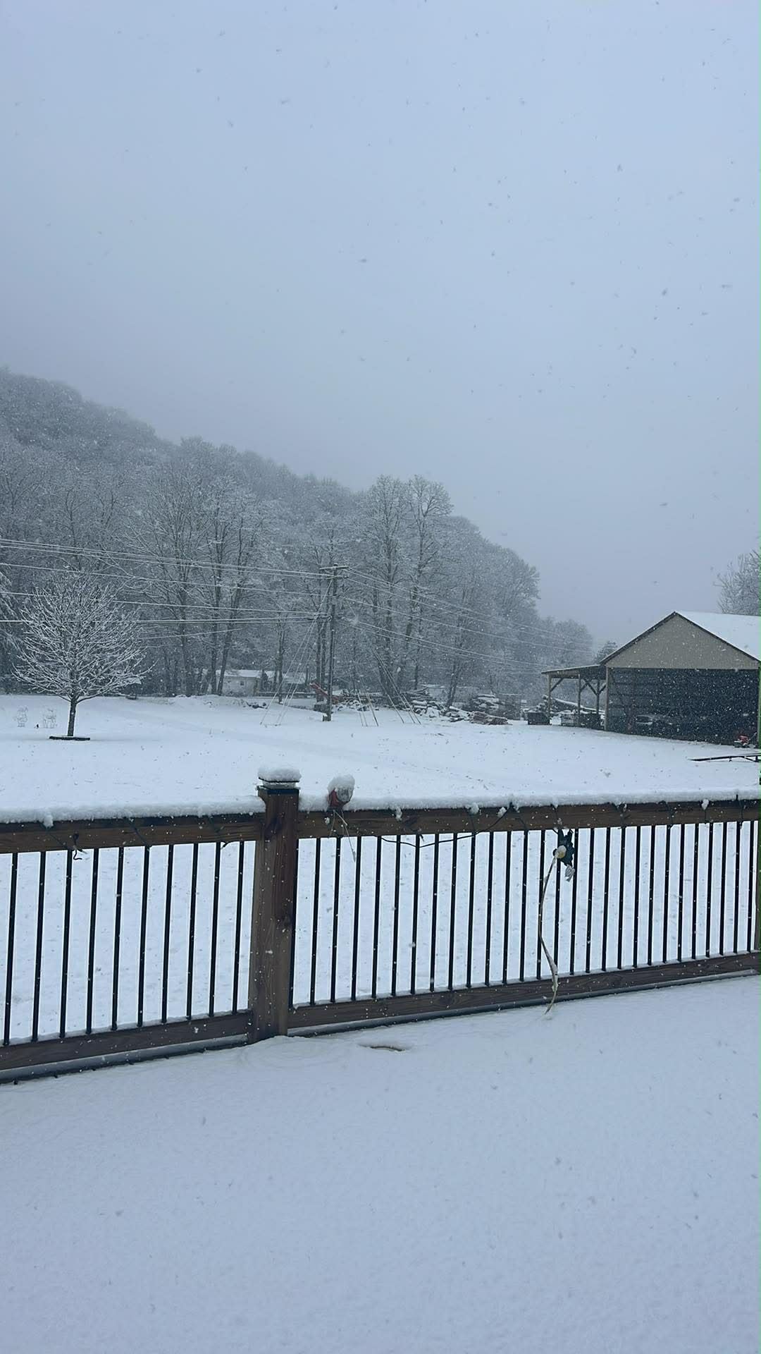
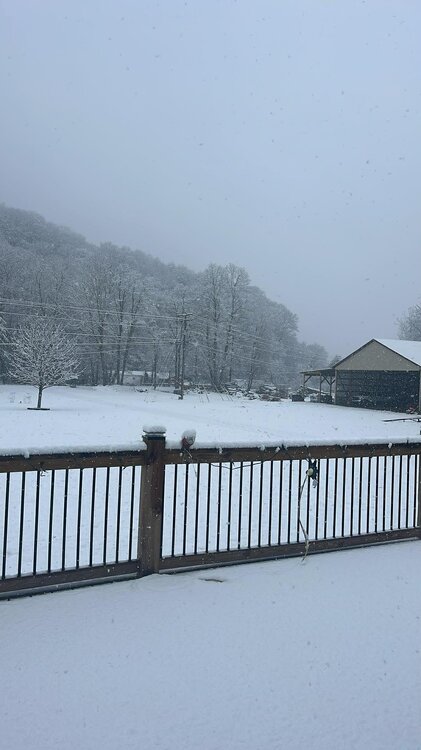
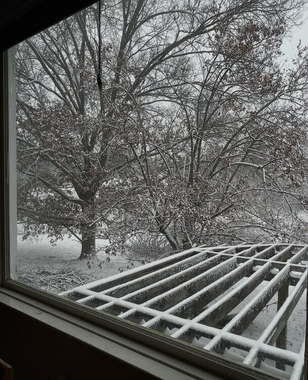
From my cousin in Todd.
-
Fantasy 6z gfs fired the first warning shot..... Return of the -NAO as well... lol
-

Richmond Metro/Hampton Roads Area Discussion
mikeeng92 replied to RIC Airport's topic in Mid Atlantic
NAMs dropped off precip but the HRRR maintains it gets cranking in the afternoon as the colder air drops in -
Change from light rain to pixie flakes in Downtown RVA. Hoping it should make for a nice scene on Kanawha Plaza, where they put the tree up and stuff, will post a pic, when it looks worthy.
-
Somewhere between 1 and 2 OTG at 9 am, still a moderate snow, but flakes are dimes instead of the quarters falling earlier. 31.5/30.1. The high end maps from Blacksburg NWS are LOL!

-

December 2025 regional war/obs/disco thread
WinterWolf replied to Torch Tiger's topic in New England
Lol…Feb is the snowiest month of the year…embrace it. Feb 14th in SNE is full blown winter…no matter what you feel in your heart. Or what you hope/want it to be. And No need to rush misery mist and mud season in any sooner than needed. -
Kind of like how the typical snow crew here has been wrong about KU’s/major snowstorms hitting the east coast, I-95 corridor every winter since the 2022-23 winter. Going on 4 in a row now…..
-
Legitimate heavy snow as more bands push northward.
-
Snowing fairly nicely in Spotsylvania at work at the moment. Flakes are decent size, only accumulating on colder surfaces/grass however. 31 and Snow
-

The Monday wintry event potential (12/8/25)
olafminesaw replied to GaWx's topic in Southeastern States
That cut-off across Guilford county
-
The switch from rain to all snow was quick at my location just west of Eden. At 9:00 it was all rain, and now its all snow and coming down at a pretty good rate. The temperature has fallen from 35.8° at 8:10 to 33.6° currently.
-
Butternut this morning. I believe that they are opening on Saturday, Dec. 13.

-
Wet snow was mixed in at the top of Old Fort mountain
-
Like @donsutherland1 always says, not even worth looking at the CFS until you are into the final few days of the month, when it actually gets a semblance of having a clue about the following month. That said, in this climate, actually getting 4 months (Nov, Dec, Jan, Feb) in a row to all be below normal for temps, would be an extremely tall order….
-
Maybe another hour or so until better stuff arrives, if at all? I don’t see how this picks up anytime soon with radar the way it is.
-
NAM, HRRR (end of run), GFS, ECM are all pretty cold (and a little snowy) for Wed morning NWNJ and I-84 area. The Canadian and RRFS are a little warmer and pivot the steadier precipitation a little north of the area until the boundary layer warms. I'd like to see this evolve into a 1-2" deal for Sussex, Orange, Putnam with flakes (coating?) or sleet into northern Morris, Passaic, Rockland, Westchester.
-
Fits the Great Lakes cutter, I-78 to I-84 hugger and Rain-snow gradient, and suppressed Southern stream which has dominated since 2018-2019. Very difficult to achieve a true benchmark KU track with such a fast Pacific Jet. Way too many issues with kicker lows, amplified ridges pushing the gradient just north of NYC, and generally very poor wavelength spacing with so many shortwaves racing through the fast flow.
-
Temp wise they have been wrong for weeks, the long range models and the typical warm crew here that model hug. They are bound to be correct eventually, then the same crew will say seeeee while totally ignoring their months+ long of busted temps.
-
It’s like the Arctic Circle out there. I love it.
-
I don’t have the data for N NC, but RIC had a major snowfall in December 2018.
-
+TNH. It wouldn’t surprise me.
-

Southern MD / Lower Eastern Shore weather discussion
csnavywx replied to PrinceFrederickWx's topic in Mid Atlantic
Yeah, going to end up about 10-20 miles south. Got a few flakes so far this morning but the accumulating stuff is going to end up just south of here and probably just south of SBY as well. We've got at least 7 more days of this pattern though, so plenty of chances for more clippers. -
Snow started in the 5 o’clock to 6 o’clock range. Steady snow now at 31° and dropping. It's windy as heck, so this is fun to watch! About 1 inch so far.
-
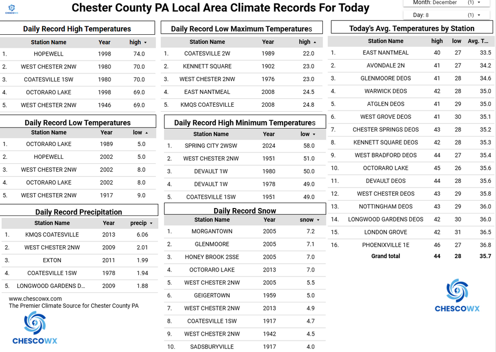
(002).thumb.png.6e3d9d46bca5fe41aab7a74871dd8af8.png)
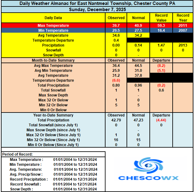
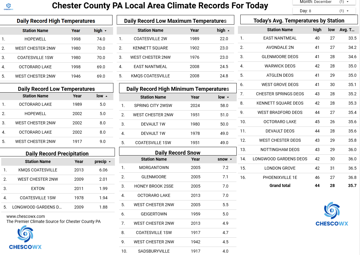
Central PA Fall Discussions and Obs
ChescoWx replied to ChescoWx's topic in Upstate New York/Pennsylvania
Following the arctic front passage temps have continued to slowly drop since sunrise across the area. Temperatures do not look to rise much today and remain in the upper 20's. Tonight will be the coldest night so far this season with lows not far from 10 degrees above zero. Some local station record lows will be broken including East Nantmeal record low was 17.7 back in 2010. We warm to near normal on Wednesday (this may be the last normal high temperature through Christmas) We should also see some snow arrive that will change pretty quickly to rain. We fall back below normal for the rest of the work week with additional snow chances arriving on Friday night into Saturday morning.