All Activity
- Past hour
-

2026-2027 Record-breaking El Nino
qg_omega replied to Stormchaserchuck1's topic in Weather Forecasting and Discussion
Historic https://x.com/us_stormwatch/status/2088444482224328788?s=46&t=m4Eqkekadb-JCXTm7k-Txg -
It already has. NYC used to have their climate only a few decades ago. Now they have what we did.
-
I feel that it was a terrible manager pick for a team that needs experience and leadership. Most MLB teams have a limited window to win it all, and this goes down as another wasted year.
-
https://radar.weather.gov/region/hawaii/standard
-
August 15 1936: St. Paul swelters with a high of 108. For Saturday, August 15, 2026 1787 - Tornadoes were reported in Connecticut, Rhode Island, Massachusetts, and New Hampshire. Wethersfield CT was hard hit by the tornado outbreak. (David Ludlum) 1946 - Saint Louis, MO, was deluged with a record 8.78 inches of rain in 24 hours. (The Weather Channel) 1967 - The Sundance fire in northern Idaho was started by lightning. Winds of 50 mph carried firebrands as much as ten miles in advance to ignite new fires, and as a result, the forest fire spread twenty miles across the Selkirk Mountains in just twelve hours, burning 56,000 acres. The heat of the fire produced whirlwinds of flame with winds up to 300 mph which flung giant trees about like matchsticks. (David Ludlum) (Note: WOW, EF5++ firenados) 1983 - Hurricane Alicia formed on this day and was the costliest tropical cyclone in the Atlantic since Hurricane Agnes in 1972. It struck Galveston and Houston, Texas directly, causing $2.6 billion (1983 USD) in damage and killing 21 people. This storm was the worst Texas hurricane since Hurricane Carla in 1961. Also, Alicia was the first billion-dollar tropical cyclone in Texas history. 1987 - Thunderstorms developing ahead of a sharp cold front produced severe weather in the Upper Midwest during the afternoon and evening hours, with Minnesota and eastern South Dakota hardest hit. A thunderstorm in west central Minnesota spawned a tornado at Eagle Lake which killed one person and injured eight others. A thunderstorm in eastern South Dakota produced softball size hail at Warner. (The National Weather Summary) (Storm Data) 1988 - Thirty five cities in twenty states in the north central and northeastern U.S. reported record high temperatures for the date, including Lamoni IA and Baltimore MD, where the mercury hit 105 degrees. Temperatures 100 degrees or above were reported in twenty-two states. Pierre SD was the hot spot in the nation with a high of 114 degrees. Bluefield WV reported eight straight days of record heat. (The National Weather Summary) 1989 - Evening thunderstorms in eastern New Mexico produced wind gusts to 66 mph at Clovis. Evening thunderstorms in West Texas produced baseball size hail around Hereford, Dimmitt, Ware and Dalhart. (The National Weather Summary) (Storm Data) Observances: 15 Sat National Relaxation Day 15 Sat National Back To School Prep Day 15 Sat International Geocaching Day 15 Sat International Homeless Animals Day 15 Sat Assumption of Mary 15 Sat Chant at the Moon Day 15 Sat Check the Chip Day 15 Sat Feast of the Assumption 15 Sat National Leathercraft Day 15 Sat National Lemon Meringue Pie Day 15 Sat National Shoe Donation Day 15 Sat St Mary's Day 15 Sat World Greatness Day 15 Sat National No Sponge Bob Day
-

E PA/NJ/DE Summer 2026 Obs/Discussion
JTA66 replied to PhiEaglesfan712's topic in Philadelphia Region
Sun sets before 8pm now 76F/DP 55F -
2026 Atlantic Hurricane Season
qg_omega replied to Stormchaserchuck1's topic in Tropical Headquarters
https://x.com/ryanweather/status/2088279380971680057?s=46&t=m4Eqkekadb-JCXTm7k-Txg -
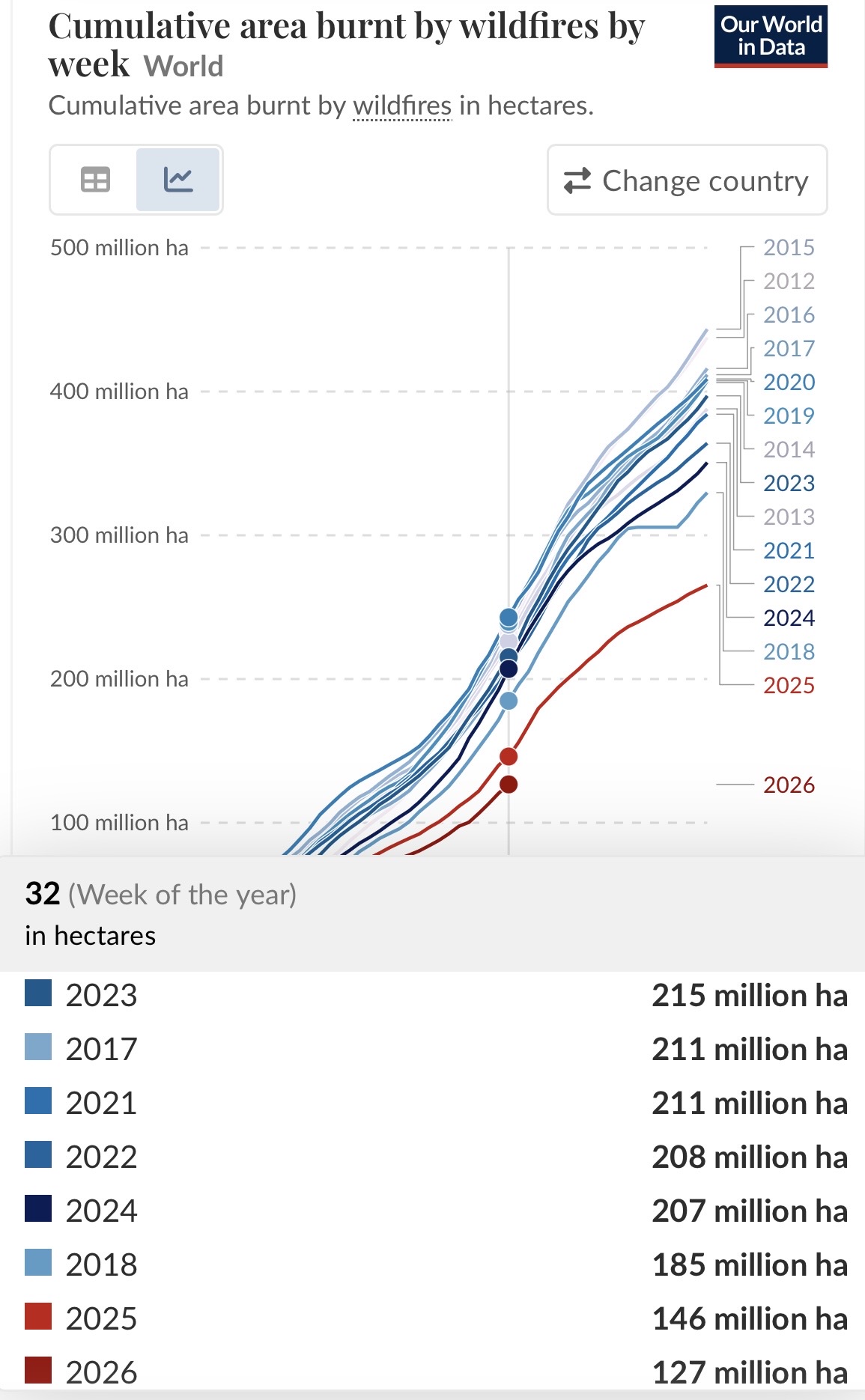
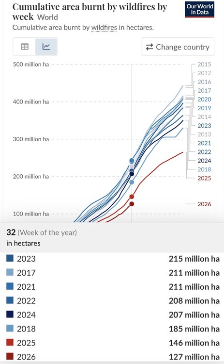
Week 32 worldwide YTD cumulative burnt area by wildfires: 2026 is still by a good margin lowest of comparable weeks of 2012-26:
-
our climate is coming for you
-
Late August/early September: Probably near normal with perhaps a cool period. Remainder of September: generally above normal. October: I am really uncertain.
-
More recent guidance leaning toward morning rain, perhaps a brief break early afternoon, and then more storms later in the afternoon and evening. Juicy precip totals.
- 1,900 replies
-
- 1
-

-
- severe
- thunderstorms
- (and 7 more)
-

2026-2027 Record-breaking El Nino
michsnowfreak replied to Stormchaserchuck1's topic in Weather Forecasting and Discussion
I feel its moreso with the coop stations. Ive seen some ridiculous temps of both extremes in old coop notes. I feel most major climate sites are pretty accurate to the 1870s. -
Thoughts on late august and sept? Do you think summer sticks around till October or do we get an early start to fall?
-

Chester County PA - Analytical Battle of Actual vs. Altered Climate Data
chubbs replied to ChescoWx's topic in Climate Change
I would look at Tavg, annual and monthly, to start. -
I get it but those features will tend to shift/weaken/strengthen at times. Nothing in the atmosphere remains static. We have had recent Ninas where the NE PAC High was a pig and in an awful spot, but then later shifted northward and morphed into a -EPO. And like I said, we are sort of in uncharted territory such that these historical analogs suggesting 'binary' options may not be as reliable and somewhat different outcomes are possible.
- Today
-
 http://mencarevirtual.com/# MenCare
 -
You are definitely right! I noticed it immediately once i got out of the foothills of the Appalachian mountains. Can smell the water in the air. Was quite the experience.
-

2026-2027 Record-breaking El Nino
roardog replied to Stormchaserchuck1's topic in Weather Forecasting and Discussion
Yeah. There’s some questionable temp records from the early days of record keeping for sure. -
Broadleaf. Shade has died out, became too expensive to grow here.
-
Yeah chances of heavy rain have dropped
-

E PA/NJ/DE Summer 2026 Obs/Discussion
Birds~69 replied to PhiEaglesfan712's topic in Philadelphia Region
66F/DP 61F <40 days...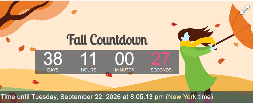
-
Forunately this will not come to fruition this weekend in the tri-state area.
-
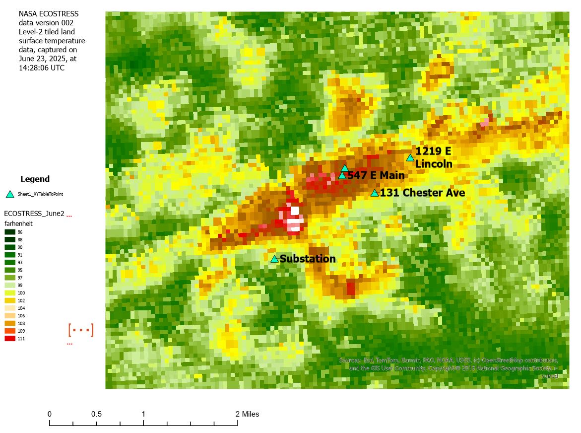
 More strawmen! 1) The 1946-direction of temperature change. "If the station relocated onto a substation with massive transformers and high loads, the raw record should have jumped warm". Built on a mechanism I never asserted, but you attributed to me and then rebutted. 2) "Unverifiability is being offered as a reason for confidence". Same false premise as #1. 3) "Your mechanism implies a ramp, PHA fits steps — wrong shape". same false premise as #1. 4) "you claimed to know the direction/magnitude". Not something I ever said. I have offered a satellite-based 30 m pixel surface temperature map that showed progressively cooler station siting conditions for the day the satellite data was collected, and that "Coatesville 1 SW generally moves progressively from hotter to colder microclimates". The satellite map is pretty neat I think, so I put it here again. 5) The "documented" vs. "thermal zoo" contradiction charge. Not something I have claimed. I have said repeatedly, and will repeat now, that the I have fully documented the breaks as valid and necessary. I have never claimed to know or documented the precise direction or magnitude of breakpoints--that is your reading. To document the timing, direction and magnitude of each break I would need to have precise and accurate microsite details, precise and accurate knowledge of the instruments, and a precise and accurate records of every interaction of the observer with the instrument--probably much more--throughout the station's record. Beyond ridiculous.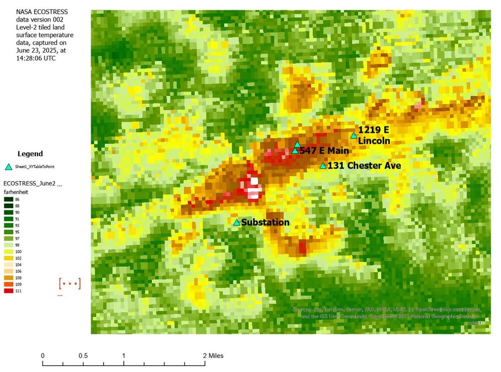
-
Cheap generic Viagra: MenCare - cheap viagra
-

Augdewst 2026: Summer's Last Stand
Damage In Tolland replied to Prismshine Productions's topic in New England
Looks slightly above to above normal thru the 31st. The coming week cool vanished. Something to keep in mind moving forward