All Activity
- Past hour
-
Canadian and UKMET both join the GFS with a more robust system. Both are a little further north though with more temp/mixing issues
-
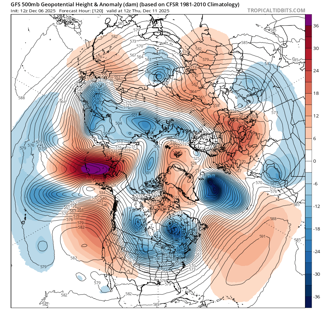
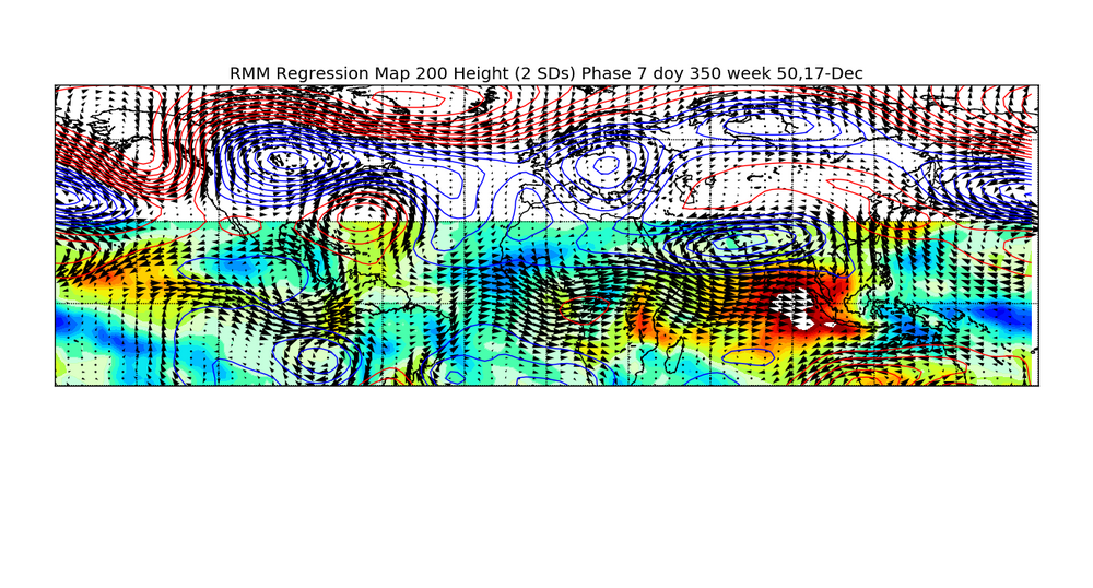
Upper air pattern is pretty potent with the neg nao breaking down but no sign of a big storm trigger yet. Just looking at the indices makes you think an Archambault type event is I the cards but the northern stream is so busy that it's running interference on itself lol. Something compact but potent n the NS could pop imho. Blocking is quite strong over the next 5 days then things unwind for a bit. Interesting and complex period on tap. Not really a setup that "locks into" anything so it would be a mistake to marry anything in the mid/long ranges

-
-SN near Porter Sq looks nice outside.
-

December 2025 Short/Medium Range Forecast Thread
Matthew70 replied to John1122's topic in Tennessee Valley
Congratulations to the you & your wife on the next little one! -

2025-2026 New England Snow Recordkeeping Thread
bristolri_wx replied to bristolri_wx's topic in New England
So I made some adjustments to the web site where it's easier to quickly view totals: https://newenglandsnowfallrecords.blogspot.com/ I removed the individual reports and made the individual pages on the Google Sheet visible for viewing. Also, I made changes to the custom Google Map so that the current total shows up as the label for each reporting location. I know that there will be situations where we get a "trace" of snow in the future. For record keeping purposes, if you want to enter trace amounts when they fall, enter them as 0.01. Throwing text into the form and the spreadsheet will break the math formulas doing the totals. -
The complete collection of photos I got on my chase: https://www.facebook.com/media/set?vanity=jgmusic22&set=a.10113554161887839 A few examples from the collection:
-

Central PA Fall Discussions and Obs
Blizzard of 93 replied to ChescoWx's topic in Upstate New York/Pennsylvania
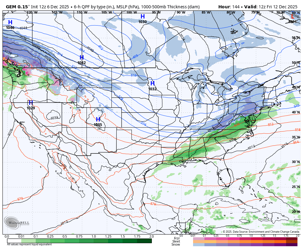
12z GFS & Canadian just got a lot more interesting for this Friday.
-

December 2025 regional war/obs/disco thread
WinterWolf replied to Torch Tiger's topic in New England
I’ll gladly take what we’ve had the last 30 years or so(milder or whatever)…than that BS from the 80’s. It’s gonna snow…And will continue to snow. Let’s see what happens in the present over the next few weeks…that’s all that matters to me. -
The complete collection of photos I got on my chase: https://www.facebook.com/media/set?vanity=jgmusic22&set=a.10113554161887839 A few more examples:
-
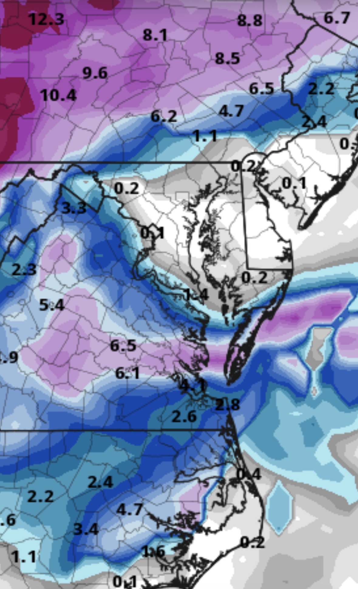
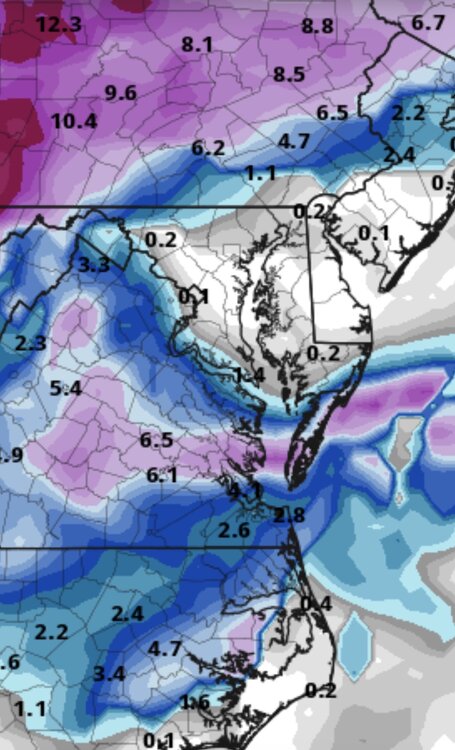
Easy 3” in that 0.2” liquid at 10°F unless the winds break up the flakes too much. These high ratio events are fun.
-
December 2025 regional war/obs/disco thread
WinterWolf replied to Torch Tiger's topic in New England
A colder version of Tuesday’s deal would be fine with me. Had alot of freezing rain Tuesday..turn a lot of that to snow, and I’d be happy. -
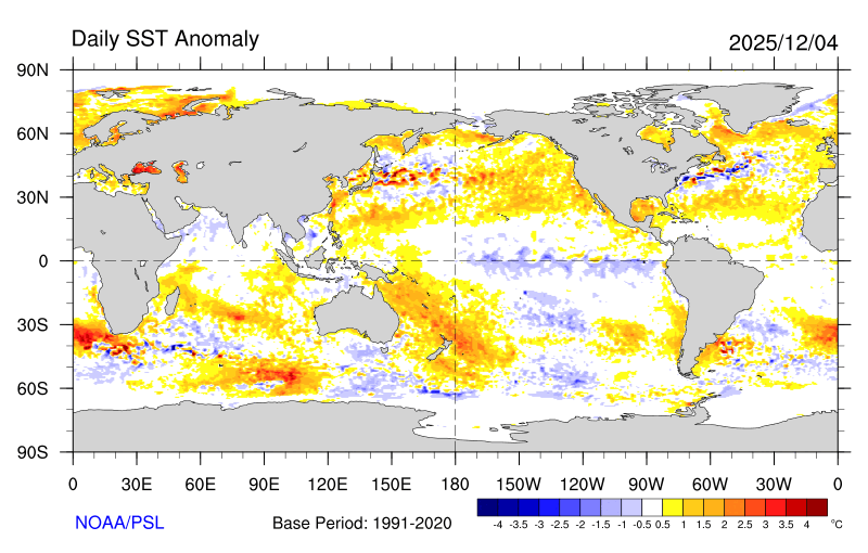
I was very hesitant about this winter until I saw this! Big blowup of the warm blob!
-
I know MJO 7 is supposed to become more favorable later in December compared to early in the month or November, but I am worried that the extended jet (relating to what you were mentioning in the west Pacific) will continue to keep things out of phase with expectations. I guess we will see.
-
December 2025 regional war/obs/disco thread
WinterWolf replied to Torch Tiger's topic in New England
For sure. -
Yep. This is better
-
Followup: this is only 8 days out 12Z GFS
-

Winter 2025-26 Short Range Discussion
Brian D replied to SchaumburgStormer's topic in Lakes/Ohio Valley
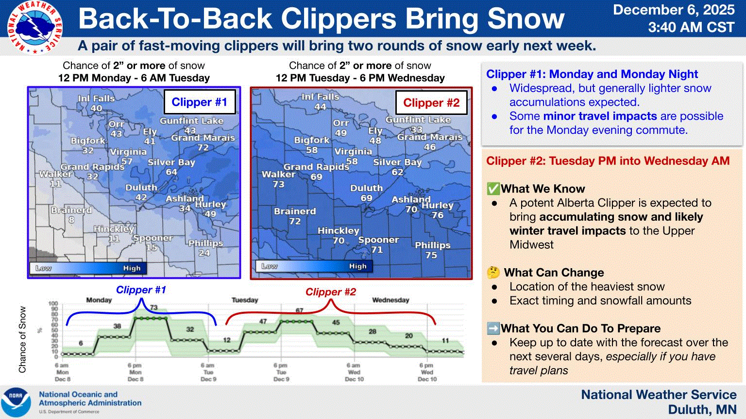
Thinking 8-12" potential along the shore with these 2 classic Alberta clippers. Lake enhancement will really help here, especially for the higher terrain with the 2nd one, which is pretty strong. Track could change some, tho, making a big difference. The boundary between the 2 may allow for some LES banding to develop Tues between systems. Something to watch.
-
It’s early still I know, but personally I could use an advisory to help with things.
-
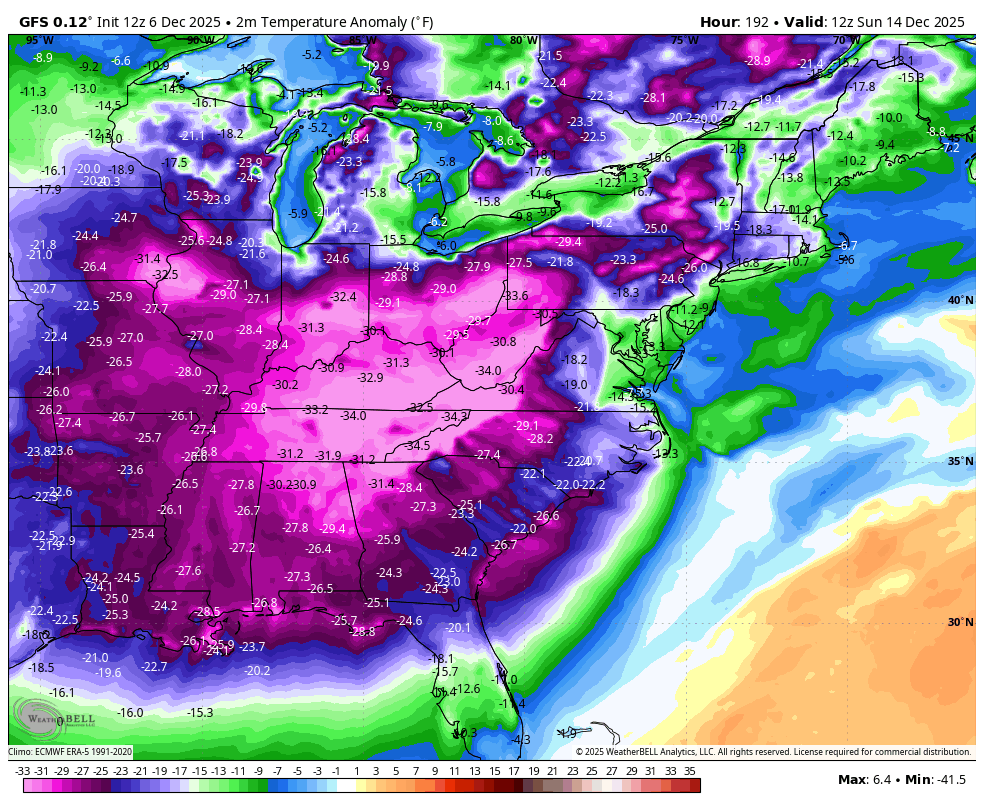
Posted about it this morning, but IMO a relaxation of the cold is looking like a very real possibility starting around 12/20. I also see nothing at all to support I-95 corridor snowstorms (nor’easters) for at least the next 14+ days
-
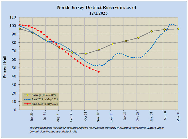
Some reservoirs in NNJ dipping under 50% with the below normal rainfall since the fall of 2024. https://dep.nj.gov/drought/current-conditions/#reservoir-levels
-
39.8 here with low clouds and some fog left . .
-
Colder version of what we just had a few days ago....most would take that look at this point, we all want the biggie, but at this point give me 3-6, with some cold to follow. Reminds me a bit of the systems from the early 2000s, just weaker.
-

Dec 6-7th (It's not a clipper) Clipper
Chicago Storm replied to Chicago Storm's topic in Lakes/Ohio Valley
It’s still melting from ground up. Soil temps are in the mid 30’s still, with the snow insulating the ground from the cold. -
Borderline temps - could be similar to last weeks event - need any HP in southeast Canada to stay in place with blocking - not showing that yet - just a LP departing up there
-
The thundersnow storm i had last Feb made the valentine's squall look like a flizzard. I got over an inch of snow in about 7 minutes along with intense lightning and strong wind.