All Activity
- Past hour
-
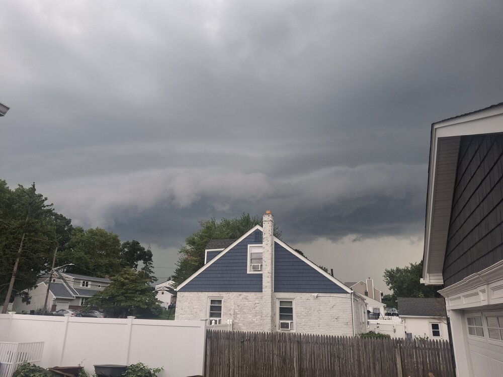
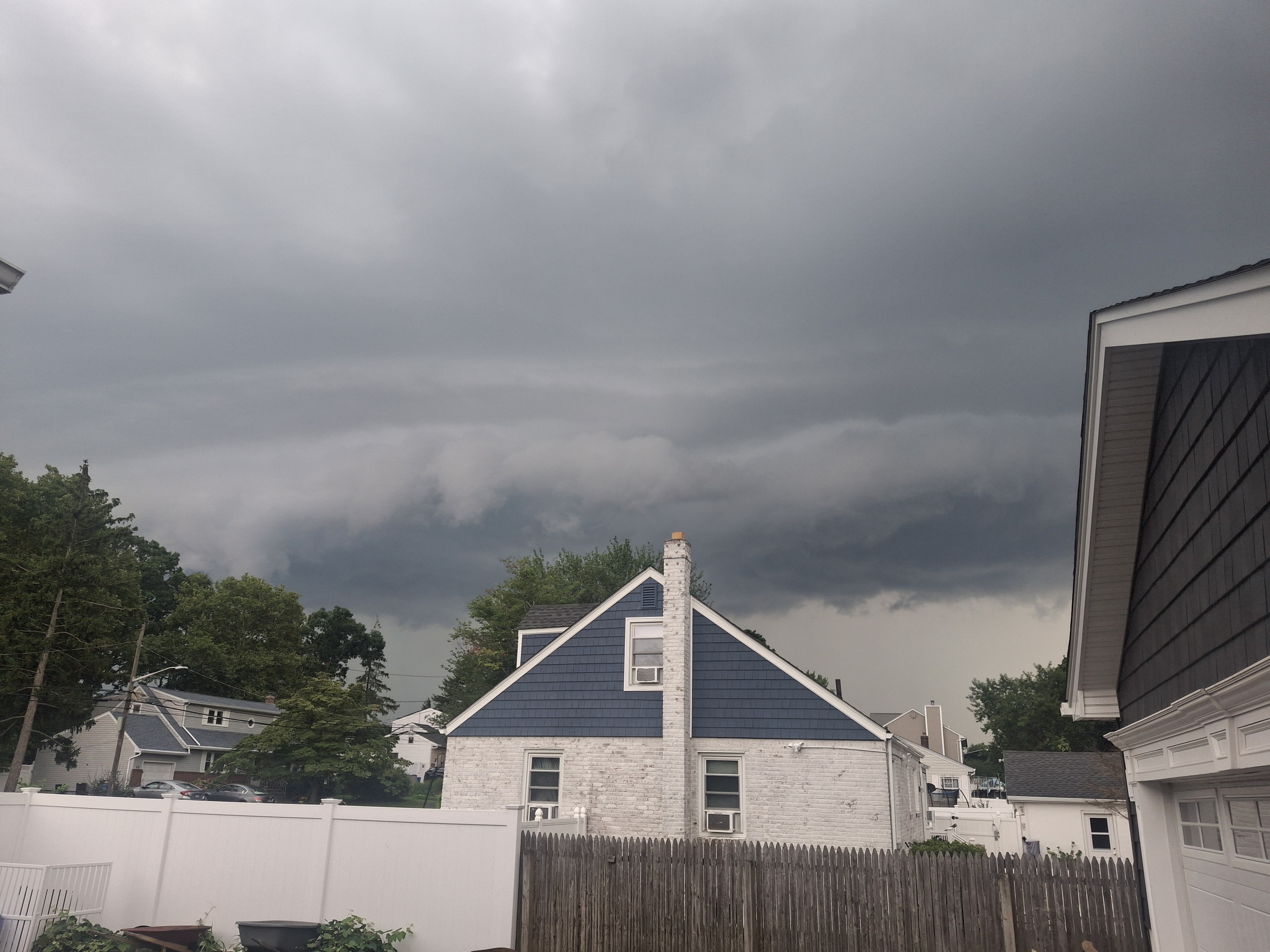
Nice shelf cloud here, the storm itself was pretty mediocre though
-
 indian pharmacy online: Trust Pharma India - Trust Pharma India
 -
NOAA is sold on the heat coming back latter third of August. Thankfully climo starts fighting back hard around then. Usually the time of year with sharpest temp drops.
-

2026-2027 Record-breaking El Nino
LakePaste25 replied to Stormchaserchuck1's topic in Weather Forecasting and Discussion
I’ve been stressing that here nonstop (along with a few others) and even snowman agreed with me to some extent. If people are getting triggered over that, it’s mostly happening outside of this thread. -
Nice flush hit here with lightning, 40-50 mph gusts and 0.9"
-

Augdewst 2026: Summer's Last Stand
dendrite replied to Prismshine Productions's topic in New England
Yeah there’s been some light smoke and haze aloft the past few days. -
Augdewst 2026: Summer's Last Stand
dendrite replied to Prismshine Productions's topic in New England
Snow weenies gone wild on social media. Everyone slapping their BBCs (big blue contours) over record snow and cold. Hopefully dews and warmth all winter with el nino grande. -
Expired the watch two hours early amidst totally blue skies.
-

2026-2027 Record-breaking El Nino
GaWx replied to Stormchaserchuck1's topic in Weather Forecasting and Discussion
This OISST relative 3.4 anomaly graph shows a rapid warming the prior 48 hours of ~0.2C. -

Augdewst 2026: Summer's Last Stand
Snowedin replied to Prismshine Productions's topic in New England
Anyone noticing the sun and sky look a little off today? I’m betting we’re getting a little smoke or haze mixed in with this airmass from the west. It’s kind of reminding me of what we had in mid July but to a much lesser extent. -
0.35" Wasn't expecting anything today, and the last 2 days all the action frustratingly went just to the north. So better than nothing.
- 1,844 replies
-
- 1
-

-
- severe
- thunderstorms
- (and 7 more)
-
Defintely seemed like smoke was sn issue in my parts
-
Well no heatwave for me...another 89 oh well Glad to see both lines of storms miss Lets keep the dry streak going
-
Decent storm here earlier with solid winds (albeit not at severe level) and heavy rain. Recent rains have done wonders to my lawn, which up to about 10 days ago looked like the Sahara desert.
-
.42” today. This Summer has been much more wetter than the previous two ones. Grass is looking good and not crunchy this year.
-

2026-2027 Record-breaking El Nino
michsnowfreak replied to Stormchaserchuck1's topic in Weather Forecasting and Discussion
Of course its reasonable. I haven't seen anyone say or imply otherwise for the GL/NE. However, the discussion that... it probably wont be record warm or a wall to wall torch, and that there isnt a linear correlation of the stronger the nino to the warmer the winter...is very triggering for some. -
A few showers or thundershowers are possible this evening and early tonight. Tomorrow will be another very warm day. Above normal temperatures will persist through Wednesday or Thursday. Highs will generally top out in the middle and upper 80s. Cooler air will move into the region to close of the week. As a result, Friday through Sunday could see highs mainly in the upper lower 80s. The ENSO Region 1+2 anomaly was +4.1°C and the Region 3.4 anomaly was +2.6°C for the week centered around August 6. For the past six weeks, the ENSO Region 1+2 anomaly has averaged +3.72°C and the ENSO Region 3.4 anomaly has averaged +2.15°C. The ongoing strong El Niño, which has reached super El Niño threshold, will continue to strengthen through the summer. The SOI was +2.00 today. That ended the 91-day streak during which the SOI was negative. The preliminary Arctic Oscillation (AO) was +0.138 today. Based on sensitivity analysis applied to the latest guidance, there is an implied near 51% probability that New York City will have a warmer than normal August (1991-2020 normal). August will likely finish with a mean temperature near 76.2° (0.1° above normal). Supplemental Information: The projected mean would be 0.9° above the 1981-2010 normal monthly value.
-

Augdewst 2026: Summer's Last Stand
VivaManchVegas replied to Prismshine Productions's topic in New England
Down with that. Torch in September and October, nothing like July. Usually short lived but enjoyable. -
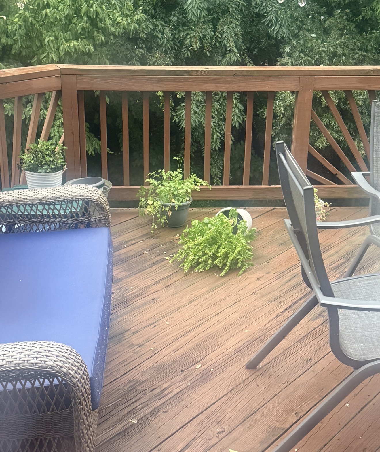
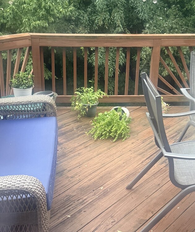
My basil didn’t stand a chance with that gust front.
- 1,844 replies
-
- 2
-

-
- severe
- thunderstorms
- (and 7 more)
-
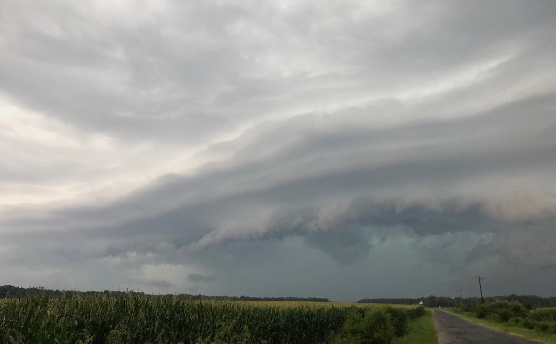
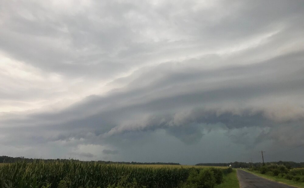
I can get some nice shots here with the wide open, flat landscape. Just have to jog down to the end of the driveway. This was an ok storm but looked pretty cool coming in.
- 1,844 replies
-
- 3
-
-
- severe
- thunderstorms
- (and 7 more)
-
Good storm here wind about 40 kts
-
Last night was a pleasant surprise with direct hit of a slow backbuilding cluster right over southern Kent County. Lots of loud thunder for several hours. Best non-severe storm of the summer. I so much prefer this type of storm to a squall line that rushes through too fast to enjoy or provide good rain totals. Required a lot of luck.
-

Augdewst 2026: Summer's Last Stand
ma blizzard replied to Prismshine Productions's topic in New England
nino summers torch second half of september into october -
2026-2027 Record-breaking El Nino
michsnowfreak replied to Stormchaserchuck1's topic in Weather Forecasting and Discussion
Almost like The Shining, only in snowmans version there is no snow because of a nuclear el nino. -
(002).thumb.png.6e3d9d46bca5fe41aab7a74871dd8af8.png) You are correct the processed data is listed as Berkeley station 35128, "WEST-CHESTER-1W" — monthly means, sole ID hadcru 720461, no COOP number - that is processed not raw data! This is a different animal entirely. The CSV matching the handwritten sheet says nothing about that file, because the CSV isn't its source this indeed looks to be West Chester 2NW old data! Below is the QC Check and of note only those 2 days in June 2 and 3 were flagged
You are correct the processed data is listed as Berkeley station 35128, "WEST-CHESTER-1W" — monthly means, sole ID hadcru 720461, no COOP number - that is processed not raw data! This is a different animal entirely. The CSV matching the handwritten sheet says nothing about that file, because the CSV isn't its source this indeed looks to be West Chester 2NW old data! Below is the QC Check and of note only those 2 days in June 2 and 3 were flagged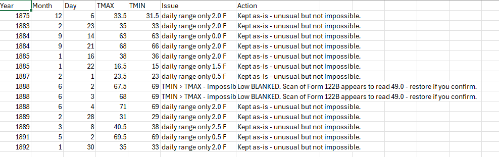





.thumb.jpg.ad3a2e31d30aff035044689b311a0540.jpg)