All Activity
- Past hour
-

First Winter Storm to kickoff 2025-26 Winter season
ORH_wxman replied to Baroclinic Zone's topic in New England
-

Central PA Fall Discussions and Obs
canderson replied to ChescoWx's topic in Upstate New York/Pennsylvania
I feel good with my 2.5” for Harrisburg call. -

First Winter Storm to kickoff 2025-26 Winter season
Prismshine Productions replied to Baroclinic Zone's topic in New England
I am still baffled at no warnings, 5-11" is a big range 18 hours out Sent from my SM-S166V using Tapatalk -
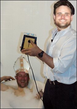
@wxmeddler did a thing for us!
-
Hi-Res models coming in a little juiced/phased... Looks like things may bump north a bit with a more neutral trough. We shall see!
-
You guys in Sullivan should do very well with this. Rock Hill, MSV areas are prob a lock for 6-8". As long as we dont see any sneaky warmth in the mid levels here in northern orange we should be good for 4"+
-

First Winter Storm to kickoff 2025-26 Winter season
CoastalWx replied to Baroclinic Zone's topic in New England
Where is the pic of Ray dropping the toaster into Kevin‘s bathtub? Is that possible? -
They issued that before this last minute model do over
-
Strange for NWS to expand WWA into northern moco given the model trends. They giving credence to HRRR? .
-
Looking pretty much set for folks like you and I. An 8-12 hour snow blitz and out by the end of tomorrow.
-
At the very least, There is some systems in the pipeline.
-

First Winter Storm to kickoff 2025-26 Winter season
tamarack replied to Baroclinic Zone's topic in New England
GYX 90/50/10 percents for Farmington (and here) are 0.5"/7"/14". Guessing that the models remain far apart. P&C forecast is 3-5 tomorrow and 2-4 tomorrow night. -

December 2025 regional war/obs/disco thread
SouthCoastMA replied to Torch Tiger's topic in New England
Yeah looked a bit better with those clippers post 12/8 -

Occasional Thoughts on Climate Change
WolfStock1 replied to donsutherland1's topic in Climate Change
Nope. Read the links I posted for actual numbers. As of 2022 renewable energy comprised 53 percent of all energy subsidies. This includes tax incentives. And this despite renewables only being 21% of production. https://www.instituteforenergyresearch.org/fossil-fuels/renewable-energy-still-dominates-energy-subsidies-in-fy-2022/ You can keep repeating the "when all financial factors" canard all you want, but it doesn't make it true. -

12/3 Snow/Sleet/Mix Bag of Everything Discussion/OBS
Birds~69 replied to Mikeymac5306's topic in Philadelphia Region
You can only name one? This storm reminds me of every storm... -

December 2025 regional war/obs/disco thread
H2Otown_WX replied to Torch Tiger's topic in New England
If by several you mean 22 then yeah. -
Well, not looking so good now. They've all lost it. We shall see!
-
 It would be hard any time of year for this to be snow at the coast when we have strong onshore flow to deal with as the storm comes in, maybe if we had a significantly colder leading airmass. You can see clearly how the fairly marginal cold retreats as the storm moves in. If the high could hang on we would have a chance but again the fast progressive pattern bites us. Storm is also gone before it can fully mature at the mid levels, so we don’t get a CCB to form and cold air to work back in.
 -
Wxbell model Spire only because it says it on the lower left corner
-
Models barely holding on to snow here, with no breathing room left. Morning runs for my yard: 6Z ECMWF- 2.0” (10:1) 12Z GFS- 3.5” (Kuchera) 12Z CMC- 5.5” (10:1) 12Z RGEM- 5” (10:1) 12Z UKMET- 3.5” (10:1) 12Z NAM 12km- 2.5” (10:1) 12Z NAM 3km- 1.5” (10:1)
-

First Winter Storm to kickoff 2025-26 Winter season
ineedsnow replied to Baroclinic Zone's topic in New England
Still thinking 6 to 9 unless this warms more -
First Winter Storm to kickoff 2025-26 Winter season
H2Otown_WX replied to Baroclinic Zone's topic in New England
Welp, this aged poorly :/ -
At this point I’m tracking Friday’s cold temps. Looks like mid-upper teens for the area Friday morning, with highs possibly below freezing.
-
Something that has been missing over the past several years are the alberta clippers but the GFS has some modeled going forward.
-

First Winter Storm to kickoff 2025-26 Winter season
WinterWolf replied to Baroclinic Zone's topic in New England
Ya…he thought 2-4” anyway. Heh, these models can jump back the other way a tad too..so it ain’t a done deal yet.


