All Activity
- Past hour
-
https://forecast.weather.gov/product.php?site=NWS&issuedby=PHI&product=AFD&format=CI&version=1&glossary=1&highlight=off While probability outlooks could still change significantly being 7 days out, early ML & AI outlooks have currently identified a 15%-30% probability for severe weather occurrence associated with this system. As details on this system become more defined, will have to continue to monitor synoptic fluctuations in model guidance to help identify any hazards associated with this system in the coming days.
-
Joined a new FB group....feels like family.

-
Some additional showers and thundershowers are possible early tonight. A few could bring heavy downpours. Tomorrow will feature high temperatures in the upper 80s. A few of the hot spots could approach or reach 90°. Showers or thundershowers are again possible. The weekend will turn somewhat cooler with highs mainly in the lower 80s. No excessive heat appears likely through mid-month. However, some of the guidance has grown hotter near mid-month so that situation will bear watching. The ENSO Region 1+2 anomaly was +3.4°C and the Region 3.4 anomaly was +1.8°C for the week centered around July 1. For the past six weeks, the ENSO Region 1+2 anomaly has averaged +2.80°C and the ENSO Region 3.4 anomaly has averaged +1.52°C. The ongoing El Niño will continue to strengthen through the summer. The SOI is not available due to data feed issues. This could be an extended issue. The preliminary Arctic Oscillation (AO) was +0.814 today. Based on sensitivity analysis applied to the latest guidance, there is an implied near 65% probability that New York City will have a warmer than normal July (1991-2020 normal). July will likely finish with a mean temperature near 78.9° (1.4° above normal). Supplemental Information: The projected mean would be 2.4° above the 1981-2010 normal monthly value.
-
Summer of '57 is a bit before my time but I know KCMO had terrible flooding. Mercifully that's not the case this year. That said, parts of the Midwest have experienced flooding this summer. Summer of '97 was meh heat in the Plains. Y'all have to refresh my memory here. Let's see what the next 2-3 weeks brings out there.
-
 Thankfully we ended with a hot and humid summer. Some knew and ACATT accepts defeat.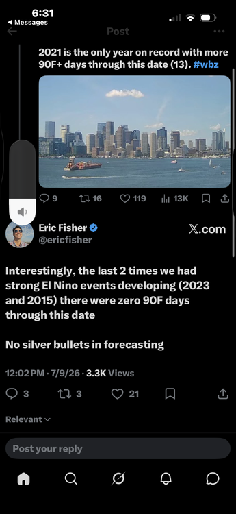
-
1.00” here
-

Fall/Winter Banter - Football, Basketball, Snowball?
KakashiHatake2000 replied to John1122's topic in Tennessee Valley
Gotcha Jeff . -
I was in Piscataway 36 years and remember losing power during Gloria and Sandy, and maybe like 3 other times haha. Im not sure why we lose it so often here
-
Strikeout here in 21057. A little drizzle/light rain
-
Thankfully we ended with a hot and humid summer. Some knew and ACATT accepts defeat.
-

Fall/Winter Banter - Football, Basketball, Snowball?
nrgjeff replied to John1122's topic in Tennessee Valley
I'll take the other side of that. Kalshi and Poly both have weather I believe. Even saw it on Draft Kings predictions, which could be dangerous lol! -
High of 100 at 5:40pm, currently 96/102 HI. 0.00" in the bucket, but we could use a break.
-
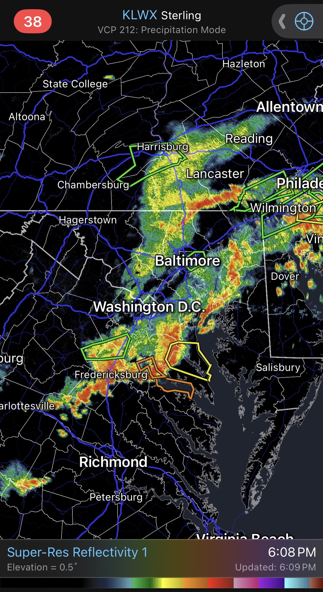
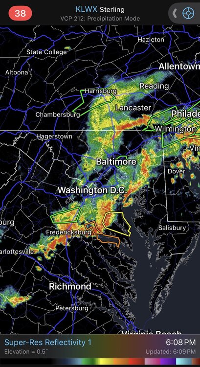
Dundalk got hit hard. North Point at Kane is flooded out
-

E PA/NJ/DE Summer 2026 Obs/Discussion
BBasile replied to PhiEaglesfan712's topic in Philadelphia Region
What in the 8-bit Nintendo is going on here? -
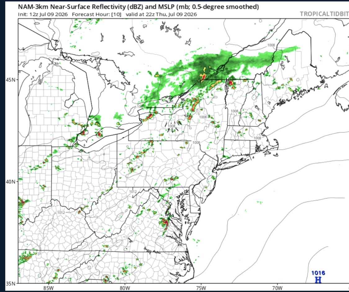
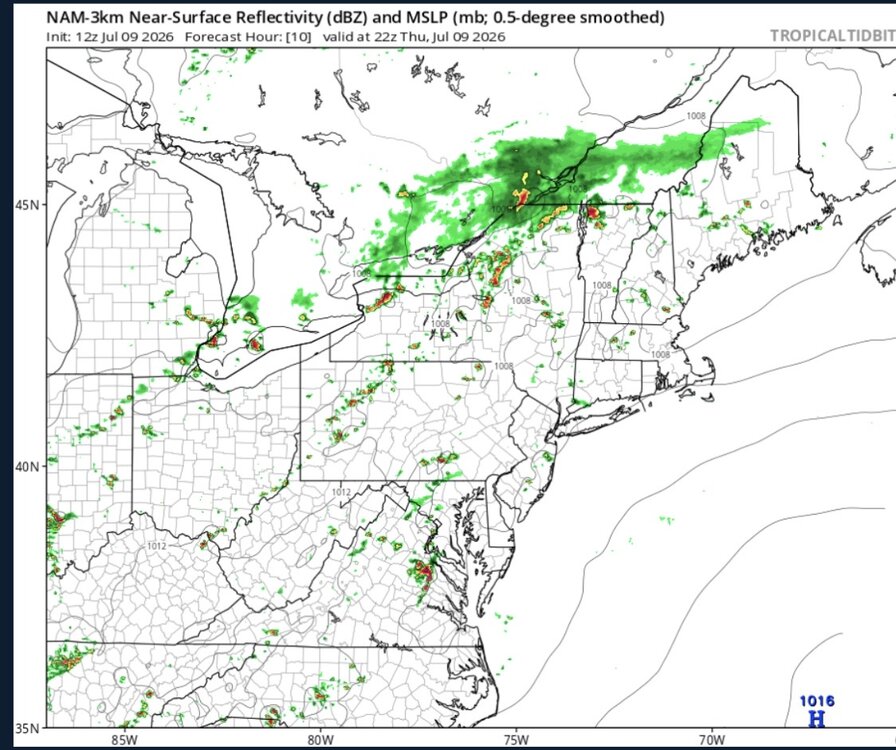
The 18z NAM image is for 22z tomorrow?
-
E PA/NJ/DE Summer 2026 Obs/Discussion
SouthernNJ replied to PhiEaglesfan712's topic in Philadelphia Region
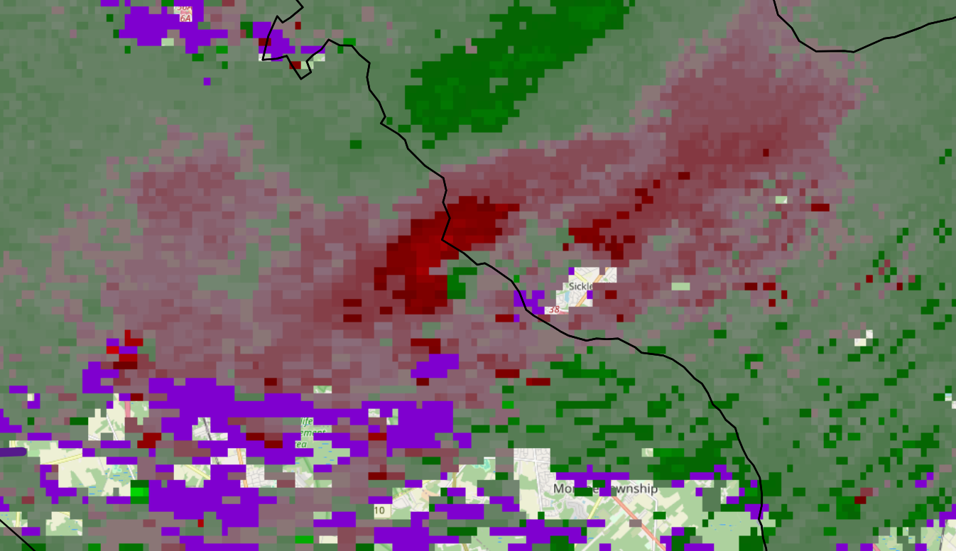
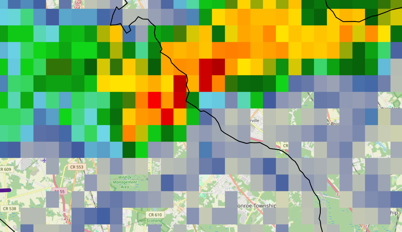
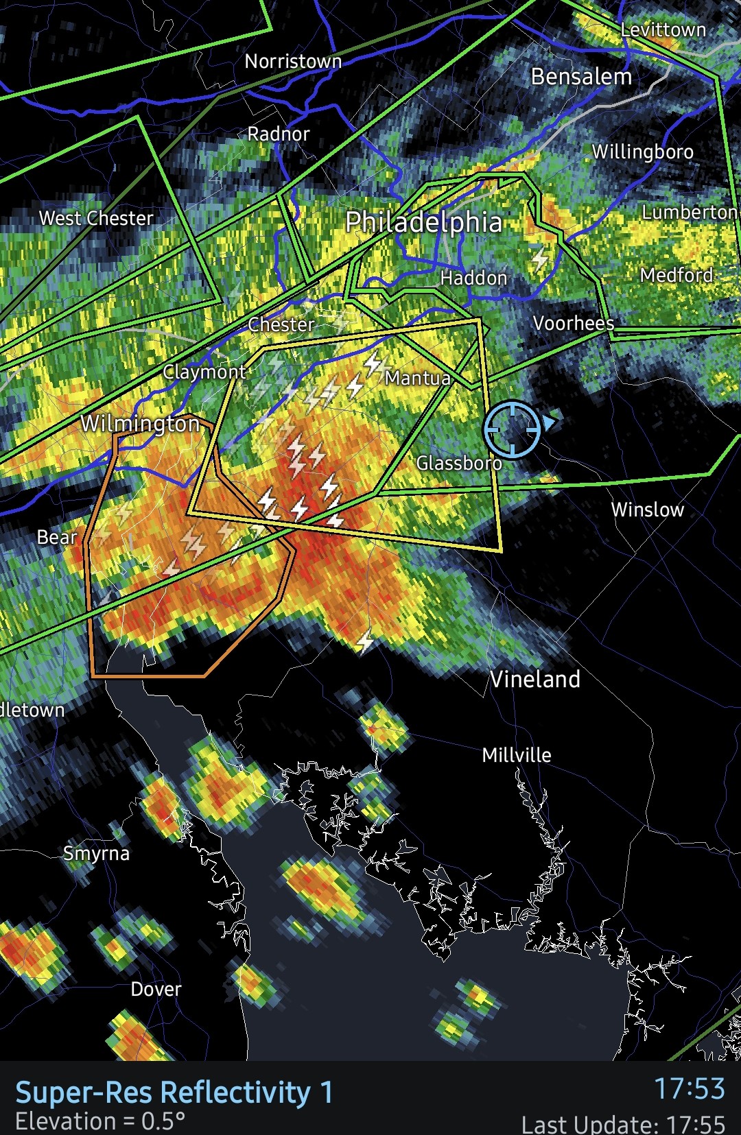
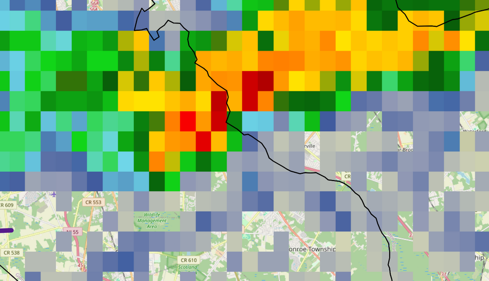
This is both TPHL and KDIX viewing the torrential thunderstorm at 4:36 PM near Cross Keys.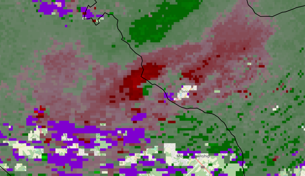
-
Seems like the NAM has been struggling with storm/rain coverage lately
-

2026-2027 Super El Nino
Stormchaserchuck1 replied to Stormchaserchuck1's topic in Weather Forecasting and Discussion
-PDO warm pool might be a higher std than El Nino right now. -
Lol wow.
-
Wow. Here I lose power maybe once every 2 or 3 years on average.
-
E PA/NJ/DE Summer 2026 Obs/Discussion
BBasile replied to PhiEaglesfan712's topic in Philadelphia Region
Over 5 inches of rain this month. Why not more?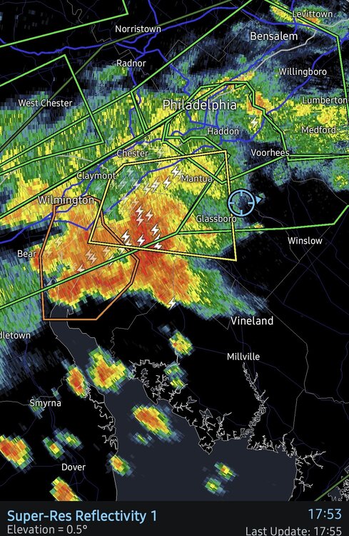
-
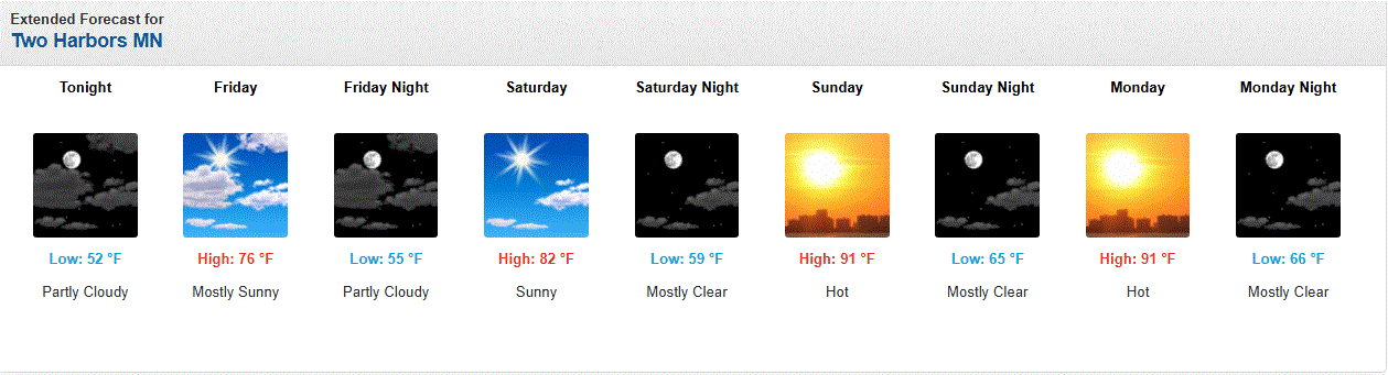
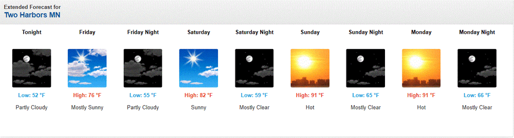
Looks like possible hot wx starting this weekend. Winds are forecast to be SW, and if so, then it will get rather warm, even here imby. Shoreline will stay a little cooler unless the wind is WSW. SW winds along the shoreline clip the Lake, but a slight W direction keeps it a fully land breeze. Down sloping may jump temps even higher than forecast.
-
Almost the exact same here in Del Ray. Had a few flashes and a strike within a mile, and what sounded like a positive strike also nearby. Now just need 3 or 4 more of these (we were sitting at under .5 here for the month).
-
It's definitely happening. That big storm has its eyes on Calvert. Was out taking care of caterpillars and tons of thunder and the humidity can be cut with a knife. Gonna be a drought buster for sure.