All Activity
- Past hour
-
Picked up 1.76” of rain between 11:00-1:00 today. Now it’s just gross as the sun comes out. 78/76, Soupy
-

2026 Mid-Atlantic Severe Storm General Discussion
SnowenOutThere replied to Kmlwx's topic in Mid Atlantic
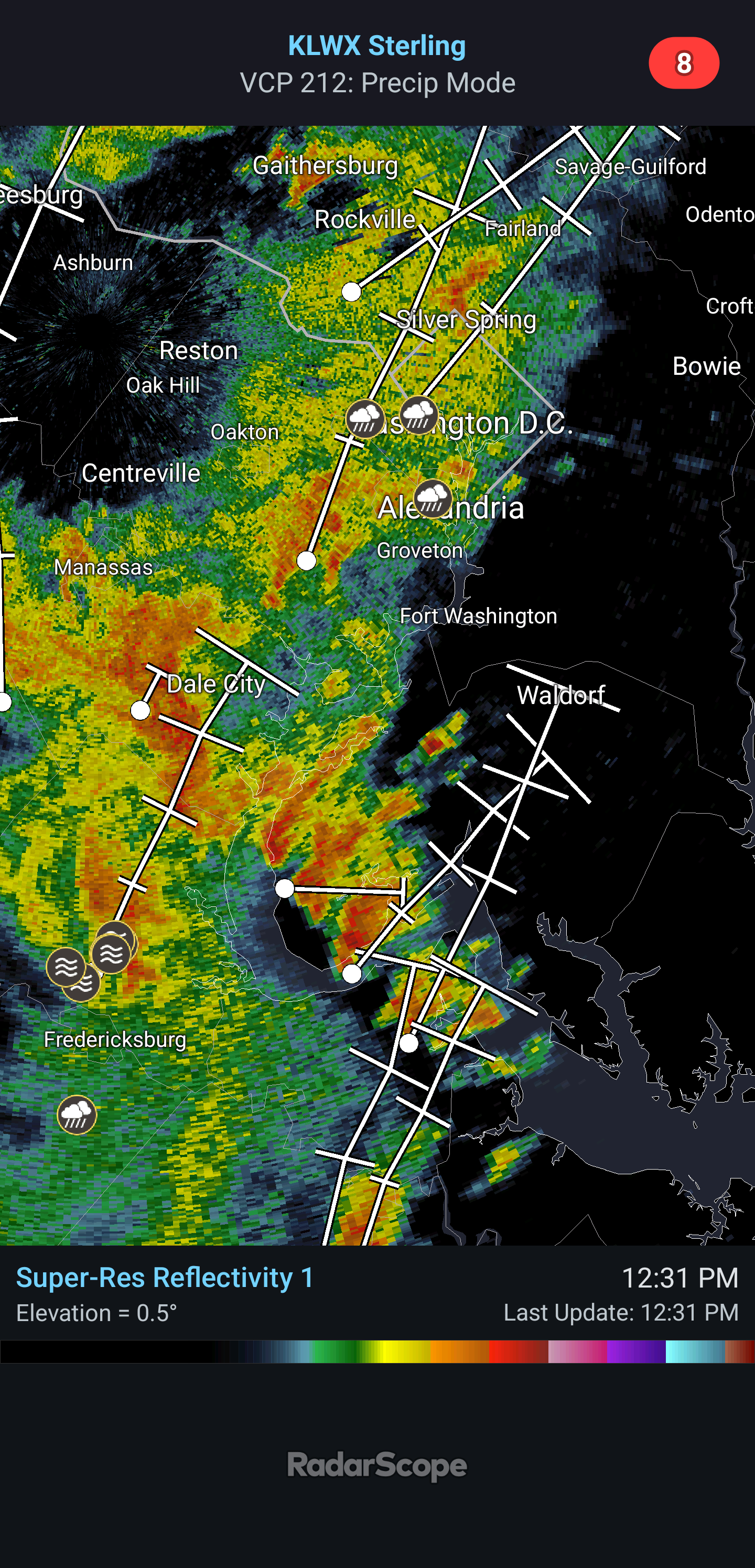
SPC mesoanalysis shows a tongue of moisture streaming directly off the Atlantic from South Carolina. Thanks to insane dew points our cape values are at 2500+. Vis sat shows some clearing behind the current line moving through which might act as a bit of an instigator too. Almost feels like a tropical system with the rotating bands of showers forming from the south. Interestingly, the low level shear also is somewhat reminiscent of a tropical cyclone. -

2026-2027 Super El Nino
GaWx replied to Stormchaserchuck1's topic in Weather Forecasting and Discussion
Today’s SOI rose to ~-8, the highest in a month, from ~-22 yesterday due to a sharp increase in pressure at Tahiti. However, Tahiti has most likely about peaked and it will be falling back noticeably within the next few days. Meanwhile, Darwin’s pressure looks to be higher tomorrow than today. Thus, I’m expecting another -SOI tomorrow, which would make it 85 straight -SOI days vs the record back to 1991 of 100 (set in 1998). Darwin should peak tomorrow followed by a drop for 2-3 days. But with Tahiti’s concurrent fall during that period, I’m thinking the -SOI streak will likely continue for at least the next few days and likely make it to at least 90 days. -
Tomatoes. eggplants, peppers and squash all doing great so far. I keep pruning the tomatoe suckers and its working out wonderfully. The lawn soil moisture % is very good, but the heat is preventing it from looking better. Last August trended drier as the month went on, I had a 34 % soil moisture near August 1 st and then it steadily declined to about 19 % by Sept 1 st. Maybe this August will be different.
-

2026-2027 Super El Nino
EasternLI replied to Stormchaserchuck1's topic in Weather Forecasting and Discussion
Yes, and it's looking like a big one too as the MJO swings back through again. -
85/76 now feeling like a sauna. Radar looks good and the precip disco is interesting with the discussion of big rainers
-

2026 Mid-Atlantic Severe Storm General Discussion
high risk replied to Kmlwx's topic in Mid Atlantic
As some of you have noted, there is absolutely low level shear today, and the low LCLs also suggest that a brief tornado or two is possible. The overall strength of the wind fields probably doesn't support a more significant threat, but I would not be surprised to see a few tornado warnings.- 1,699 replies
-
- 2
-

-
- severe
- thunderstorms
- (and 7 more)
-
0.02" of rain early this morning has put the dew at 78. 86F, feels like 99.
-

Augdewst 2026: Summer's Last Stand
Chrisrotary12 replied to Prismshine Productions's topic in New England
Dewsgusting out there. Congrats to those that enjoy this. -
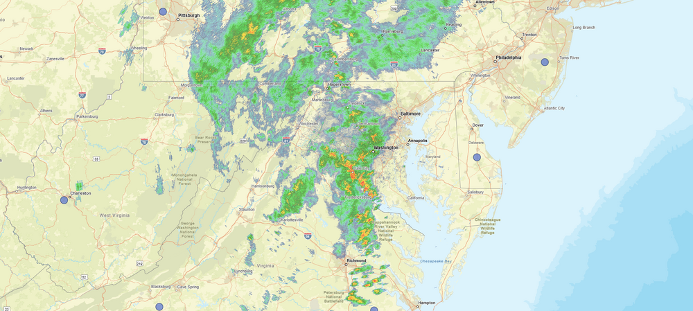
Appears that August is going to take over where July left off.
-
2026-2027 Super El Nino
GaWx replied to Stormchaserchuck1's topic in Weather Forecasting and Discussion
I was wrong as the Darwin 1015+ mb streak is still going! It’s now up to 24 days and tomorrow looks to also be 1015+. That would make it 25 straight days vs the prior longest of 20 days from July of 2015. -

Spring/Summer 2026 Pattern Discussion Thread
jaxjagman replied to Carvers Gap's topic in Tennessee Valley
MJO moving into the Maritime.GFS and Euro is trying to light the torch for our parts but we seem to be in a -NAO right now into the next several days Typically the MJO moving into P5 mean this time of year heat stroke moves into the plains not us,ensembles seem to look good ATM -

Augdewst 2026: Summer's Last Stand
SJonesWX replied to Prismshine Productions's topic in New England
85/72. disgusting. -

2026 Mid-Atlantic Severe Storm General Discussion
southmdwatcher replied to Kmlwx's topic in Mid Atlantic
Some rotation evident on radar near Springfield -
Looking like a slight forecast miss by the NAM
-
Hudson Valley and Western CT as well. Still very wet here.
-
Nice looking storm clouds to my south from second floor window. PA is getting dumped on today.
-
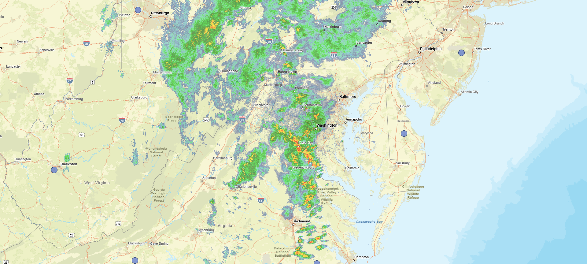
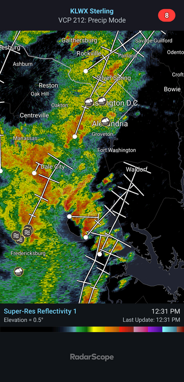
Looks like some supercells are already trying to get going as they move towards DC. A lot already have a bit of a rotation going on them.
- 1,699 replies
-
- 2
-
-
- severe
- thunderstorms
- (and 7 more)
-

E PA/NJ/DE Summer 2026 Obs/Discussion
Birds~69 replied to PhiEaglesfan712's topic in Philadelphia Region
Preseason games start later since they went from 4 to 3 preseason games. Birds 1st preseason 8/15/Ravens...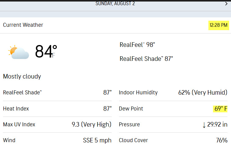
-
Rain and in many places a LOT of it is incoming....radar is awesome, bring it!!
-
Agree, but its a season long thing. What's his record now, 4-10? Could be 10-4 lol
-

2026 Mid-Atlantic Severe Storm General Discussion
wxmeddler replied to Kmlwx's topic in Mid Atlantic
I've been thinking / under the impression that the flooding threat from this system has been underplayed by WPC / LWX since about Wednesday. We don't often get 2.25" PWAT's coupled with a cut-off low to our southwest with a 200mb right entrance overhead. At least LWX on Saturday AM started to pick up the rainfall risk and has been amplifying the message since.- 1,699 replies
-
- 2
-
-
- severe
- thunderstorms
- (and 7 more)
-
Pouring rain here right now
-

Augdewst 2026: Summer's Last Stand
weatherwiz replied to Prismshine Productions's topic in New England
The big difference in this versus the previous setups is this rain isn't spread out over a long duration. This will be the type of stuff that produces 2-4" in 1-2 hours versus several-plus hours. -
A bit off here. HP will slide E with a front moving in with scattered shwrs/stms.