All Activity
- Past hour
-
-

2026 Mid-Atlantic Severe Storm General Discussion
SnowtoRain replied to Kmlwx's topic in Mid Atlantic
0.37", missed the worst of it in Easton so far, @CAPElooks like everything is converging over you -
~1" in 30 minutes - storm total.
- 1,647 replies
-
- 1
-

-
- severe
- thunderstorms
- (and 7 more)
-

2026-2027 Super El Nino
LakePaste25 replied to Stormchaserchuck1's topic in Weather Forecasting and Discussion
La Niña or cold neutral is likely after any super Nino because the cold waters in the W pac propagate eastward/promote trades, and a lot of the ocean heat in the tropics is released into the atmosphere. -

E PA/NJ/DE Summer 2026 Obs/Discussion
KamuSnow replied to PhiEaglesfan712's topic in Philadelphia Region
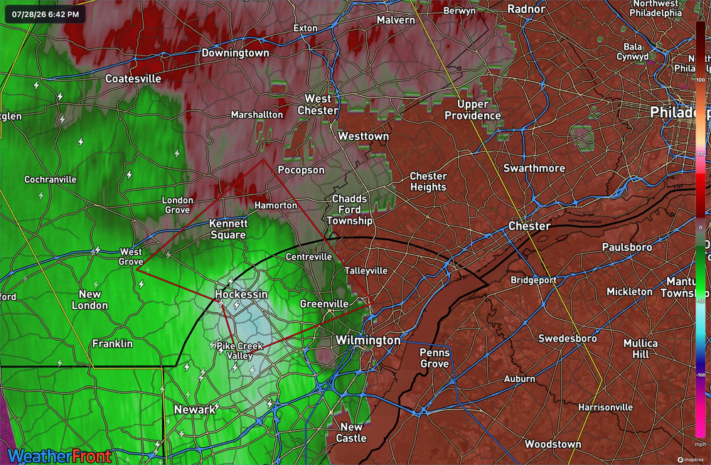
Here it comes!.thumb.jpg.8922861615e1f7619f4fbd42b3a08877.jpg)
-
0.81” rain, 40mph peak wind. Definitely some tornadic circulation at ground level over the Chesapeake Bay near the Magothy River, but no funnel clouds.
-
Still nearly zilch near New Brunswick
-
Wow to the rainfall rate!
-

2026 Spring/Summer Mountain Thread
Maggie Valley Steve replied to Buckethead's topic in Southeastern States
Wind gusting to 50 here at the house with driving rain. -
 Your area has been ground zero for severe and storms this summer
 -
So the woman we are pet sitting for here in DE just called and is stuck in Boston overnight. Her flight got canceled into DC. So we will be heading home a bit later than we had planned tomorrow afternoon.
-
Where in essex county was the mudslide?
-
Predicted totals not going to verify on LI I think
-
Flash flood in DC English Basement Apartment confirmed.
- 1,647 replies
-
- 1
-
-
- severe
- thunderstorms
- (and 7 more)
-
 That’s a crusher WOR. Wow if that verified.
 -
Flash Flood Statement National Weather Service Baltimore MD/Washington DC 644 PM EDT Tue Jul 28 2026 MDC003-005-510-290015- /O.CON.KLWX.FF.W.0027.000000T0000Z-260729T0015Z/ /00000.0.ER.000000T0000Z.000000T0000Z.000000T0000Z.OO/ Anne Arundel MD-Baltimore MD-Baltimore City MD- 644 PM EDT Tue Jul 28 2026 ...FLASH FLOOD WARNING REMAINS IN EFFECT UNTIL 815 PM EDT THIS EVENING FOR NORTH CENTRAL ANNE ARUNDEL AND SOUTHEASTERN BALTIMORE COUNTIES AND BALTIMORE CITY... At 644 PM EDT, emergency management reports multiple roads closed due to flooding in Baltimore City. Between 2 and 3.5 inches of rain have fallen. Additional rainfall amounts up to 0.5 inches are possible in the warned area. Flash flooding is already occurring. HAZARD...Life threatening flash flooding. Thunderstorms producing flash flooding. SOURCE...Emergency management reported. IMPACT...Life threatening flash flooding of creeks and streams, urban areas, highways, streets and underpasses. Some locations that will experience flash flooding include... Baltimore... Pikesville... Middle River... Riviera Beach... Sparrows Point... Back River... North Point State Park... Fort Smallwood State Park... Millers Island... Glen Burnie... Dundalk... Towson... Catonsville... Essex... Woodlawn... Parkville... Carney... Perry Hall... Lochearn... Pasadena... PRECAUTIONARY/PREPAREDNESS ACTIONS... Turn around, don`t drown when encountering flooded roads. Most flood deaths occur in vehicles. Move to higher ground now. Act quickly to protect your life. Be aware of your surroundings and do not drive on flooded roads. && LAT...LON 3914 7661 3925 7671 3929 7672 3941 7673 3940 7639 3924 7640 3918 7645 3918 7646 3921 7652 3917 7646 3914 7648 FLASH FLOOD...OBSERVED FLASH FLOOD DAMAGE THREAT...CONSIDERABLE
-

2026 Spring/Summer Mountain Thread
Tyler Penland replied to Buckethead's topic in Southeastern States
Saw a photo of what appeared to be a lowered mesocyclone from a drone shot in Asheville but hard to tell for sure not great quality. Sent from my Pixel 10 Pro using Tapatalk -
...a crap emoji for asking a legitimate question???....
-
Seem to have a tornado heading to me in Orange Co from Alamance Co.
-
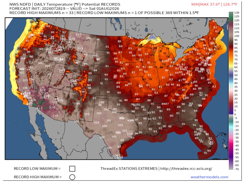
 That's some serious heat for the desert Southwest later this week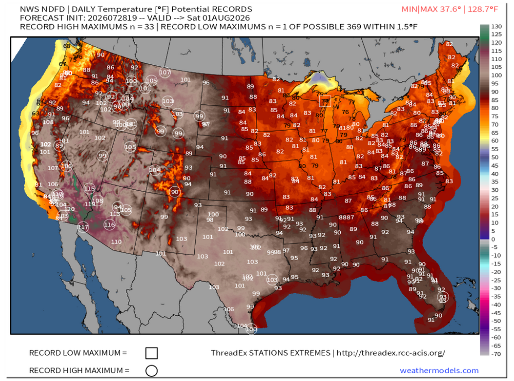
-
Wanna see something funny. Pull up accumulated qpf today so far in this area .Stein dropped a Roman helmet directly .. and I mean directly .. on me
-
Columbia: 0.61” imby, 6.89” for July.
-

2026 Mid-Atlantic Severe Storm General Discussion
somecallmetim replied to Kmlwx's topic in Mid Atlantic
Pretty perfect Alexandria fail unfortunately. But we did get hit hard with rain last week at least. -
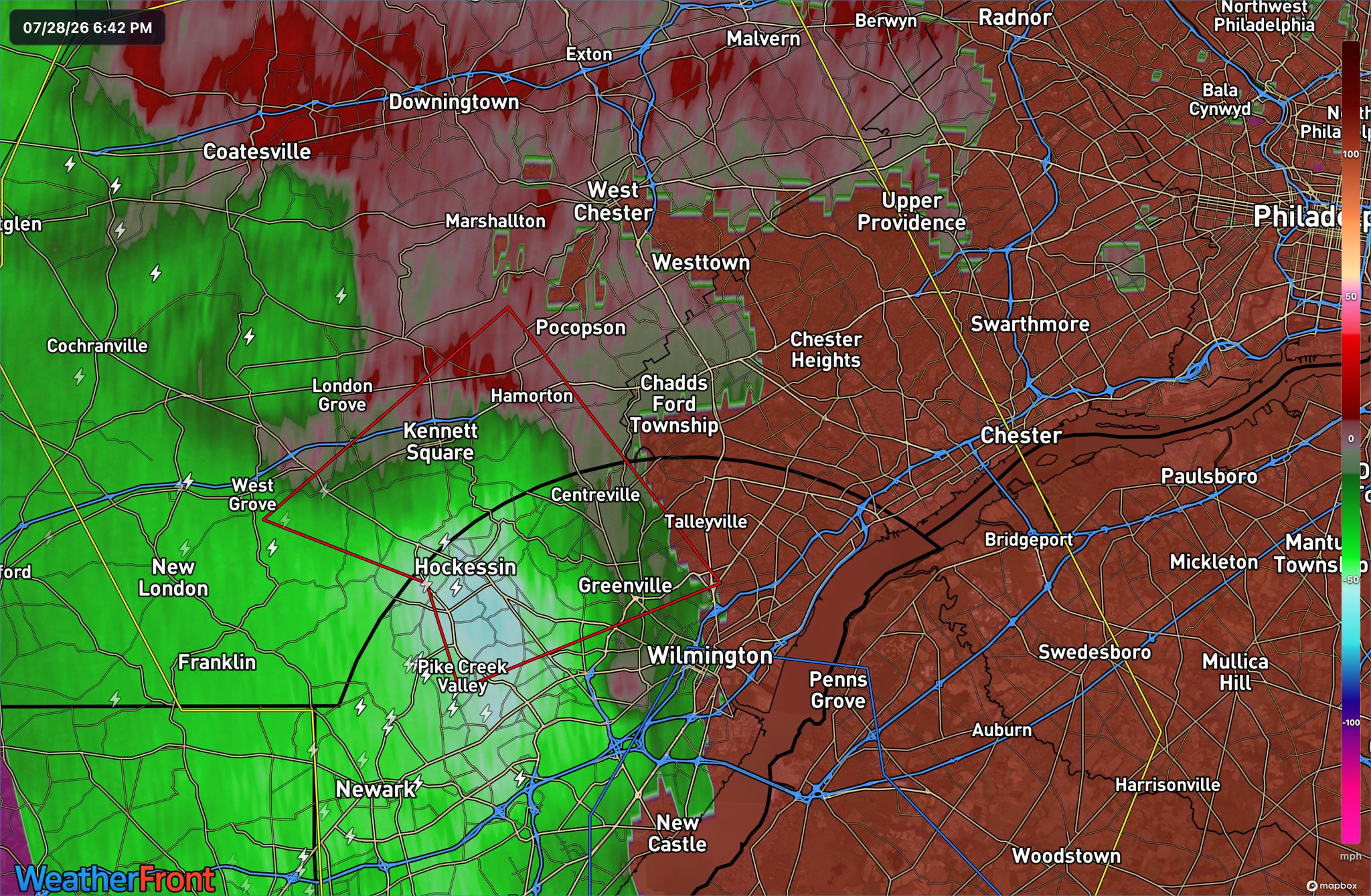
Deluge with scattered thunder and lightening. I'm up to 2", including an inch in the past 27 minutes. We're passing through 3-4 inches easily based on that radar. My street is a river. Meanwhile, if I'm reading it right, it looks a huge bow echo is heading into South Jersey. Wild evening.


.jpg.38efb572bc58e1dc10a23de61983d295.jpg)