MANDA
-
Posts
2,055 -
Joined
-
Last visited
About MANDA

Recent Profile Visitors
8,777 profile views


-
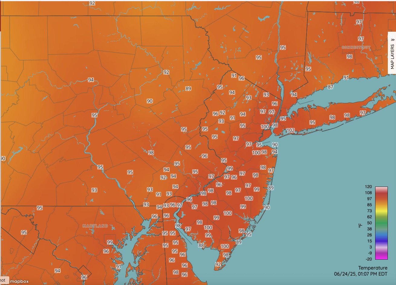
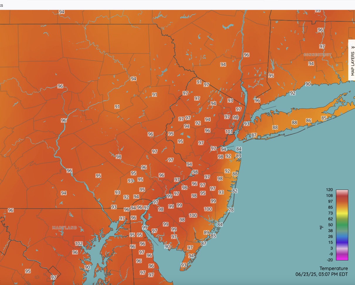
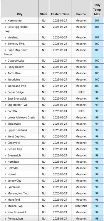
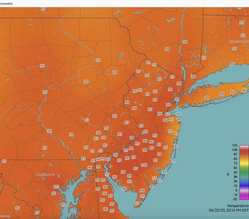
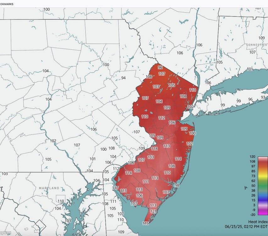
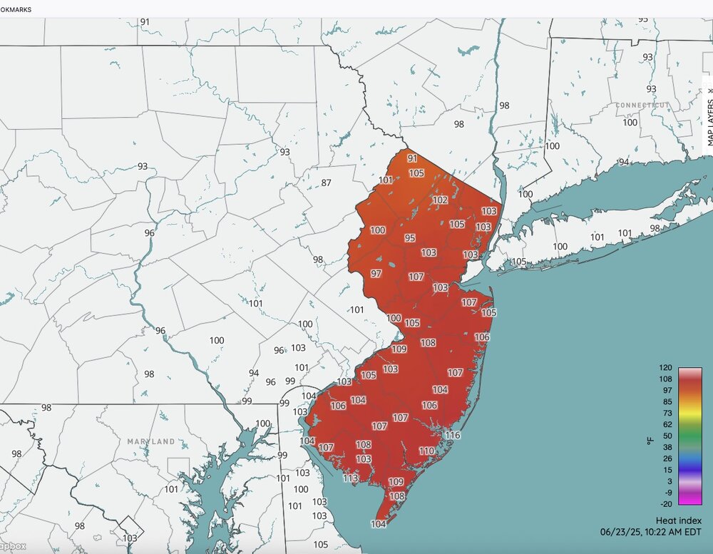
 Current temps / heat index from NJ WXNET and max temps so far today.

-
Good luck! I do hope you can find something.
-
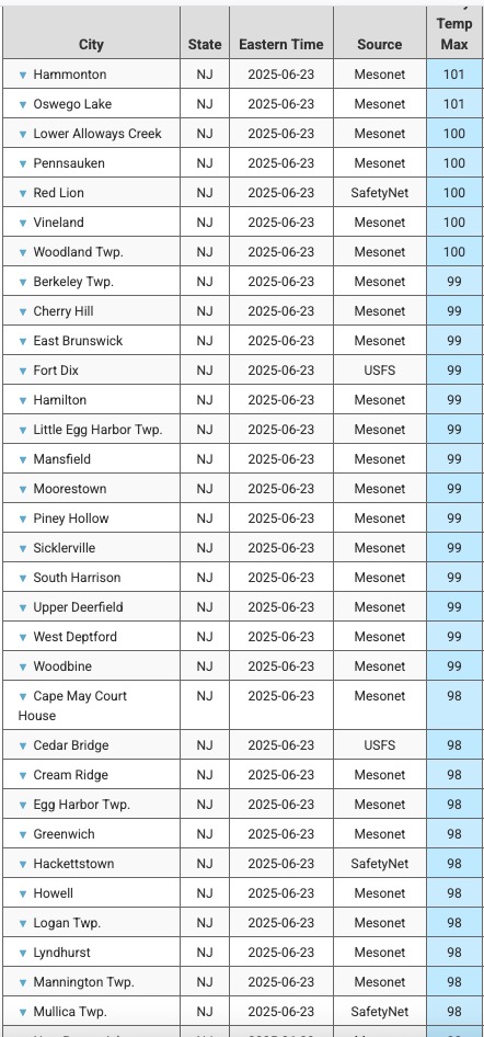
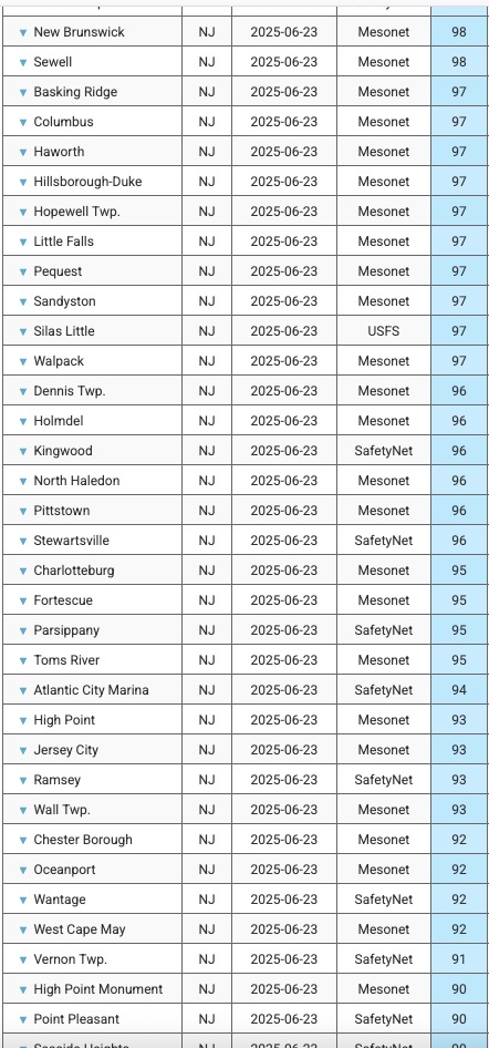
Hence why I said "nearing" the 1995 levels.
-
Some of these local HI readings are nearing the suffocating levels of the 1995 heat wave. Going to be a stiflingly hot night coming up especially in the urban areas.
-
Some of these local HI readings are getting close to the suffocating heat of 1995.
-
Central air doing it's thing. Very comfortable 68 degrees on the first floor. Unit on second floor is set to 80 and kicking on and off to keep it at 80. It is hot out there.
-
Heat Index is the story today. Temperatures are hot for sure but not extreme. Noteworthy though to see m/u 90's far NW NJ. That is as impressive as anything.
-
Sea breeze visible on latest visible over L.I. : https://www.meteo.psu.edu/ewall/PSUGOES_PA2/loop60v.html
-
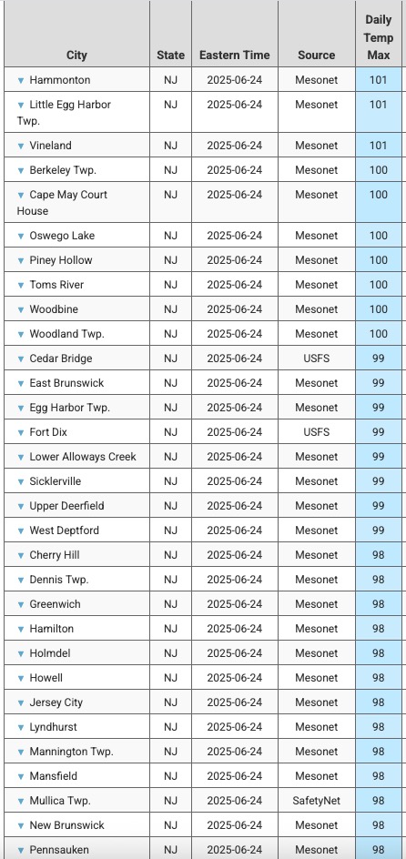
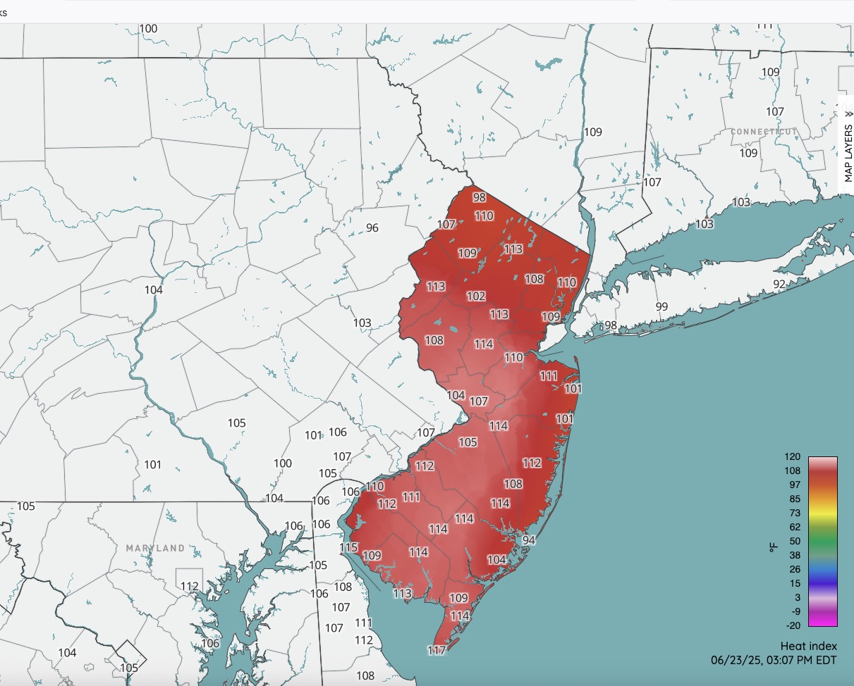
Snapshot of current Heat Index numbers: Click to enlarge.
-
Highly urbanized locations have not dropped below 80. Very steamy.
-
Highly urbanized locations have not dropped below 80. Very steamy night.
-
11:0O heat index CP 90 and EWR 95
-
11:0O heat index CP 90 and EWR 95