PineHillsWx Posted February 7, 2021 Share Posted February 7, 2021 Really picking up in Plymouth, close to an inch of wet snow. Temp is 32.9, dew point 31.1, no wind to speak of. Link to comment Share on other sites More sharing options...
NorEastermass128 Posted February 7, 2021 Share Posted February 7, 2021 Pouring 38F 1 2 Link to comment Share on other sites More sharing options...
WinterWolf Posted February 7, 2021 Share Posted February 7, 2021 2.5” down, and heavy snow continues. All Puff and Fluff. Link to comment Share on other sites More sharing options...
weathafella Posted February 7, 2021 Share Posted February 7, 2021 Big fatties at a god rate. Temperature dropped to 32. Link to comment Share on other sites More sharing options...
The 4 Seasons Posted February 7, 2021 Author Share Posted February 7, 2021 ratios im sure are super high 20-1 or more. growth on the soundings always looked very impressive to me for this. Radar update! For some reason the OKX radar isnt loading past 11:14AM Link to comment Share on other sites More sharing options...
geo1 Posted February 7, 2021 Share Posted February 7, 2021 2 minutes ago, Greg said: I'd say moderate to heavy rates at the moment. I think we may pull off the higher end of the advisory amounts if this can sustain. 1 1 Link to comment Share on other sites More sharing options...
mahk_webstah Posted February 7, 2021 Share Posted February 7, 2021 Snow increased to moderate here but hole to the west. Coating Link to comment Share on other sites More sharing options...
WinterWolf Posted February 7, 2021 Share Posted February 7, 2021 Just now, NorEastermass128 said: Pouring 38F Holy smokes that sucks..feel for you pal. :-( 1 Link to comment Share on other sites More sharing options...
tavwtby Posted February 7, 2021 Share Posted February 7, 2021 1" on the nose.... congrats south coast and cape, your storm! still steady mod snow, meh growth, again was expecting this, happy it ain't rain or dry cold Link to comment Share on other sites More sharing options...
GansettBay Posted February 7, 2021 Share Posted February 7, 2021 1 minute ago, WxWatcher007 said: Mesoscale Discussion 0065 NWS Storm Prediction Center Norman OK 1040 AM CST Sun Feb 07 2021 Areas affected...Long Island through southeastern New England Concerning...Heavy snow Valid 071640Z - 072045Z SUMMARY...Heavy snow is in the process of developing, with hourly snow rates expected to maximize around to 2-3+ inches per hour by 2-4 PM EST across the Greater Providence and southern Greater Boston Metropolitan areas. DISCUSSION...Rapid deepening of a surface cyclone is now underway to the east-northeast of the southern Mid Atlantic coast, as a 100 kt cyclonic 500 mb jet streak, associated with a vigorous mid-level short wave impulse, noses across the North Carolina coast. This system is forecast to accelerate northeastward through this afternoon, with continued rapid deepening of the cyclone, and intensifying deep-layer frontogenetic forcing to its north-northeast. Periods of heavy snow have already been observed within the developing frontal precipitation band across parts of southeastern Pennsylvania into the Greater New York City area, with increasing snow rates in the process of developing across Long Island and southern New England. Latest model output suggests that forcing for ascent will increasingly be aided by strengthening frontogenesis in the 700-500 mb layer, across southeastern New England during the 18-21Z time frame. Forecast soundings indicate that this will include the favorably cold mixed-phase layer supportive of large dendritic ice crystal growth, which may maximize across Rhode Island and southeastern Massachusetts. This likely will include snow rates occasionally on the order of 2 inches per hour, and at least some guidance appears suggestive that an influx of lower/mid-level moisture may contribute to weak destabilization supportive of convective bursts around 3+ inches per hour. ..Kerr.. 02/07/2021 Looking forward to that! Link to comment Share on other sites More sharing options...
The 4 Seasons Posted February 7, 2021 Author Share Posted February 7, 2021 Just now, tavwtby said: 1" on the nose.... congrats south coast and cape, your storm! still steady mod snow, meh growth, again was expecting this, happy it ain't rain or dry cold thanks keep me updated, be curious to see your total 1 Link to comment Share on other sites More sharing options...
The 4 Seasons Posted February 7, 2021 Author Share Posted February 7, 2021 Just now, WxWatcher007 said: One of our followers reporting just over 3" in Middletown in 75 minutes. sounds about right i got 2.8" in 75 minutes 1 Link to comment Share on other sites More sharing options...
Damage In Tolland Posted February 7, 2021 Share Posted February 7, 2021 1 minute ago, tavwtby said: 1" on the nose.... congrats south coast and cape, your storm! still steady mod snow, meh growth, again was expecting this, happy it ain't rain or dry cold You’re in Winsted right? I always initially think WAterbury with your screen name Link to comment Share on other sites More sharing options...
JC-CT Posted February 7, 2021 Share Posted February 7, 2021 Just now, WxWatcher007 said: One of our followers reporting just over 3" in Middletown in 75 minutes. Sankaty? Link to comment Share on other sites More sharing options...
TalcottWx Posted February 7, 2021 Share Posted February 7, 2021 Snow is garbage once you hit Brighton Link to comment Share on other sites More sharing options...
tavwtby Posted February 7, 2021 Share Posted February 7, 2021 Just now, Damage In Tolland said: You’re in Winsted right? I always initially think WAterbury with your screen name yeah, Winsted for the last 8 years, was wtby most my life Link to comment Share on other sites More sharing options...
JB_Wchstr Posted February 7, 2021 Share Posted February 7, 2021 2 minutes ago, GansettBay said: Looking forward to that! That’s a weenie description if I’ve heard one 1 Link to comment Share on other sites More sharing options...
NorEastermass128 Posted February 7, 2021 Share Posted February 7, 2021 2 minutes ago, WinterWolf said: Holy smokes that sucks..feel for you pal. :-( It is what it is. Local Cape Cod climo here FTL Link to comment Share on other sites More sharing options...
Hoth Posted February 7, 2021 Share Posted February 7, 2021 Just about three inches down. More air than snow. Not bad considering we didn't start until 10:30 or so. Link to comment Share on other sites More sharing options...
NorEastermass128 Posted February 7, 2021 Share Posted February 7, 2021 Just now, Hoth said: Just about three inches down. More air than snow. Not bad considering we didn't start until 10:30 or so. Dang. That’s ripping good. Link to comment Share on other sites More sharing options...
Baroclinic Zone Posted February 7, 2021 Share Posted February 7, 2021 19 minutes ago, Baroclinic Zone said: We watch the 2-6pm time period around TAN for heaviest rates. 4 minutes ago, WxWatcher007 said: Mesoscale Discussion 0065 NWS Storm Prediction Center Norman OK 1040 AM CST Sun Feb 07 2021 Areas affected...Long Island through southeastern New England Concerning...Heavy snow Valid 071640Z - 072045Z SUMMARY...Heavy snow is in the process of developing, with hourly snow rates expected to maximize around to 2-3+ inches per hour by 2-4 PM EST across the Greater Providence and southern Greater Boston Metropolitan areas. DISCUSSION...Rapid deepening of a surface cyclone is now underway to the east-northeast of the southern Mid Atlantic coast, as a 100 kt cyclonic 500 mb jet streak, associated with a vigorous mid-level short wave impulse, noses across the North Carolina coast. This system is forecast to accelerate northeastward through this afternoon, with continued rapid deepening of the cyclone, and intensifying deep-layer frontogenetic forcing to its north-northeast. Periods of heavy snow have already been observed within the developing frontal precipitation band across parts of southeastern Pennsylvania into the Greater New York City area, with increasing snow rates in the process of developing across Long Island and southern New England. Latest model output suggests that forcing for ascent will increasingly be aided by strengthening frontogenesis in the 700-500 mb layer, across southeastern New England during the 18-21Z time frame. Forecast soundings indicate that this will include the favorably cold mixed-phase layer supportive of large dendritic ice crystal growth, which may maximize across Rhode Island and southeastern Massachusetts. This likely will include snow rates occasionally on the order of 2 inches per hour, and at least some guidance appears suggestive that an influx of lower/mid-level moisture may contribute to weak destabilization supportive of convective bursts around 3+ inches per hour. ..Kerr.. 02/07/2021 I see they listened to me. 1 Link to comment Share on other sites More sharing options...
tavwtby Posted February 7, 2021 Share Posted February 7, 2021 2 minutes ago, The 4 Seasons said: thanks keep me updated, be curious to see your total if I had to guess, seeing upstream radar, and the growth not improving, 3 would be my high end I think, we'll see if we can get the forcing a bit further north and west Link to comment Share on other sites More sharing options...
HalloweenGale Posted February 7, 2021 Share Posted February 7, 2021 Snow starting in W. Dennis. Cottonballs 2 Link to comment Share on other sites More sharing options...
rnaude241 Posted February 7, 2021 Share Posted February 7, 2021 Dumping in Plymouth... Surfaces all covered. Link to comment Share on other sites More sharing options...
Hoth Posted February 7, 2021 Share Posted February 7, 2021 Just now, NorEastermass128 said: Dang. That’s ripping good. It is pounding and not a breath of wind. The trees are gorgeous. It's like what you see in Japan or something. 2 Link to comment Share on other sites More sharing options...
Spanks45 Posted February 7, 2021 Share Posted February 7, 2021 Just measured 2 inches, super fluffy stuff...27.7⁰ under a quarter mile visibility, radar returns aren't that impressive though Link to comment Share on other sites More sharing options...
sankaty Posted February 7, 2021 Share Posted February 7, 2021 2 minutes ago, JC-CT said: Sankaty? Wasn't me, but I can corroborate the report. Gorgeous! 1 Link to comment Share on other sites More sharing options...
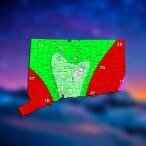
EastonSN+ Posted February 7, 2021 Share Posted February 7, 2021 6 minutes ago, The 4 Seasons said: ratios im sure are super high 20-1 or more. growth on the soundings always looked very impressive to me for this. Radar update! For some reason the OKX radar isnt loading past 11:14AM Where do u get those radar images they are cool. 1 Link to comment Share on other sites More sharing options...
bmj16725 Posted February 7, 2021 Share Posted February 7, 2021 2.25" since 10:30 with heavy snow - 25 F. 1 Link to comment Share on other sites More sharing options...
USCAPEWEATHERAF Posted February 7, 2021 Share Posted February 7, 2021 I was really giddy reading the MESO discussion from the SPC. I have not had one of those in my area in the last three plus seasons. 1 Link to comment Share on other sites More sharing options...

Recommended Posts
Create an account or sign in to comment
You need to be a member in order to leave a comment
Create an account
Sign up for a new account in our community. It's easy!
Register a new accountSign in
Already have an account? Sign in here.
Sign In Now