-
Posts
7,917 -
Joined
-
Last visited
About EastonSN+

Profile Information
-
Four Letter Airport Code For Weather Obs (Such as KDCA)
KBDR
-
Gender
Not Telling
-
Location:
Easton CT
Recent Profile Visitors
8,218 profile views
-
Impossible! Benchmark storms are extinct!
-
For me 1993 had more to do with the effects down south and the Appalachians. Also the strength of the storm and the severe storm outbreak in Florida during the storm. I can see April 1982 happening with a late sswe and a cross polar flow. I don't think it will happen in my lifetime but of the four would pick this.
-
This is actually an interesting debate on the rarity of each of the events. If I had a guess which one we would likely see sooner if at all would be April 1982. If I had a guess which one we would never see again in our lifetimes it would be 1993.
-
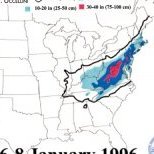
Yeah even Baltimore mixed but had over 30 inches. Philly did not mix at all and had 32. Central Park did not mix either.
-
Yup. I honestly believe we can end up with higher average snowfall than the 30 year 70 through 99 period.
-
Unfortunately lower temps do not always correlate to higher snowfall. You need lift as well. In my home town we had 4 full hours of verga and still ended up with a foot, but could have been much more. Maybe 96 is a bad example as instead of 12 degrees and snow you would have 15 degrees and snow today lol.
-
Correct. We may lose snow in a similar setup today, however, all those storms like the blizzard of 96 where we had a lot of verga because it was 12° outside would likely be more snowfall today. This is the offset I was talking about. Heck even the blizzard of December 2009 had a lot of virga.
-
Yeah this is precisely my thinking. Just like last year's storm that blew up and hit New Jersey with a ton of snow, the increased volatility will compensate for the increased temperatures. Something to keep in mind and it's important is although we have seen the temperatures rise we are still seeing snow in multiple snow events in the Middle Atlantic / Delmarva region. Even a fluke event on the Gulf Coast. Also we have seen snow in November in the past 7 years as well as a dusting in May. So while our snow events have decreased in frequency in the beginning and end of a season it is not impossible. You have to be careful of speculation that what has occurred in a very short window of time is the new Norm. We still have naos that do not link up with the southeast ridge. We have not seen persistent forcing in phases four five and six due to the warm Waters in Indonesia. We have not seen the end of below average temperature seasons as experienced this winter. Therefore you have to be careful in speculating that what we have seen with regards to the fast pac is now never going to change. So far I have not seen one thing that has become a new Norm that we were afraid of. We need more years of persistence to even entertain that thought.
-
It's easier to look at average snowfall, warmer climate means more moisture and volatility. The 90s was a perfect example of this. 2 above average snowfall winters and a higher decade average than the 70s or 80s. I mean the other years of the 90s outside of the below average 92/93 were absolutely putrid for snowfall and STILL highest snowfall decade. Think about this year the cold did not help us much.
-
All we need it approx 21 inches next year to be in perfect alignment with the 80s WRT snowfall. Just a little more to align with the 70s and 90s.
-
Yeah but you have to think that in great snow years you can get a benchmark track 2 to 3 times a month. Other years nothing.
-
I bet the fast pac had an influence in our bad snow years in the past.
-
I would suggest taking it up in the NE forum. However think about how much territory surrounds the benchmark track. 15% actually seems high.
-
I can't disagree with them as they have been correct on almost everything so far. Thinking about it though it HAS to be correct. For 30 freaking years we had almost no snow lol. 2000 through 2018 we had a bonanza but that is half of the duldrum period. Also think about how much space there is outside of the benchmark track.
-
Also the NE forum had a great point, non-benchmark tracks are approx 85% of our normal storm track. So even taking the fast pac out it's hard to get a heavy snow event here.


