All Activity
- Past hour
-
We play by our own rules in Allentown. Billy Joel
-
Pffft we kept playing football my junior year in 1998 vs Kemp even as lighting blew up one of our light standards* * people would get arrested for this now
-
- 421 replies
-
- 1
-

-
- severe
- thunderstorms
- (and 5 more)
-
While floating down the lazy river at Laguna Splash Water Park with my two-year-old, we saw the brightest bolt of lightning I have seen in a long time. We then had to evacuate. I did in fact, not, dodge the storms.
-

May 2024 General Discussion
mississaugasnow replied to HillsdaleMIWeather's topic in Lakes/Ohio Valley
I wonder if we're going to go right into non-stop 90s. The last week though has helped scratch the no heat issue here. Got 83-86F for a few days there. -
The orientation and proximity of the warm front on Monday would have me lean towards the NAM family. Definitely a decent set up for tornadoes.
- 421 replies
-
- 2
-

-
- severe
- thunderstorms
- (and 5 more)
-
Warm day today, high of 90. Dew point near 70 reminds me that summer is coming.
-
HRRR says line holds together pretty well as it heads east.
-
It is absolutely pouring downtown. And windy af ArtsFest vendors stuff blowing all over
-
I’ve been seeing a lot of those “find the ___” posts, and I’m surprised I haven’t been eaten by a snake or other creature yet. Camouflage is scary.
-
Looks like maybe that airport cell was a hailer. Might we get our official trace of snow for May?
-
Tomorrow will be another warm day with readings topping out mainly in the upper 70s and lower 80s. Temperatures will generally remain near or somewhat above normal through the remainder of May. Rain will overspread the region on Memorial Day. A general 0.50"-1.00" rainfall with locally higher amounts is likely. The latest summer guidance continues to suggest a warmer to much warmer than normal summer lies ahead. The ENSO Region 1+2 anomaly was -1.1°C and the Region 3.4 anomaly was +0.2°C for the week centered around May 15. For the past six weeks, the ENSO Region 1+2 anomaly has averaged -0.25°C and the ENSO Region 3.4 anomaly has averaged +0.57°C. Neutral conditions are imminent. The SOI was +1.17 today. The preliminary Arctic Oscillation (AO) was +0.772 today. On May 23 the MJO was in Phase 3 at an amplitude of 1.719 (RMM). The May 22-adjusted amplitude was 1.691 (RMM). Based on sensitivity analysis applied to the latest guidance, there is an implied 97% probability that New York City will have a warmer than normal May (1991-2020 normal). May will likely finish with a mean temperature near 65.1° (1.9° above normal).
-

Spring/Summer '24 Banter and Complaint Thread
SchaumburgStormer replied to IWXwx's topic in Lakes/Ohio Valley
None out here, but was at Brookfield today and it was insane how loud it was -
I'm watching Ryan Hall's stream; some of the questions people ask in chat are making my eyes bleed.
-
No threat of any heat over the next 14 days it seems.
- Today
-
Without fail Sent from my SM-G970U using Tapatalk
-
Tornado Warning for Allegheny County Issued by National Weather Service Pittsburgh, PA 4:59 PM EDT Sat, May 25, 2024 The National Weather Service in Pittsburgh has issued a * Tornado Warning for... Southwestern Beaver County in western Pennsylvania... Northern Washington County in southwestern Pennsylvania... Western Allegheny County in southwestern Pennsylvania... * Until 530 PM EDT. * At 459 PM EDT, a severe thunderstorm capable of producing a tornado was located near Shippingport, or 8 miles southeast of East Liverpool, moving southeast at 20 mph. HAZARD...Tornado. SOURCE...Radar indicated rotation. IMPACT...Flying debris will be dangerous to those caught without shelter. Mobile homes will be damaged or destroyed. Damage to roofs, windows, and vehicles will occur. Tree damage is likely. * This tornadic thunderstorm will remain over mainly rural areas of southwestern Beaver, northern Washington and western Allegheny Counties, including the following locations... Raccoon Creek State Park, Hanover Township, Frankfort Springs, and Pittsburgh International Airport. PRECAUTIONARY/PREPAREDNESS ACTIONS... TAKE COVER NOW! Move to a basement or an interior room on the lowest floor of a sturdy building. Avoid windows. If you are outdoors, in a mobile home, or in a vehicle, move to the closest substantial shelter and protect yourself from flying debris. Please report severe weather by calling 412-262-1988, posting to the NWS Pittsburgh Facebook page, or using Twitter @NWSPITTSBURGH. && TORNADO...RADAR INDICATED; MAX HAIL SIZE...<.75 IN
-

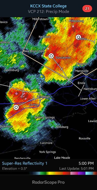
Central Pa. Spring 2024
Itstrainingtime replied to mahantango#1's topic in Upstate New York/Pennsylvania
Not much happening south of the turnpike until you get to western PA. -
Central Pa. Spring 2024
Itstrainingtime replied to mahantango#1's topic in Upstate New York/Pennsylvania
Fake fan... -
Central Pa. Spring 2024
Itstrainingtime replied to mahantango#1's topic in Upstate New York/Pennsylvania
F that. You gave an early evening-er report! -

May 2024 Discussion - Welcome to Severe Season!!!!
Cyclone-68 replied to weatherwiz's topic in New England
I don’t want to see another 2-1 loss for the rest of my life -
2 Tor warned cells in Texas already. One hat N of Throckmorton and the other just S of Abilene.
-

2024 Hurricane season forecast contest -- enter by June 1st
ldub23 replied to Roger Smith's topic in Tropical Headquarters
Amending my forecast to 20/7/3. -
Looking like the Senators game tonight will be a rain delay mess - I’ll prob bail on that