-
Posts
6,220 -
Joined
-
Last visited
About Quincy

- Birthday 02/03/1987
Contact Methods
-
Website URL
http://www.quincyvagell.com
Profile Information
-
Four Letter Airport Code For Weather Obs (Such as KDCA)
KOKC
-
Gender
Male
-
Location:
Moore, OK
Recent Profile Visitors
12,353 profile views
-

Plains States Observations and Discussion Thread
Quincy replied to lookingnorth's topic in Central/Western States
Almost everything is over performing so far. Moisture, mid-level lapse rates, CI (much earlier and farther south than most CAMs) and instability. Mesoanalysis shows substantial low-level CAPE near the developing convection in western Oklahoma, which HRRR handled very poorly. There’s virtually no capping out there and the 18z LMN sounding suggests there’s minimal capping remaining near I-35. WoFS is running and several members show CI even south of I-40. Latest SREF severe probabilities have also increased substantially in central/southern Oklahoma. -

Plains States Observations and Discussion Thread
Quincy replied to lookingnorth's topic in Central/Western States
Looks like the best shot at severe convection will be in the vicinity of dryline/cold front intersection over south-central Kansas into north-central Oklahoma late Wednesday. Farther south, moisture may be slightly richer, but weaker forcing and more modest lapse rates should exist. CAMs attempt to initiate a few isolated cells down toward I-40 near OKC. Near or northeast of Wichita, linear storm modes are more likely as deep shear will be nearly parallel to a surging cold front. Between these two areas is where the higher likelihood may exist for a few longer-lived discrete/semi-discrete storms. Keeping an eye on this. We are getting into the cool season, so it’s more of a stronger shear / modest instability setup. Not a high-end scenario, but robust for late October standards. The typical biases exist. HRRR may be mixing out low level moisture too quick and surging faster (too fast?) with the cold front. 3km NAM is juicier and is just a bit slower with frontal progression. -
Very intriguing setup. I’d definitely be out if I still lived in the Northeast. Broyles just added a 10% contour in the day 1 outlook up across New York.
- 6,666 replies
-
The NAM is absurd with an extreme parameter space. Verbatim, it would support a regional tornado outbreak. It has >2000 J/kg MLCAPE over the entire warm sector with >3000 J/kg near the warm front. That does not happen (rarely, if ever) in this region, coincident with highly favorable shear/hodographs. The HRRR is much more toned down, but even with it mixing out, you still see a supercell-favorable environment with upwards of 1000 J/kg MLCAPE. I do realize the maps show SBCAPE, but forecast soundings show similar MLCAPE. Typically a compromise between the two models gets you close to the end solution and that is definitely a yikes. CIPS analogs is even popping a 10% contour over parts of New York. The only caveat with central PA is that as you get displaced more than about 150 miles from the low center, tornado and supercell probabilities decrease. You want to be closer to the inner core, where forcing and vorticity will be maximized. Also, with southward extent, expect veering of winds along the cold front. The shear profile near the warm front in New York looks ridiculous, but we’ll see how that works out. Warm fronts in the Northeast are notorious for being fickle in severe setups. Still, several CAMs show at least isolated warm sector storms across parts of NW into the northern half of the state.
- 6,666 replies
-
- 4
-

-
There were over 100 tornado warnings yesterday. It looks like it was one of the most active days of this year, one of the more active July days on record and it will probably rank high on the list in terms of tropical cyclone tornado outbreaks. Chasing those things is hard. I intercepted at least three other tight circulations and had virtually not discernible visual on them. I got lucky with that tornado near Natchitoches occurred over flat terrain. Otherwise, there were too many terrain obstructions. I’ll share more info once we get surveys and summaries of the overall event.
-
Looks like two main regimes, embedded tornadic circulations closer to the NE inner core and more discrete cells farther away east across Louisiana. And there’s the main convective arc near the LA/TX, but I think winds are more veered with southward extent. This was the earlier tornado near Powhatan/Natchitoches:
-
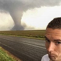
Numerous tornadoes today across far eastern Texas and Louisiana. I chased this tornado a short time ago and more may be on the way.
-
I updated the title to cover threats through the 4th, before the pattern breaks down a bit. I chased marginally archers storms in eastern Wyoming yesterday. Nothing too remarkable, although there was a lot of lightning: Today looks like a localized, conditional tornado threat near the Kansas/Nebraska border. The environment near a warm front across the area is very favorable for tornadoes. However, as the front lifts northward, residence time of storms along the narrow favorable environment may be limited. This combined with mixed storm modes casts uncertainty. Still, if a storm can thread the needle, you could see a few tornadoes and possibly a significant tornado. Tomorrow, SPC has a day 2 enhanced risk from northeastern Kansas into northern Missouri and southern Iowa. The risk is wind-driven, but it’ll be the second day in a row with 5% tornado probabilities across portions of the Central Plains/Lower Missouri Valley.
-
More video from yesterday's tornado in northeastern Nebraska: Today’s threat has been largely disrupted by the surging early day MCS. With a ridge over New Mexico and most of the favorable shear displaced to the NE of the region, only isolated pulse or transient supercell storms are anticipated across the Southern Plains. Tomorrow, a shortwave ejects towards the Northern Rockies with seasonably strong deep layer shear targeting the western Dakotas.. SPC has issued a Day 2 enhanced risk for portions of the northern/central High Plains.
-
An active pattern has returned and should continue for at least a few days across the Plains and surrounding areas. Just a really quick post because I’m wrapping up a storm chase, but I’ll add more analysis tonight or first thing in the morning. I observed a few tornadoes in Madison County, Nebraska today. The first was a dusty hybrid tornado, while a second was a brief cone and the third was a more well defined, but brief tornado over Kalamazoo, NE: I’m uploading better resolution video, but here’s a preview from Twitter: There have been numerous other storms, including a supercell over north-central Oklahoma. I debated on staying local to chase that, but ultimately went for the target that had greater tornado potential. It looks like @andyhbwas on that storm:
-
Special 18z ALB sounding is actually one of the more impressive ones I can recall, for local climo. Mid level lapse rates are marginal, but that was expected and is limiting this from being a more substantial event: Subjective surface analysis places the warm front in southern NH with slow progress northward:
-
19z mesoanalyses: Still some convective inhibition across New England, but looks like that will erode quickly from west to east. Enlarged hodographs in place and increasing low level instability. It’s almost go time!
-
Latest HRRR shows a broken line of storms with the early trough as far south as NW CT at 21z. Could be a damaging day
-
Dews are definitely on the juicier side across Connecticut. You don’t want full clearing (unexpected anyway), as that could result in deeper mixing. Most guidance holds dews fairly steady, except to the north, as the warm front lifts. This surface map will auto update hourly:
-
Here are the 12z HREF paintball maps with old runs omitted, valid at 21z/5 PM. The first graphic shows the high reflectivity signal, with attempted discrete storms across southern New England. The second graphic shows the stronger UH tracks, mostly confined to NH/VT:


.thumb.jpg.ad3a2e31d30aff035044689b311a0540.jpg)


